Monument Valley, AZ
|
Las Vegas 2013
|
Historic Town of Mesilla, New Mexico
|
Historic New Mexico
|
Organ Mountains, southern New Mexico
|
Skies of New Mexico
|
Bosque del Apache Wildlife Refuge, New Mexico
|
Mesilla Valley Bosque State Park, New Mexico
|
City of Rocks State Park, New Mexico
|
Rodeo - Women's Barrel Racing, Las Cruces (2010)
|
White Sands National Monument, New Mexico
|
Chiricahua National Monument, Arizona (2010)
|
Utah National Parks
|
Silver City, New Mexico
|
El Paso Zoo (Panasonic FZ 150)
|
Southwest Cemeteries
|
San Juan Mountains, Colorado (2011)
|
Mesa Verde N.P., Colorado (2011)
|
Taos Pueblo, New Mexico
|
Raft the Rio 2010, Las Cruces New mexico
|
Raft the Rio, New Mexico, May 2009
|
Tortugas: Our Lady of Guadalupe
|
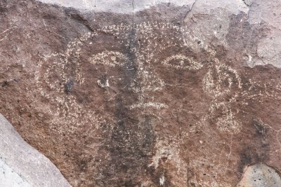
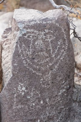
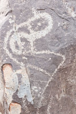
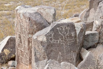
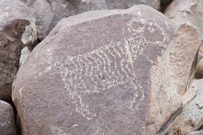
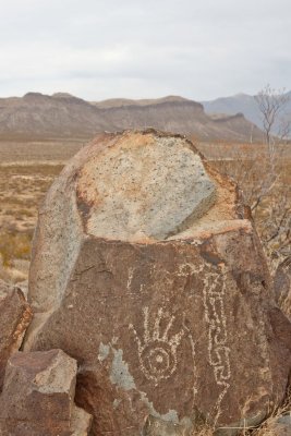
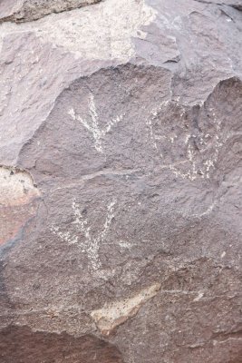
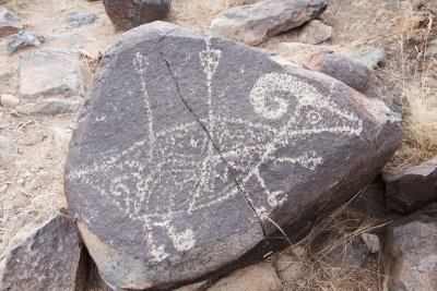
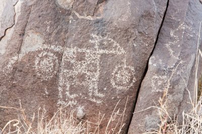
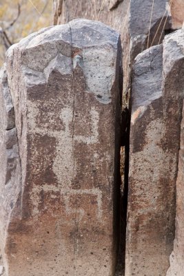
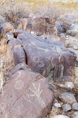
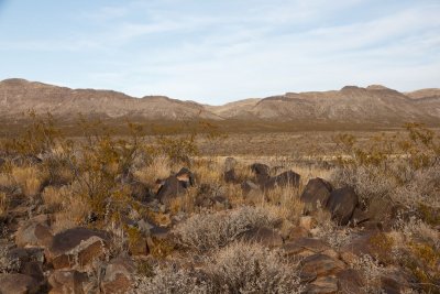
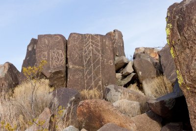
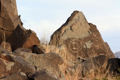
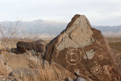
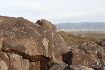
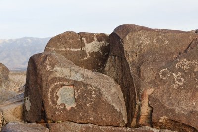
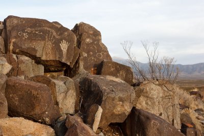
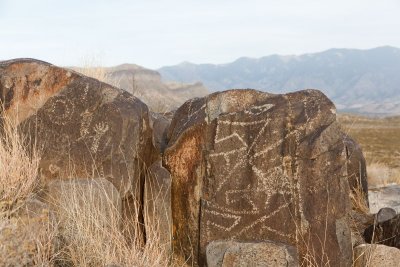
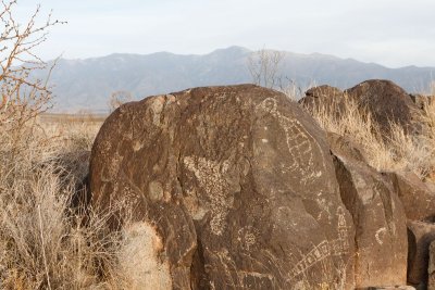
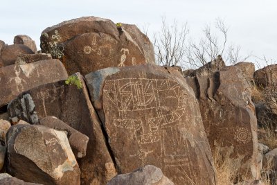
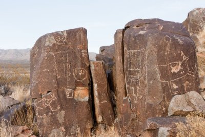
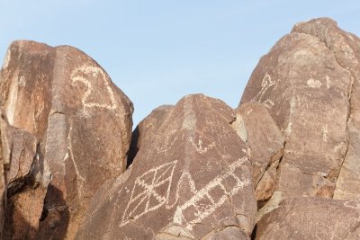
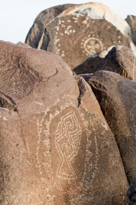
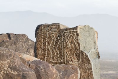
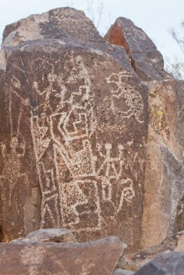
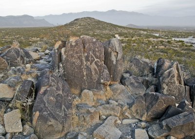
Three Rivers Petroglyph Site, New Mexico
|
Mesilla House 2009
Three Rivers Petroglyph Site, New Mexico
click on thumbnails for full image