


|
|
|
|
|
|
| |
| 15-JAN-2008 | |
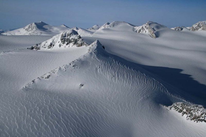
Henderson (50° 52' 30"N, 123° 40' 26"W) is the double summit at R/center.
Mills is at L background. The crags at center/L are unnamed.
Photograph location (est): 50°51'31.49"N 123°37'58.21"W
| Full EXIF Info | |
| Date/Time | 15-Jan-2008 12:35:06 |
| Make | Canon |
| Model | Canon EOS DIGITAL REBEL XTi |
| Flash Used | No |
| Focal Length | 26 mm |
| Exposure Time | 1/1600 sec |
| Aperture | f/7.1 |
| ISO Equivalent | 400 |
| Exposure Bias | |
| White Balance | |
| Metering Mode | average (1) |
| JPEG Quality | |
| Exposure Program | aperture priority (3) |
| Focus Distance | |
Copyright 2002-2025, John H. Scurlock, Photographer/Pilot