photo sharing and upload picture albums photo forums search pictures popular photos photography help login
Don Boyd | all galleries >> Memories of Old Hialeah, Old Miami and Old South Florida Photo Galleries - largest non-Facebook collection on the internet >> Memories of Old HIALEAH, Florida - Historical Photo Galleries and Commentaries - click on image to view and read > 2011 - aerial view of Palm Springs Mile - where it is and where it isn't
previous | next
2011 WikiMapia

2011 - aerial view of Palm Springs Mile - where it is and where it isn't

Hialeah, Florida


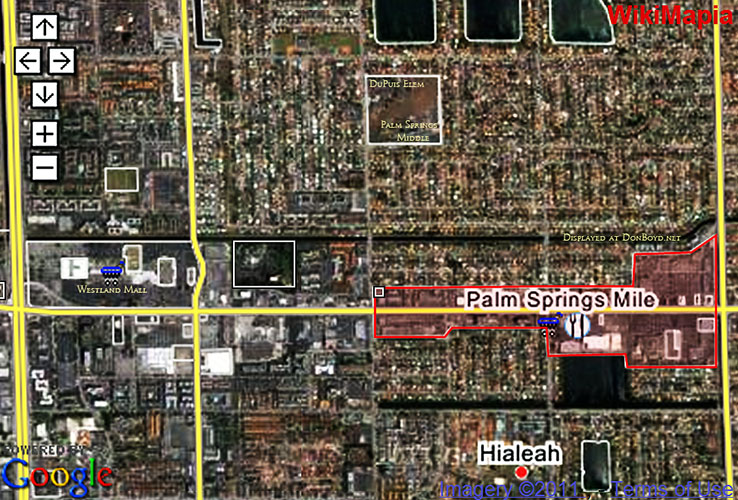
Somehow our intelligent Miami-Dade County road sign division has recently installed "Palm Springs Mile" street signs on overhead traffic light cables between W. 12th Avenue (Ludlam Road) and W. 20th Avenue (Palmetto Expressway) without having a clue as to where Palm Springs Mile is.

Of course these are the same people who spelled road signs as "Curtis Road" at Opa-locka Executive Airport when it should be "Curtiss Road" in honor of Glenn Curtiss, the famed aviator and founder of Opa-locka, Miami Springs, and co-developer of Hialeah with James Bright. And it's the same people who have "Opa-Locka Executive Airport" signs at Opa-locka Executive Airport.


other sizes: small medium original auto
comment | share
Don Boyd20-May-2012 06:00
Guest of 20-May, I agree and I thank you for commenting which caused me to see what you were writing about. I've made the other comment "non-public" so it shouldn't be visible now.

Don
Guest 20-May-2012 04:46
This isnt the place for comments like that