


|
|
|
|
|
|
| Long Bach Nguyen | profile | all galleries >> Galleries >> Aerial Eastern Washington State | tree view | thumbnails | slideshow | map |
| previous page | pages 1 2 3 ALL | next page |
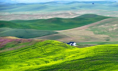
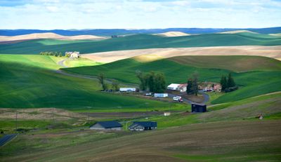
 Green Pasture in Palouse Hill, Tiegs Road, Colfax, Washington 550 |
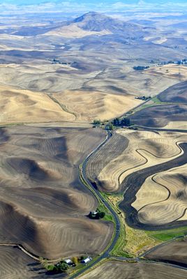 Steptoe Butte State Park Heritage Site, State Route 23, Palouse Hills, Colfax, Washington 537 |
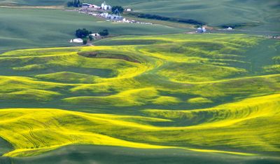
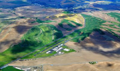
 Colorful Palouse Landscape by Colfax Airport, Washington 575 |
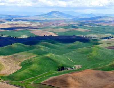
 Large Farm in Palouse and Steptoe Butte in background, Colfax Washington 547A |
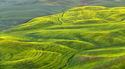
 Landscape of Wheatfield in Palouse Hills, Steptoe, Washington 543 |
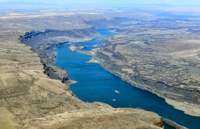
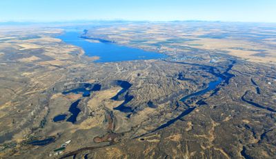
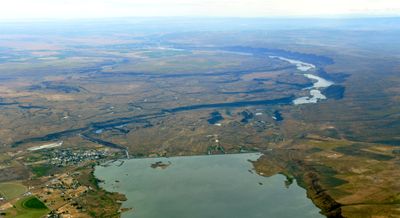
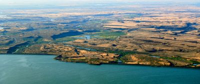
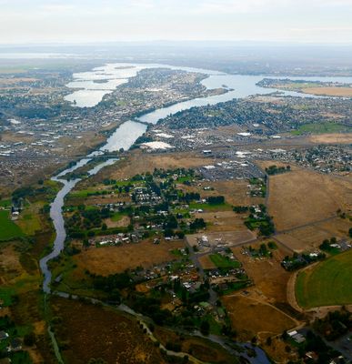
 City of Moses Lake, Moses Lake, Sage Point, Moses Lake Mud Flats and Sand Dunes, Potholes Reservoir, Drumheller Channels Nationa |
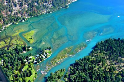
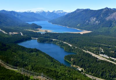
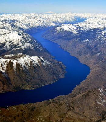
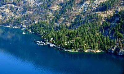 Stehekin, Lake Chelan, Washington 132 |
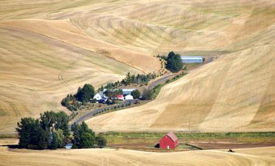
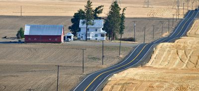
 Rd N NW, Red Barn and Farm, Waterville, Washington 117 |
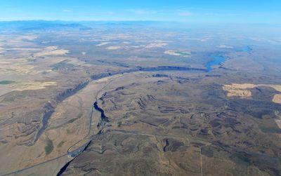 Moses Coulee, Hiway 2, Sulphur Canyon, Burton Draw, Kester Draw, Jameson Lake, Grimes Lake, Mansfield Plateau, Eastern Washingto |
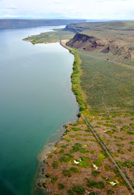
 Lenore Lake, The Great Blade, Lake Lenore Caves State Park Hertiage Site, Alkali Lake High Hill, Drby Coulee, Blue Lake, Park La |
 Gentle Rolling Landscape in the Palouse Hill, by Pullman Airport, Washington 391 |
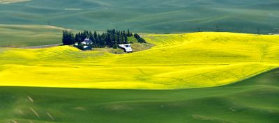
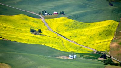
 Canola Field in Palouse by Pullman Airport, Washington 387 |
 Canola Field in Palouse by Pullman Airport, Washington 330 |
 Washington State University WSU, Pullman, Washington 323 |
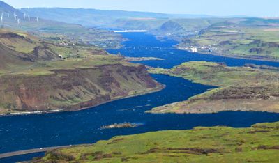
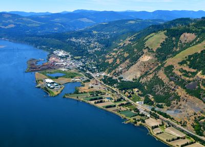 Bingen, Lewis and Clark Hwy, Columbia River, Hood River-White Salmon Interstate Bridge, White Salmon, Columbia River Gorge |
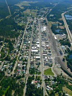 Town of Cle Elum, Washington 161 |
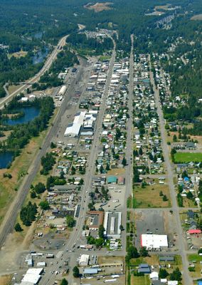 Town of Cle Elum, Washington 153 |
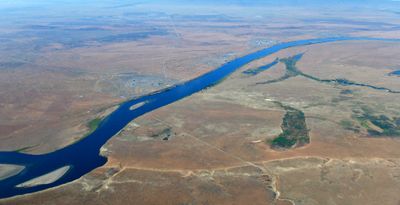 Hanford Nuclear Reservation, Hanford Reach, Saddle Mt Natl Wildlife Refuge, Wooded Island, Columbia River, Wahluke, Washington |
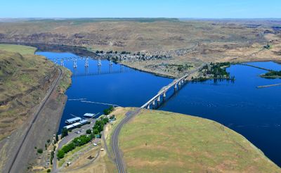 Lyons Ferry Bridge, Joso High Bridge, Lyons Ferry State Park, Lyons Ferry Fish Hatchery-Main, SnakeRiver, Palouse River, Perry, |
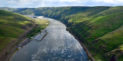
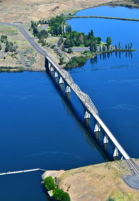 Lyons Ferry Bridge, Lyons Ferry State Park, Snake River, Palouse River, Perry, Washington 324 |
 Old Railroad Track and Highway 155, Coulee Boulevard, Banks Lake, Upper Grand Coulee, Fordair, Washington 114 |
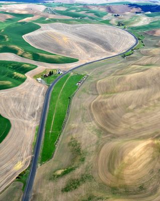
 Country Road in Palouse Hills by Pullman Airport, Pullman Washington 208 |
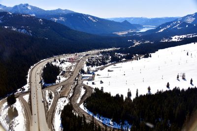 Snoqualmie Pass, Snoqualmie Ski Area, Interstate 90, Lake Keechelus, Rampart Ridge, Washington 178 |
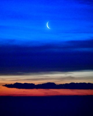 Crescent Moon and Sunrise over Eastern Washington 081 |
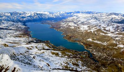 Chelan, Lake Chelan, Chelan Dam, Manson, Wapato Lake, Roses Lake, Cascade Mountains, Washington 1708 |
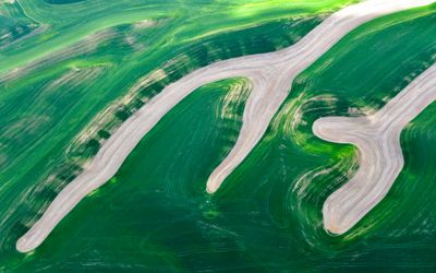
 Palouse Hills Washington 259 |
 Upper Grand Coulee, Banks Lake, Steamboat Rock, Devils Punch Bowl, Northrup Canyon, Castle Rock, Electric City Airport |
 Silos on Storment Road, Palouse Hills, Endicott, Washington 199 |
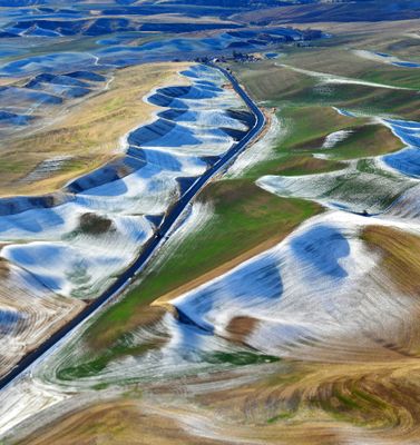 Fresh Snow along Highway 26 across the Palouse Hills, Colfax Washington 257 |
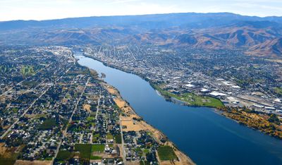 West and East Wenatchee, Columbia River, Wheeler Hill, Roosster Comb, Jumpoff Ridge, Washington 257 |
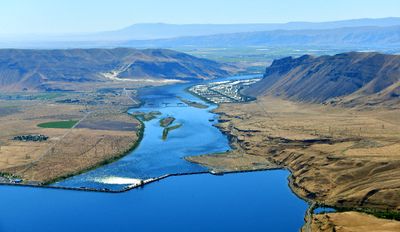
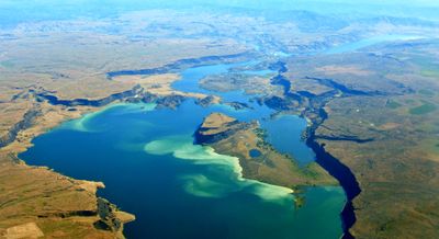
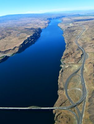
 Vantage Bridge, Columbia River, Wanapum Lake, Ginkgo Petrified Forest State Park, Wanapum Dam, Saddle Mountain, Sentinel Gap, Se |
 Sun Lakes State Park, Lower Grand Coulee, Dry Falls Lake, Dry Falls Dam, Meadow Creek, Deep Lake, Don Paul Draw, Coulee City, |
 Lenore Lake, Lower Grand Coulee, Alkali Lake, Lake Lenore Caves State Park, Blue Lake, Park Lake, Dry Coulee, High Hill, |
 Abandoned House and Barns on Rd B NW Withrow, Washington 1093a |
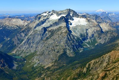 Bonanza Peak, Isella Glacier, Mary Green Glacier, Railroad Creek, Hart Lake, Holden Creek, Holden Lake, Mount Baker |
 Remote Town of Stehekin, Lake Chelan, Washington 452 |
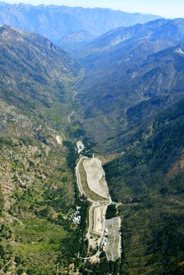 Holden Village, Holden Hydroelectric Plant, Copper Falls, Holden Mine Site Cleanup, Washington 464 |
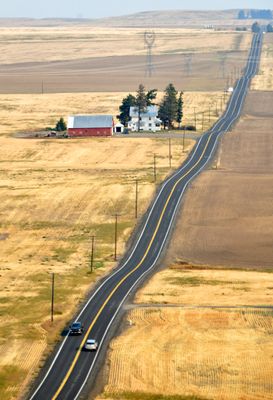
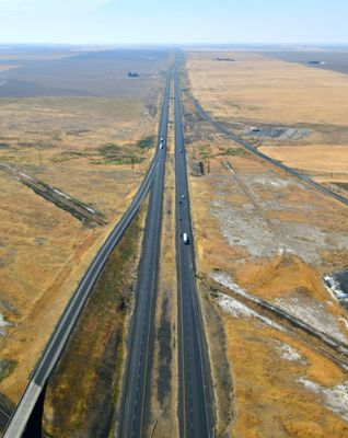 Looking West over Interstate 90 by Ritzville Washington 584 |
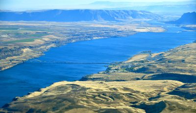
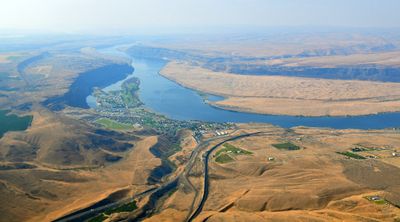
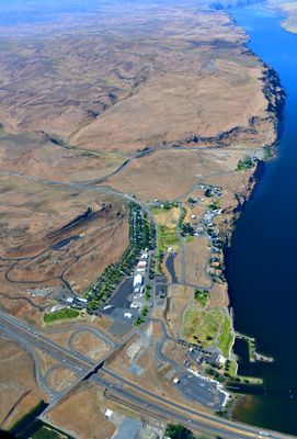 Community of Vantage, Freeway I-90, Columbia River, Wanapum Lake, Vantage Hwy, Ginkgo Petrified Forest State Park, Rocky Coulee, |
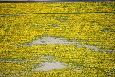 Sunflowers on Leahy Road S, North Sim Corner, Waterville Plateau, Mansfield, Washington 915 |
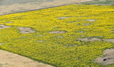 Sunflowers on Leahy Road S, North Sim Corner, Waterville Plateau, Mansfield, Washington 877 |
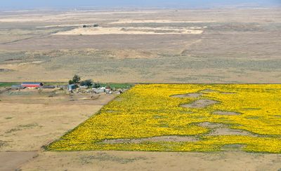 Sunflowers on Leahy Road S, North Sim Corner, Waterville Plateau, Mansfield, Washington 865 |
 Rock Formation from Columbia River Basalt Group, Waterville Plateau, Banks Lake, Upper Grand Coulee, Washington 265 |
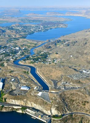 John W. Keys III Pump-Generating Plan, Banks Lake Feeder Canal, Banks Lake, Grand Coulee, Electric City, Steamboat Rock, Upper G |
 Trinidad, Crescent Bar, Babcock Ridge and Bench, Wanapum Lake, Columbia River, West Bar, Washington 497 |
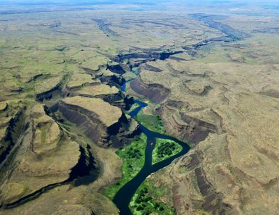
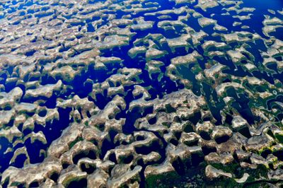
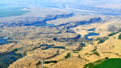 Primordial Potholes Coulee, Ancient Lake, Dusty Lake, Hi Lake, Stan Coffin Lake, Quincy Lake, Babcok Bench and Ridge,The Gorge |
 House and Red Barn on Rd O NW, North Rd NW, Waterville, Washington 1156 |
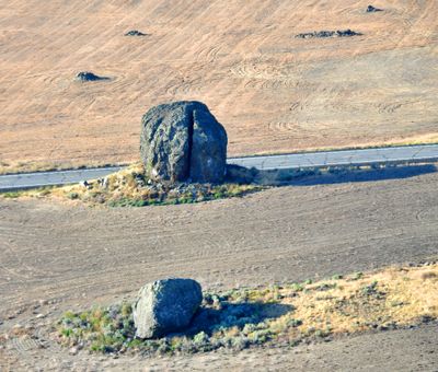 Yeager Rock, glacial erratics, haystack rocks, Mansfield, Washington 1012 |
 Canola Field in Pullman Washington 222a |
 Fertile Rolling Hills of Palouse, Ewartsville, Washington 205 |
 Wanapum Dam, Wanapum Lake, Columbia River, Wanapum Village, Beverly Railroad Bridge, Auvil Fruit, Sentinel Gap and Bluffs, Saddl |
 Palouse Falls, Palouse Falls State Park, Palouse River, LaCrosse, Washington 146 |
 Coulee City, Dry Falls Dam, Banks Lake, Main Canal, Dry Falls Lake, Deep Lake, Sun Lakes State Park, Lower Grand Coulee, Park La |
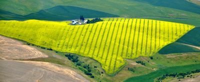 Small Farm with Canola Field on Kirby Mayview Rd, South Fork Deadman Gulch, Kirby, Washington 310 |
 Upper Grand Coulee, Banks Lake, Steamboat Rock, Devils Punch Bowl, Northrup Canyon, Castle Rock, Electric City Airport, Electric |
 Canola Field on Bauer Road, Colton, Washington 286 |
 Amabilis Mountain, Easton Lake, Easton Airport, Kachess Lake, Kachess Ridge, Bear Breast Mountain, Mount Hinniman, Overcoat Peak |
 Vantage Bridge, Columbia River, Wanapum Lake, Interstate 90, SR 28 Interchange, Babcock Bench, Frenchman Coulee, Evergreen Ridge |
 Palouse River, Palouse Falls State Park, Lyons Ferry State Park, Eastern Washington 598 |
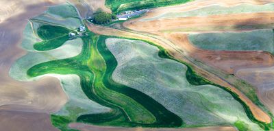
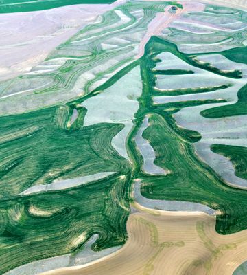
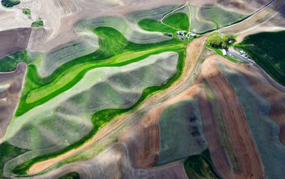
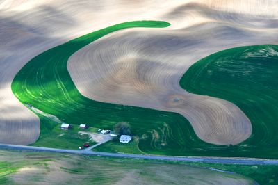 Unique farm pattern in Palouse, Colfax, Washington 388 |
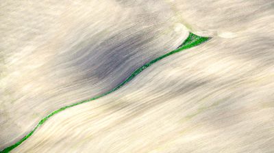
 Tracks in Field Paulouse Hills, Colfax, Nevada 449a |
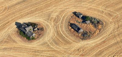
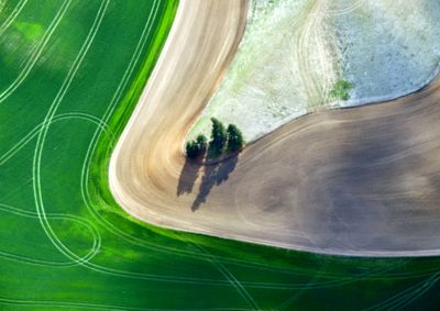
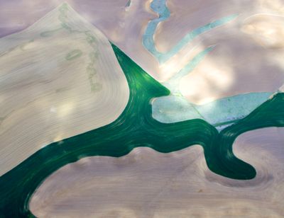
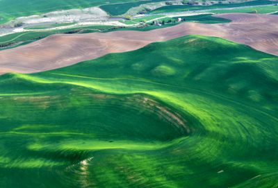
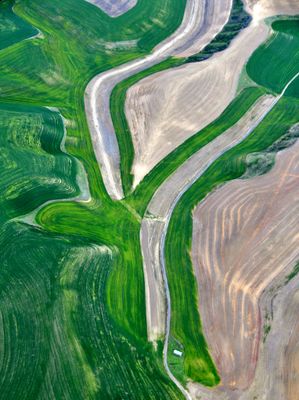
 Sliver of Green in Field, Palouse Hills, Washington 454 |
 Scott Canyon Road, Scott Canyon, Oregon 124 |
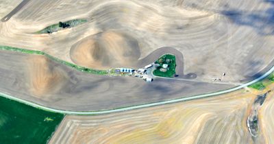
 Port of Whitman Business Air Center, Palouse Hills, Colfax, Washington 445 |
 Pataha Valley, Highway 12, Palouse Hills, Dodge Washington 247 |
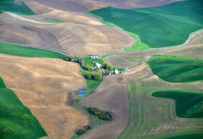
 Little Farm in Palouse near Colfax, Washington 352 |
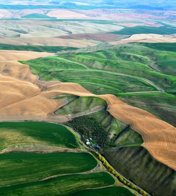
 Farm in Palouse Hills, Ewartsville, Washington 285 |
 Country Road through Palouse Hills near Dayton, Washington 216 |
 Colorful Landscape on Palouse Hills near Dayton Washington 224 |
 Colorful Landscape on Palouse Hills near Colfax, Washington 342 |
 Colorful Landscape on Palouse Hills near Gould City Washington 254 |
 All Lead to Steptoe Butte, Palouse Hills, Washington 380 |
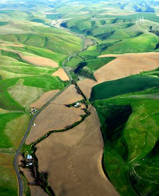
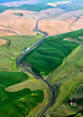
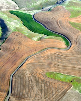
 Aimota Road and Penawawa Creek in Palouse Hills, Colfax, Washington 378 |
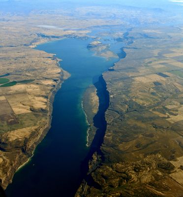
 Lower Granite Lake, Lower Granite airfield, Lower Granite Dam, Snake River, Lake Bryan, Almota, Palouse Hills, Washington 519 |
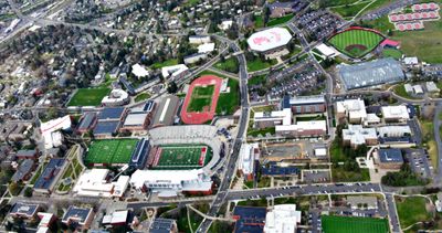 Washington State University, Martin Stadium, Rogers Field, Mooberry Track, Beasley Coliseum, Grimes Way Playfield, Pullman Washi |
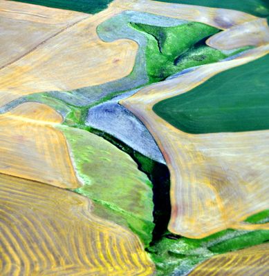
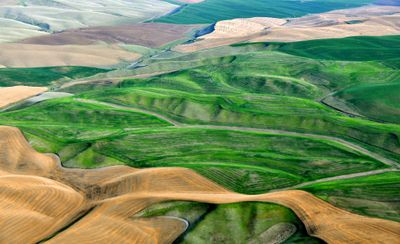
 Abstract Pattern in Palouse Hills, Colfax, Washington 338 |
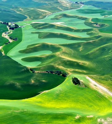
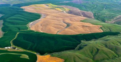
 Landscape Patterns of the Palouse, Pullman Area, Washington 330 |
 Spring Time in Palouse Hills near Pomeroy Washington 266 |
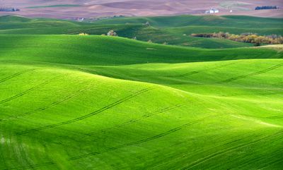 Rolling Hills of The Palouse east of Pullman, Washington 643 |
 Spring Time in Palouse Hills, Barn on Wawawai-Pulluman Rd, Pullman, Washington 289 |
 Spring Colors over Palouse Hills near Walla Walla Washington 212 |
 Palouse Hills in Springtime near Pullman, Washington 481 |
 Colorful Landscape on Palouse Hills near Dayton Washington 226 |
 Colorful Landscape on Palouse Hills near Dayton Washington 224 |
 Palouse Hills in Springtime, Colfax, Washington 472 |
 Palouse Hills in Springtime, Alkali Flat Creek, Colfax, Washington 467 |
 Palouse Hills in Springtime near Pullman, Washington 477 |
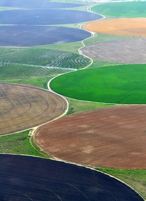 Multi-Color Crop Circles in Longview Washington 196 |
 Columbia Gorge, Columiba River, Columbia Hills, Miller Island, Lake Celilo, Maryhill State Park, John Day Dame, Washington and |
 Lake Chelan, Slide Ridge, 4th of July Mtn, Grouse Mtn, Little and Big Goat Mtn, Domke Lake and Mtn, North Cascades National Park |
 Potholes Reservoir, The Potholes, South Columbia Basin State Wildlife Recreation Area, Moses Lake, Washington 1076 |
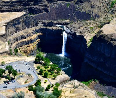
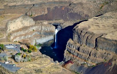 Palouse Falls, Palouse Falls State Park, Palouse River, LaCrosse, Washington 951 |
 Potholes Reservoir, The Potholes, South Columbia Basin State Wildlife Recreation Area, Moses Lake, Washington 1065 |
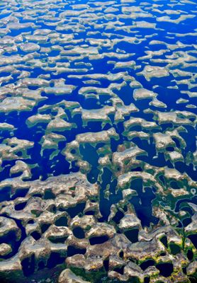
 Drumheller Channels National Natural Landmark, Channeled Scablands., Crab Creek, Potholes Reservoir, Moses Lake, Washington |
 Banks Lake, Upper Grand Coulee, Highway 155, Paynes Gulch, Steamboat Rock, Foster Coulee, Barker Canyon, Cache Butte |
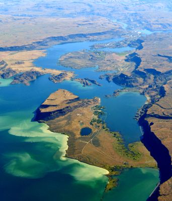
 Moses Lake, Pelican Horn, Marsh Island, Goat Island, Galleys Island, Parker Horn, Potholes Reservoir, Washington 053 |
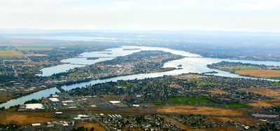 Moses Lake, Pelican Horn, Marsh Island, Goat Island, Galleys Island, Parker Horn, Potholes Reservoir, Washington 050 |
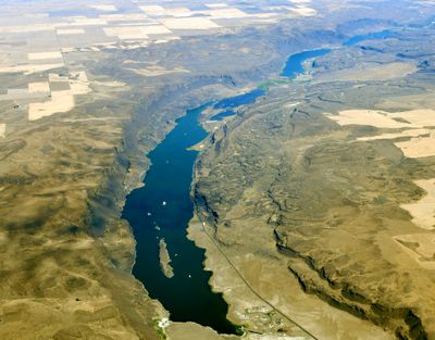
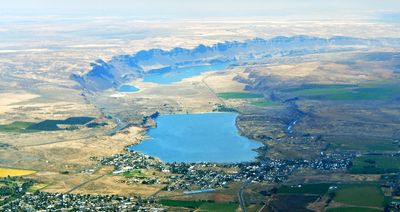 Soap Lake, Lenore Lake, Lower Grand Coulee, Washington 067 |
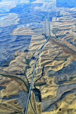 Palouse Hills and Farmland and State Route 195 and Old Thornton Hwy, Thornton, Washington 373 |
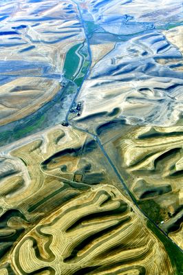 Palouse Hills and Farmland near St John Washington 320 |
| previous page | pages 1 2 3 ALL | next page |
| Blandine Mangin | 01-Feb-2025 21:29 | |
| Dan Greenberg | 28-Dec-2022 18:52 | |
| Jean-Claude Billonneau | 19-Aug-2022 13:23 | |
| Paco López | 16-Jun-2020 06:14 | |
| Zoltán Balogh | 02-Oct-2018 08:16 | |
| Paolo Peggi (aka Bracciodiferro) | 21-Mar-2016 06:16 | |
| danielhechter | 01-Apr-2015 14:36 | |