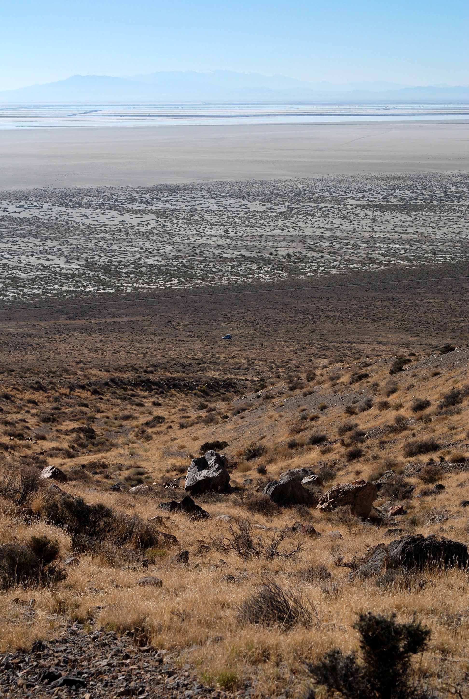
photo sharing and upload picture albums photo forums search pictures popular photos photography help login
Dave Beedon | all galleries >> Places >> Utah >> Wendover Area >> Silver Island Mountains >> Tetzlaff Peak Re-visited > Salt flats (and its dead-end access road), evaporation ponds, and Interstate 80
previous | next
13-OCT-2006 Dave Beedon

Salt flats (and its dead-end access road), evaporation ponds, and Interstate 80

Tetzlaff Peak, Silver Island Mountains, Utah

My car is at center. Above it, running left-right, is the Silver Island Backcountry Byway. The lowest
thin line in the light area is the salt flats access road, which ends at the left side of the image.
Above that is a dike, then a light line that is I-80, then Frontage Road. This view is to the south.
.

Nikon D80 ,Nikkor 28-105mm f/3.5-4.5D AF
1/500s f/9.0 at 55.0mm iso100 full exif

other sizes: small medium large original auto
share
Type your message and click Add Comment
It is best to login or register first but you may post as a guest.
Enter an optional name and contact email address. Name
Name Email
help private comment