


|
|
|
|
|
|
| |
| 1992 | Paul D. |
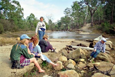
This is the causeway where the original "coach road" to Newnes (which is now a walking track
only) crossed the Wolgan River. What the signs call the "car park" is at the turn off from
the present Newnes Road, up that hill on the right of this picture. And see previous picture.
| Full EXIF Info | |
| Date/Time | |
| Make | |
| Model | |
| Flash Used | No |
| Focal Length | |
| Exposure Time | |
| Aperture | |
| ISO Equivalent | |
| Exposure Bias | |
| White Balance | |
| Metering Mode | |
| JPEG Quality | |
| Exposure Program | |
| Focus Distance | |
| comment | |