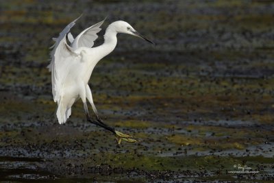
IMG_7694-1200x800.jpgLittle Egret (Egretta garzetta, migrant)
Habitat: Coastal marsh and tidal flats to ricefields.
Shooting info - San Juan, Batangas, April 16, 2010, 7D + 400 2.8 IS + Canon 1.4x TC, 560 mm, f/5.6, ISO 200, 1/2000 sec,
475B/3421 support, major crop, GPS Latitude = 13°48'04.24", GPS Longitude = 121°26'28.64". |
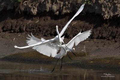
IMG_7757-1200x800.jpgIntermediate Egret (Egretta intermedia, migrant)
Habitat - Fresh water marshes, ricefields and tidal flats.
Shooting info - San Juan, Batangas, April 16, 2010, 7D + 400 2.8 IS + Canon 1.4x TC, 560 mm, f/5.6, ISO 250, 1/2000 sec,
475B/3421 support, major crop, GPS Latitude = 13°48'04.24", GPS Longitude = 121°26'28.64". |
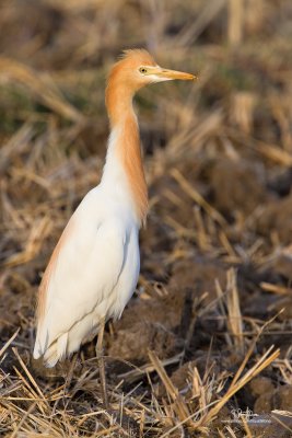
IMG_7559-1200x800.jpgCattle Egret (Bubulcus ibis, resident/migrant)
Habitat: Pastures, ricefields and marshes.
Shooting info - San Juan, Batangas, April 16, 2010, 7D + 400 2.8 IS + Canon 1.4x TC, 560 mm, f/5, ISO 200, 1/200 sec, bean bag, major crop,
GPS Latitude = 13°48'11.1857", GPS Longitude = 121°25'46.6696". |
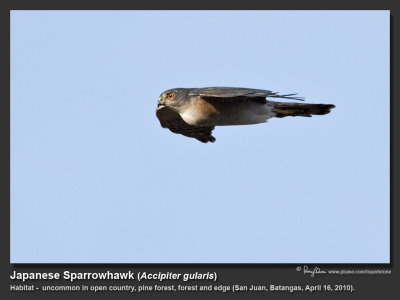
Japanese_Sparrowhawk-IMG_7605Japanese Sparrowhawk (Accipiter gularis, migrant)
Habitat - Uncommon in open country, pine forest, forest and edge.
Shooting info - San Juan, Batangas, April 16, 2010, 7D + 400 2.8 IS + Canon 1.4x TC, 560 mm, f/4.5, ISO 400, 1/1600 sec, 475B/3421 support, near 100% crop,
GPS Latitude = 13°48'04.24", GPS Longitude = 121°26'28.64". |
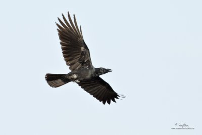
IMG_7623-1200x800.jpgLarge-billed Crow (Corvus macrorhynchos, resident)
Habitat - open country.
Shooting info - San Juan, Batangas, April 16, 2010, 7D + 400 2.8 IS + Canon 1.4x TC, 560 mm, f/4.5, ISO 400, 1/1600 sec, 475B/3421 support, near 100% crop,
GPS Latitude = 13°48'04.24", GPS Longitude = 121°26'28.64".
|
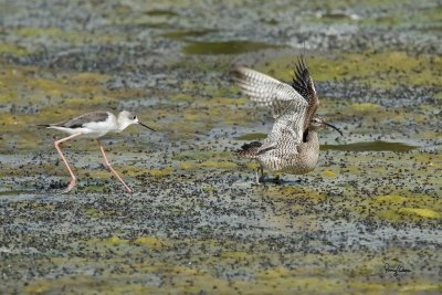
IMG_7824-1500x1000.jpgBlack-winged Stilt (Himantopus himantopus)/Whimbrel (Numenius phaeopus)
Habitat - Wetlands from coastal mudflats to ricefields/Various wetlands.
Shooting info - San Juan, Batangas, April 16, 2010, 7D + 400 2.8 IS + Canon 1.4x TC, 560 mm, f/5, ISO 250, 1/1600 sec, 475B/3421 support, near full frame,
GPS Latitude = 13°48'04.24", GPS Longitude = 121°26'28.64". |
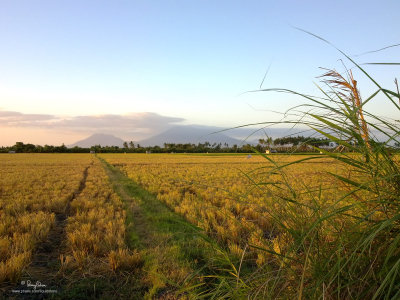
04152010130-1200x900.jpgMT. BANAHAW AT SUNSET. This enchanted mountain at nearby Quezon province towers over the newly harvested ricefields of San Juan, Batangas.
Shooting info - San Juan, Batangas, April 15, 2010, Nokia N97, 5.4 mm, f/2.8, ISO 100, 1/250 sec, hand held, GPS Latitude = 13°48'11.1857", GPS Longitude = 121°25'46.6696", GPS Altitude = 19m ASL. |
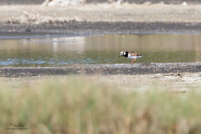
IMG_7468.jpgRuddy Turnstone (Arenaria interpres, migrant)
Habitat - Uncommon along coast on exposed mud and coral flats.
Shooting info - San Juan, Batangas, April 15, 2010, 7D + 400 2.8 IS + Canon 1.4x TC, 560 mm, f/5.6, ISO 400, 1/2000 sec, 475B/3421 support, major crop, GPS Latitude = 13°48'04.24", GPS Longitude = 121°26'28.64".
|


