


|
|
|
|
|
|
| |
| 05-NOV-2007 | |
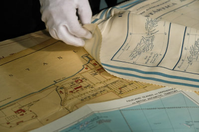
Been to the National Archives in Kew today, with a film crew to record a video to launch a forthcoming government publication. The maps in the photo date from the 1950s. At the outbreak of hostilities with Argentina in 1982 they were the only detailed maps of Port Stanley available outside Port Stanley itself and they were used to inform military strategy in the early part of the Falklands campaign.
All photographs copyright � Rose Atkinson 2004 - 2012. All Rights Reserved..
| Nicki Thurgar | 10-Nov-2007 18:35 | |
| Ray :) | 05-Nov-2007 22:19 | |