


|
|
|
|
|
|
| |
| 24-May-2015 | |
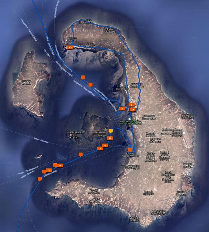
The blue line on this map is a GPS track of our tour of Santorini.
The crescent shape main island of Santorini forms the rim of an underwater volcanic caldera. Our cruise-ship arrived from Crete in the south and anchored near Nea Kameni, the small island with the volcanic dome. We traveled by tender to the port of Ormos Athinios, where we took a bus tour up and then along the rim to the town of Oia on the northwest tip of Santorini. The return trip followed the gentle plateau on the sea facing side of the island back to the main town of Fira. We descended the steep rim via cable cars and back to the ship via tender. By sunset, our ship departed northward to the Greek mainland.
Copyrighted © 2003 - 2022 by Peter Kwok. Images may not be reproduced for commercial purpose without written permission.