![]() |
![]() |
![]() |
![]() |
![]() |
![]() |
![]() |
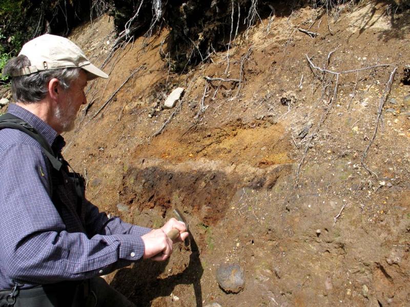
The pale 'O' layer lies atop a darker layer of ancient topsoil.
This layer was deposited approximately 7,000 years ago during the catastrophic eruption
of Mt. Mazama (Crater Lake), Oregon.
This photograph was taken along Rocky Creek, in the vicinity of the Scott Paul trailhead.
Full EXIF Info | |
Date/Time | 21-Jun-2005 11:08:25 |
Make | Canon |
Model | Canon PowerShot G6 |
Flash Used | No |
Focal Length | 7.2 mm |
Exposure Time | 1/400 sec |
Aperture | f/4 |
ISO Equivalent | |
Exposure Bias | |
White Balance | (-1) |
Metering Mode | center weighted (2) |
JPEG Quality | (6) |
Exposure Program | shutter priority (2) |
Focus Distance |
Copyright 2002-2023, John H. Scurlock, Photographer/Pilot