


|
|
|
|
|
|
| |
| 12-APR-2005 | |
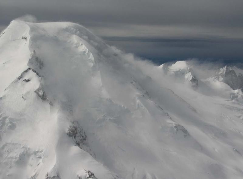
The wind speed estimate is based on comparisons of True Airspeed & GPS-generated
ground speeds when flying upwind and downwind while circling adjacent to Mt. Baker.
It is likely that local windspeeds over & around the summit here are significantly
greater, however, due to acceleration caused by terrain-related 'venturi' effects.
Overall, the wind is associated with an approaching storm front.
| Full EXIF Info | |
| Date/Time | 12-Apr-2005 11:10:33 |
| Make | Canon |
| Model | Canon PowerShot G6 |
| Flash Used | No |
| Focal Length | 10.2 mm |
| Exposure Time | 1/1250 sec |
| Aperture | f/5.6 |
| ISO Equivalent | |
| Exposure Bias | |
| White Balance | (-1) |
| Metering Mode | center weighted (2) |
| JPEG Quality | (6) |
| Exposure Program | |
| Focus Distance | |
Copyright 2002-2025, John H. Scurlock, Photographer/Pilot