photo sharing and upload picture albums photo forums search pictures popular photos photography help login
Dave Beedon | profile | all galleries >> Places >> Utah >> Moab (environs) >> Corona Arch tree view | thumbnails | slideshow

4922 Plateau | Arches National Park | Canyonlands National Park | Castle Valley (introduction) | Castle Valley: Round Mountain | Castle Valley: Castleton Tower | Corona Arch | Corona Arch Domes | Day Canyon | Dead Horse Point State Park | The Goose Neck | Ida Gulch | Jackson-Kane plateau | Jeep Arch | Monitor and Merrimac Buttes | Negro Bill Canyon ("NBC") | Other Moab Environs | Poison Spider Mesa: Loop Through the Fins | Poison Spider Mesa: Return to the Maw | Potash Area | Sand Flats | Shafer Trail | Tombstone Plateau | White Rim Trail | Moab: Tilted Hunter-Gatherer Plateau

Corona Arch

Corona Arch, a huge formation, is near Moab Utah. It is at the center of this WikiMapia aerial view.

On my first visit to the arch I was treated to the spectacle
of rope-swinging (see the "Swinging Time" gallery).


.
Hike to Corona Arch
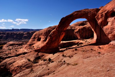
:: Hike to Corona Arch 
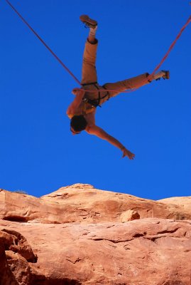
::
A Swinging Time at Corona Arch
:: A Swinging Time at Corona Arch 
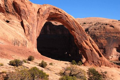
::
Leaving Corona Arch
:: Leaving Corona Arch ::