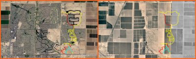
This is two Google Earth screen shots combined into one image. At left is Maricopa in 2017, at right is Maricopa in 1997. The main landmark in both halves is the diagonal road (SR 347). The colored lines are the route of a recent trike ride. It is a weird feeling to ride on these streets and realize that they are built on land that used to contain trees and crops.