


|
|
|
|
|
|
| |
| 30-MAR-2010 | Jason Anderson |
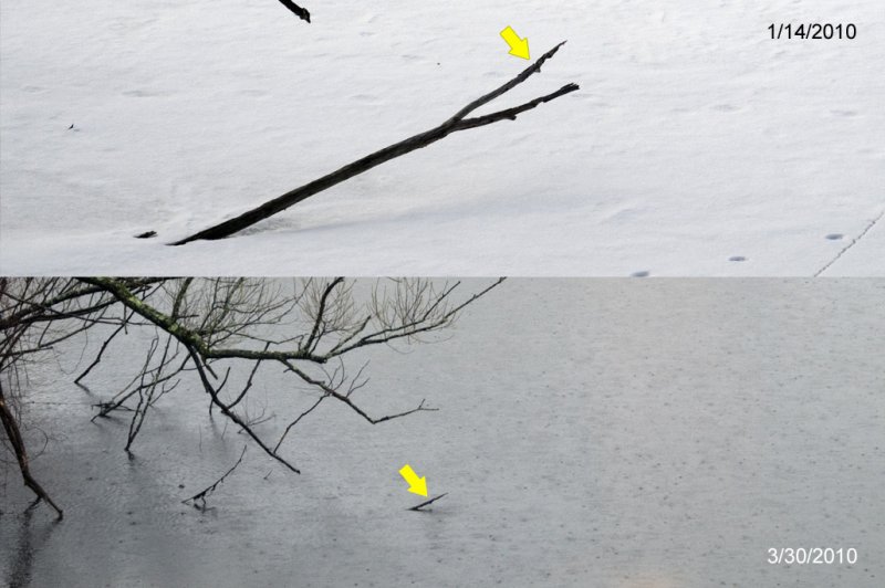
This comparative shot shows the normal water level (ice at the time) on top, with the water level during the height of the recent storm below.
The yellow arrows point to the same bump on the partially submerged branch, to provide scale since the zoom level is different.
I thought it only went up six inches or so, but it looks more like a foot.
Canada Pond is part of the West River, which didn't flood; but the West runs into the Woonasquatucket, which did.
| Full EXIF Info | |
| Date/Time | 30-Mar-2010 14:42:39 |
| Make | Nikon |
| Model | NIKON D300 |
| Flash Used | No |
| Focal Length | 92 mm |
| Exposure Time | 1/100 sec |
| Aperture | f/7.1 |
| ISO Equivalent | 320 |
| Exposure Bias | |
| White Balance | |
| Metering Mode | multi spot (3) |
| JPEG Quality | |
| Exposure Program | aperture priority (3) |
| Focus Distance | |
All images copyright 1985-2015 Jason Anderson. Please ask prior to any use.
| Inga Morozoff | 03-Apr-2010 02:24 | |
| Lee G | 03-Apr-2010 00:55 | |