| |
| 1960 | |
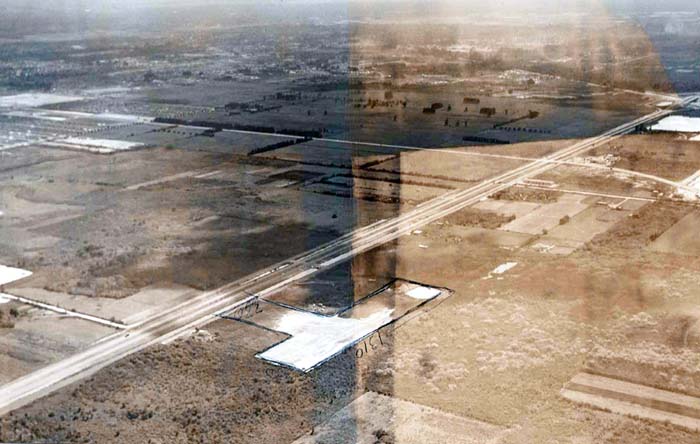
1960 - View of the Palmetto Expressway, W. 49th Street and western Hialeah (no text)
Hialeah, Florida
This view is looking south-south-east and features the Palmetto Expressway with two lanes each running north-south from the lower left corner to the upper right corner. All intersections in the north end of the county were grade level with stop signs for intersection side streets. They later put a blinking red light for traffic on W. 49th Street/N. W. 103rd Street, which is depicted in the upper right corner running towards the upper left corner.
W. 12th Avenue (Ludlam Road) is seen in the upper left corner about 1/3rd down and there is no development to the right (west) of it except for the City of Hialeah Dump which ran from W. 12th Avenue to the equivalent of W. 14th Avenue and north of the W. 53rd Street equivalent. The road running from the left edge near the bottom to the Palmetto was W. 68th Street/NW 114th Street. W. 60th Street had not been extended west of W. 12th Avenue yet.
Some development on W. 49th Street (Palm Springs Mile from W. 4th to W. 12th Avenues) is seen in the upper left corner east of W. 12th Avenue.
Unless otherwise noted under the right bottom of the photo, all images are copyrighted by Don Boyd