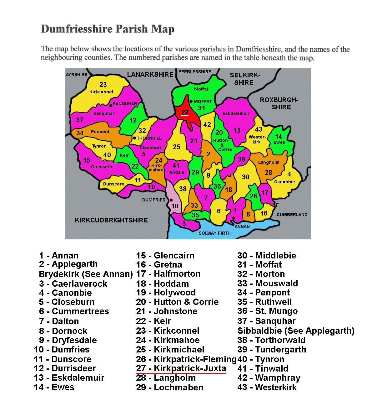
Kirkpatrick-Juxta parish is underlined as it is the parish in which Poldean is situated. Poldean was a 2,000 acre holding owned at one time by Herbert Johnston of Nese, Glennybank and Poldean.
Other Poldean kin at one time or another owned the Devil's Beeftub, Moffat, Corehead, Craigieburn, and other lands. By the mid-1700s they appear to have scattered. The surrendering of their lands is attributed to the increased taxation after the union (with England) which put them at an unfair disadvantage. One by one they sold their lands and moved on...