


|
|
|
|
|
|
| |
| 15-APR-2012 | |
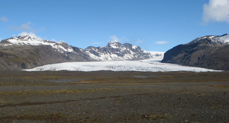
This is the broad glacier flowing out into the valley toward the coast visible in the map earlier, and area where the massive jokullaup floods routinely decimate everything in their path (including the road/bridges).
Skaftafell National Park area, south side of the ring road.
| Full EXIF Info | |
| Date/Time | 15-Apr-2012 05:28:41 |
| Make | Canon |
| Model | Canon PowerShot A710 IS |
| Flash Used | No |
| Focal Length | 6.4 mm |
| Exposure Time | 1/1000 sec |
| Aperture | f/4 |
| ISO Equivalent | |
| Exposure Bias | -0.67 |
| White Balance | |
| Metering Mode | |
| JPEG Quality | |
| Exposure Program | |
| Focus Distance | 0.480 m |
These images are copyrighted, contact me if you want to use one, otherwise, please don't!