


|
|
|
|
|
|
| |
| 30-APR-2009 | |
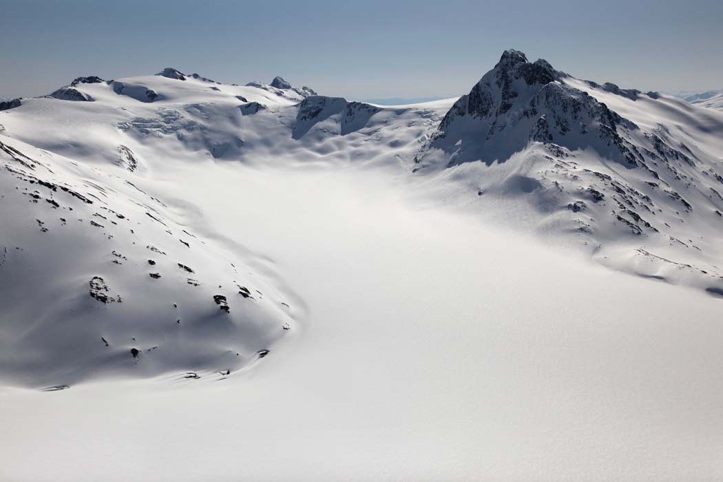
The peak at R (N 55° 54' 35.52", W 129° 37' 42.76") is unnamed, and sits 4 km S of Mt. Camber.
The peak at L/center (N 55° 55' 29.72", W 129° 35' 11.97") is estimated at 7800'+,
based on map contour analysis. It sits about 3 km SE of Mt. Camber.
The rocky summit at center/background is probably Pk 2246 (N 55° 54' 22.71", W 129° 30' 54.58" est.)
Photograph taken from a position east of the E margin of the Bromley Glacier.
Ref. map 103P-13
| Full EXIF Info | |
| Date/Time | 30-Apr-2009 10:54:30 |
| Make | Canon |
| Model | Canon EOS 5D Mark II |
| Flash Used | No |
| Focal Length | 35 mm |
| Exposure Time | 1/6400 sec |
| Aperture | f/9 |
| ISO Equivalent | 400 |
| Exposure Bias | -0.33 |
| White Balance | |
| Metering Mode | matrix (5) |
| JPEG Quality | |
| Exposure Program | aperture priority (3) |
| Focus Distance | |
Copyright 2002-2023, John H. Scurlock, Photographer/Pilot