


|
|
|
|
|
|
| Long Bach Nguyen | profile | all galleries >> U.S National Parks, National Monuments, State Parks >> Grand Canyon, Canyonland National Park, and Arches National Park 2017 | tree view | thumbnails | slideshow | map |
| previous page | pages 1 2 ALL | next page |
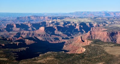
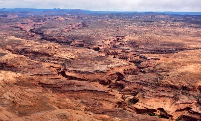
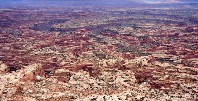
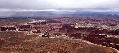 Monument Basin, The Totem, White Rim at Grandview Point in Canyonlands National Park, Moab Utah 289 |
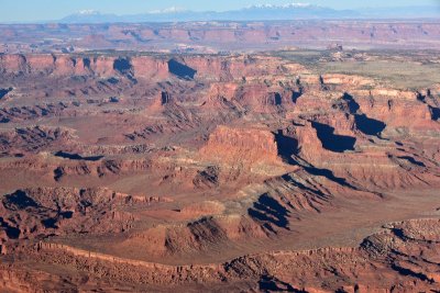
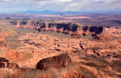
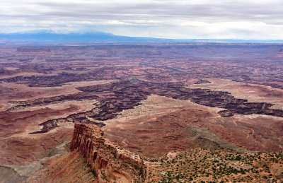
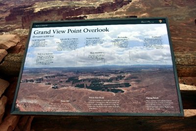 Grand View Point Overlook at Canyonlands National Park Moab Utah 291 |
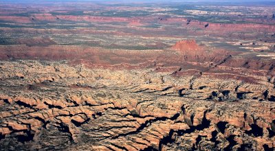
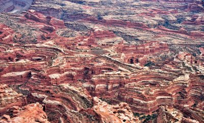
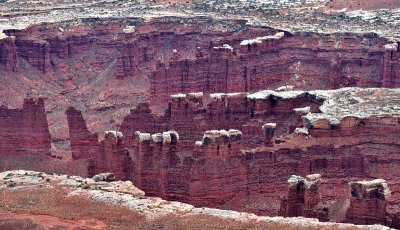 Monument Basin at Cayonlands National Park Moab Utah 303 |
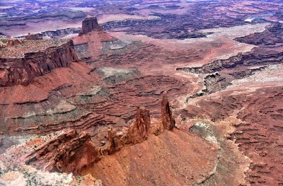
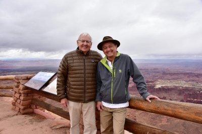 Here we are at Canyonlands National Park 307 |
 Trail Canyon Grays Pasture Island in the Sky Canyonlands National Park Moab Utah 331 |
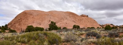 Whale Rock at Canyonlands National Park Moab Utah 344 |
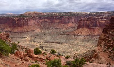
 Holeman Spring Basin from Island in the Sky, Canyonlands National Park, Moab, Utah 349 |
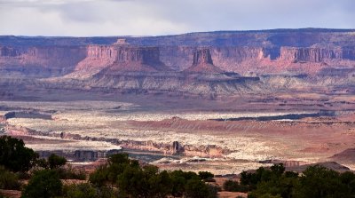 Buttes of the Cross, White Rim, Millard Canyon, Orange Cliffs, Colorado River, Canyonlands National Park, Moab, Utah 352 |
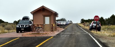 Traffic Jam at the park entrance Canyonlands National Park Moab Utah 373 |
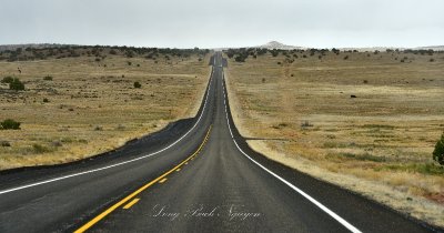 Leaving Canyonlands National Park Moab Utah 379 |
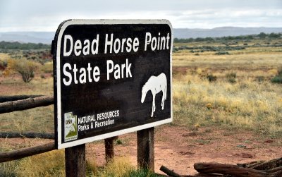 Dead Horse Point State Park Moab Utah 386 |
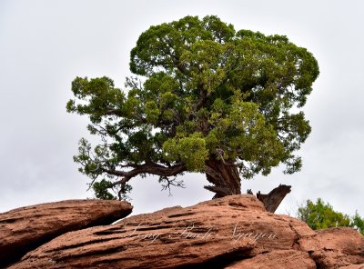 Tree at Dead Horse Point State Park Moab Utah 390 |
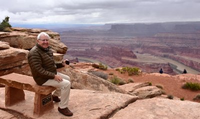
 Charlie at Dead Horse Point State Park Moab Utah 392 |
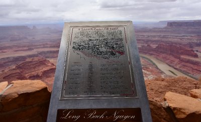 A Layer Cake of Time Dead Horse Point State Park Moab Utah 398 |
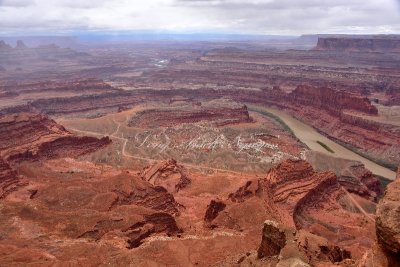 Dead Horse Point State Park and Colorado River Moab Utah 395 |
 Dead Horse Point State Park and Colorado River Moab Utah 407 |
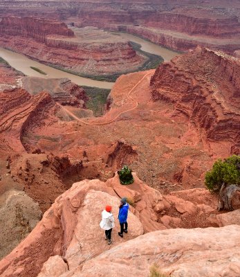
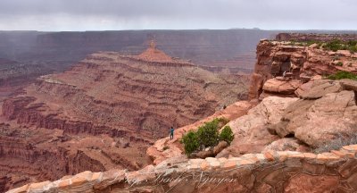 Brave Visitors at Dead Horse Point State Park Moab Utah 409 |
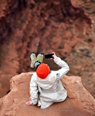
 Risking LIfe for Selfie at Dead Horse Point State Park Moab Utah 418 |
 Selfie on the edge at Dead Horse Point State Park Utah 431 |
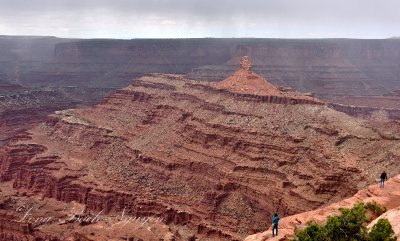
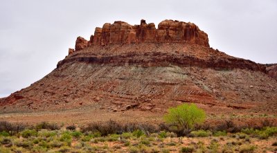
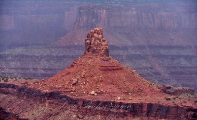 Butte at Dead Horse Point State Park Moab Utah 430 |
 Charlie at Dead Horse Point State Park Moab Utah 446 |
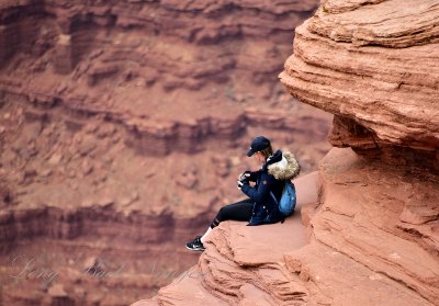 Risking All for the Shot at Dead Horse Point State Park Moab Utah 442 |
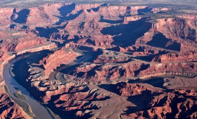
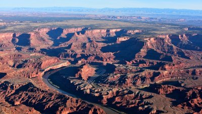
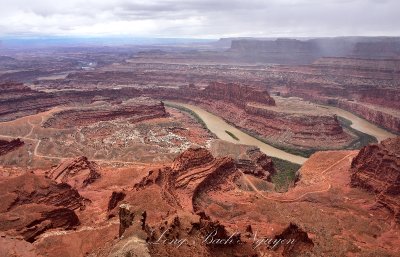 Goose Neck and Colorado River from Dead Horse Point State Park Moab Utah 450 |
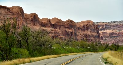
 Mesa along Moab Canyon Moab Utah 487 |
 Potash Lower Colorado Road Scenic Byway Posion Spider Mesa Moab Utah 498 |
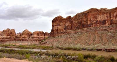
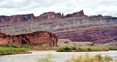
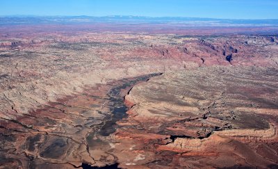
 King Bottom and Colorado River Moab Utah 501 |
 Potash Lower Colorado Road Scenic Byway Posion Spider Mesa Moab Utah 527 |
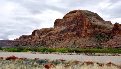
 Kane Spring Canyon Campground Moab Utah 547 |
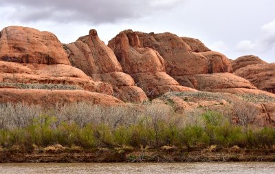
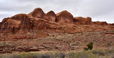
 Amasa Back The Billboard The Bliss Bottom Potash Lower Colorado River Moab Utah 556 |
 Bowtie Arch Moab Utah 564 |
 Colorado River Amasa Mesa Moab Utah 600 |
 Gold Bar Campground Amasa Back Colorado River Moab Utah 622 |
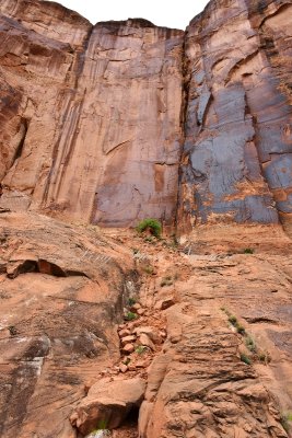
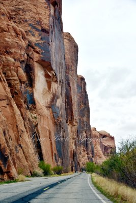 Vertical Wall of Poison Spider Mesa Potash Road Moab Utah 632 |
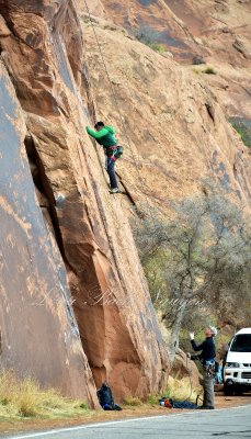 Scaling the Wall on Poison Spider Mesa Moab Utah 636 |
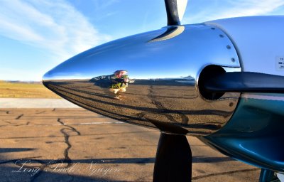 Me in Meridian Spinner at Canyonlands Airport Moab Utah 031 |
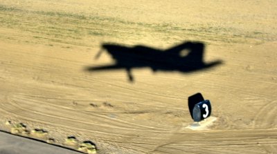 Piper Meridian departing Canyonlands Airport Moab Utah 034 |
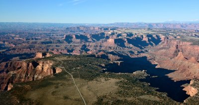
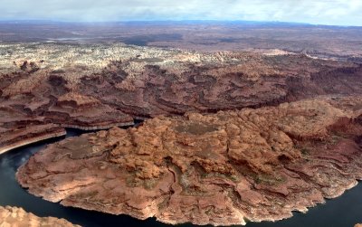
 Dead Horse Point State Park and Canyonlands National Park Navajo Mountain Moab Utah 047 |
 Dead Horse Point State Park and Canyonlands National Park Navajo Mountain Moab Utah 049 |
 Dead Horse Point State Park and Canyonlands National Park Navajo Mountain Moab Utah 053 |
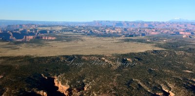
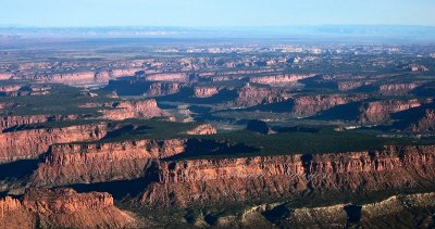
 Canyonlands National Park, Little Bridge Canyon, Lathrop Canyon, White Rim, Island in the Sky, Moab, Utah |
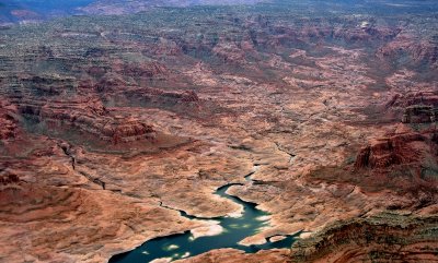
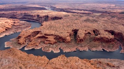
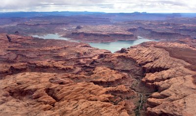
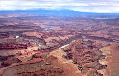
 Goose Neck, Colorado River, Dead Horse Point State Park and Canyonlands National Park, Moab, Utah 075 |
 Goose Neck, Colorado River, Dead Horse Point State Park and Canyonlands National Park, Moab, Utah 084 |
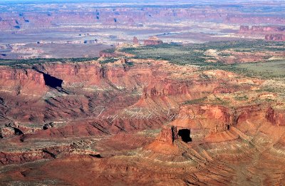
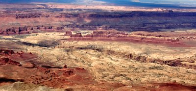
 Canyonlands National Park Moab Utah 100 |
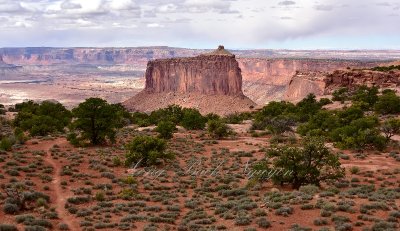
 Airport Tower, Washer Woman, Buck Canyon, Mesa Arch, Island in the Sky, White Rim, Canyonlands National Park, Utah 105 |
 Sewing Machine of South Block The Cove Glen Canyon National Rec Area Hite Crossing Utah 159 |
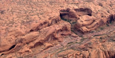
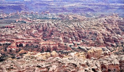
 The Maze Elaterite Butte and Basin Canyonlands National Park Utah 142 |
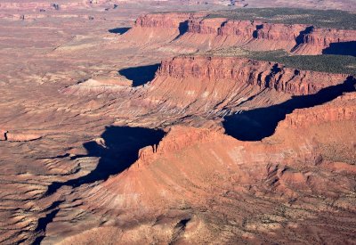
 Canyonlands National Park Moab Utah 145 |
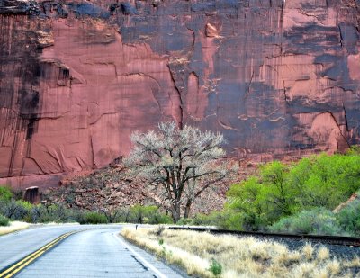 Tree at bend of the road Moab Utah 580 |
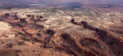
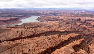
 Waterpocket Fold and Grand Gulch Utah 227 |
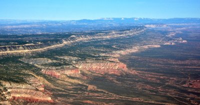 Fiftymile Mountain Fiftymile Bench Utah 239 |
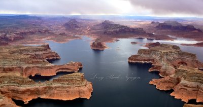
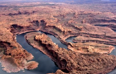
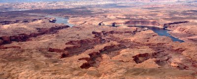
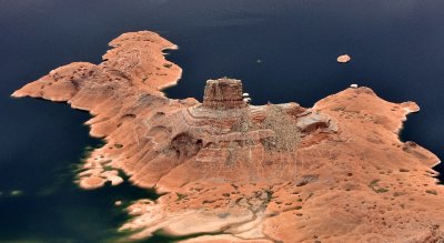 Cookie Jar Butte Padre Bay Lake Powell Colorado River Utah 182 |
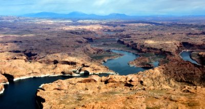
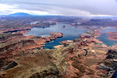 Gunsight Butte, Gunsight Bay, Alstrom Point, Cookie Jar Butte, Gooseneck Point, Lake Powell, Wild Horse Mesa, Rainbow Plateau, U |
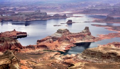 Gunsight Butte Gooseneck Point Lake Powell Navajo Mountain Utah-Arizona 162 |
 Last Chance Bay Gooseneck Point Grand Bench Rainbow Plateau Navajo Indian Nation Utah 188 |
 Mountain Sheep Canyon Lake Powell Cummings Mesa Navajo Nation Arizona 218a |
 Mountain Sheep Canyon Lake Powell Cummings Mesa Navajo Nation Arizona 218a |
 Navajo Valley and Bench Fiftymile Cliff Navajo Indian Nation Utah 234 |
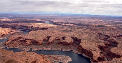
 Lake Powell Colorado River Wilson Mesa Navajo Indian Nation Utah 247 |
 Cottonwood Canyon Lake Powell Navajo Indian Nation Utah 258 Standard e-mail view.jpg |
 San Juan River Wilson Mesa Lake Powell Navajo Indian Nation Utah 253 |
 Long Canyon Waterpocket Fold Glen Canyon National Recreation Area Utah 273 |
 Wilson Mesa Colorado River Lake Powell Ribbon Canyon Navajo Indian Nation Utah 261 |
 Glen Canyon National Recreation Area Colorado River Lake Powell Utah 270 |
 Glen Canyon Lake Powell Wilson Mesa The Rincon Navajo Indian Nation Utah 265 |
 Rock formation over Peshliki Fork in Glen Canyon Lake Powel Good Hope Mesa l Utah 317 |
 Cedar Canyon Knowles Canyon Tapestry Wall Colorado River Lake Powell Glen Canyon Utah 337 |
 Moqui Canyon Red Rock Plateau Glen Canyon Recreation Area Utah 387a |
 Ticaboo Creek Ticaboo Mesa Lake Powell Red Rock Plateau Glen Canyon Utah 300 |
 Utah State Route 95 Hite Crossing Lake Powell Narrow Canyon Browns Rim Utah 424 |
 The Fins Natural Arches Canyonlands National Park Utah 469a |
 Stillwater Canyon Water Canyon Jasper Canyon Green River Canyonlands National Park Utah 475 |
 Stillwater Canyon White Rim Green River Canyonlands National Park Utah 482 |
 White Rim Buck Canyon Colorado River Hatch Point Canyonlands National Park Utah 510 |
 Washer Woman Buck Canyon Airport Tower White Rim Canyonlands National Park Utah 515 |
 Goose Neck Musselman Arch Colorado River White Rim Canyonlands National Park Utah 523 |
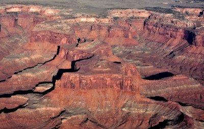
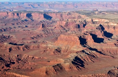 Canyonlands National Park Moab Utah 069 |
| previous page | pages 1 2 ALL | next page |
| Eldar Kadymov | 01-May-2017 15:24 | |
| Tom LeRoy | 28-Apr-2017 12:32 | |
| Paolo Peggi (aka Bracciodiferro) | 28-Apr-2017 08:28 | |
| barbarajoy | 26-Apr-2017 05:30 | |
| Jim's Atavistic Visions | 25-Apr-2017 01:13 | |
| Chris Picard | 12-Apr-2017 22:33 | |
| Dan Greenberg | 10-Apr-2017 16:47 | |
| sand_shadow | 08-Apr-2017 23:34 | |
| Jola Dziubinska | 08-Apr-2017 14:02 | |
| Dan Opdal | 07-Apr-2017 22:45 | |
| Hugh Rooney | 06-Apr-2017 09:05 | |
| Zoltán Balogh | 03-Apr-2017 10:45 | |
| Bart Aldrich | 31-Mar-2017 15:02 | |