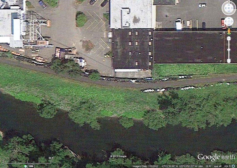
Every once in a while I get inundated with requests to post photos of certain things. Lately people have been clamoring for an aerial shot of the southernmost point of the Green River Trail, so here it is, courtesy of Google Earth. Ironically, the southern end of the trail is not the southernmost point (it's northeast of here). When the trail is extended into Auburn (waiting for funds), this photo will become moot.
This Google Earth view is in southern Kent, Washington and at the center of this WikiMapia aerial view.
The round things on both sides of the trail are huge sandbags that were put there to deal with the possibility of flooding due to failure of the Howard Hansen Dam. The dam had developed some leaking that might have led to collapse during heavy rain (which never came). The sandbags were installed in Fall 2009 and removed in Fall 2012 after the dam had been repaired. While they were in place, the trail was open only to pedestrians.
I lied. The requests did not quite reach the level of "clamoring."
|