Dave Beedon
|
all galleries
>>
Places
>>
Utah
>>
Moab (environs)
>>
Corona Arch
>>
Hike to Corona Arch
> Topographic map of the area
previous
|
next
26-OCT-2006
Dave Beedon
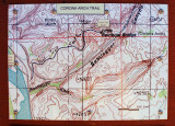
Topographic map of the area
Nikon D80
,
Nikkor 28-105mm f/3.5-4.5D AF
1/320s f/5.0 at 20.0mm iso100
full exif
other sizes:
small
medium
large
auto
previous
|
next
All images are copyright 1966 - 2023 by Dave Beedon (davebeedon AT comcast DOT net).
share
Type your message and click Add Comment
It is best to
login
or
register
first but you may post as a guest.
Enter an optional name and contact email address.
Name
Name
Email
help
private comment
Guest
25-May-2007 16:34
Did names like "Corona" and "bootlegger" exert a subliminal pull on you, Dave?
Jason Anderson
25-May-2007 00:43
Those canyons really run deep. Cool.
Type your message and click Add Comment
It is best to
login
or
register
first but you may post as a guest.
Enter an optional name and contact email address.
Name
Name
Email
help
private comment