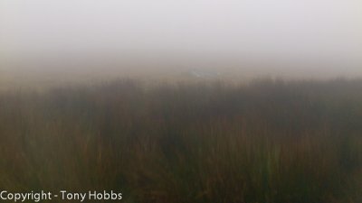
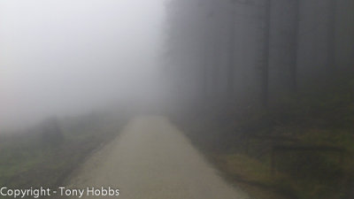
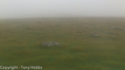
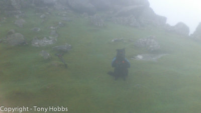
The pix are softer than a babies bottom as taken on my smart phone through a aLocSak waterproof bag. It was very misty and wet.
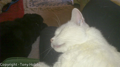
Once again this was a sad start to the day. This time in addition to my usual woes I had the sad news from a 6am phone call, literally minutes before I left home from mum to say a rescue cat had died. This was no normal cat. This was Evie, she only came in a month or so ago, she was 18 years old. She needed a home as her owner was dying of cancer and wanted to return to Australia. Evie took time to settle in, she hid for a week, but quickly took to me and whenever I visited mums, quite regularly, she would come over and sit on my lap. She would not leave my side. I seldom cry, but I did several times this day at her passing. In her honour I have put an image on this page of her sleeping on my lap.
I arrived at Scorhill car park just after 8am to be welcomed not by a rainbow like last time but mist. That mist was thick with some light rain and never cleared all day, until the very end, visibility only a few dozen metres I guess. I sat in the car for a short while, contemplating having to get out.
After my breakfast by the car of hot milk and Shreddies, I fitted Bess's coat and pack on her and shouldered my pack. The new Mountain Laurel Designs Exodus FS. I was very impressed by this pack and had no trouble putting map in the side pocket and getting to it during the walk. This time I put my OS map in an aLoksac. This worked very well. I had packed my sleeping bag and tarp, not with intention of using it but to pitch it. It also helped fill out the pack. Thinking of Evie and the bad visibility did nothing to lift any enthusiasm, besides I never saw anywhere to pitch, not that I was looking much or even thought to look much! In any event time got short later in the day. So just as well I kept walking.
I took a compass bearing to my first port of call, Rappator or Rival Tor. It has both names on the map. If the weather had been clear I would have dog legged it, but in that visibility I was going straight, nothing got in my way, through bogs, gorse, tussocks and heather. The going was very slow, I think it took a good 50 minutes to walk 2km. Simply due to stopping every 20 feet to sight on a blade of grass, bit of heather or a booby shaped tussock. When I finally saw Rappator it was about 40 feet to my right in the mist. I was very chuffed I had found it. From there I took a bearing to Wild Tor again about 2km away and missed smacking it on the nose by a miniscule 20ft. So once again I was mightily pleased I found it. I used compass and map interpretation only and solely dealt in straight lines. I have no ideas on pacing and timing! On that terrain I personally think that would be tricky. Though I am sure its not...
From there I took a bearing to Watern Tor, this took me down a valley, there was a track around the valley, but not a chance in hell was I deviating from my straight lines, besides I had no idea where that path went. So down into the steep valley I went. Over a stream and found a good path directly on my bearing. I have some experience of paths not going where I want them to, so I regularly checked my compass.
From Watern Tor I took a bearing for Hangingstone Hill. The going here was quite gorsey and I had to find a point near by to walk around to on several occasions.
This time I was a fraction more out. I was getting a bit bored of following blades of grass, it was painfully slow, so I became a slave to the compass and walked looking at it at very regular intervals. I did stop occasionally to sight on something. I recon I was about 100ft out, to the left again. It does show that this walking and looking at compass whilst not inaccurate, is not as accurate as slighting on blades of grass!
Using the map and my knowledge of the area I recognised the path, a linear feature ;) and followed that around to Whitehorse Hill. It was good to be off rough ground for a bit.
A compass bearing to Quintins Man lead me there and on to Stats House. Most of this section had a "path" of sorts so my speed was able to increase. Though I still kept a close eye on compass. Walking alone worked to my advantage as I was able to concentrate with no distractions. I have no real problems walking on Dartmoor alone and for the most part am very happy, all things considered..... A blog entry from a previous walk sums up my feelings on that. I think. My thoughts have not changed.
I noticed my backside getting wet when I was traversing Hangingstone Hill. I thought it was the rain in the mist, but on opening my pack my Platypus had leaked! It was 3km to a stream, Teign Head. In those conditions that was no problem, in hot weather I would have been concerned.
Stats House to Sittaford Tor was mostly following a path, but that did monetarily disappear by a very boggy section. Compass to rescue. A real lifesaver, as many times I went to start in a direction, checked compass to find it said differently!
Getting over the stile at Sittaford Tor was much easier than expected in this direction, which surprised me. Thankfully part of the wooden surround and rock wall were damaged enough to allow Bess to clamber over, with just a small help from me.
I had Tweeted earlier about Evie and there were a couple of lovely replies to me, you know who you were, you brought tears to the eyes, but much needed tears. It was very comforting to know that people care.
A compass bearing confirmed Grey Wether Stone Circle, a nice path helped my passage. Then to the stile over a "track" that a farmer had left, at the edge of Fenworthy Forest. One of those tracks you may never find again. But I made the most of it and made good time. I was once again starting to enjoy my walk near its tail end.
For most of the walk Bess stayed quite close, there were times from here on in that Bess took the lead, I am sure she knows the walk was coming to its close, even this distance out.
The walk through the forest was easy forestry roads out to the reservoir all the while in bad visibility. I could see the shore of the reservoir, and no more. The tracks were easy to follow.
I had a rough idea how to get back on the moor and was proved correct as I again used compass to find Thornworthy Tor. This was the first time I noticed dusk approaching and thought better not linger. Not that there was much to linger for in the mist. I did not want to be too far out in the dark.
The going from here was pretty easy with just a wall to cross to reach Middle Tor and Kestor Rock. The mist lifted a little at this point and I was able to see Batworthy Corner and headed to Teign-a-ver Clapper bridge. As I approached the bridges I saw the first of two people in the distance all day, it almost spoilt the solitude. It was on the second of these bridges I stopped and removed my pack to cook a meal and allow darkness to engulf me.
I had kept my meths bottle in my inside coat pocket and that made a big difference as I lit it in four strikes of my fire steel. I used 40ml of meths, a fraction too much as it nearly evaporated too much water, but enough to make up my Smash potato to add to my meal. As my meal cooled a fraction I put more meths quickly to work to boil water for a tea. It was at this point I saw the second bod of the day, a person appeared at the top of Scorhill, turned around and left. As I finished my meal and prepared my tea darkness well and truly settled in. I packed up under torch light and again taking a compass bearing, this time due to darkness not miss, I tried to follow the path over Scorhill. I have to admit, night walking is not that easy. Some say don't use a torch as it messes your night vision up, so I tried in darkness or with the red filter light on, but given this was a path of sorts, I would not much fancy rougher ground. It was here that Bess really took the lead I had to call her back several times. All I could see was a flashing red light heading for the car. It was very dark by the time I reached the car at 5.30, some 9 hours after I started, and this was only a 20 km walk.
It was good to finalise the walk and I looked back with fondness on a good and rewarding walk in near zero visibility.