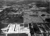
photo sharing and upload picture albums photo forums search pictures popular photos photography help login
Don Boyd | all galleries >> Memories of Old Hialeah, Old Miami and Old South Florida Photo Galleries - largest non-Facebook collection on the internet >> 1950 to 1959 Miami Area Historical Photos Gallery - click on image to view > 1957 - Bird Road in the middle, viewed to the east, SW Dade County
previous | next
1957

1957 - Bird Road in the middle, viewed to the east, SW Dade County

Southwest Dade County, Florida


Thanks to Ray Vaughan for identifying the location.


other sizes: small medium original auto
comment | share
Barry Diamond 09-Jul-2009 03:07
Ray is correct. Crown Lanes opened around 1962 and only lasted a few years. I bowled in the Scratch Leagues that year, but the place fell out of favor because the land hadn't been properly graded and settling caused the lanes to slant slighly - a no-no.

In 1957, none of the area between 107Ave and 117Ave (the N-S Canal going across the foreground) was developed.
Ray 11-Oct-2007 03:12
I have seen some images on the Miami Dade web site way out of place. The property might be correct but, yes, I have seen pictures from the future. My guess is a later application resulted in some research on older applications and the photo's ended up misfiled in the older file. By the way, I'm the Guest that figured out the location for this one. And I'm still spending hours on your site. Thanks!
Don Boyd18-Sep-2007 20:20
I don't know what to tell you except that it was attached to a 1957 zoning appeals case and they surely couldn't use a photo from the future for their case. Unless things got scrambled at the zoning department's offices? Don
russ 18-Sep-2007 19:29
This photo seems to be a little newer than 1957. Westwood Lakes, both additions and both lakes are complete. The tax records show these additions were done in '56 and '57 and there seems to be some maturing of this neighborhood. The light (sandy) area in the forground is Village Green which was built in 1960. The Kendall Regional Hospital was originaly a bowling alley, Crown Lanes I think, then it became a nursing home then the hospital. The Bird Road Bridge was new also, the only way west into what is now Horse County (lower right quadrant of the photo) was a wooden bridge at SW 42 st over the Snapper Creek Canal behind the Hospital. The ground where the 42nd st bridge was is now covered by the northbound exit to Bird Road from the Turnpike as it crosses Snapper Creek Canal. Wore out a lot of bike tires here.
Guest 15-Sep-2007 02:52
It's looking east, right down Bird Road. The jog in the road is where Kendall Regional Hospital is today. Today the Turnpike would go from the left to the right.

You have no idea how many hours I've been spending on your web site.