


|
|
|
|
|
|
| |
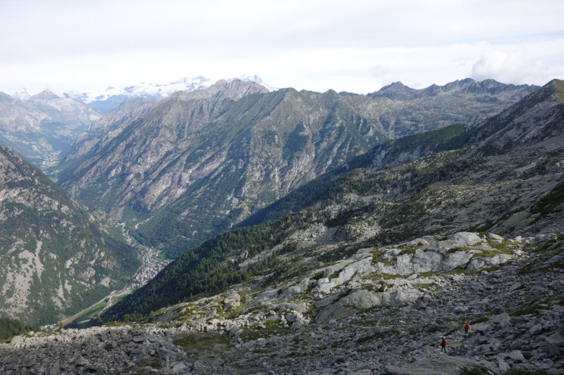
The trail descends first past the rocks in the sun, then turns left to descend the valley, then wraps around the ridge in the middle of the picture (in the forest to reach Niel. From there the trail climbs again to Col Lazouney on the far horizon (right half of the image). From there the trail descends the long Loo valley (not visible) to Gressoney. Gressoney is the town in the valley floor on the left. From there the trail climbs to Col Pinter (below the Matterhorn).