photo sharing and upload picture albums photo forums search pictures popular photos photography help login
Bryan Murahashi | all galleries >> 2012 Adventures >> July 28 - Eight days and 77 Miles on the Pacific Crest Trail > Day Four Map
previous | next

Day Four Map

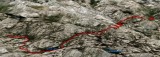
The link to the GPS plots for this 10.57 mile fourth day http://connect.garmin.com/activity/208341036

Elevation Gain: 2,107 ft
Elevation Loss: 2,290 ft
Min Elevation: 7,754 ft
Max Elevation: 8,931 ft


other sizes: small medium large original auto
share