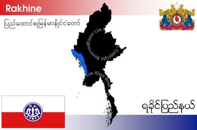
Rakhine State is a state of Myanmar. Situated the western coast, it is bordered by Chin State in the north, Magwe Division, Bago Division and Ayeyarwady Division in the east, the Bay of Bengal to the west, and the Chittagong Division of Bangladesh to the northwest. It is located approximately between latitudes 17°30' north and 21°30' north and east longitudes 92°10' east and 94°50' east. The Rakhine (Arakan) Yoma mountain range, which rises to 3,063 m at Victoria Peak, separates Rakhine State from Burma Proper. Its area is 36,762 km˛ and its capital is Sittwe.
The estimated population in 2000 was 2.75 million of which the ethnic Rakhine make up the slight majority. The Rohingya make up approximately 25% of the state's population (about 723,000 in 2009) but are not counted as citizens by the military government.