photo sharing and upload picture albums photo forums search pictures popular photos photography help login
Type your message and click Add Comment
It is best to login or register first but you may post as a guest.
Enter an optional name and contact email address. Name
Name Email
help private comment
Brian McMorrow | all galleries >> Asia >> China - 中国 >> Tibet - 西藏 (བོད་) >> Mountain Passes to Gyantse >> Karo-la Pass (4960m) > Kalurong Qu river flowing down from the Karo-la Pass
previous | next
05-OCT-2008

Kalurong Qu river flowing down from the Karo-la Pass

Nikon D200
1/500s f/11.0 at 18.0mm iso400 full exif

other sizes: small medium original auto
comment | share
bruno_tibet11-Oct-2009 06:10
Nice Picture!

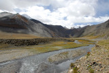
But according to the map of Noijin Kangang http://www.summitpost.org/view_object.php?object_id=501991 - click on it for higher resolution), the main river is called Kalurong Qu. Nganyang valley is a side valley heading north towards Noijin Kangsang Base Camp.