


|
|
|
|
|
|
| Sunbird Photos by Don Boyd | profile | all galleries >> NEWEST photos - from Nikon D800E DSLR only >> Nikon D800E Aerial Landscape Photo Gallery | tree view | thumbnails | slideshow |
These are Nikon D800E photos of aerial landscapes, most taken with a 50mm f1.4 lens from aircraft.
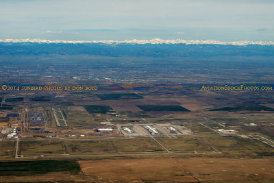 April 2014 - aerial view of Denver International Airport |
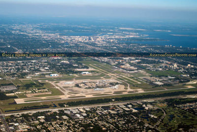 2014 - aerial photo of Tampa International Airport and downtown Tampa landscape stock photo #4784 |
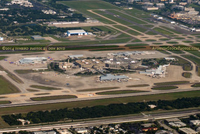 2014 - aerial photo of Tampa International Airport (TPA) aviation stock photo #4784C |
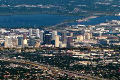 2014 - aerial photo of downtown Tampa #4784C2 |
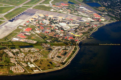
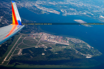 2014 - aerial photo of MacDill Air Force base, Davis Islands, and downtown Tampa landscape stock photo #4793 |
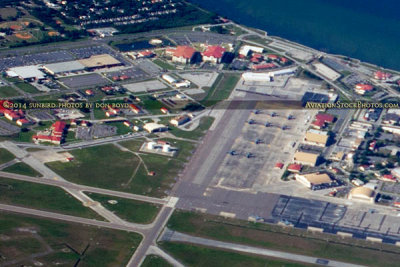 2014 - aerial photo of the northeast corner of MacDill Air Force Base aerial photo #4793C |
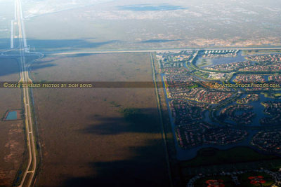 2014 - aerial view of the US 27 I-75 interchange that wiped out Andytown - Weston on the right stock photo #4803 |
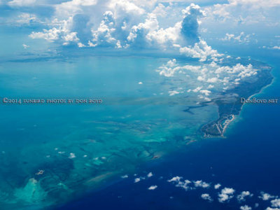 2014 - Grand Bahama Island aerial stock photo #5565 |
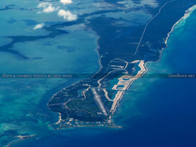 2014 - aerial photo of West End Airport, Grand Bahama Island aviation stock photo #5565C |
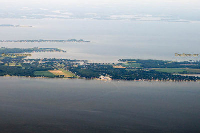 2014 - aerial view of the Kentmorr Restaurant and Crab House on Kent Island, Maryland landscape aerial stock photo #5574 |
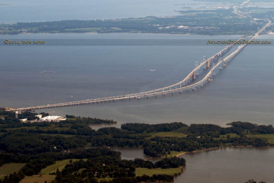
 2014 - aerial view of the Chesapeake Bay Bridge aerial landscape stock photo #5580 |
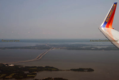
 2014 - aerial view of the Chesapeake Bay Bridge landscape stock photo #5580C |
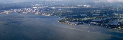 2014 - aerial photo of eastern St Petersburg from Whitted Airport to Shore Acres stock photo #5914C |
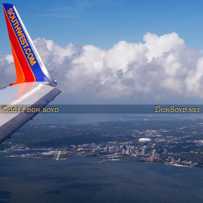 2014 - aerial view of the Southwest winglet and downtown St. Petersburg aerial landscape stock photo #5914C |
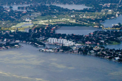 2014 - aerial photo of Shore Acres (foreground on right) and east end of Snell Island (condos) landscape stock photo #5914C |
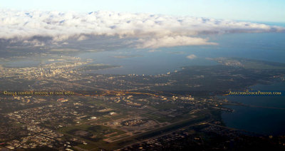 2014 - aerial view of a cloud bank over Tampa International Airport, downtown Tampa and MacDill AFB aerial stock photo #5923 |
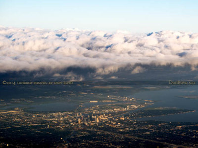 2014 - cloud bank over downtown Tampa aerial landscape stock photo #5923C |
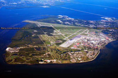 2014 - aerial photo of MacDill Air Force Base landscape military aerial stock photo #6118 |
 2014 - aerial photo of the eastern side of MacDill Air Force Base military landscape stock photo #6118C |
 2014 - aerial photo of Tampa's Bayshore Boulevard (top), Davis Island and ship channel landscape aerial photo #6121 |
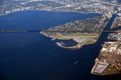
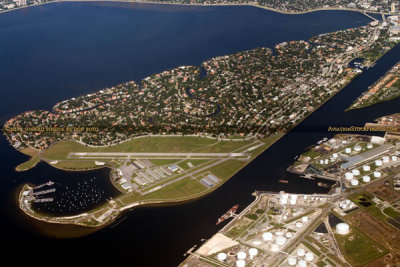
 2014 - aerial photo of Davis Island and Peter O. Knight Airport aerial landscape stock photo #6121C |
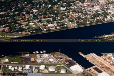
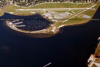 2014 - aerial photo of Peter O. Knight Airport at the south end of Davis Island in Tampa aviation stock photo #6121CC |
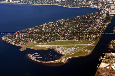
 2014 - aerial photo of Davis Island and Peter O. Knight Airport landscape aviation airport stock photo #6123 |
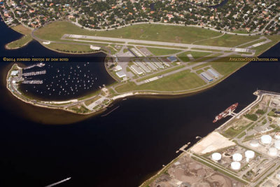 2014 - aerial photo of Peter O. Knight Airport and Seddon Channel landscape airport aviation stock photo #6123C |
 2014 - aerial photo of Davis Island, Seddon Channel (top) and Sparkman Channel (right) landscape stock photo #6125 |
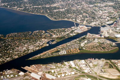 2014 - aerial photo of Davis Island, Seddon and Sparkman Channels and Harbour Island aerial landscape stock photo #6125 |
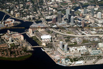
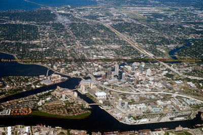 2014 - aerial photo of Davis Island, Harbour Island and downtown Tampa landscape aerial stock photo #6126 |
 2014 - aerial photo of downtown Tampa landscape stock photo #6126C |
 2014 - aerial photo of downtown Tampa landscape aerial stock photo #6127 |
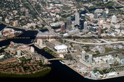
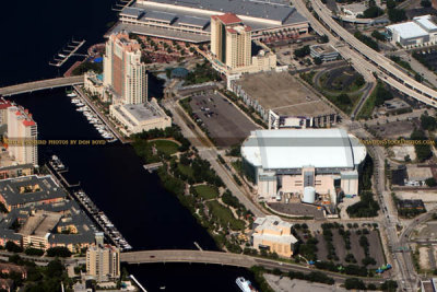 2014 - aerial photo of the Tampa Marriott Waterside Hotel and Tampa Convention Center (top) landscape aerial stock photo #6127C |
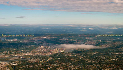 2015 - the Pittsburgh area with downtown obscured by a cloud aerial stock photo #1562 |
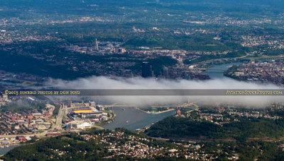 2015 - closeup of the Three Rivers area with downtown Pittsburgh behind the cloud aerial stock photo #1562C |
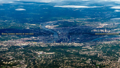 2015 - aerial stock photo of Pittsburgh, Pennsylvania #1565 |
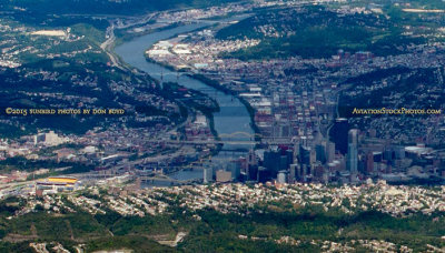 2015 - aerial stock photo of Mount Washington and downtown Pittsburgh, Pennsylvania #1565C |
 2015 - a large and high cloud full of lightning offshore of Cape Canaveral, Florida stock photo #1582 |
 2015 - a huge and high cloud full of lightning offshore of Cape Canaveral, Florida stock photo #1586 |
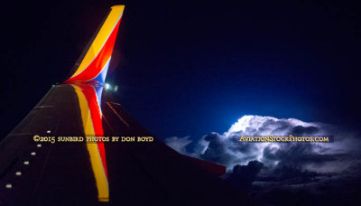 2015 - huge lightning storm cloud with the winglet of our Southwest Airlines B737-700 due east of Sebastian stock photo #1606 |
| comment | share |