


|
|
|
|
|
|
| yogib | profile | all galleries >> Galleries >> U S State Railroad Maps from 1895 | tree view | thumbnails | slideshow |
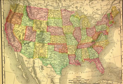 United States Railroads 1895 |
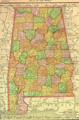 Alabama Railroads 1895 |
 Alaska Territory 1895 |
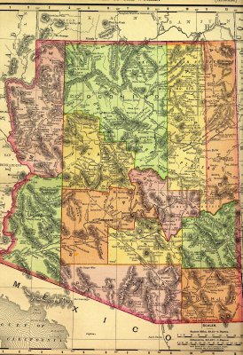 Arizona Territory Railroads 1895 |
 Arkansas Railroads 1895 |
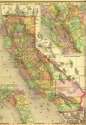 California Railroads 1895 |
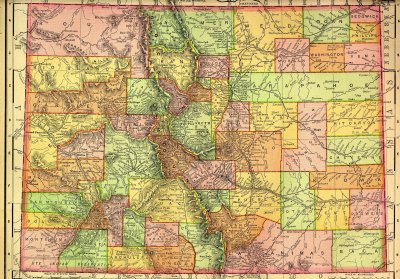 Colorado Railroads 1895 |
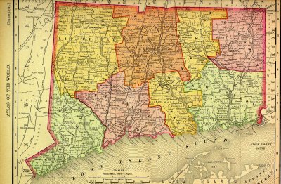 Connecticut Railroads 1895 |
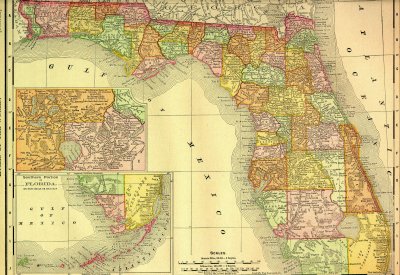 Florida Railroads 1895 |
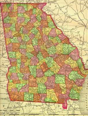 Georgia Railroads 1895 |
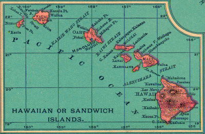 Republic of Hawaii 1895 |
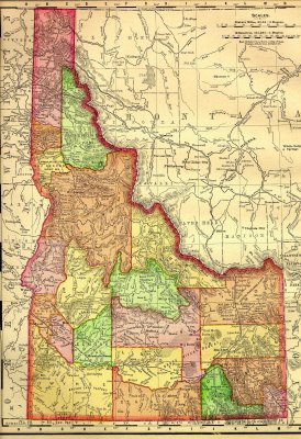 Idaho Railroads 1895 |
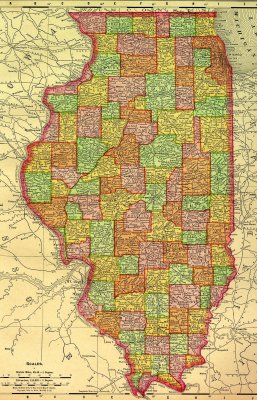 Illinois Railroads 1895 |
 Indiana Railroads 1895 |
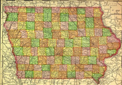 Iowa Railroads 1895 |
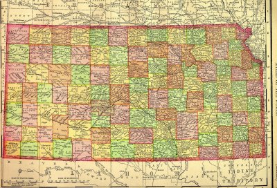 Kansas Railroads 1895 |
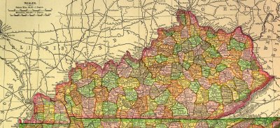 Kentucky Railroads 1895 |
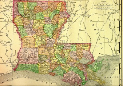 Louisiana Railroads 1895 |
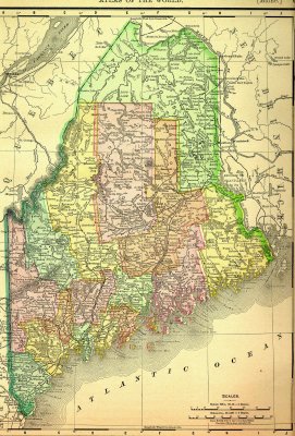 Maine Railroads 1895 |
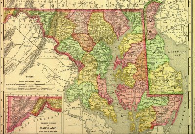 Maryland and Delaware Railroads 1895 |
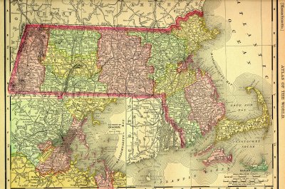 Massachusetts Railroads 1895 |
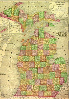 Michigan Railroads 1895 |
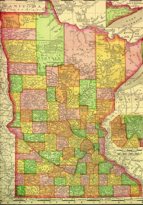 Minnesota Railroads 1895 |
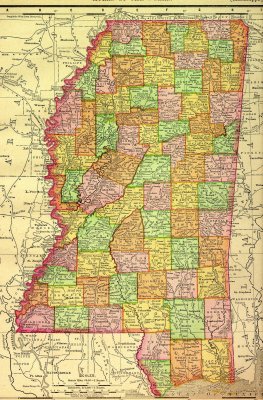 Mississippi Railroads 1895 |
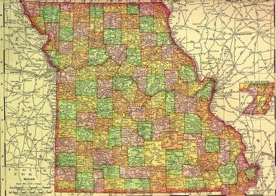 Missouri Railroads 1895 |
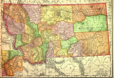 Montana Railroads 1895 |
 Nebraska Railroads 1895 |
 Nevada Railroads 1895 |
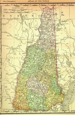 New Hampshire Railroads 1895 |
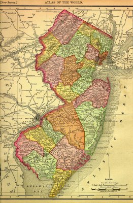 New Jersey Railroads 1895 |
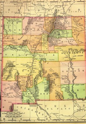 New Mexico Territory Railroads 1895 |
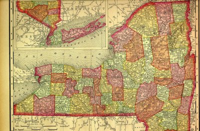 New York Railroads 1895 |
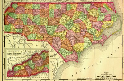 North Carolina Railroads 1895 |
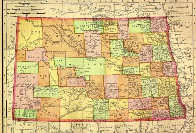 North Dakota Railroads 1895 |
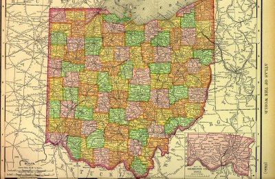 Ohio Railroads 1895 |
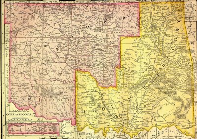 Oklahoma Territory Railroads 1895 |
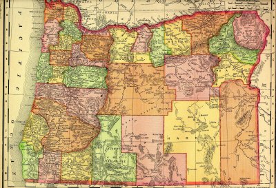 Oregon Railroads 1895 |
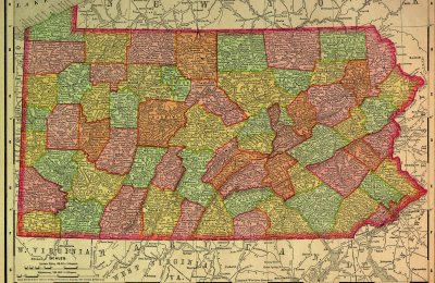 Pennsylvania Railroads 1895 |
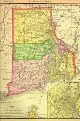 Rhode Island Railroads 1895 |
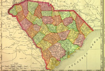 South Carolinia Railroads 1895 |
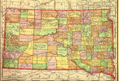 South Dakota Railroads 1895 |
Tennessee Railroads 1895 |
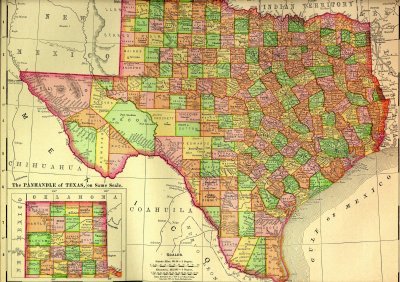 Texas Railroads 1895 |
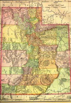 Utah Territory Railroads 1895 |
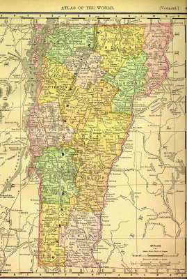 Vermont Railroads 1895 |
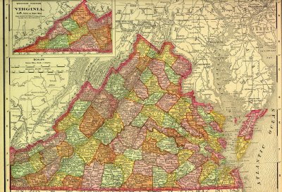 Virginia Railroads 1895 |
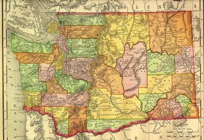 Washington Railroads 1895 |
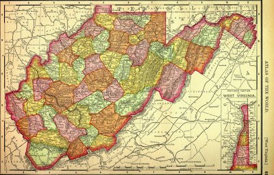 West Virginia Railroads 1895 |
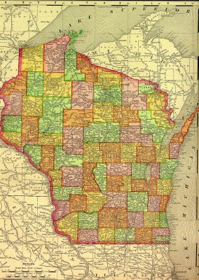 Wisconsin Railroads 1895 |
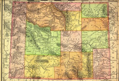 Wyoming Railroads 1895 |
| comment |