CARRIZO PLAIN NATIONAL MONUMENT CALIFORNIA WALLACE CREEK SAN ANDREAS FAULT OVERLOOK (3).JPG
|
CARRIZO PLAIN NATIONAL MONUMENT CALIFORNIA WALLACE CREEK SAN ANDREAS FAULT OVERLOOK (4).JPG
|
CARRIZO PLAIN NATIONAL MONUMENT CALIFORNIA WALLACE CREEK SAN ANDREAS FAULT OVERLOOK (5).JPG
|
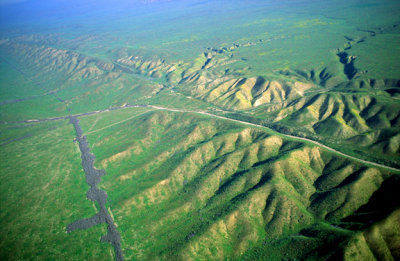
Right lateral strike slip offset on the San Andreas Fault Zone, CA
|
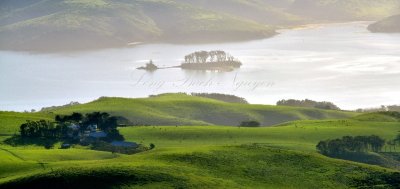
Hog Island, Duck Island, Tomales Bay, San Andreas Rift Zone, California 281a
|
(SG34) View of the trace of the San Andreas Fault, Carizzo Plain, CA
|
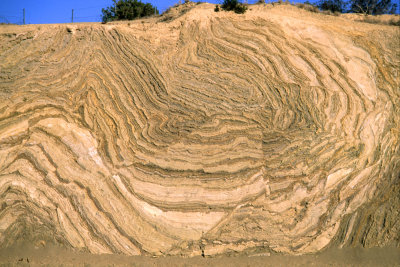
Rocks are highly distorted by movement along the San Andreas strike slip fault near Palmdale, CA
|
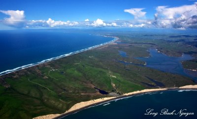
Point Reyes National Seashore, Drakes Bay, Drakes Estero, San Andreas Rift, California
|
(SG3) Right lateral strike slip offset on the San Andreas Fault., Carrizo Plain, CA
|

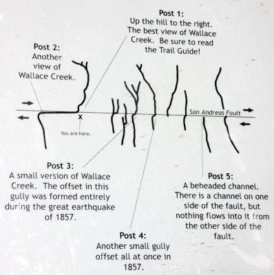
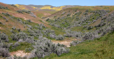
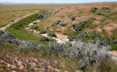
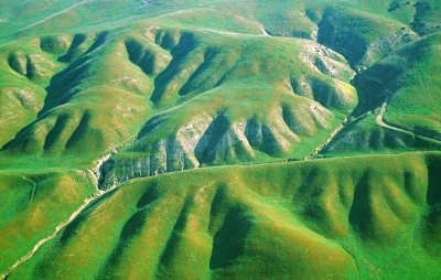
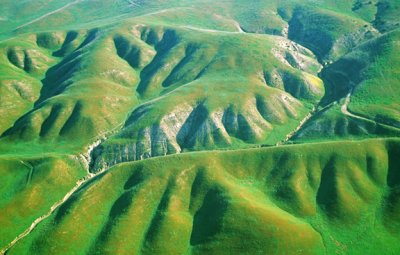
Offset channel of Wallace Creek created by the movement of the San Andreas Fault in Carrizo Plain National Monument
|


