


|
|
|
|
|
|
| RJB Graphics | profile | all galleries >> Me, My and Myself >> The Western Tour 2009-2011 | tree view | thumbnails | slideshow | map |
An urge to go west "young man".. Alberta and British Columbia: Mountains and Waterfalls
Currently more or less in random order, but am working to place in chronologic sequence and finish filling out the portfolio.
Start viewing the picture in the "large" format. If the picture is a panorama and much wider than high, there should be an instruction to click on the "original size". That will give better viewing. At times there are variants of the picture, usually to a high contrast Black & White ala Ansell Adams.
Please comment on the pictures (like or hate).
| previous page | pages 1 2 3 4 5 6 7 8 9 10 11 12 ALL | next page |
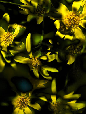 varied_alpine.jpg |
 2009 Western Tour | For about a week I wandered through the Rocky Mountains in Alberta and British Columbia. What I learned from this is that going on a set time frame does not allow for more spontaneous photography but rather limits the extent of the images. | Castle Mountain to Mount Ishbel Panorama | The first of the panoramas I photographed in the journey through the mountains. Castle mountain on the left Through to Mt. Ishbel on the right. Eisenhower Peak is the right most peak making up Castle Mountain. The Bow river is in the foreground. Best viewed on Original Size |
 Crowfoot Glacier | One of the first glaciers seen from the Icefiel Parkway within Banff National Park Taken 3.39 Km from Crowfoot Glacier, looking over Bow Lake Best viewed on Original Size |
|
 Crowfoot Glacier | Best viewed on Original Size |
 Crowfoot Glacier | Best viewed on Original Size |
 Crowfoot Glacier | Best viewed on Original Size |
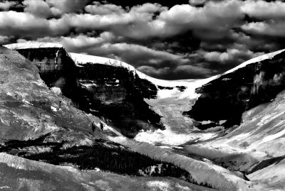
 Crowfoot Glacier (B&W) | Best viewed on Original Size |
 Crowfoot HDR | Best viewed on Original Size |
 Before Athabasca | Looking southerly to Cirrus Mountain (5.5 to 7Km). From a severe switchback. Best viewed on Original Size |
 Mt. Athabasca to Mt. Kitchener 0604hrs Panorama | Mt. Athabasca (far left) 4.3 Km , Mt. Andromeda (Left of centre) 4.9 Km, Athabasca Glacier (Center) 1.13 Km, (top of Glacier 7.1 Km), Un-named Mountain (Right of centre) Dome Glacier 2.5 Km and Mt. Kitchener 5.5 Km (Far Right). From Mt. Athabasca to Mt Kitchener 8.3 Km Best viewed on Original Size |
Mt. Athabasca to Mt. Kitchener (0752hrs) | A slightly later in morning picture showing the snow field on Athabasca, Athabaska Glacier and Dome Glacier. Best viewed on Original Size |
 Mt. Andromeda Icefield Panorama | A composite picture showing the ice field on the flanks of Mt. Andromeda |  Athabasca Glacier | Mount Andromeda on the left, Athabasca Glacier (center) and Mountain ridge on right separating Dome and Athabasca Glaciers. Sunwapta Lake in right near foreground. | Athabasca Mountain Ice Field Panorama | Best viewed on Original Size |
 Dome Glacier |
|
 Dome Glacier Panorama |
 Gong Glacier Panorama |
 Gong Glacier Panorama BW |
 WEB_gong-.jpg |
| previous page | pages 1 2 3 4 5 6 7 8 9 10 11 12 ALL | next page |
| comment | share |