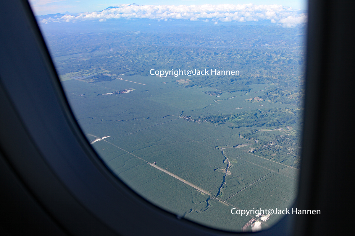
This image shows the two airstrips belonging to a vast export quality banana plantation called Tagum Agricultural Development Company (TADECO).
The field in the lower section of this photo is TADECO 2 Airstrip. While the hangar and bldgs are located in Panabo,
Google maps shows that this strip is located in Santo Tomas. Panaga River runs perpendicular to this strip's end.
The other airfield near the middle of this image is TADECO 1 and is located in Tagum. Both airstrips are in the province of Davao del Norte.
The pinnacle peering above the clouds in the distance is Mount Apo, the tallest mountain in the Philippines.
This photo was taken at 7:59AM from aboard Philippine Airlines Airbus A-321 flight PR811 Manila to Davao (MNL-DVO)
IMG_3623pb.jpg