Sunday 9/2
Up early the next morning and had a strong pot of coffee. Washed up in the nice restrooms (flush toilets and warm water). We met our camp neighbors from Minnesota who were on a 12 day trip but had no plan. They asked us where we were headed which led to a flurry of maps and notepads. I think we convinced them to do the Grand Circle. We�ll have to drop them an email for the rest of the story.
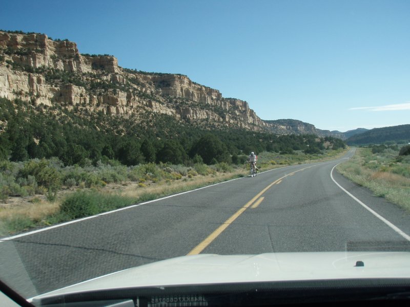
Finally broke up the gabfest to pack up and hit the road. Out of the park and onto Hwy 12. Off through Tropic and Cannonville, then out through the canyons toward Escalante. We set the cruise control to 45 mph and enjoyed the morning. We only needed to get to Escalante. We were in no hurry�we were already where we wanted to be.
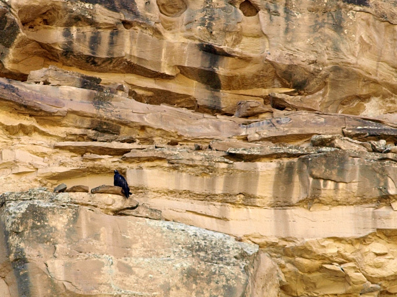
Somewhere along the way, Sharon spotted a large bird on the cliff near the road. We pulled over and watched through the binoculars but it was too far for a decent picture. We decided it was an immature Golden Eagle.
-
Even dawdling along and pulling out for traffic to pass, we soon arrived at the new joint BLM/NPS Visitor�s Center. On our last trip it was under construction and the trailer that was the temporary VC was closed for the night. We pulled in to check it out and who should be there but our Minnesota friends from the campground. They were just leaving the VC and had even watched the movie in the theater. I guess we were taking our time.
The visitor�s center is very nice. The grounds are landscaped with native plants and some great sculpture of desert critters. We watched a bit of the movie and checked out the displays. It isn�t a large VC but there are people to talk to for advice on activities in the area. They have an extensive selection of topo maps which are a vital bit of gear if you�re headed away from the roads.
-
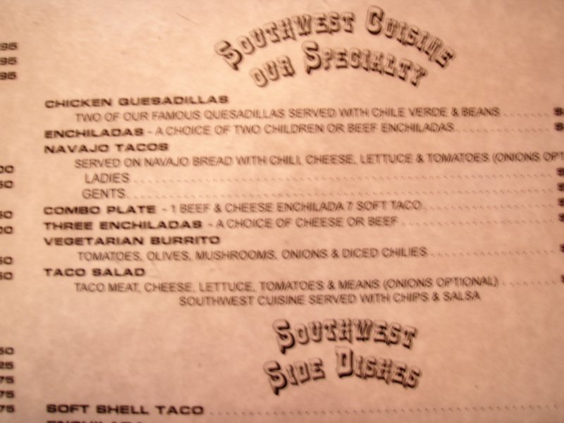
We left the VC and headed into Escalante. After touring the main drag, we were hungry and ended up at one of the only places open, the restaurant at the Prospector Inn. Ordered a couple of Mexican food items � taco, enchilada, veggie burrito. Pretty basic food but fine. We were amused that they served children�children enchiladas! Quite a menu misprint! When we asked for some salsa we were brought what appeared to be a bowl of canned stewed tomatoes but, hey, we were hungry.
After our mediocre mid day meal, we decided to take a backroad cruise on the Hell�s Backbone Road. Before heading out of town, I stopped at the minimart at the north end of town to check the tire pressure. I was suspicious of the left front tire, it looked a little low and the Jeep was pulling to the left a bit. Sure enough, it was about 10 psi low. I checked the other tires as well, and they were all different� not uncommon for a rental. I should�ve checked them sooner in the trip as I usually do.
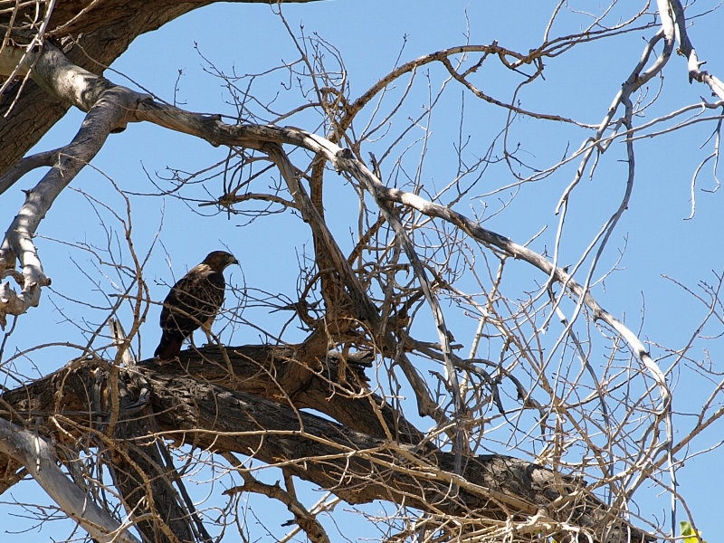
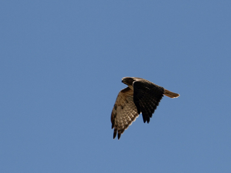
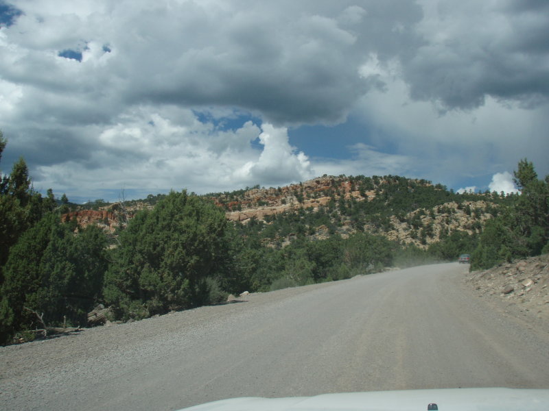
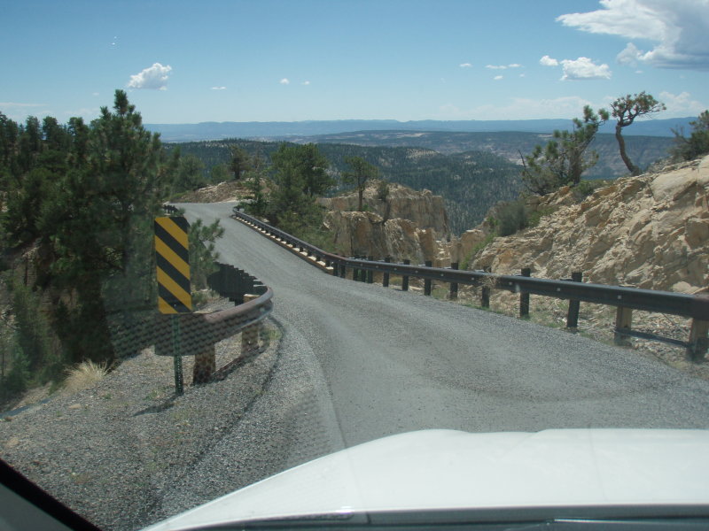
The Hell�s Backbone Rd. is a 38 mile drive that dumps you out on Rt. 12 about three miles south of Boulder. We found the road easily since it is well marked at the north end of Escalante. It starts out as a back street but then turns to gravel as you head out of town. It was wide and dusty. Just as we left town, Sharon spotted a small hawk on one side of the road and I spotted another in a tree on the other side. We stopped and watched them as they eyed us warily.
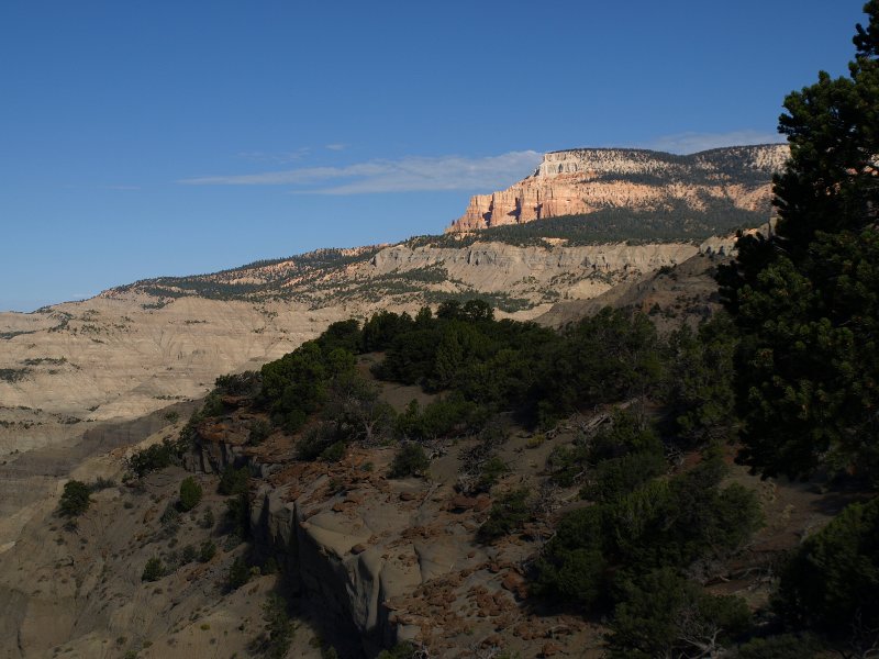
As we continued along, the road began to climb and red ridges dotted with sage and juniper rose along the left. The road was still loose gravel and had become washboard.
Since it was wide and fairly straight, I was able to keep up some reasonable speed to smooth out the rippled road.
-
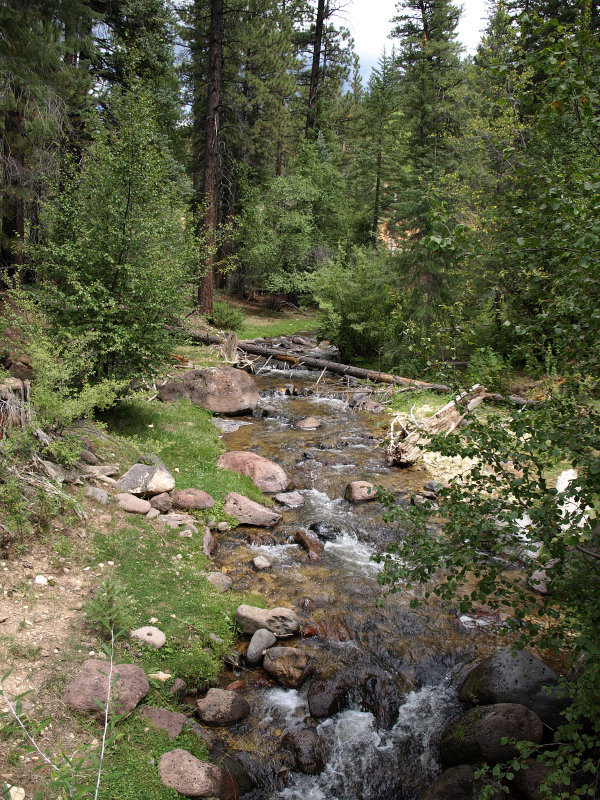
Eventually we climbed higher and the junipers gave way to the alpine forest of spruce and pines. The road got smaller and twistier as we climbed. It was still washboard and caution replaced speed. A car bouncing on washboard in a turn doesn�t respond well and with steep drop-offs alongside the road, I needed a sure response.
It always amazes me to drive just a few miles and find myself in an entirely different environment. A few minutes earlier, we�d been in a dry, scrubby juniper-filled land and here, we were passing babbling mountain streams where the scent of firs and pines filled the air.
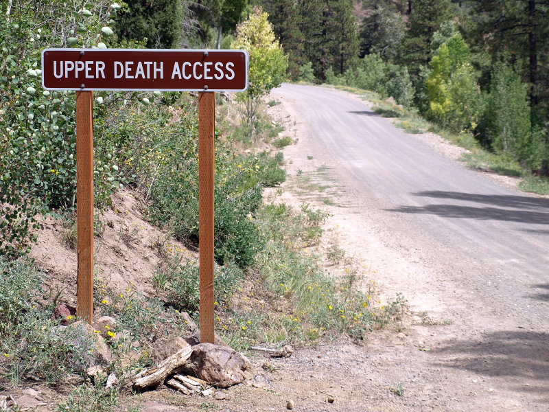
As we passed the highest point on Hell�s Backbone Rd. (9,000� or so) we began to get glimpses of The Box Death Hollow Wilderness on the right. This is a little-used yet spectacular area. I hear there is great hiking in there and I can believe it. Some of the signs in the area are amusing too.
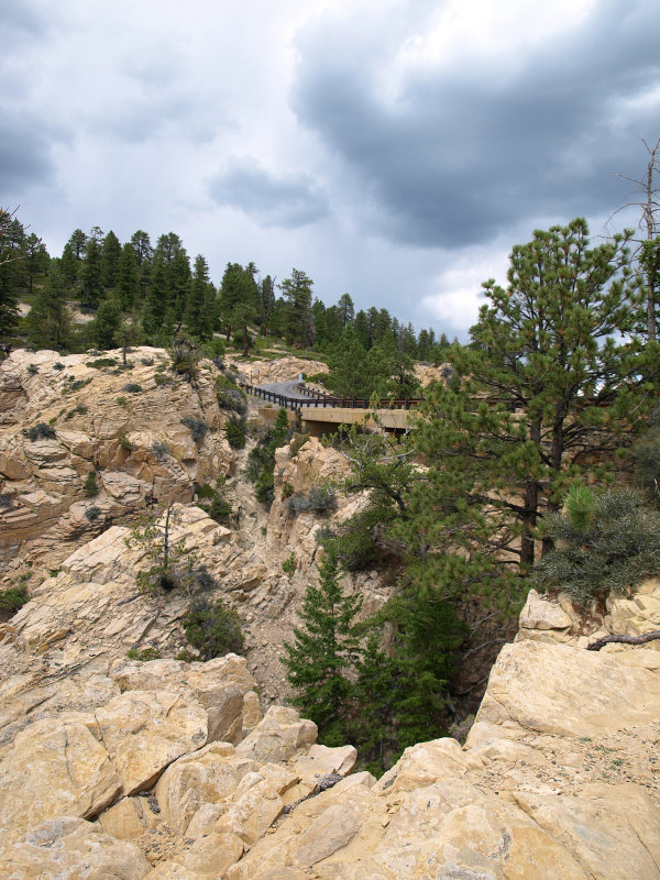
Eventually the road headed down to Hell�s Backbone Bridge which provides great views and photo ops of the area. We stopped to try our luck with the cameras and stretch our legs.