


|
|
|
|
|
|
| paure1 | profile | all galleries >> Galleries >> A photo record of the Orongorongo Valley Huts in 2012 | tree view | thumbnails | slideshow | map |
| previous page | pages 1 2 3 4 5 6 7 ALL | next page |
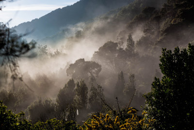 Morning mist at the beginning of the Orongorongo Track. |
 Orongorongo Map 1944.jpg |
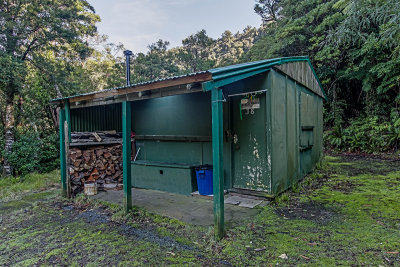
 Amber Inn_40_2012.jpg |
 Bain Iti_56_2012.jpg |
 Bambazoola_73_2012.jpg |
 Bedlam_61_2012.jpg |
 Black Whare_38_2012.jpg |
 Orongorongo Track. |
 Boar Inn_34_2012.jpg |
 Boulder_32_2012.jpg |
 Bushmans Arms_22_2012.jpg |
 Camp Two_41_2012.jpg |
 Orongorongo River below Big Bend. |
 Cookies_9_2012.jpg |
 Cookies_9_2012B.jpg |
 Delta Lodge_63_2012.jpg |
 Delta Lodge_63_2012B.jpg |
 Diggles_52_2012.jpg |
| previous page | pages 1 2 3 4 5 6 7 ALL | next page |
| comment | share |
| Warwick Scarlett | 14-Feb-2024 01:46 | |
| Paul Reid | 22-Dec-2022 02:10 | |
| Mark Pirritt | 06-Feb-2018 13:53 | |
| Guest | 08-Apr-2017 00:25 | |
| Margaret Mitchinson | 09-Feb-2017 08:08 | |
| Margaret Mitchinson | 09-Feb-2017 08:06 | |
| Roger Tidman | 16-Feb-2016 08:36 | |
| Bert Hedley | 20-Aug-2015 10:33 | |
| Guest | 04-Nov-2014 07:44 | |
| Guest | 15-Jul-2014 08:46 | |
| Alastair Laing | 07-Jul-2014 10:31 | |
| Alastair Laing | 07-Jul-2014 10:30 | |
| Anthony | 28-Dec-2013 01:54 | |
| Guest | 27-Oct-2013 08:44 | |
| Guest | 27-Oct-2013 08:42 | |
| Guest | 25-Oct-2013 12:46 | |
| Guest | 25-Oct-2013 12:44 | |
| Karen | 04-Sep-2013 06:23 | |
| clarkie | 11-Aug-2013 03:24 | |
| Guest | 22-Jan-2013 23:44 | |