01-NOV-2012
You Got Something Better To Do?
When I’m on a trail and I’m not headed to a specific site, and the surroundings aren’t yielding much in the way of photos I need to decide whether to continue. My response to myself is, “You got something better to do?” Actually yes, I could usually go to a different trail and see what it has to offer. But the truth is that I always continued on. I’ve mentioned multiple times how much I enjoy the experience of hiking in the forest. So the reality is that no, there’s absolutely nothing better that I could have been doing.
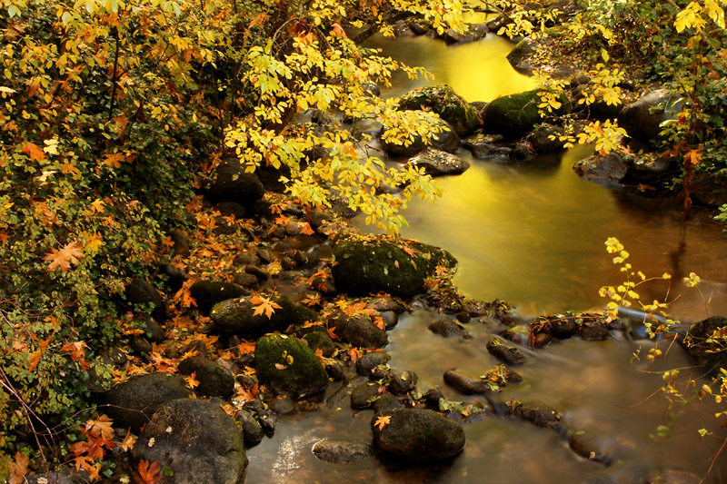
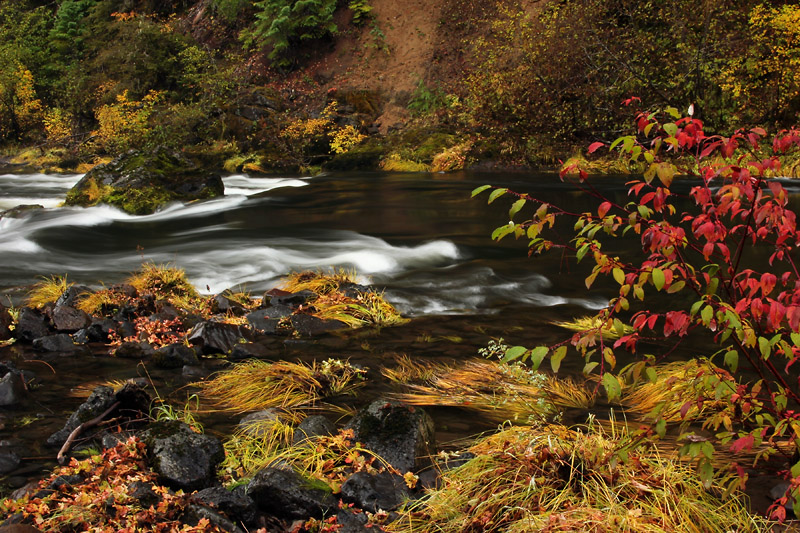
Today, however, is a driving day. I’m back in California. I didn’t have a long way to go to get to this night's motel. I was planning on two stops, but I decided against leaving my car full of stuff sitting while I hiked to Mossbrae Falls. I suppose that maybe I should have checked the site to see how it looked. I just didn’t have a good feeling about it this morning, so I decided that I would only stop at Lithia Park. Now I did leave my car sitting there for hours, but it’s a heavily used site. That’s no guarantee that a vehicle won’t be broken into, but I felt as though that was safer than an out of the way spot.
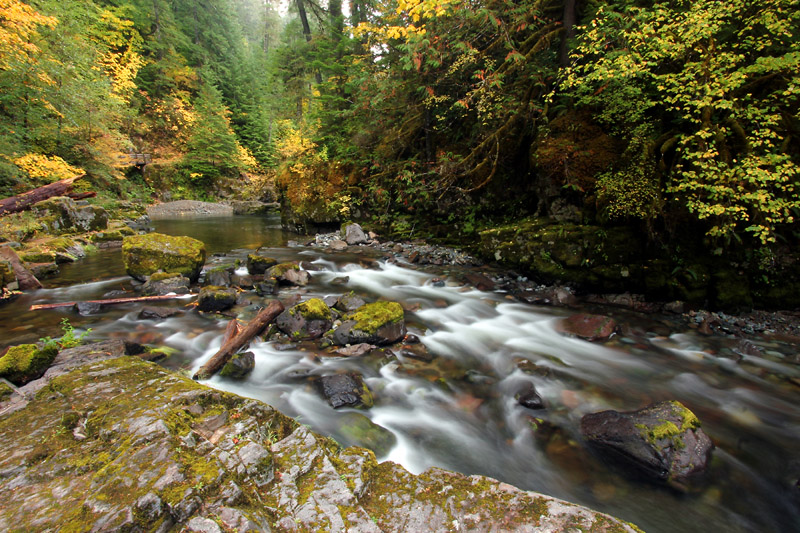
I left my tripod in my car since the sun was out. As soon as I saw Ashland Creek, I had to go right back and retrieve the tripod. There was marvelous reflected light in the water. I don’t feel as though the creek would have been a compelling subject with my normally preferred overcast. But today’s conditions offered many spots where I felt would produce some nice photos. I spent several hours strolling along the creek. After all, it’s not as though I had anything better to do.
31-OCT-2012
The Happy Camera
This morning it occurred to me that this is the first time I’ve brought this camera body to the Pacific Northwest. I bought it last summer. So far besides shooting at hikes at home I took it to Zion last November. That was pretty nice, but Oregon is what I love. My camera body is lucky to have an owner to takes it out to get rained on! Actually I do try to protect it. I usually hold an umbrella over my camera when it’s raining.
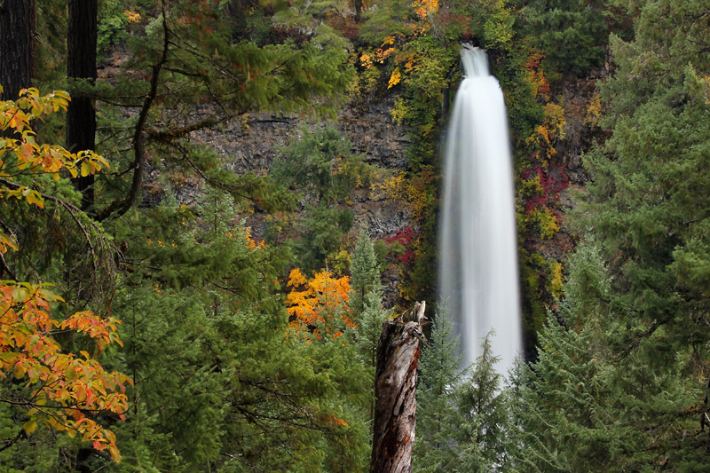
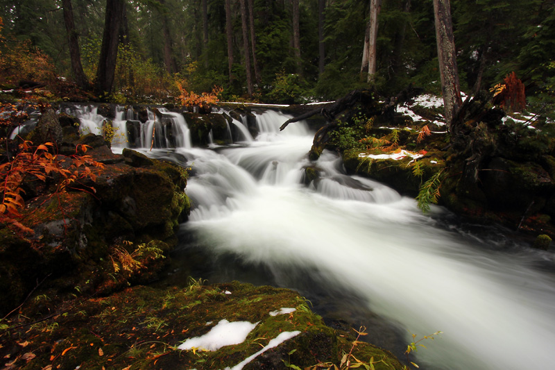
I finished up some odds and ends today. I finally got a chance for the short hike to Mill Creek Falls and Barr Creek Falls. I’ve been planning to do that since day one at Prospect, but it’s been either sunny or I was out of time. Today I finally had plenty of time, so I even went to the Avenue of Giant Boulders.
My next Stop was at Natural Bridge. I just felt like hiking along the Rogue River Trail on the far (west) side. If I had other better things to do, and if the forecast wasn’t for rain, I don’t think I would have been on this portion of trail. I was just on the east side of the river in this area yesterday. The trail on the west side has some steep switchbacks. I crossed the hiker bridge and then walked downstream back to my car to make it a loop. I was just on that section of trail yesterday so I didn’t even bother taking any pictures. I would like to comment that I’m in awe of how much water goes rushing through that lava tube at Natural Bridge. I just stood there and watched it in amazement. And I’ve been there many times before.
I finished the day, so to speak, at the end of Union Creek. The trail on the south side is pretty good, while the north side requires a little more effort. It’s not difficult by any means, but there are some logs to step over and some vegetation across the trail. It was raining by the time I finished. I decided that I was not going to get soaked on my last day here, so I ended my day very early. Heck, my camera hardly even got wet.
30-OCT-2012
A National Acrobat
I planned on hitting the trail right around 8 AM. That’s when it’s been getting light. This morning I opened the door and it was already light. What? The forecast was mostly cloudy, but the sky looked fairly clear. There was just a slight haze.
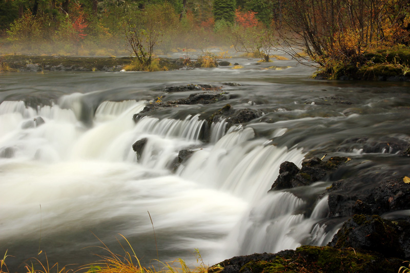
Today’s main hike was the Rogue Gorge Trail. I parked at Natural Bridge and headed out. The trail wasn’t close to the river so at one point I decided to head over that way. Great choice. The river in that area is flowing through a section of lava. I worked my way downstream and was soon at Natural Bridge. This is the first time that I’ve seen it from this side. I could say that I’ve now seen the entrance to the lava tube, but I couldn’t really see it. All I could see was a cauldron where the river enters it. Many of the pools of water in the lava were bubbling. That’s from the water pressure in the lava tube passing through tiny cracks. I got a good look at the main blow hole.
By the time I was done taking pictures I was pretty much back where I started and over an hour had passed. So I went back to the trail and started over. I soon reached Natural Bridge Campground. It turned out that I had headed over to the river right before I reached the campground earlier. Now I was planning to continue, but it was very difficult. There were no signs, and I was now in a maze of campground social paths. Since there are two other places I can access this trail, I decided to go back to my car and drive over to the Rogue River Gorge.
The trail ended up having some good sections and some not quite as good, much like the segments of the Rogue River Trail that I had already been on. Well mostly it’s all good. Except that it looked as though someone had run stock on the trail. Some of it was pretty beat up with hoof prints and there were cow patties galore.
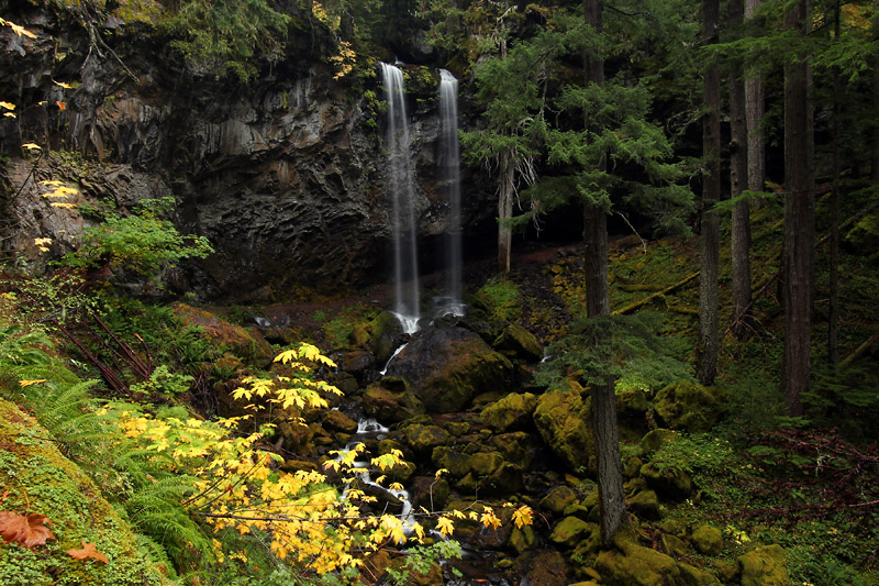
Since it’s been warmer I decided to head to National Creek Falls. You may recall that I wasn’t able to get there last Friday because of snow. I was pleased to see that it’s all melted, and I was able to hike to the falls. The short trail switchbacks to the base of the falls, but the best view is from the other bank. Last time I walked over on a log. This time the logs were wetter. I got up on a couple and moved my feet around to see how slippery they were. I decided that there was a good chance that I was going to fall into the creek. So I wouldn’t be getting over to the other side to take pictures unless I could find a more suitable crossing downstream.
I did find something I thought might work, but the two log didn’t exactly reach a good crossing spot on the other side. One stopped just short of the bank, while the other ended in a bunch of branches. I figured maybe I could push the branches aside. I crossed only to find that wasn’t exactly going to be easy. There were a lot of branches. I could bend some but there were plenty right behind them. Plus I would have to deal with that while trying to walk on a mossy log. Well I could just jump to that spot right over there. Yes, that worked. Then I needed to use my poles to sort of vault over another small, but deep creek. I had done that at Zion last year so I knew it would work. So I did manage to get to the good view of National Creek Falls. I took one of my favorite pictures here in 2007, so it was nice to return. We’ll see how my current pictures turn out. I suppose it doesn’t matter much since I’m completely satisfied with the old version.
During our last stay at Prospect I had set a waypoint at Muir Creek Falls. Using my GPS lead me to the falls, but not the way I was expecting. I parked and walked a very short distance down a steep, rutted road. This didn’t seem right. Nor did the two buildings at the bottom. But I could hear the waterfall so I checked it out. It seems that I was now on the opposite side of the falls from my previous visit. I returned to my car, backtracked fifty feet, continued down the road I had previously been on and found a spot to park mostly off the very wide gravel road. This looked familiar. This short trek to the falls is off the beaten path, but I did find that there is now a small, but definite use trail. You still have to work your way through obstacles since it’s not a real trail, but it’s a little nicer being able to follow a path that others have used before. On my previous visit I had to take a few quick shots and beat a hasty retreat because of the hordes of mosquitoes. There wasn’t a single mosquito this time.
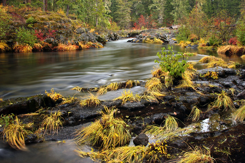
I finished the day finally getting a chance to shoot at the lava area above the Rogue River Gorge. Then I followed the trail the short distance upstream to Farewell Bend Campground. The trail wasn’t close to the water at that point so I cut over. It’s a nice area. I continued up to where I’m pretty sure the rapid water section ends. If it hadn’t been getting late I would have went a little farther just to make sure.
I covered a lot of ground today, which was very good since this is probably my last good weather day. The sun was rising this morning as I was shooting in the Natural Bridge area, but it soon got cloudy and stayed that way. I wanted to cover as much as I could since tomorrow is supposed to be rainy. In any case, I’ve now done most of the hikes I want in this area. There are a few left, but all leave something to be desired. From what I’ve seen, I’m not expecting the hike from River Bridge to Prospect to be anything amazing. The hike from Natural Bridge to Farewell Bend (and beyond) is just on the other side of the river from where I hiked today. From what I saw, I don’t see any particular reason to cover it from the other side. I had a possible hike along the Upper Rogue, but I don’t feel like doing that in bad weather. So that just leaves me with a few short catch up items. Depending on how the weather tomorrow I may find myself back at the motel very early.
It’s purely coincidence that A National Acrobat was later playing on my car stereo as I returned to Prospect. I’m happy to report that I didn’t perform any acrobatic moves while falling from a log into the water at National Creek Falls. I was very pleased to make it back across without any mishaps at all. That’s probably a good thing since I doubt that I’m cut out to be an acrobat.
29-OCT-2012
Gone Shopping
If I’m given a choice between hiking or shopping, you know which one I’m going to pick.
I began the day at Natural Bridge. It was just getting light. I took some long exposure shots of leaves. You know how I like long exposures – usually of creeks or waterfalls. The reason that these particular leaf exposures were so long is because it was still fairly dark. I walked to the manmade bridge downstream from Natural Bridge to take a couple of quick shots. I already visited Natural Bridge once during this trip and I expect to be there once or twice more because that’s a good trailhead for my next two hikes.
It’s a tiny bit difficult to shoot the waterfall because the bridge shakes. It was also a bit misty near the river, which either obscures or adds atmosphere depending on your point of view.
I then walked a few yards back to the Rogue River Trail. I liked this portion of the trail much better than yesterday’s segment. For one thing there was a big more color, although as I mentioned yesterday I know that the Takelma Gorge section can get marvelous color. Another thing is that the trail was very clear and very easy. Finally, I liked this section of the river. It has a bit more action going. Maybe I shouldn’t have said finally. I’ll finish the thought by saying that I just happened to like it a lot.
The above mentioned river action extends to Knob Falls, which was very cool to witness, but not my type of waterfall photographically speaking. I liked it more than I was expecting to. After that the trail descends a very short distance and ends up in an extremely flat, level section of forest. The surroundings later change a bit. I saw some Manzanita and lupine. After 3.5 miles I ended up at Woodruff Bridge, which was my trailhead yesterday. I’m beginning to think that I should take the Falcon Guide’s distances with a grain of salt. That’s at least two times that they’ve been off on trail distances. My goodness, they couldn’t even get the right driving distance from SR62 to Woodruff Bridge.
I continued my habit of taking a long time on my outbound hike. I take all of my pictures and explore during that time. My return hikes have been quick. I still look at things, but I keep a fast pace since I already took all of my shots. This is working out pretty good since I’m either getting wet or the sun is out by the time I return. Today it was the sun. I looked up at the sky and saw that there were big cloud banks, but there were also clear spaces. Since the sun was in the middle of clear sky, and since it was so early I decided to take a chance and head up to Crater Lake.
I had spoken to a couple of people at the Rogue River Gorge the other day. They volunteered the information that they had been at Crater Lake and couldn’t even see the lake. When I was at Crater Lake today a clerk told me that the lake had been obscured for the past three days.
Due to the snow, the Rim Drive was closed. Thus I only surveyed the lake from the Rim Village. It was almost completely cloudy up there, so the water wasn’t as blue as it is when the sun is out. I still enjoyed looking down at the lake. I walked along and then stood there for a long time. I finally decided that it was time to leave. I stopped at the gift shop and bought a T shirt (because that’s what I do when I’m at a National Park). I even spent money filling up my gas tank when I returned to Prospect (where the sun was shining). Now you know about my apparent shopping addiction. Well to be honest, I sometimes choose to go hiking instead.
28-OCT-2012
The Sittin’ Porch
Today’s hike was the Rogue River Trail between Woodruff Bridge and River Bridge. The feature it’s known for is Takelma Gorge. I wasn’t wowed by the gorge. It was okay to see, but in my opinion the Rogue River Gorge, which is upstream, is much more interesting and scenic.
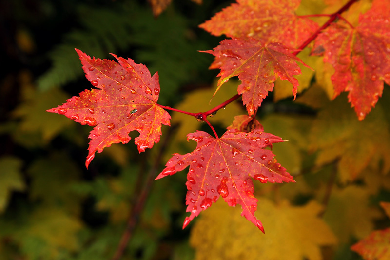
I know that this location can get some spectacular fall color. Unfortunately for me, that wasn’t the case today. It appeared that I’m a bit late, and I just think that this hasn’t been a good year for color in Oregon. Of course you can always find something, but it’s not as good as when we were here in 2009, and it’s not as good as I’ve seen in a lot of photos.
Since there wasn’t much color, and since the gorge didn’t strike my fancy, maybe I should have turned around at that point. The reason I didn’t is because I was enjoying the hike. A major reason I’m up here it to take pictures, and it didn’t appear as though there would be much of that today. However another reason for being here is because I love the experience of being on a trail in the woods. So I continued and completed the 9.2 mile hike I had planned. I figured that I could go get some shots at one or two different places afterward. The weather didn’t cooperate though.
The day started off with showers. Although the trail is in great shape, there is vegetation growing into it, so the wet leaves brushing against me eventually overwhelmed my lower rain gear. The main problem is that by the time I finished the hike the sun was out. I drove to my next location, got out, looked at the sky, and decided to call it an early day. I went back to the motel and changed. Then I went out and sat on a swing on their porch.
The Historic Prospect Hotel has a fantastic porch. I have a fond memory of sitting on that porch on a rainy night listening to an itinerant musician telling stories. I just might go back out there right now.
27-OCT-2012
This Ain’t No Hippie Love Fest
I’m finally at peace with my tripod. After fighting with the head for this whole trip, I had a new head express shipped. It arrived yesterday. It’s so nice to not have to fight with my tripod any more. I was going to title this entry "Peace". That would have more than one meaning, but it didn’t really seem interesting enough. You’re probably wondering what the heck the actual title means. More on that later.
This morning found me waiting to leave my motel room. I didn’t see any reason to leave before it got light since the drive to the trailhead was only going to be eleven miles. That’s quite different from my previous mornings.
The hiking books mentioned parking on the side of the road, but there’s a big new parking area. I should have known I was in for a long day as soon as I had walked a couple of minutes and there were big trees downed across the trail. The second hint could have been that the bridge is out. I crossed on a convenient downed tree. I doubt that the trail gets a whole lot of use since it’s quite overgrown, which made for slow going for me. For most people dragging their legs through vegetation probably isn’t any big deal, but it causes strain for me. Other than that, there is no noticeable elevation change, so it's an easy trail. The majority of the trail is close to the creek, which was nice. The only vine maple I saw was right at the beginning, so the only fall color was the subdued reds of the abundant dogwood.
It was interesting seeing that there’s actually a waterfall at Union Creek Falls. The last time we were there the creek was flowing so low that I went upstream and downstream trying to figure out where the darn waterfall was. During that trip, we parked at the east trail head, so it was a very short hike to the waterfall, which is at the spot where the eastern trail meets the creek. Something else of interest to me is that there are a few big flat patches of lava that look exactly like a remnant of an asphalt road.
On our last visit we were attacked by hordes of butterflies. This time I saw no wildlife but birds. I did see some really big cat prints in some of the patches of snow. I had earlier seen some bones on the trail. I have no idea what kind, although I do know it wasn’t a chicken.
The forecast was for PM showers, but they must have a funny definition of PM around here since it was raining all day. Even with the water –resistant layers I was wearing, the bottom of my pants and my boots got wet. My jacket was so saturated that it was dripping about fifteen minutes after I finished my hike. But it was still early, so after hiking eight miles, I wanted to do some more. The hikes I have planned are much too long for an early afternoon fill in, so I decided to shoot at the Rogue Gorge and especially the area upstream. I ended up retrieving my filter case from my jacket pocket only to find that it was completely soaked and my ND filter was covered with water. I didn’t even try to dry it off. I figured it was a good sign that I should call it a day, return to my room, and dry off.
About that title. When I was thinking Peace, it reminded me of something a coworker told me years ago. He was going to Oz Fest (or some sort of hard rock concert). His buddy asked if they should bring blankets so they could sit on the grass. My coworker replied, “This ain’t no hippie love fest; get ready for Armageddon.” Well, Peace or Hippie Love Fests. It’s all the same to me.
26-OCT-2012
Scouting Report
I took the scenic route to Prospect. I stopped at a spot along the South Umpqua River just before Tiller and got a few shots that I liked a lot. I ended up on a very curvy, and fun, road on my way to Butte Falls. I had seen pictures of the falls before and wasn’t overly impressed. Now I’ve seen it in person and probably will never be back. I’m not saying it’s horrible, but it doesn’t do much for me. And this is from someone who can be pleased as punch with a tiny bit of water dropping a foot on a creek. Different strokes and all.
Road 992 had a lot of color in a lot of places, but nowhere really good to stop, so I just enjoyed the drive. I stopped at Pearsony Falls and got a few shots before the sun came out. The owner of the hotel told me that there would probably be snow at National Creek Falls. He was right, so I ended up turning around at the first road off SR230. I could have continued on that, but there was no way that I would have been able to take the next road. That also meant that Muir Creek Falls would be out of the question. I didn’t even continue to Lower Rogue Falls (aka Highway Falls) since I doubted that I would be able to pull over.
I finished the day scouting. I marked waypoints for each trailhead and walked a short distance on each. I walked to Natural Bridge, although I didn’t take any photographs. I’ll return on an overcast day. I noticed that they had enlarged the parking area and had installed a new vault toilet. Good. The old toilet had a sign saying how environmentally friendly it was. It had a slanted black roof that was supposed to create air currents to remove odors. It may have been a wonderful concept but the execution literally stunk.
I’m feeling optimism that this is going to be a really good week. One thing that’s different is that instead of driving an hour to an hour and a half to get to each day’s trail I’ll be doing all of my hiking within about a fifteen mile radius. That will be nice, but it isn’t really the point. I’m just feeling anticipation that the hikes are going to be good. Time will tell.
25-OCT-2012
The Better Life
It’s hard to believe that I could be at work right now. Well not at night, but I was thinking about it for about two minutes while I was on the trail today.
Today was sunny. That sort of thing happens to interfere with my plans. So my backup plan is mostly to just hike and enjoy myself without really taking many pictures. Most of what I took were the I was here variety. I like to take a lot of pictures of my surroundings to remind me of the good life when I’m back at home.
More of the north side of the wall of columnar basalt is visible at Toketee Falls. I hadn’t been there in years, but I really don’t remember being able to see that much. Most people just enjoy the falls, but I happen to like columnar basalt. I’m pretty sure that the reason more is visible is due to a dead tree. There aren’t any needles, and some of the branches have broken off. It’s amazing what a drum of Roundup will do. :o)
There wasn’t any sun on the falls, but a tree in the foreground was lit up. There was a lot of mist in the air lit up by the sunlight. That’s okay. I’ve taken pictures there before.
I didn’t know a lot about the Clearwater River Trail except the location and distance. If you’re looking for peace and quiet you won’t find it there. For the majority of the hike you’ll hear that darn rushing water because the trail is actually very close to the river. My disclaimer is that there is also some traffic noise because highway 138 is nearby.
There are plenty of cascades and some small waterfalls that look very nice. There aren’t many good vantages though. Either there isn’t a place to set up, or branches are in the way. I should have left out the “or” part since branches were pretty much in the way of the scenes I would have been shooting if there hadn’t been mostly shade with patches of bright sunlight.
There was one nice waterfall about ten feet tall. There was a lot of water going over. It was very nice to be standing near it, but I’m pretty sure it would photograph a lot better if the water level had been much lower. There was a Columbia Lily in the foreground. That might have been a good shot if it had been blooming. Speaking of which, there are plenty of rhododendrons along the trail, as well as dogwood. That’s not unusual. I’ve been seeing a lot of rhododendrons. Of course they don’t bloom at this time of year, but I can imagine how nice it must be when they do.
I thoroughly enjoyed hiking today, although it didn’t end up being a day for pictures. I decided to take it easy and come back early. There were some other locations I could have visited, but I’ve been to most of them before and I wasn’t expecting that I would be able to get any shots. I also figured it might be a good day to take it somewhat easy since I will hopefully be doing a lot of hiking in my next location.
When the most you have to complain about is the fact that the day was sunny and pleasant I would have to say that you’re living the better life.
24-OCT-2012
Consolation Prize
Driving towards Lake in the Woods, I saw one lone tree on a hillside amid a clearcut. Talk about not seeing the forest for the tree.
My first hike was Hemlock Falls, which was just as gorgeous as ever. I then went to Yakso Falls. I spent quite a bit of time talking with two rangers who happened to be checking a couple of bridges on that trail.
I’ve known about the upper falls on the Hemlock trail for many years, but until today I hadn’t had time to visit them. I knew that there was going to be either limited viewing or difficulty getting to a good vantage. The trail is steeper than someone with my knees should be on, but my knees have actually been in somewhat better shape the past couple of days, so I went for it. I did not attempt to get to a view of Middle Hemlock Falls. When I got to Clover Falls, I could hear it, but I couldn’t see anything. There was a steep hillside with obvious paths, so I knew that I was in the right place. The location was also marked by a huckleberry bush loaded with berries. I went partway down the hill, but I decided that I just wasn’t going to push my luck any farther. That doesn’t mean that a view of the falls is inaccessible. It’s just more than what I felt was reasonable with my current limitations. Upon climbing the hill I noticed that the bush was no longer loaded with berries. I’m not admitting anything, but the other huckleberry bushes I saw today also featured vanishing fruit. Once I got back up to the trail I walked a few more steps and was able to sort of see the waterfall through the trees.
On my return I occasionally stopped just to enjoy the feeling of being in the forest. Some of that included areas that strangely featured all the same species of tree all approximately the same size. Something tells me that’s not natural. So it’s replanted after a clear cut, but I still enjoyed the not quite natural beauty. So there’s hope for those bald hills I see in so many places. I’m not comparing that to old growth, but it can still be quite nice. Heck, put that in San Diego and it would be very crowded.
I can’t see myself returning to that trail, but I’m glad that I finally had a chance to check it out in person. Sometimes you just need to see things that you’ve thought about for many years.
I wasn’t planning to go to Grotto Falls, but I decided it was worth the drive to get there. The drive isn’t exactly long, but it’s not the sort of road where I would want to meet oncoming traffic. Not to mention the fact that it’s not encouraging to see a sign indicating a CB channel at the start of the road. Fortunately I was the only car both going to and coming from the falls. Grotto is just an incredible place to be. I stayed there for a long time because I just didn’t want to leave.
I had seen a nice cascade in the Little River a short distance downstream from Wolf Creek, so I parked and walked down the road to look for it. Unfortunately the bank between the road and the river was posted No Trespassing, so I only got a view from the roadside.
Since I was so close to Cavitt Falls, I figured why not swing by. I was shocked to see the entrance road gated. The sign stated that the rec area is closed for the winter. The reason I was surprised is because we’ve been there during winter.
I sort of thought that the huckleberries were a consolation prize for not being able get a good view of the waterfalls along the Hemlock Trail. But I think that finding the opportunity to return to Grotto Falls is the best thing that happened all day. Or perhaps just being in Oregon with the opportunity to hike in the woods is more important than reaching any particular destination.
23-OCT-2012
Accommodations
I think that this is the place to be. That is if you have any sort of mobility challenge. I’m pleased to report that the forest service has built new accessible platforms at both Clearwater Falls and Whitehorse Falls. The trail to Susan Creek Falls has been wheelchair accessible for years. It’s nice to know that they’ve creating opportunities for everyone to get out and enjoy nature. Not everybody is disabled, but we’re all going to get old some day.
The forest service has also been busy building some bridges. They built a huge hiker bridge over the North Umpqua near Susan Creek and have built a new bridge to Umpqua Hot Springs.
I had planned to drive east to Lemolo Falls and then work my way back west. The weather forecast was for periods of heavy rain around here and snow in the east. I changed my plans. I figured that I would start off closer to Roseburg and work my way east. Even though it has never impressed me a great deal, I started off at Susan Creek Falls. I see that they’ve barricaded the trail to the Indian mounds. It’s not as though that would be a huge hindrance if I wanted to go there, but I never felt the need even when the trail was open.
My next stop was at Watson Falls. I don’t know if others would find it as impressive as I do, but I’ve always loved Watson. It doesn’t have a large flow, but it’s tall and flows into a huge amphitheater.
As I drove west there was snow on the ground, but the road had been plowed. I stopped at Clearwater. There wasn’t any color there and I was getting pelted with snow falling from the tree branches. Sometimes if fell as flurries. I considered uploading a picture of my palm. A few times I had my camera timer running but had to place my hand over the lens as snow was about to hit it.
Whitehorse Falls was probably the waterfall that I was most looking forward to seeing while I was in Roseburg. I seem to remember some vine maple in the area, but there wasn’t any color today.
The sun was out when I was at Surprise Falls and Columnar Falls. The last time we were at Columnar Falls there was a pool at the base enclosed by huge tree roots. Now that pool is mostly gone. The water didn’t find another exit that I could see. It flows down the wall of columnar basalt and most of it disappears right at the base. If Surprise Falls wasn’t higher I might think that the water was coming out there. You see Surprise Falls flows out of a spring right below the trail.
Since the sun was sometimes out I decided that it might not do me a lot of good to hike to Toketee Falls. I’ll leave that for another day. I finished up the day at Little Falls, which is nice, and at nearby Steamboat Falls, which looks terrible unless Steamboat Creek is running very high. They’ve completely destroyed it with a huge fish ladder. Well I suppose that if I happened to be a fish I might feel that they were mighty accommodating.
22-OCT-2012
Uneventful
Roseburg is only sixty four miles south of Eugene. I know it seems as though I should have stayed in the previous hotel. That’s not a huge distance. However, I have generally been driving long distances to my hiking destinations, so cutting out an extra two hours of driving time is helpful.
I drove east on SR 42 to Myrtle Point and then drove up to Dora to pick up the Coos Bay Wagon Road. Right out of Myrtle Point I noticed that when they constructed this road there must have been a sale on curves. Oh and it’s pretty narrow too. Past Sitkum it’s a one lane gravel road. The area is pretty, although I can think of other roads I like much better. I stopped in just a few places. While I was stopped I had pickups drive past me like they were starring in a truck commercial. That was way too fast to drive on this road, especially considering that it’s used by logging trucks. I had to pull over, and/or back up to a wider spot three times to let the log trucks pass. But that was easy. It was much better than having one of those pickup truck guys crash into me.
I was very happy to get past that ten mile stretch of gravel road. There were more potholes on the west end, but they weren’t an issue. The only problem is that it was narrow and winding. I’ve been on gravel roads before, but this one seemed more dangerous than the others.
The drive from that point was a little bit steep and winding, but it seemed pretty darn good to me by that time.
It was fairly early when I got back to Roseburg. I had planned to drive out to Steamboat Creek, but it seemed like a lot of driving for not a lot of payoff. I’ll already be out there the next three days, so I decided to call it quits.
For a day that was supposed to be rainy, it’s been fairly dry. There were only scattered showers. Hopefully the weather will hold. I have a lot planned for tomorrow.
21-OCT-2012
Resisting Temptation
My knee was hurting so bad this morning that I hardly wanted to bend it. I limped around the hotel room and limped to breakfast. I figured that I would still go to the trailhead and see if it would loosen up any. I started out very slow, but I was able to keep on moving. I’m sort of slow at that portion of Brice Creek anyway since I’m usually busy taking pictures.
On a previous trip I had run ahead and scouted a portion of the trail that begins shortly after the waterfall. It veered away from the creek at that point and went uphill. I was curious how far it would go before it got back down to creek level. I didn’t go a really long distance since I was just scouting.
Today my plan was to hike the entire eleven mile trail. To clarify, the trail isn’t eleven miles. That’s the total out and back distance. Yesterday I hiked about eight miles. I had planned to take it easy knowing that I needed to rest my knees for today, but I guess I overdid it a little bit.
Since my knee was already hurting when I woke up I figured that being able to hike any distance would be something to be thankful for. It ended up taking my almost four hours to hike the first 2.5 miles. At that point I definitely did not want to subject my knees to a return on the trail with the ups and downs. They weren’t anything out of the ordinary, but my knees don’t do well with elevation change these days. So I exercised my option to “hike” back to my car via the road. The ironic thing is that, unlike the trail, the road is actually closer to the creek almost the whole way.
My knee was doing much better by then, so I made good time. When I got back to my car I had a quick snack, changed water bottles, and hiked the western portion of the trail. This section had no creek access at all. Sometimes I could see it down below and sometimes the trail was a bit farther so I could not see or hear the creek at all. I suppose that it does more or less follow Brice Creek, so naming it the Brice Creek Trail makes sense. I would have been nice if there was closer to the creek though. Still I do have to say that I was enjoying myself very much. It was a marvelous place to be. I do need to remember to watch out for poison oak though. I remember seeing it here before, although I didn’t spot any of those pretty red leaves until the end of the trail.
I ended up hiking eight miles. I was very tempted to hike the section from Lund Park to Trestle Creek since that’s the only portion of the trail I have not yet seen. I was running a bit short of time. I’m pretty sure I could have finished that with plenty of daylight to spare. I even drove back to Lund Park to start the hike. But after thinking about it some more I decided that I would be wise to call it a day. That was probably a good decision since the rain started right when I was leaving. It reminds me of our first visit to Brice Creek when Cheryl wisely talked me out of attempting a “quick” hike to Upper Trestle Creek Falls at the end of the day while thunder was booming.
This will be the end of my stay in Eugene. I covered all of the primary destinations I had planned. There were plenty of options left over, but I always plan lots of extras. One thing I would very much like to do in the future is hike a few more sections of the McKenzie River Trail. And I do want to finish seeing all of the Brice Creek Trail even though I’m not expecting that last mile to be anything special. I’m going to be sorry to leave this nice hotel, but I’ve got other places to be.
Oh, lest I forget, I was tempted to upload a picture that wasn’t much more than a small stream scene showing the cobbles in the water. I don’t imagine that anyone would be saying, “Wow!”, but that’s one of the things I really like about Brice Creek. Well I like seeing them in the water much more than I like walking on them along the shore. Although I didn’t get many good shots today, I had a hard time choosing between two stream scenes. No matter which one I pick, I’ll know that I was tempted to chose the other.