


|
|
|
|
|
|
| Dave Beedon | profile | all galleries >> Places >> Utah >> Arches National Park >> Salt Wash Precipice Via "Direct Route" | tree view | thumbnails | slideshow |
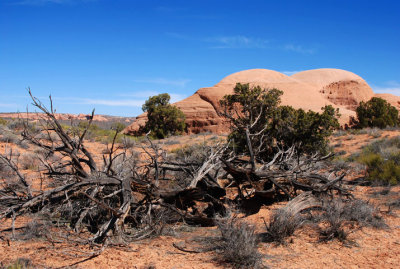
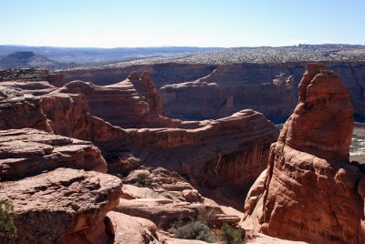
Salt Wash is a stream in a deep canyon west of Delicate Arch. Its canyon walls are weirdly-shaped and have varying gradients. The topography qualifies as "eye-popping." Earlier trips to Arches NP had exposed me to distant views of the canyon and Google Earth's aerial views allowed me to explore the area vicariously. Curiosity evolved into full-blooded landscape lust, so it became my mission to see the place up close. |

:: Salt Wash Precipice #1: Delicate Arch Trail :: |
:: Salt Wash Precipice #2: The "alcove blob" :: |

:: Salt Wash Precipice #3: To the Precipice :: |
:: Salt Wash Precipice #4: Along the Precipice :: |
| comment | share |
| Jomosoft | 28-Oct-2007 00:45 | |
| Jason Anderson | 21-Aug-2007 11:30 | |
| Guest | 16-Aug-2007 15:48 | |
| Monte Dodge | 07-Aug-2007 02:33 | |
| Jason Anderson | 07-Aug-2007 02:02 | |