


|
|
|
|
|
|
| |
| 16-APR-2006 | Dave Beedon |
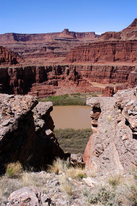
This view to the northwest from the north end of the mesa shows how the mesa's covering
rock has weathered, producing this five-foot-wide crack. The muddy Colorado River is
flowing from right to left. Straight ahead on the far side of the river is the bottom
end of Shafer Canyon, the route of Shafer Creek (when it flows) to the river. The plateau
(with the light-colored lip) above that canyon is the location of Shafer Trail.
.
| Full EXIF Info | |
| Date/Time | 16-Apr-2006 13:25:55 |
| Make | Nikon |
| Model | D100 |
| Flash Used | No |
| Focal Length | 20 mm |
| Exposure Time | 1/160 sec |
| Aperture | f/14 |
| ISO Equivalent | |
| Exposure Bias | 0.67 |
| White Balance | (9) |
| Metering Mode | matrix (5) |
| JPEG Quality | (6) |
| Exposure Program | manual (1) |
| Focus Distance | |
All images are copyright 1966 - 2023 by Dave Beedon (davebeedon AT comcast DOT net).