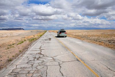
Looking southeast on Frontage Road, east of Green River, Utah. Interstate 70 is out of view to the right. Frontage Road used to be the main highway between Green River and Grand Junction, Colorado. The main highway is now Interstate 70.
The white writing on this side of the line is "GRAND" (for Grand County). On the far side is "GR CITY" (for city of Green River). The markings make no sense in terms of official boundaries: the county line and the city of Green River are both miles behind my vantage point. Maybe the markings have some local significance.
The dark ridge at far left is probably Hatch Mesa. Geo-tagging is approximate.
|