King, Alan (1978) ‘Ribblehead’ Current Archaeology. No 61, 38-41.
King, A (1978) 'Gauber high pasture, Ribblehead - an interim report' in Hall, R A (ed) (1978) Viking Age York & the North. CBA Research Report No 27, 21-25.
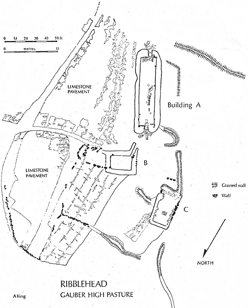
King concluded that "Ribblehead could indeed be an early Viking settlement; it could either have links to York and the 'Great Army', or alternatively we could attribute the buildings to Vikings entering northwest England from the Irish Sea, perhaps in this instance by following the Lune Valley from Morecambe Bay. On the other hand the building could be Anglian, for we have no idea of what stone buildings of this period looked like, and though built on a stone base, it may compare favourably with Northumbrian timber examples." This view remains valid.
The coins found at the site date occupation to the third quarter of the 9th century, with the Wulfhere styca suggesting later in that quarter. Such copper alloy stycas remained in circulation at sites of Viking camps at Torksey and near York.