


|
|
|
|
|
|
| Doug Sherman | profile | all galleries >> Galleries >> Arizona Images | tree view | thumbnails | slideshow |
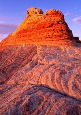
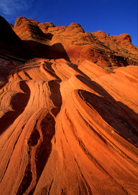
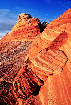
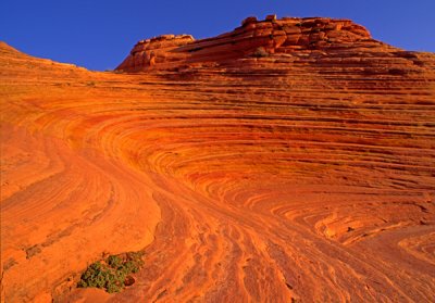
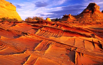
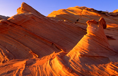
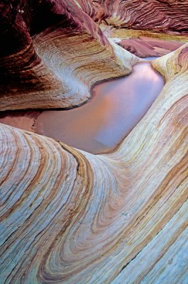
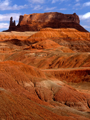
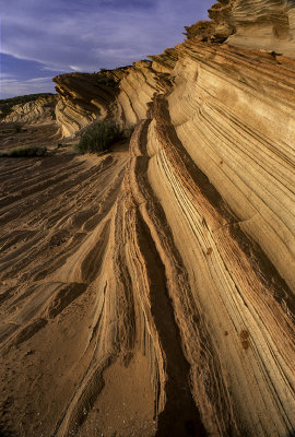 Waterholes Canyon Area, Paige, AZ |
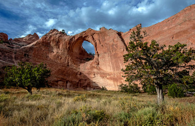 Window Rock at the Navajo Tribal Park, AZ |
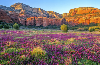
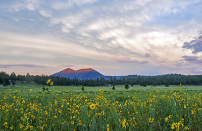 Sunset Crater from Bonito Meadow, Sunset Crater National Monument, AZ |
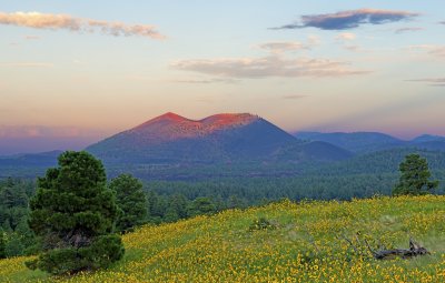
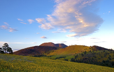 Volcanic cones near Flagstaff, AZ |
 Sunset Crater sunset, Sunset Crater National Monument, AZ |
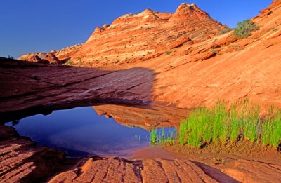
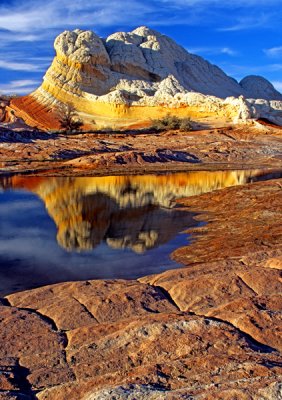
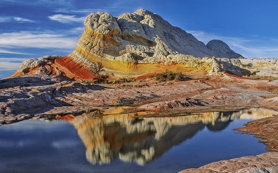 Reflection at White Pocket, AZ |
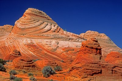
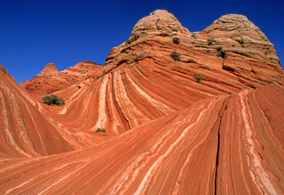
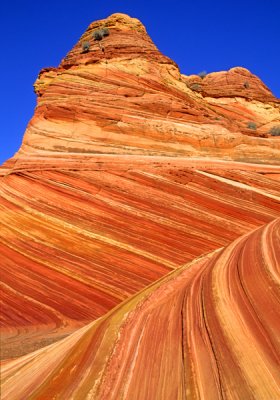
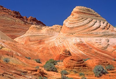
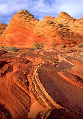
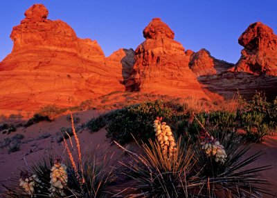
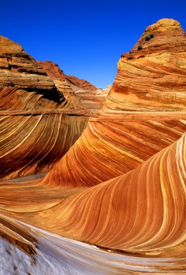
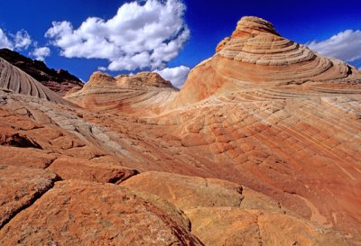
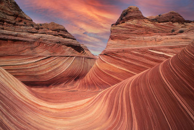 The Wave, North Coyote Buttes, Paria Plateau, AZ |
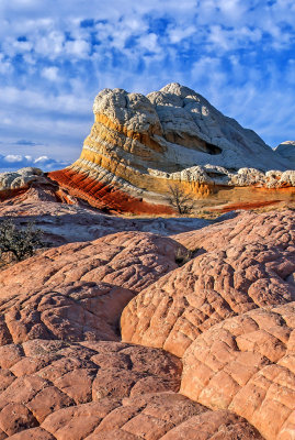
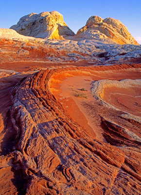
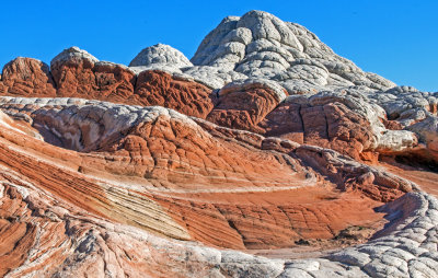
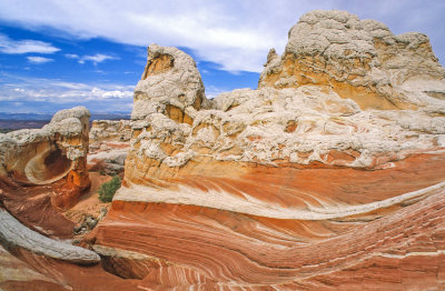
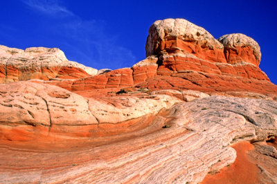
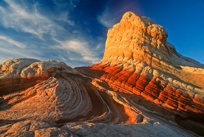
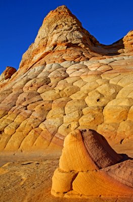
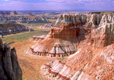
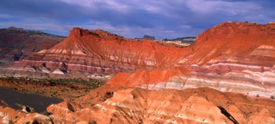
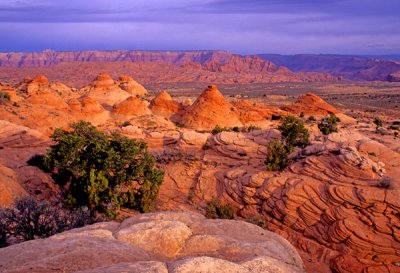
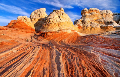 White Pocket Buttes & Layers, Paria Plateau, AZ |
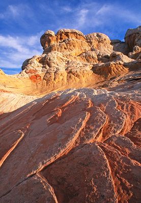
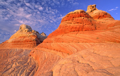
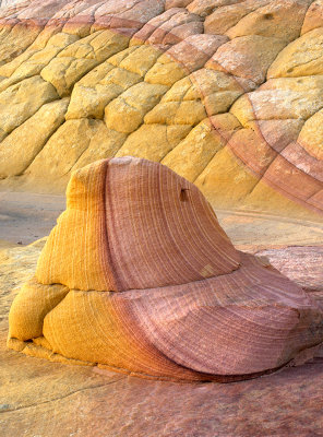
 Striped Sentinel and Polygons, White Pocket, AZ |
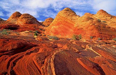
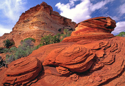
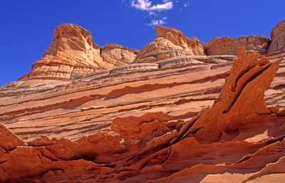
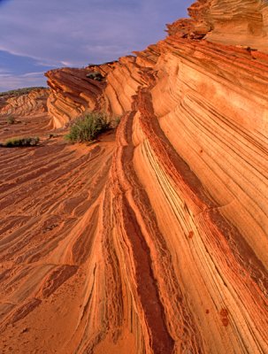
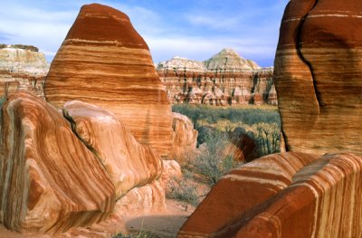
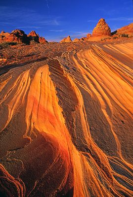 South Coyote Buttes Layers, AZ |
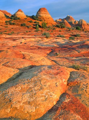
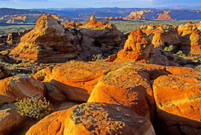
 North Coyote Buttes Boulders, AZ |
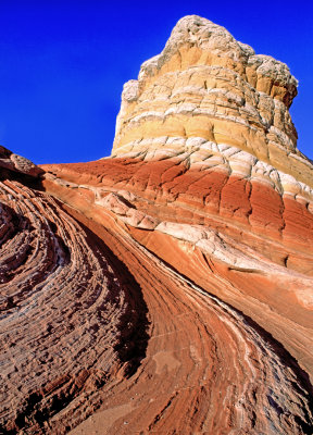
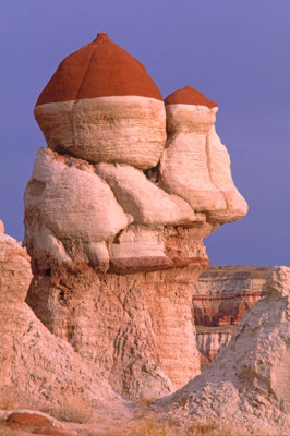
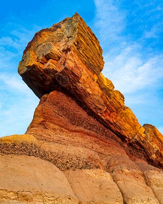
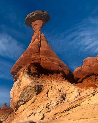
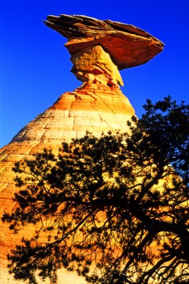 (PP 10) Hoodoo, Paria Plateau, AZ |
 Tilted rocks, White Pocket, Vermilion Cliffs National Monument, AZ |
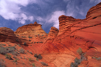
 (PP 12) Coyote Buttes North, AZ |
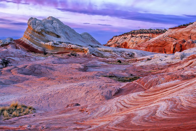 After sunset glow, White Pocket, Vermilion Cliffs National Monument, AZ |
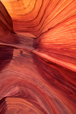 (PP 14) North Coyote Buttes sandstone canyon detail, AZ |
 Last light at White Pocket, AZ |
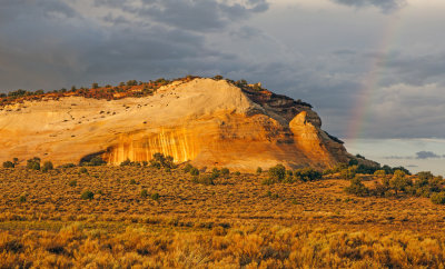 Cliff of Navajo Sandstone and rainbow, White Pocket, Vermilion Cliffs National Monument, AZ |
 First light at White Pocket, AZ |
 Buttes in White Pocket, Vermilion Cliffs National Monument, AZ |
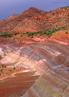
 Chinle formation, AZ |
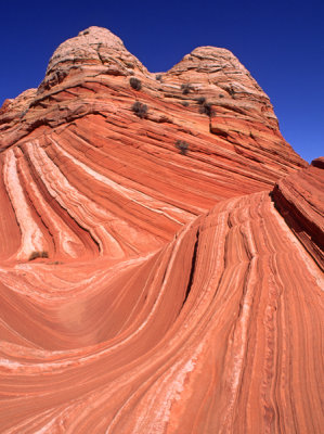
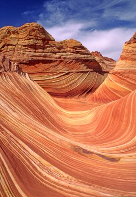 The Wave, North Coyote Buttes, AZ |
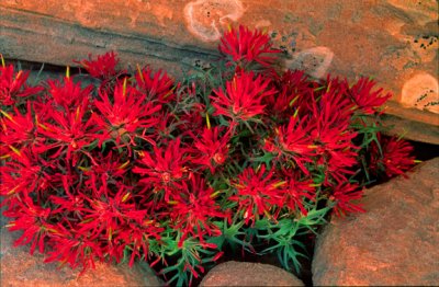 (PP 21) Slickrock Paintbrush, North Coyote Buttes, AZ |
 (PP 22) Paw Hole cross-bedding, South Coyote Buttes, AZ |
 (PP 23) North Coyote Buttes, AZ |
 Cross bedding in Jurassic Navajo Sandstone, North Coyote Buttes, AZ |
 (PP 25) Paw Hole Section, South Coyote Buttes, AZ |
 (PP 26) Paw Hole section South Coyote Buttes, AZ |
 Domes, White Pocket, Vermilion Cliffs National Monument, AZ |
 North Coyote Buttes AZ |
 Crosbedding, North Coyote Buttes, AZ |
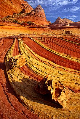
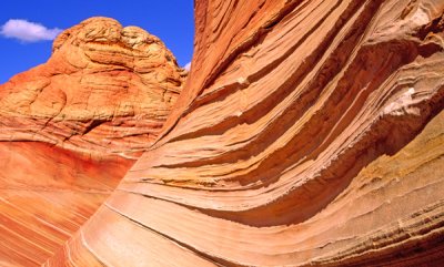
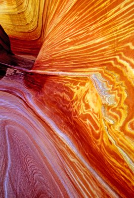
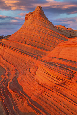
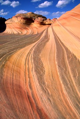 The Swirl, North Coyote Buttes, AZ |
 White Pocket is number one, Vermilion Cliffs National Monument, AZ |
 Waterhole, North Coyote Buttes, AZ |
 Rock detail, North Coyote Buttes, AZ |
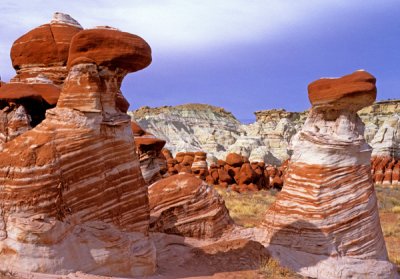
 Striped Sentinal, White Pocket, AZ |
 North Coyote Buttes, AZ |
 Lichen encrusted rocks, North Coyote Buttes, AZ |
 Twin towers, North Coyote Buttes, AZ. |
 Bonsai pipeline (left side of image), White Pocket, Paria Plateau, AZ |
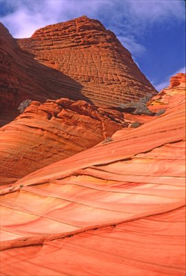
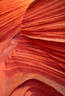
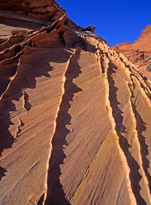
 Curves caused by erosion of Navajo Sandstone, North Coyote Buttes, AZ |
 North Coyote Buttes, AZ |
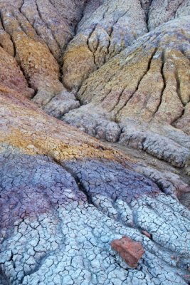
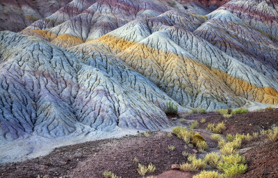
 Banded Chinle Formation, Arizona Strip, AZ |
 Lines in Navajo Sandstone, North Coyote Buttes, AZ |
 White Pocket bedding, AZ |
 Veins filled with resistant gypsum create thin layers, North Coyote Buttes AZ. |
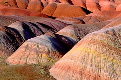
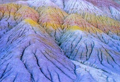
 Colorfully banded Chinle Formation, Paria Plateau, AZ |
 Chinle Formation, Paria Canyon-Vermillion Cliffs Wilderness, AZ |
 South Coyote Buttes Veins, Paria Plateau, AZ |
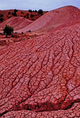 Pink Chinle Formation, Paria Canyon-Vermillion Cliffs Wilderness, AZ |
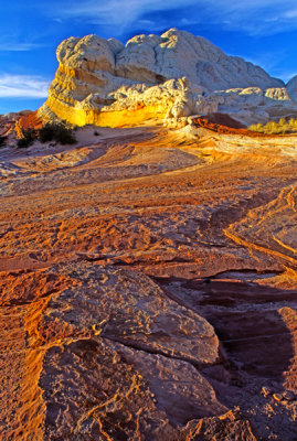 Last light at White Pocket, Vermilion Cliffs National Monument, AZ |
 Entrance to Coyote Buttes South, Paria Canyon-Vermilion Cliffs Wilderness, AZ |
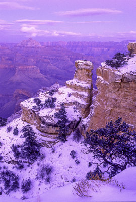
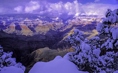
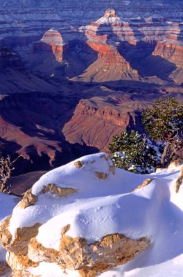
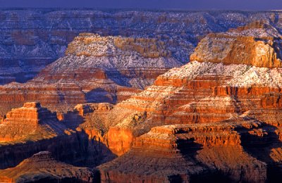
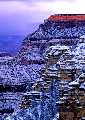
 Winter in Coyote Buttes North, Paria Canyon-Vermilion Cliffs Wilderness, AZ |
 Colorful canyon, Coyote Buttes North, Paria Canyon-Vermilion Cliffs Wilderness, AZ |
 Striped Sentinal reflection, White Pocket, Vermilion Cliffs National Monument, AZ |
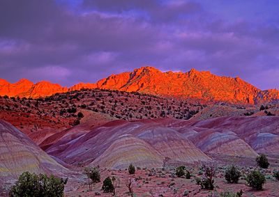
 South Coyote Buttes sunset, Paria Canyon-Vermilion Cliffs Wilderness, AZ |
 North Coyote Buttes , Paria Canyon-Vermilion Cliffs Wilderness, AZ |
 Veins of calcite in Navajo Sandstone, North Coyote Buttes, AZ |
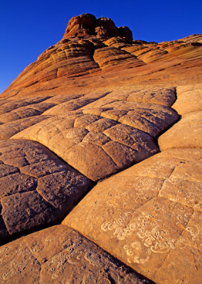 Polygons within polygons, North Coyote Buttes, AZ |
 Chinle Formation, Paria Canyon-Vermillion Cliffs Wilderness, AZ |
 Striped Sentinel, White Pocket, Paria Plateau, AZ |
 Chinle Formation, Paria Canyon-Vermillon Cliffs Wilderness, AZ |
 Banded rock, South Coyote Buttes, Paria Canyon-Vermillion Cliffs Wilderness, AZ |
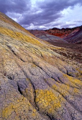
 Chinle Formation abstract, Paria Canyon-Vermillion Cliffs Wilderness, AZ |
 Banded rock, South Coyote Buttes, Paria Canyon-Vermillion Cliffs Wilderness, AZ |
 South Coyote Buttes, Paria Canyon-Vermillion Cliffs Wilderness, AZ |
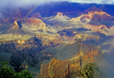
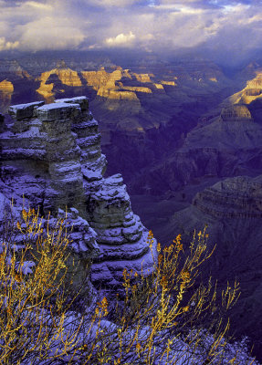 Late afternoon storm, Mather Point, Grand Canyon, AZ |
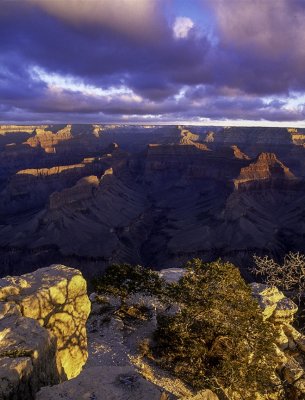
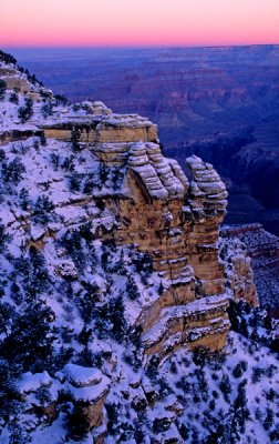 Predawn, Mather Point, Grand Canyon, AZ |
 Last light, Yaki Point, Grand Canyon, AZ |
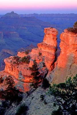
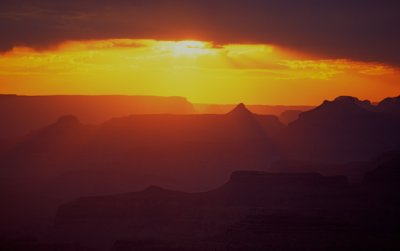
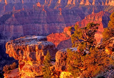
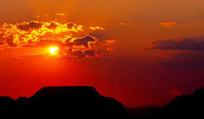
 Sunset Glow at Yaki Point, Grand Canyon, AZ |
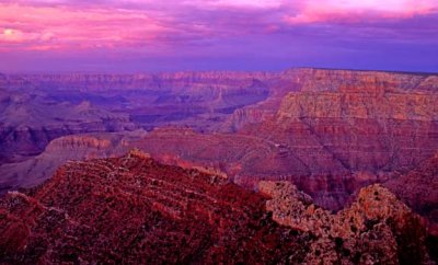
 Yavapai Point sunset, Grand Canyon, AZ |
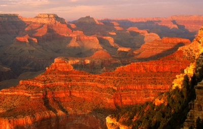
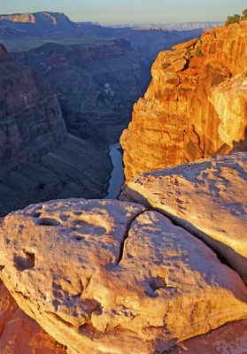
 (GC1) Mather Point sunrise, Grand Canyon, AZ |
 Mohave Point, Grand Canyon, AZ |
 Yavapai Point, Grand Canyon, AZ |
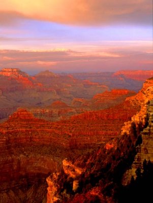
 Sunrise, Grand Canyon, AZ |
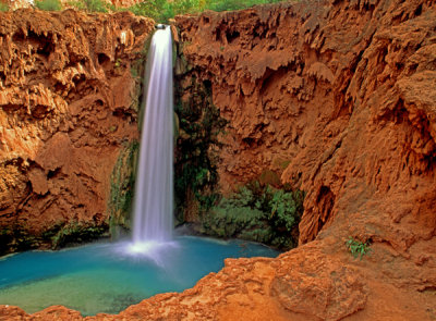
 (GC11) Havasu Falls, Gand Canyon, AZ |
 (GC12) Sunset, Yavapai Point, Grand Canyon, AZ |
 Yavapai Point, Grand Canyon, AZ |
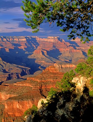
 Mather Point, Grand Canyon National Park, AZ |
 After sunset, Grandview Point, Grand Canyon, AZ |
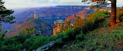
 (GC16) Point Imperial, Grand Canyon, AZ |
 Yavapai Point, Grand Canyon, AZ |
 Woton's Throne, Cape Royal, North Rim, Gand Canyon AZ |
 Navajo Falls, Havasu Canyon, Grand Canyon, AZ |
 (GC20) Yavapai Point, Grand Canyon, AZ |
 (CG21) Hayden Peak, Point Imperial, North Rim, Grand Canyon AZ |
 Early morning light at Desert View, Grand Canyon National Park, AZ |
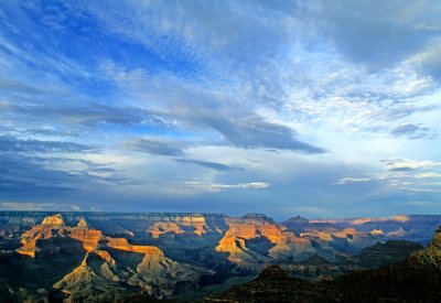 Grand Canyon sky from Yavapai Point, Grand Canyon National Park, AZ |
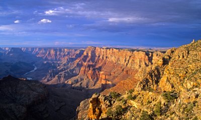
 View from Navajo Point, Grand Canyon National Park, AZ |
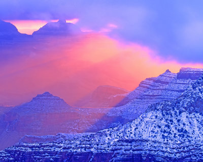
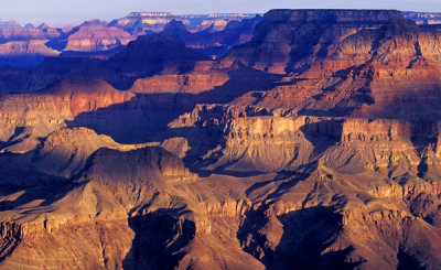
 Clearing storm, Grand Canyon National Park, AZ |
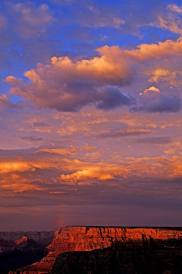 Summer monsoon, Grandview Point, Grand Canyon National Park, AZ |
 Last light at Mather Point, Grand Canyon National Park, AZ |
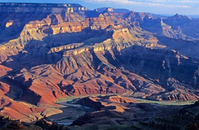
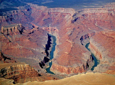
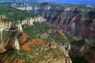 Aerial view of Hayden Peak, Grand Canyon National Park, AZ |
 Sunset at Woton's Throne, Cape Royal, North Rim, Grand Canyon National Park, AZ |
 First light at Hayden Peak, Point Imperial, North Rim, Grand Canyon, AZ |
 East rim of Grand Canyon from Desert View, Grand Canyon National Park, AZ |
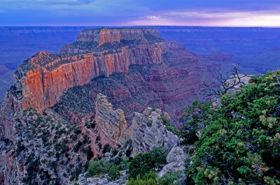 Woton's Throne, North Rim, Cape Royal, Grand Canyon National Park, AZ |
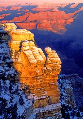
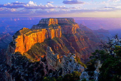
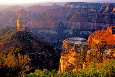
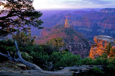
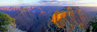
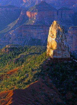 Hayden Peak, Point Imperial, North Rim, Grand Canyon National Park, AZ |
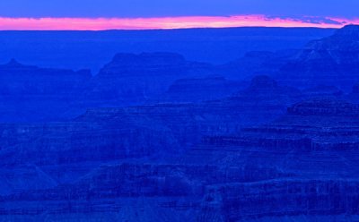 Blue layers after sunset, Yavapai Point, South Rim, Grand Canyon National Park, AZ |
 Sunrise, Yavapai Point, South Rim, Grand Canyon National Park, AZ |
 Woton's Throne Panoramic, Cape Royal, North Rim, Grand Canyon National Park, AZ |
 Hermits Rest, Grand Canyon National Park, AZ |
 Hayden Peak, Point Imperial, North Rim, Grand Canyon National Park, AZ |
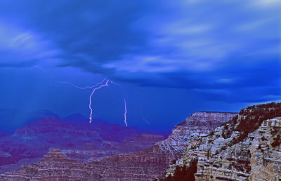 Night lightning at Yavapai Point, Grand Canyon National Park, AZ |
 Toroweap Overlook looking west, Grand Canyon National Park, AZ |
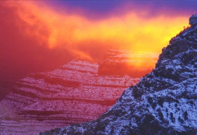
 Toroweap sunrise, Grand Canyon |
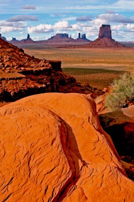
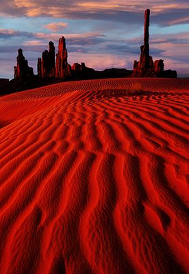 Totem Pole, Yea Bi Chei, and Dunes, Monument Valley, AZ/UT |
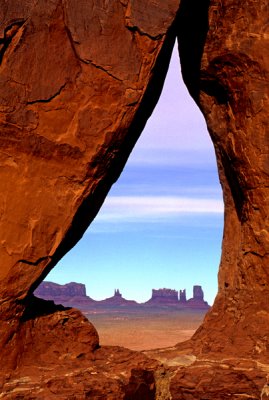
 North Window Monument Valley AZ |
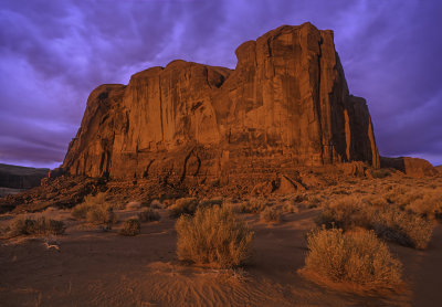
 Cly Butte and West Mitten, Monument Valley, UT |
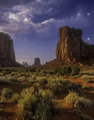
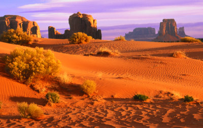
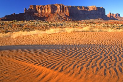
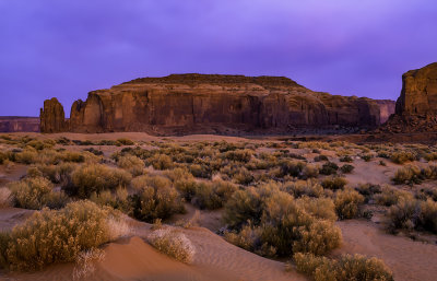
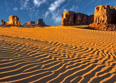 Sand dunes and buttes, Monument Valley, AZ |
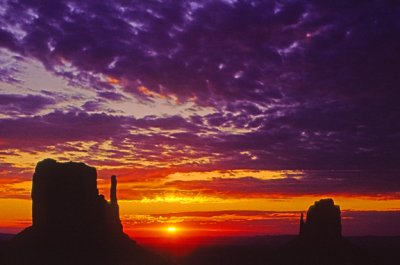
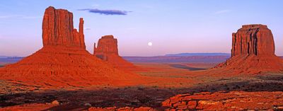 Moonrise, Monument Valley, AZ/UT |
 Mules ears and Mitten Buttes, Monument Valley, AZ |
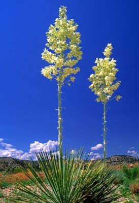
 Yuccas and Butte, Monument Valley, Navajo Tribal Park, AZ/UT |
 Asymmetrical ripple marks, Monument Valley, AZ |
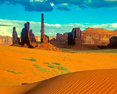 Totem Pole and dunes, Monument Valley, Navajo Tribal Park, AZ/UT |
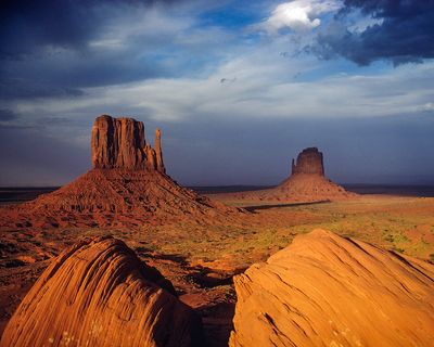 Mittens, Monument Valley, Navajo Tribal Park, AZ/UT |
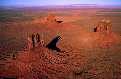 Aerial view of West Mitten, East Mitten, and Merrick butte, Monument Valley, AZ |
 The Teardrop, Monument Valley, Navajo Tribal Park, AZ/UT |
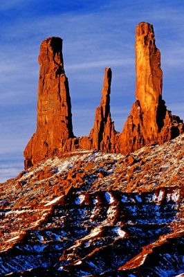 The Three Sisters, Monument Valley, Navajo Tribal Park, AZ/UT |
 Three Fingered Jack, Monument Valley, Navajo Tribal Park, AZ/UT |
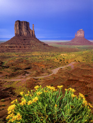
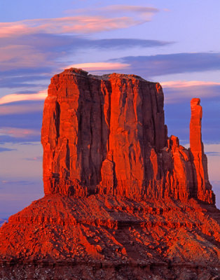 West Mitten, Monument Valley, Navajo Tribal Park, AZ/UT |
 View from North Window, Monument Valley, Navajo Tribal Park, UT |
 Sunrise on Cly Butte, Monument Valley, Navajo Tribal Park, AZ/UT |
 Rain God Mesa, Monument Valley, UT/AZ |
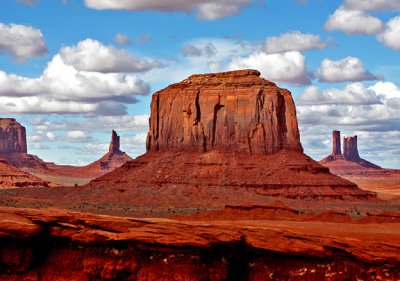 Merrick Butte from John Ford Point, Monument Valley, Navajo Tribal Park, UT/AZ |
 East and West Mitten Buttes at Sunrise, Monument Valley, AZ |
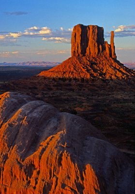 The West Mitten, Monument Valley, Navajo Tribal Park, UT |
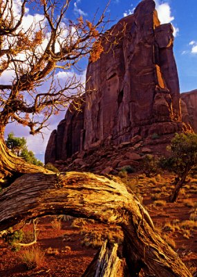 Juniper and butte, Monument Valley, Navajo Tribal Park, AZ/UT |
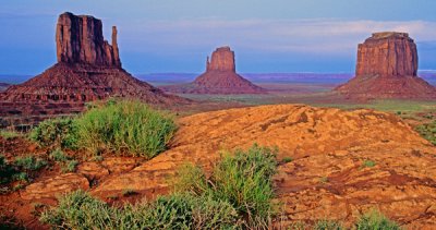 Mittens and Merrick Buttes, Monument Valley, Navajo Tribal Park, AZ/UT |
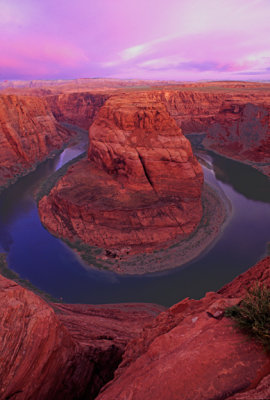
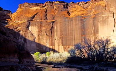
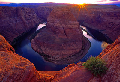 Last light at Horseshoe Bend, an entrenched meander near Page, AZ |
 Little Cut near Page, AZ |
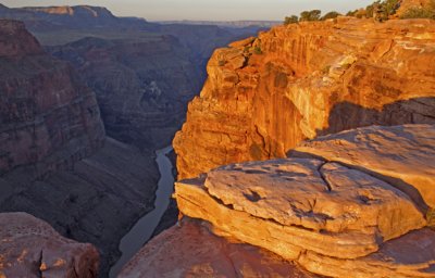
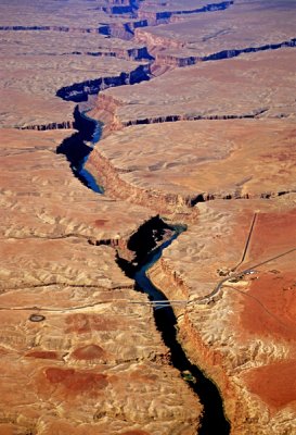
 Horseshoe Bend, Colorado River near Page, AZ |
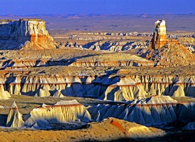
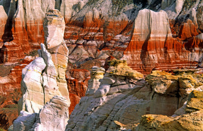
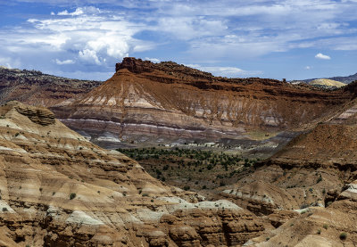
 Coal Mine Canyon, AZ |
 Ha Ho No Geh Canyon, AZ |
 Mother and child, Blue Canyon, Moenkopi Wash, AZ |
 Cockscomb Ridge, UT |
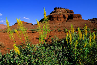
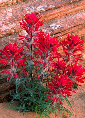 Slickrock Paintbrush near Page, AZ |
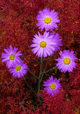
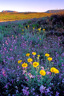
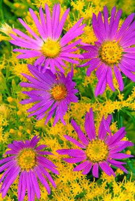 Rabbitbush and asters, Coconino County, AZ |
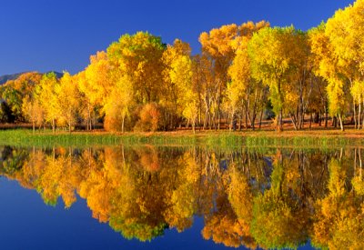
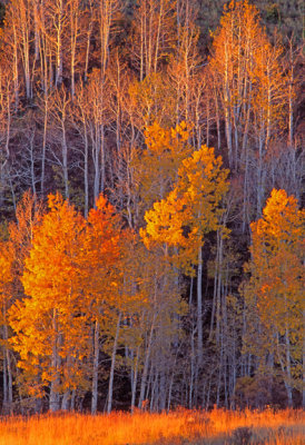 Heart Prairie aspens, near Flagstaff, AZ |
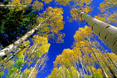 Snow Bowl aspens, Coconino County, AZ |
 Lake Powell, AZ |
 Waterholes area, Page, AZ |
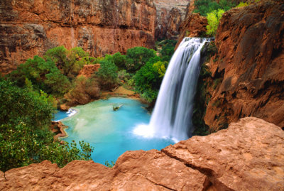
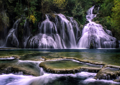
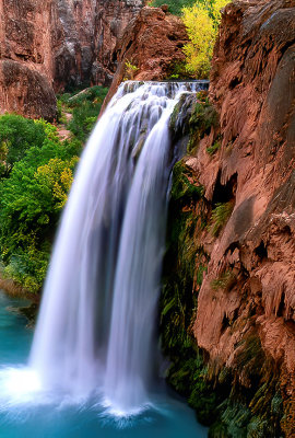 Havasu Falls, Havasu Canyon, AZ |
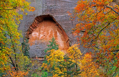
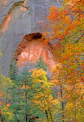 Arch, West Fork, Red Rock-Secret Mountain Wilderness, AZ |
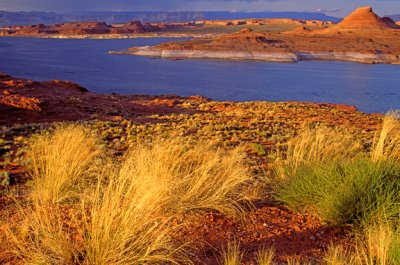
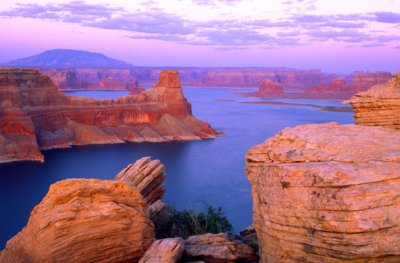 Alstrom Point, Lake Powell National Recreation Area, AZ |
 Petrified wood pedestal rock, Petrified Forest National Park, AZ |
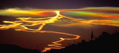 Noctilucent clouds near Why AZ. |
 Waterholes Canyon area cliff near Page, AZ |
 Waterholes Canyon area sandstone peak near Page, AZ |
 Mooney Falls, Havasu Canyon, AZ |
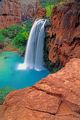 Havasu Falls, Havasu Canyon, AZ |
 Navajo Falls, Havasu Canyon, AZ |
 Little Cut near Page, AZ |
 Striped rocks, Blue Canyon, AZ |
 Ha Ho No Geh Canyon, AZ |
 Blue Canyon Hoodoos, AZ |
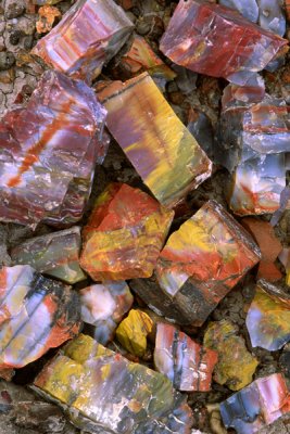
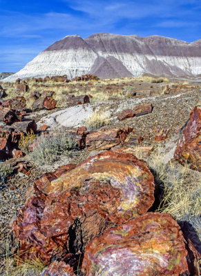 Petrified Wood, Petrified Forest National Park, AZ |
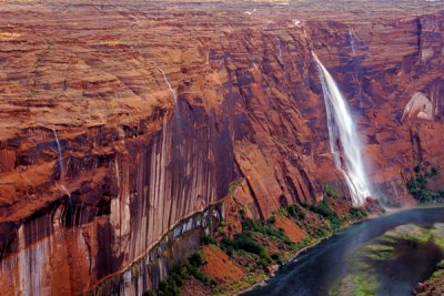 Waterfalls in Glen Canyon after heavy rainfall, AZ |
 Zebra rock near upper Antelope Canyon, AZ |
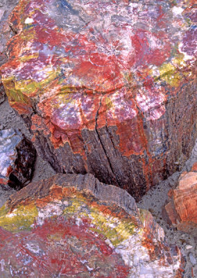 Close-up of petrified logs, Petrified Forest National Park, AZ |
 The Preacher, Ha Ho No Geh Canyon, AZ |
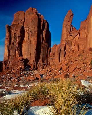
 Sandstone wall, Canyon De Chelly, AZ |
 Round Rock, Navajo Reservation, AZ |
 Chinle Formation, Grand Staircase- Escalante National Monument, UT |
 Petrified wood fragments, Petrified Wood National Park, AZ |
 Asters and foetid goosefoot, Sunset Crater National Monument, AZ |
 Aerial view of Tatahotso Point and the Colorado River near Cedar Ridge, AZ |
 Aerial view of Navajo Bridge spanning Marble Canyon near Lee's Ferry, AZ |
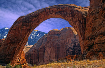 Rainbow Bridge, Glen Canyon National Recreation Area, AZ |
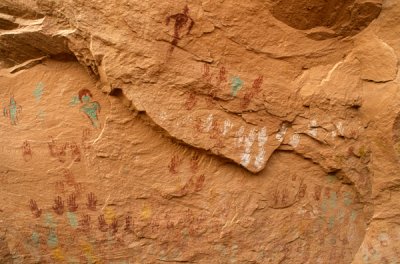
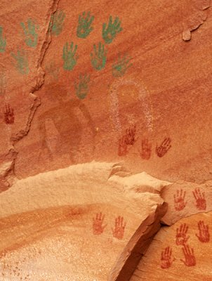
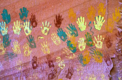 Anasazi hand prints, AZ |
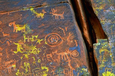
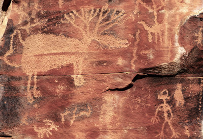
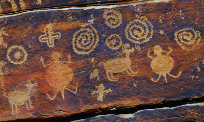 Turtles, spirals and rams, AZ |
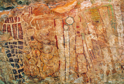 Shaman's Gallery, AZ |
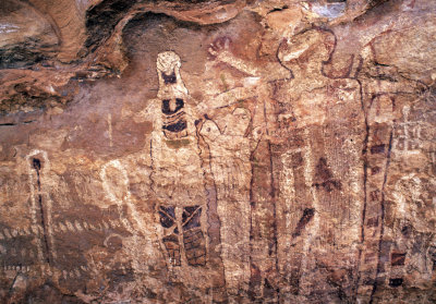 Shaman's Gallery, AZ |
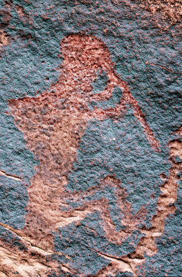
 Bobcat Petroglyph, AZ |
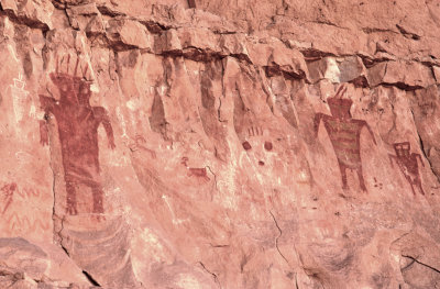
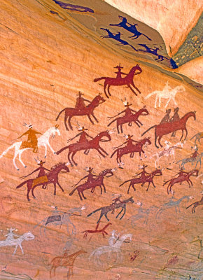 Navajo pictographs, AZ |
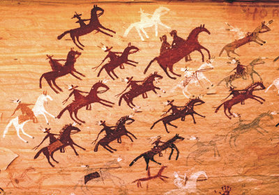 Navajo pictographs, AZ |
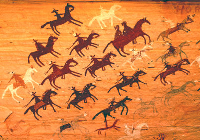 Navajo pictographs, AZ |
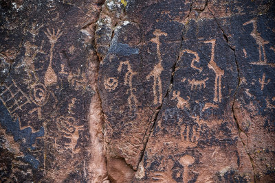
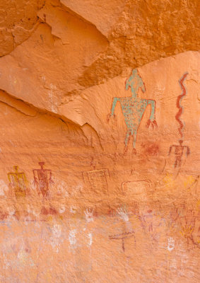
 Kokopelli, Arizona |
 Snake Gulch Anthropomorphs, AZ |
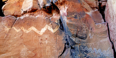
 V Bar V Ranch petroglyph site, AZ |
 V Bar V Ranch petroglyphs site, AZ |
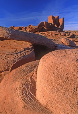 Wukoki Ruin, Wapatki National Monument, AZ |
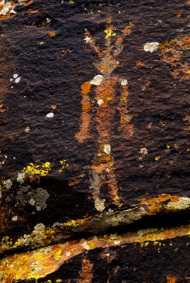 Lichen man, AZ |
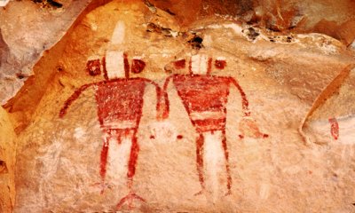 Snake Gulch Pair, AZ |
 Snake Gulch anthropomorphs, AZ |
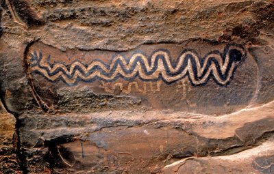 Snake Pictograph, AZ |
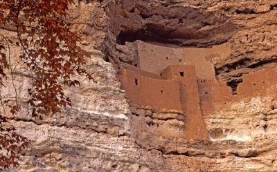 Montezuma's Castle, Montezuma's Castle National Monument, AZ |
 Snake pictographs, AZ |
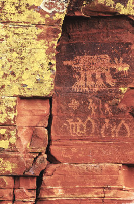
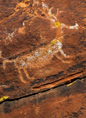 Deer petroglyph, AZ |
 Elk Petroglyph, AZ |
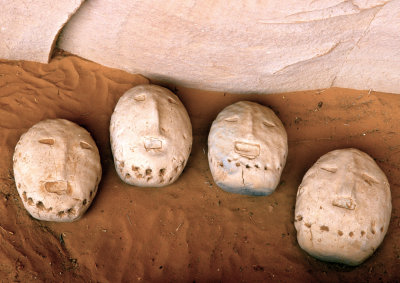 Yei Bi Chei ceremonial masks, AZ |
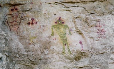
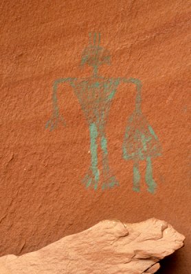
 Anasazi pictographs of Green Man and friends, AZ |
 Anasazi pictographs, AZ |
 The alter and anasazi pictographs, AZ |
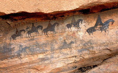 Spanish riders, Navajo pictographs, AZ |
 Navajo pictographs, AZ |
Pictographs on the Wall of Hands, AZ |
 Navajo pictograph, AZ |
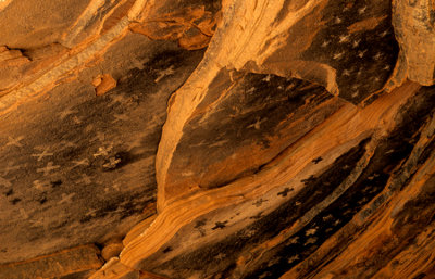 Stars on the ceiling of an alcove, Canyon de Chelly, AZ |
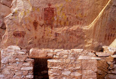
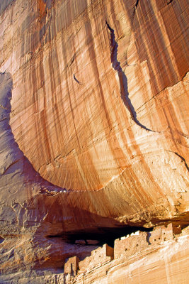 White House Ruin, Canyon De Chelly National Monument, AZ |
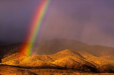 Rainbow, Mingus Mountain, Cottonwood, AZ |
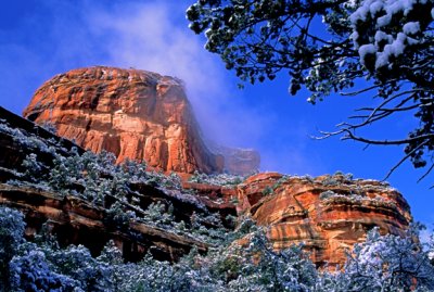
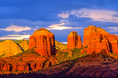
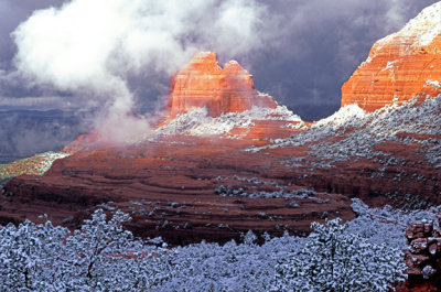 (SED2) Winter at Schnebly Hill, Sedona, AZ |
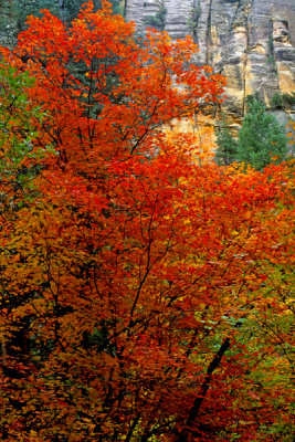
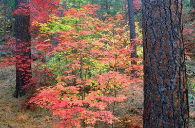 (SED3) Fall in Oak Creek Canyon, AZ |
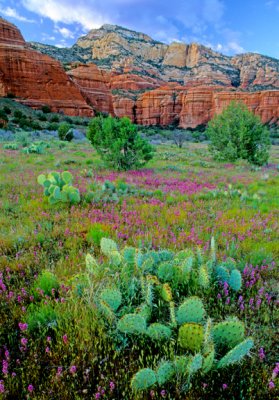
 Owl's Clover during spring at Bear Mountain Meadow, Sedona, AZ |
 (SED5) West Fork Arch, Sedona, AZ |
 (SED6) Oak Creek, Sedona, AZ |
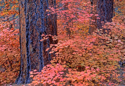
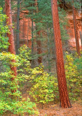
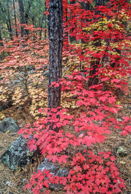
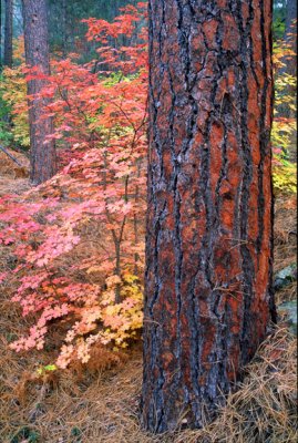 (SED7) Ponderosa Trunk & Big Tooth Maples, Oak Creek Canyon, AZ |
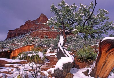
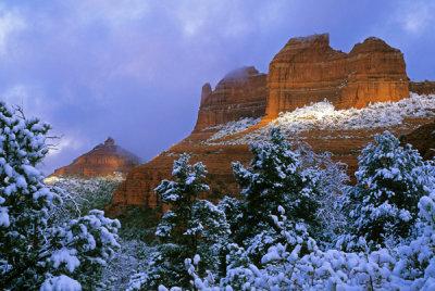
 (SED8) Dry Creek Winter, Sedona, AZ |
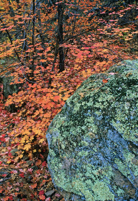
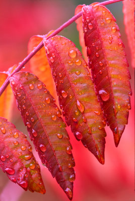 Staghorn Sumac Leaves, Oak Creek Canyon, AZ |
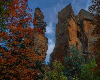
 Fay Canyon, Sedona, AZ |
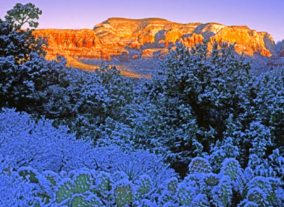
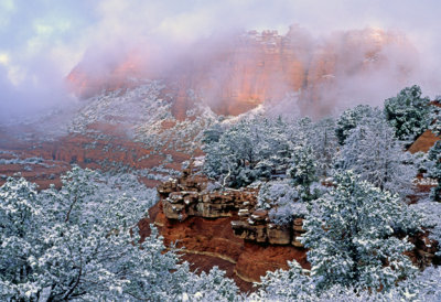
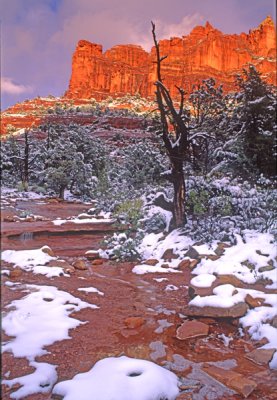
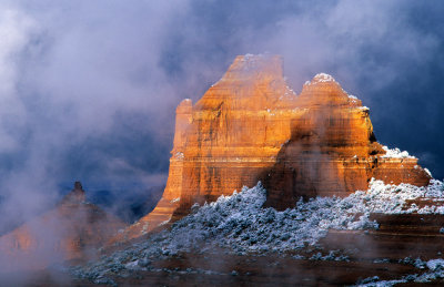
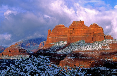 Clearing snowstorm at Mitten Ridge, Schnebly Hill Road, Sedona, AZ |
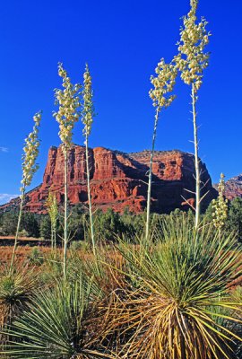
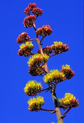
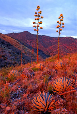
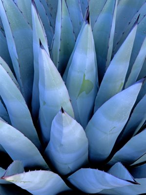
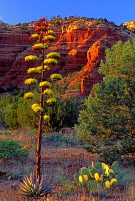 Parry's agave, Sedona, AZ |
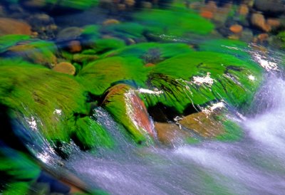 (SED 13) Algae Covered Rocks, Oak Creek, Sedona, AZ |
 Big Tooth Maples and Ponderosas, Secret Canyon, Red Rock-Secret Canyon Wilderness, AZ |
 Sandstone Pillars, West Fork, Oak Creek Canyon, AZ |
 Ponderosa Pines, West Fork, Oak Creek Canyon, AZ |
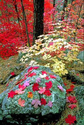 Big tooth maples, Oak Creek Canyon, AZ |
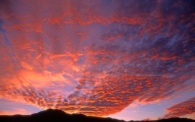 Altocumulus sunset, Mingus Mountain, Cottonwood, AZ |
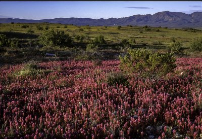 Owl's clover, Verde Valley, Cottonwood, AZ |
 Big tooth maples, Oak Creek Canyon, Sedona, AZ |
 Clearing storm, Schnebly Hill, Sedona, AZ |
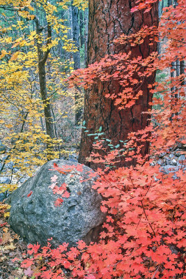 Ponderosa, big tooth maples, and boulder, Oak Creek Canyon, Sedona, AZ |
 Soldiers Pass, Sedona AZ |
 Dead Horse Ranch State Park, Cottonwood, AZ |
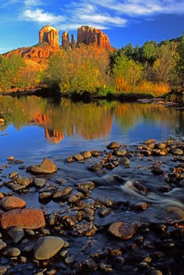
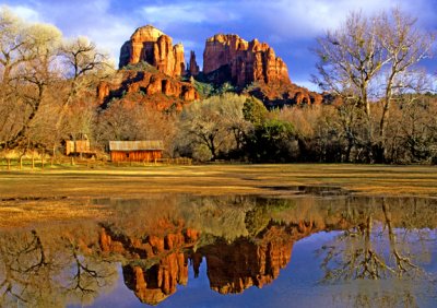
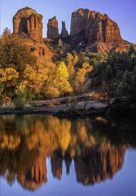 Cathedral Rock, Red Rock Crossing, Sedona, AZ |
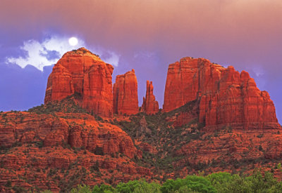 (SED1) Cathedral Rock Moonrise, Sedona, AZ |
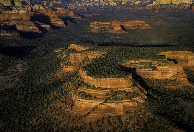 Aerial view of Doe Mountain, Sedona, AZ |
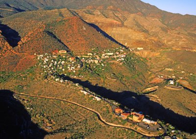 Aerial view of Jerome, AZ |
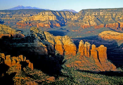 Aerial view of the Coffee Pot at the edge of the Mogollon Rim near Sedona, AZ |
 Soldiers Pass Trail, Sedona, AZ |
 Big tooth maple, West Fork, Oak Creek Canyon, AZ |
 West Fork of Oak Creek Canyon, AZ |
 Owl's clover and prickly pear cactus, Sedona, AZ |
 Water cress and big tooth maple leaves, Oak Creek Canyon, AZ |
 Big tooth maple, West Fork, Sedona, AZ |
 Cathedral Rocks, Sedona, AZ |
 Rising mists, Schnebly Hill, Sedona, AZ |
 View from Schnebly Hill Road, Sedona, AZ |
 Yuccas in Bear Mountain Meadow, Sedona, AZ |
 Lichen covered rock in Secret Canyon, Red Rock-Secret Canyon Wilderness, AZ |
 Crescent Moon Park, Sedona |
 Soap tree yuccas at Courthouse Rock, Sedona AZ |
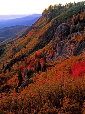 Fall color on Mingus Mountain at sunrise, Yavapai County, AZ |
 Pricly pear and owl's clover, Sedona, AZ |
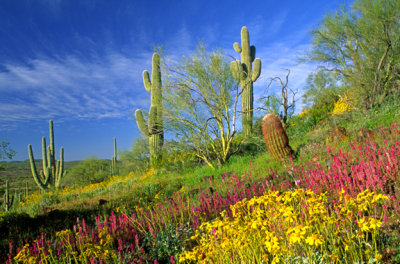
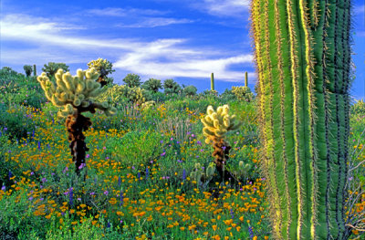
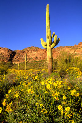
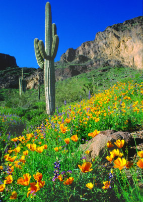 (DES2) Saguaro & Poppies, Picacho Peak S. P., AZ |
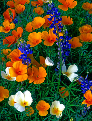
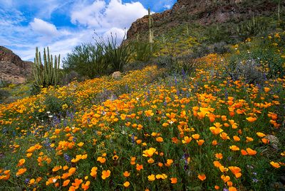
 Mexican gold poppies & lupines, Organ Pipe Cactus National Monument, AZ |
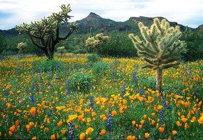
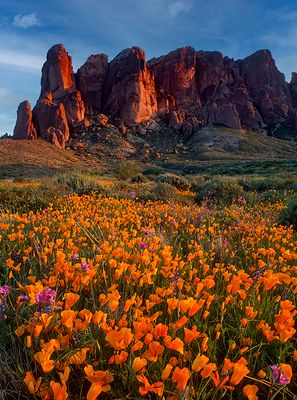
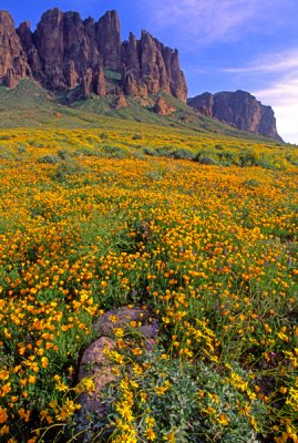
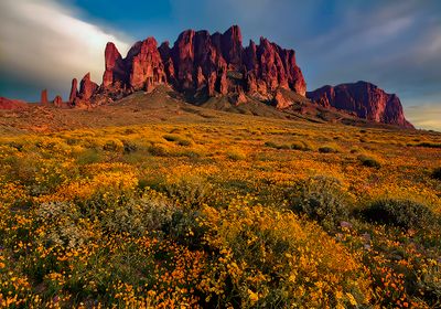
 Poppies, Lost Dutchman State Park, AZ |
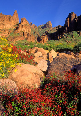
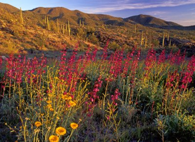
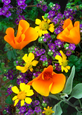 Poppies, Phacelia, and Brittlebush, AZ |
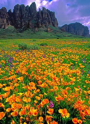
 Lost Dutchman Poppies at sunset, AZ |
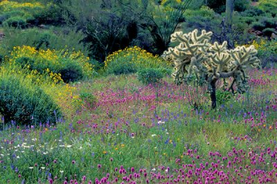
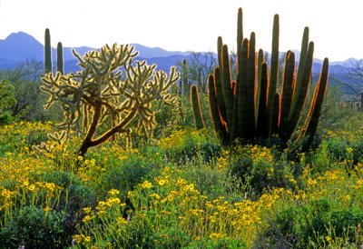 Chainfruit Cholla, Brittle Bush, and Organ Pipe Cactus, Organ Pipe Cactus N. M., AZ |
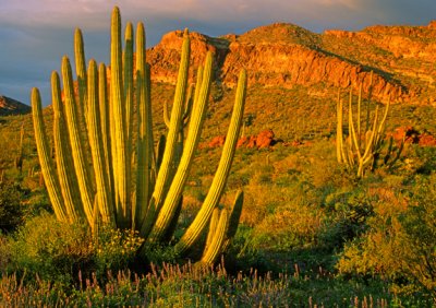
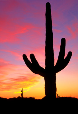 Saguaro Cactus, Organ Pipe Cactus N. M., AZ |
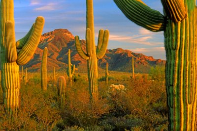 (DES13) Saguaros, Organ Pipe Cactus N. M., AZ |
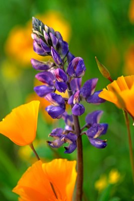
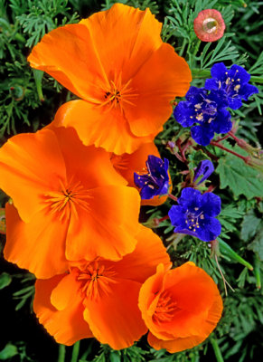
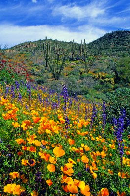
 Lupines and poppies, Organ Pipe Cactus N. M., AZ |
 (DES15) Primrose, Coconino N. F., AZ |
 Owl clover and brittlebush, near Wickenburg, AZ |
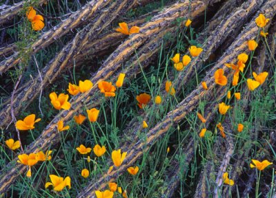
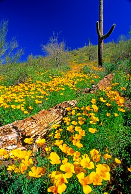 Poppies and fallen Saguaro, Lake Pleasant, AZ |
 (DES18) Poppies and saguaro skeleton, Lake Pleasant AZ |
 Chollas, poppies and saguaros, Lake Pleasant, AZ |
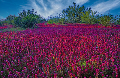
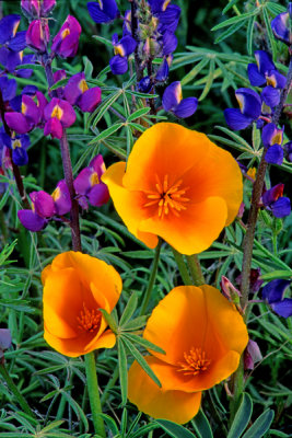
 Arizona lupine and Mexican gold poppies, Badger Springs, AZ |
 Mexican gold poppies and owl clover, Sells, AZ |
 Desert Marigolds and Stock, Sycamore Canyon Road, AZ |
 Agave, Bell Rock Trail, Sedona, AZ |
 Owl clover and creosote bush near Wickenburg, AZ |
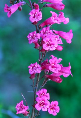 Parry's penstemon, Organ Pipe Cactus National Park, AZ |
 Brittle bush and saguaro, Silly Mountain Park, AZ |
 Peridot Mesa, San Carlos Apache Reservation, AZ |
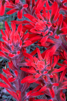 Indian Paintbrush, Sedona, AZ |
 (DES 31) Desert Bluebells and Mexican Gold Poppies, Mingus Mountain, AZ |
 Poppies and Ocotillo Branches, Picacho Peak State Park, AZ |
 (DES 33) Fairy duster and Brittlebush, Organ Pipe Cactus National Park, AZ |
 (DES 34) Brittlebush and poppies, Lost Dutchman State Park, AZ |
 (DES 35) Chuparosa and brittlebush, Lost Dutchman State Park, AZ |
 (DES 36) Mexican gold poppies and brittlebush, Lost Dutchman State Park, AZ |
 (DES 37) Agaves on Mingus Mountain near Jerome, AZ |
 Mexican gold poppies and lupines, Picacho Peak State Park, AZ |
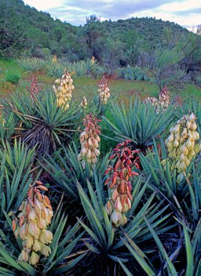 Banana yuccas, Sedona, AZ |
 Organ Pipe Cactus, Organ Pipe Cactus N. M., AZ |
 (DES 49) Poppy, Bartlett Lake AZ |
 Agave buds, Coconino National Faorest, AZ |
 Phacelia, desert marigold, and penstemon, Florence Junction, AZ |
 Beehive cactus, Mingus Mountain, Cottonwood, AZ |
 (DES 53) Yuccas, Yavapai County, AZ |
 Prince's plume, Lee's Ferry, AZ |
 Desert annuals, Organ Pipe Cactus National Monument, AZ |
 California barrel cactus, brittlebush and phacelia, South Mountain Park, Phoenix, AZ |
 Penstemon and desert marigold near Superior, AZ |
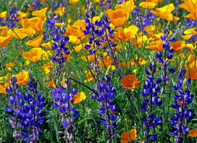
 White and orange Mexican gold poppies and lupines, Bartlett Lake, AZ |
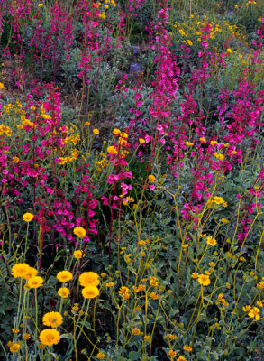
 Poppies, lupines, chia, and chuparosa, Bartlett Lake, AZ |
 Lupines and poppies at Bartlett Lake, AZ |
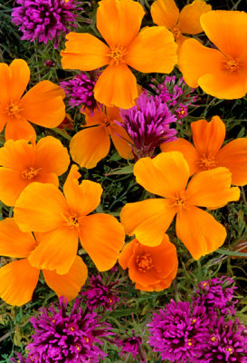
 Phacelia and Mexican goldpoppies near Superior, AZ |
 Chuparosa, poppies, and saguaro, Barlett Lake, AZ |
 Poppies, lupine, chuparosa, and brittlebush, Bartlett Lake AZ |
 White and gold poppies, Barlett Lake, AZ |
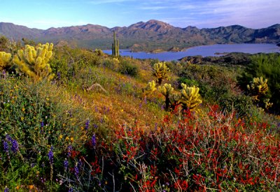 Bartlett Lake, AZ |
 Parry's penstemon, desert marigolds, and brittlebush, Gonzales Pass, Maricopa County, AZ |
 Mexican gold poppies and owls clover, Sells, AZ |
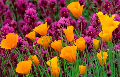
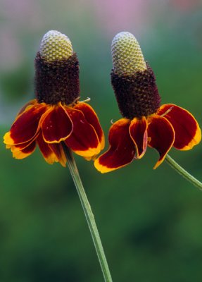 Mexican hats, Cottonwood, AZ |
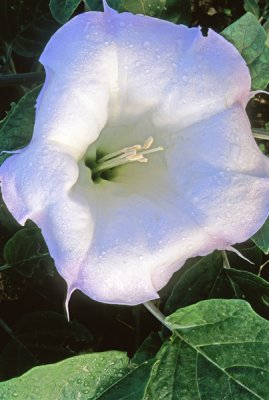 Sacred datura with dew, Cottonwood, AZ |
 Beaver tail cactus, AZ |
 Santa Rita prickly pear cactus, Santa Rita Mountains, AZ |
 Summer poppies, Cottonwood, AZ |
 Parry's agave, Sedona, AZ |
 Mexican gold poppies, chia, lupine and chickory, Organ Pipe Cactus National Monument, AZ |
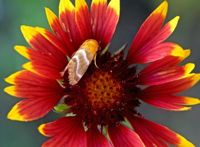 Skipper on gaillardia flower, Cottonwood, AZ |
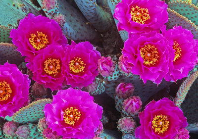
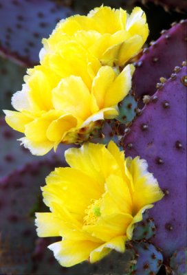
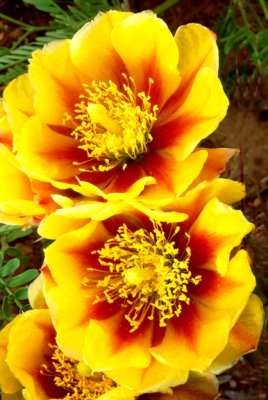 (C1) Yellow Prickly Pear, AZ |
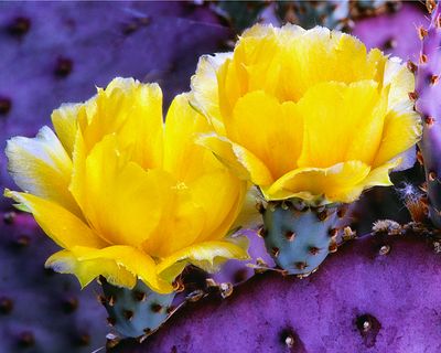
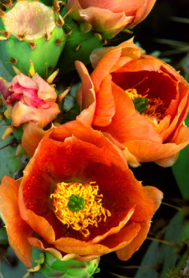 (C2) Orange Prickly Pear, AZ |
 (C3) Santa Rita Prickly Pear, AZ |
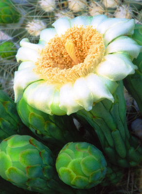 (C4) Saguaro, AZ |
 (C5) Cholla Cactus, AZ |
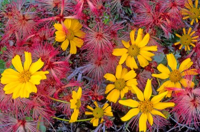
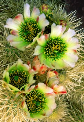
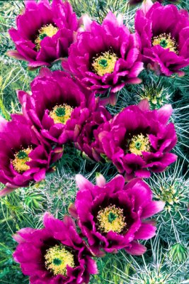
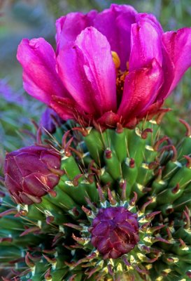
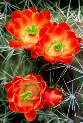 (C6) Claret Cup Cactus, AZ |
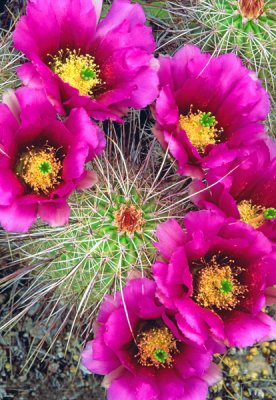
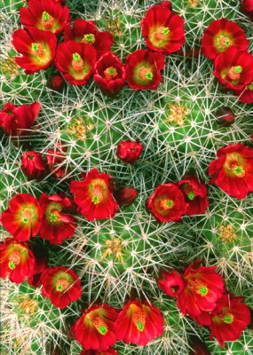 (C7) Claret Cup Cactus, Waterholes Canyon, AZ |
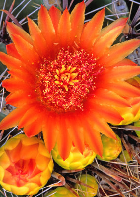 (C8) Barrel Cactus, AZ |
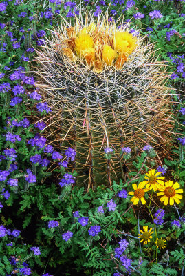
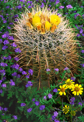 (C9) Phacelia, Brittlebush, and Barrel Cactus, AZ |
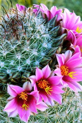 (C10) Pincushion Cactus, AZ |
 (C11) Hedgehog Cactus, AZ |
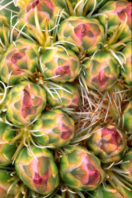 (C12) Whipple's fishook cactus buds near Page, AZ |
 (C13) Hedgehog cactus, Apache Trail, AZ |
 Cane cholla, Yavapai County, AZ |
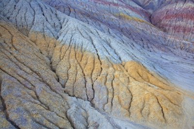
 Striped Chinle Formation, Paria Canyon-Vermillion Cliffs Wilderness, AZ |
 Hoodoo near Wahweap Wash, UT |
| comment | share |
| joseantonio | 20-Jul-2023 04:17 | |
| Eldar Kadymov | 26-Aug-2021 11:39 | |
| Marlene Rose Besso | 04-Jul-2013 17:44 | |
| Geoff Smith | 28-Aug-2012 18:23 | |