


|
|
|
|
|
|
| Don Boyd | profile | all galleries >> Memories of Old Hialeah, Old Miami and Old South Florida Photo Galleries - largest non-Facebook collection on the internet >> Miami and Florida AVIATION Historical Photos Gallery - Airports, Airlines, Aircraft - All Years - click on image to view >> Other Historical South Florida Airports (Viking, Sunny South, Homestead General, Tamiami, North Perry, TNT etc.) | tree view | thumbnails | slideshow | map |
There were numerous other airports in South Florida that existed long before most of the current residents were born or moved into the area. Unfortunately, like with other historical buildings and features in the county, they have been plowed under and there are few if any historical markers that have been erected to tell people what once existed there.
Wanted: any information on the 54th Street Flying Field, also known as Hialeah Airport on the north side of NW 54th Street (Hialeah Drive) between E. 4th Avenue and E. 8th Avenue (LeJeune Road). There are a couple of photos below that show this airport but I would love to have more.
This photo gallery attempts to preserve some of the memories for future generations.
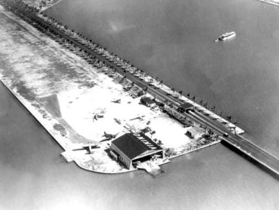 1920s - Viking Airport at the west end of Collins (later Venetian) Causeway |
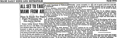 1924 - article about first aerial mapping of Miami with Andrew Heermance as pilot of the Curtiss aircraft |
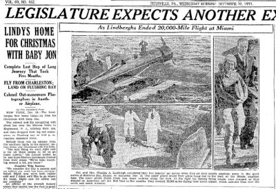 1933 - article about Charles Lindbergh and wife returning to the USA at Miami's Seaplane Base |
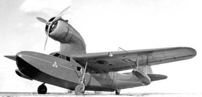 1935 - Richard Archibold's Fairchild 91 "Kono" aircraft at the Viking Airport along the Venetian Causeway |
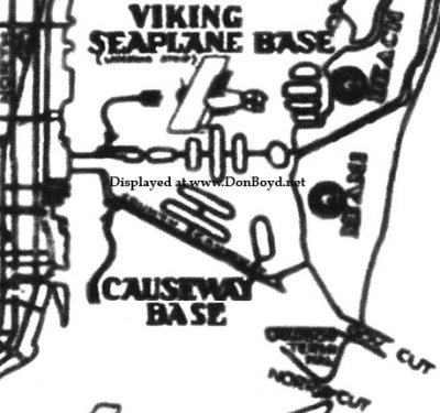 1930's - Viking Seaplane Base and Causeway Base from the Miami Air Guide |
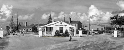 1943 - entrance to the Army Air Corps base at Morrison Field (now Palm Beach International Airport) |
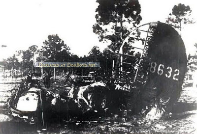 1943 - B-24H #41-28632 crash after takeoff from Morrison Field, West Palm Beach |
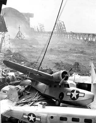 1945 - destruction of aircraft and hangars at Richmond Naval Air Station in southwest Dade County |
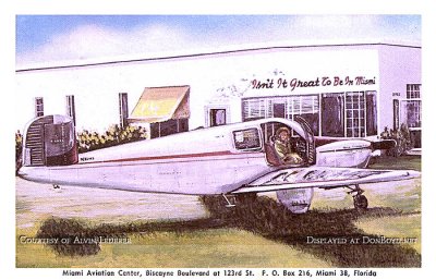 1940's - Miami Aviation Center at Biscayne Boulevard (US 1) and NE 123rd Street, North Miami |
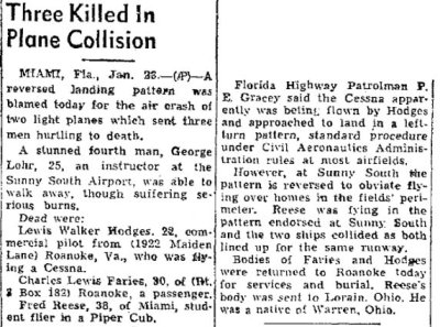 1950 - article about mid-air collision and crash at Sunny South Airport, Miami |
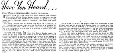 1952 - article about Coast Guard providing PBY escorts for group of private aircraft from Sunny South Airport to Havana |
 1952 - unknown just east of NW 27th Avenue north of 135th Street, Miami |
 1952 - the original Homestead Airport east of US 1 (see comments below) |
 1955 - two Navy blimps at Boca Chica Naval Air Station |
 1963 - aerial view of the original Tamiami Airport on the Tamiami Trail (US 41) in Dade County |
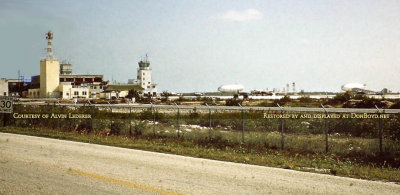
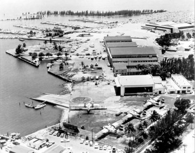 1964 - the Coast Guard Air Station at Dinner Key before their move to Opa-locka Airport |
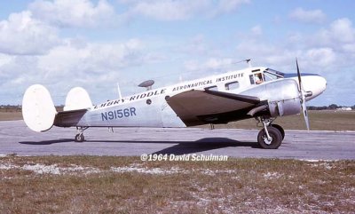 1964 - Embry-Riddle Aeronautical Institute Beech-18 N9156R at the original Tamiami Airport |
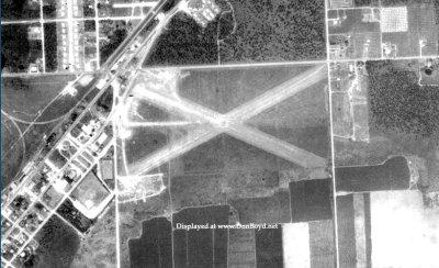
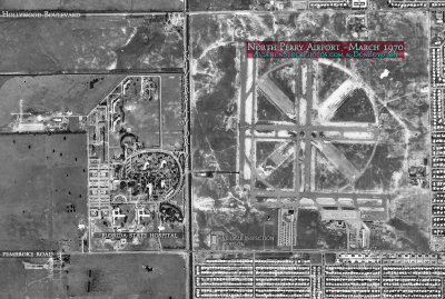 1970 - aerial view of North Perry Airport, Miramar, Hollywood, Pembroke Pines |
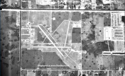
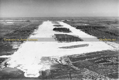 1970 - aerial view of the Dade County Training & Transition Airport under construction |
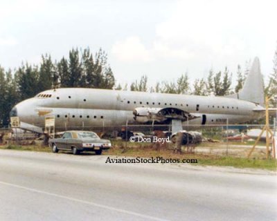 1970's - ex-USN Lockheed XR6O-1 (R6V-1) Constitution N7673C on NW 135th Street, Opa-locka |
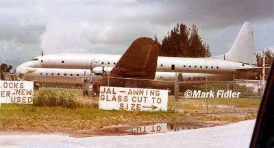 1970's - ex USN Lockheed XR6O-1 (R6V-1) Constitution N7673C on NW 135th Street, Opa-locka |
| comment | share |
| Richard Paul | 03-Oct-2015 23:41 | |
| Ronnie Safreed | 14-Jan-2015 04:53 | |
| Guest | 29-Oct-2014 14:03 | |
| Don Boyd | 18-Aug-2014 04:33 | |
| Don Boyd | 27-Jan-2014 07:28 | |
| Bill | 26-Jan-2014 19:06 | |
| Don Boyd | 11-Dec-2010 16:24 | |
| Bill | 11-Dec-2010 15:36 | |
| Bob | 05-Feb-2010 16:45 | |