


|
|
|
|
|
|
| |
| 17-DEC-2012 | |
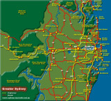
For those of you not familiar with the layout of the Sydney/Blue Mountains area, here is a roughly
accurate map. You can see Blackheath situated in about the centre of the far left, with the city
situated centre far right. You can see the Great Western Highway/M4 clearly marked in yellow.
Images are subject to copyright. They may not be used without permission.