


|
|
|
|
|
|
| Brian McMorrow | profile | all galleries >> Asia >> Bhutan འབྲུག་ཡུལ་ >> Druk Air - Himalaya | tree view | thumbnails | slideshow |
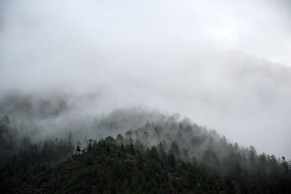 This does not look like a promising day to fly out of Paro |
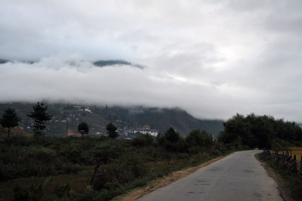 Driving to Paro Airport not feeling confident. Departures require good cloud clearance to visually avoid terrain |
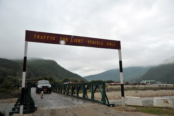 Bridge between town and Paro Airport for light vehicles only |
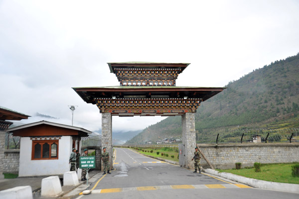
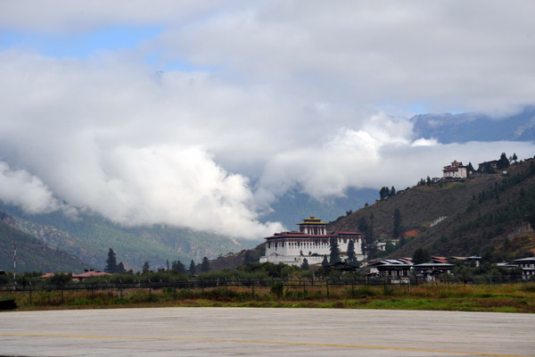
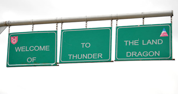 Welcome to the Land of the Thunder Dragon, Paro Airport |
 Bhutan2009 2481.jpg |
 Arriving at Paro Airport on Departure Day |
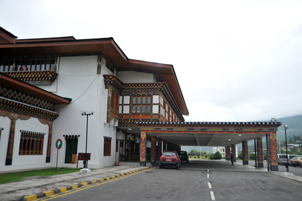 The passenger terminal of Paro, Bhutan's only airport |
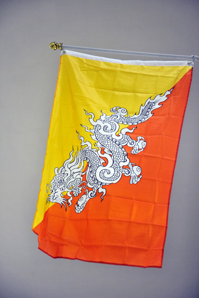 Flag of Bhutan - the Thunder Dragon with Buddhist orange and the royal yellow |
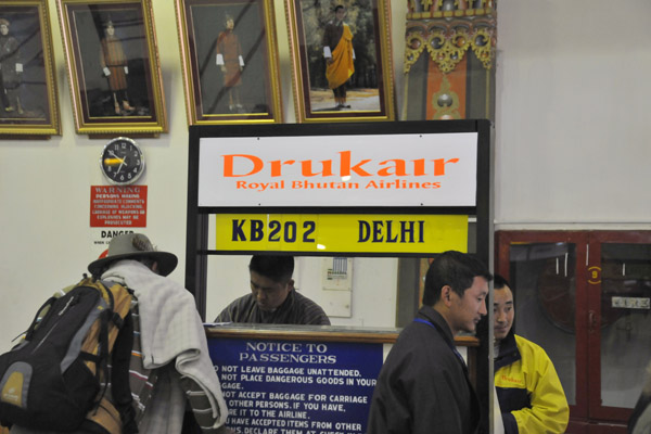 Drukair - Royal Bhutan Airlines - checkin counter for flight KB202 to Delhi |
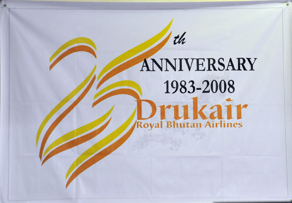 Banner of the 25th Anniversary of Drukair, Royal Bhutan Airlines |
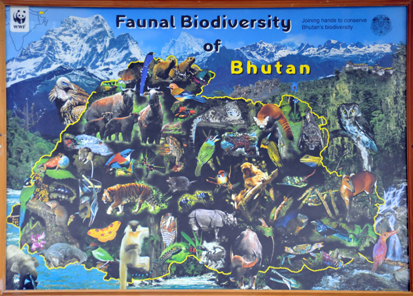 Faunal Biodiversity of Bhutan - outline of Bhutan with photographs of its native animals on a background of the Himalaya, Paro |
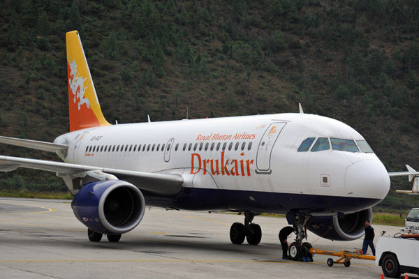
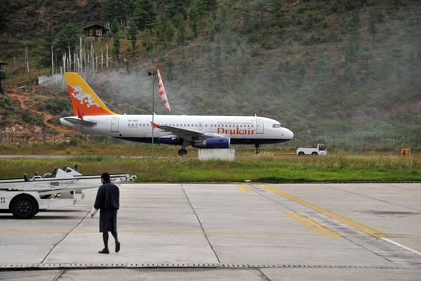 Our aircraft being towed from the hangar to the terminal for our flight to Delhi |
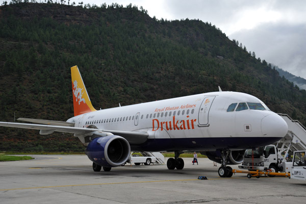
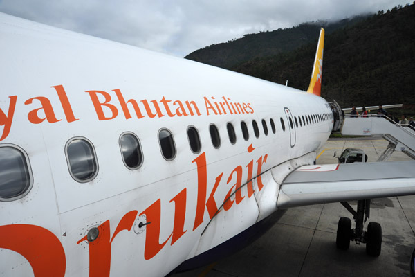
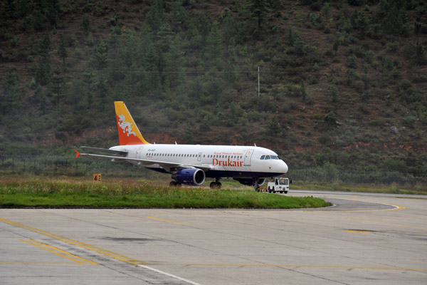 Drukair Royal Bhutan Airlines Airbus A319 (A5-RGF), Paro Airport |
 Drukair Royal Bhutan Airlines Airbus A319 (A5-RGF), Paro Airport |
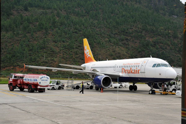 Fueling the Drukair A319 for its flight to Delhi |
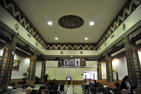 Departure Hall - Paro Airport, Bhutan |
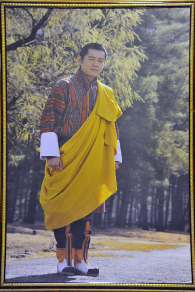 Royal Portraits at Paro Airport - the 5th King of Bhutan (r. 2006-current) |
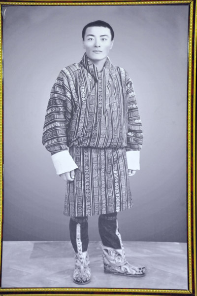 Royal Portraits at Paro Airport - the 4th King of Bhutan (r. 1972-2006) |
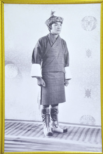 Royal Portraits at Paro Airport - the 3rd King of Bhutan (r. 1952-1972) |
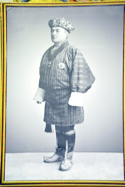 Royal Portraits at Paro Airport - the 2nd King of Bhutan (r. 1926-1952) |
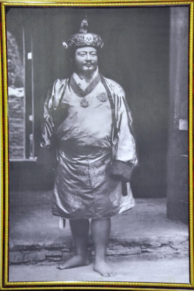 Royal Portraits at Paro Airport - the 1st King of Bhutan (r. 1907-1926) |
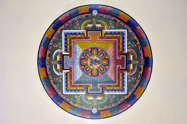 Mandala painting, Paro Airport |
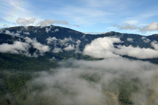
 A few breaks in the clouds over Paro |
 The Captain is happy, we board our flight |
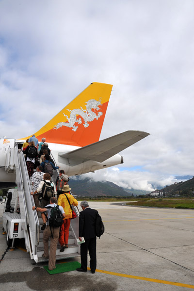
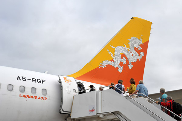 Boarding Drukair A319 (A5-RGF) at Paro Airport |
 Economy in the back, Drukair |
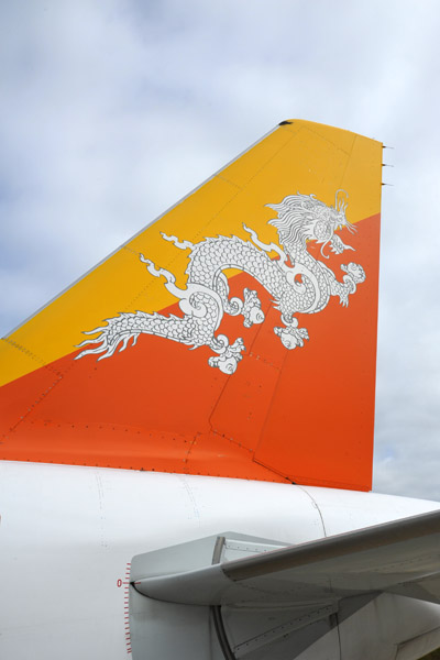 The tail logo of Drukair |
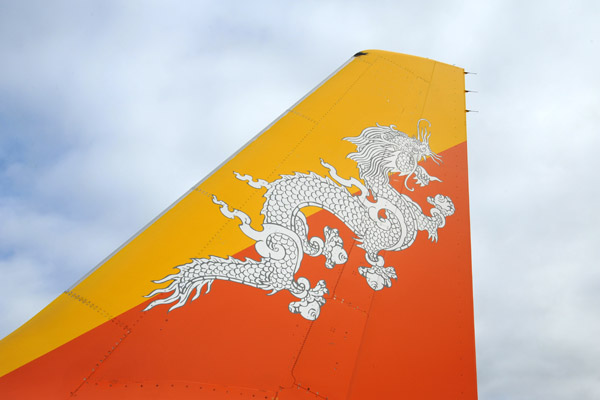 The tail logo of Drukair |
 View of Drukair - Royal Bhutan Airlines - A319 from the front |
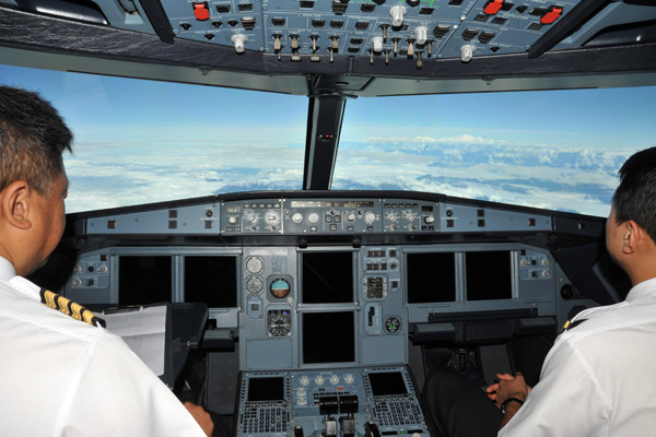
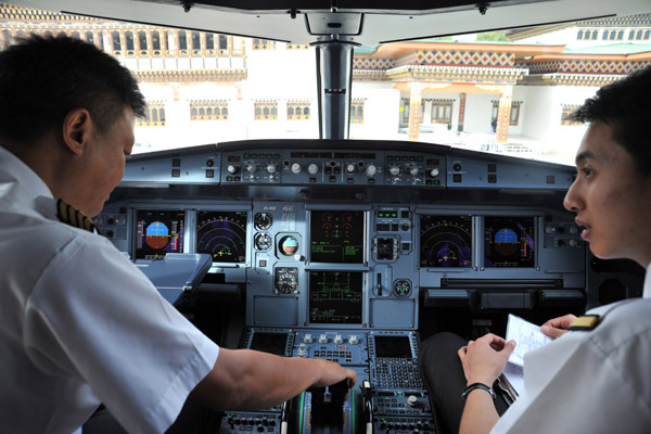 Captain and his young First Officer preparing their A319 for departure from Paro Airport |
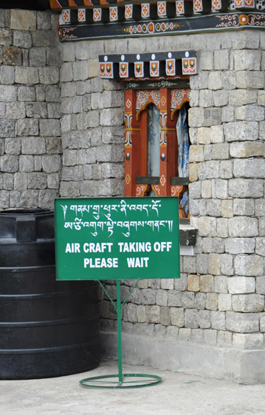
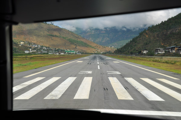
 Paro Airport, elevation 7340 feet |
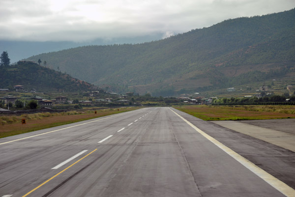 Back Taxi at Paro (Runway 15/33 only 1964m/6445ft) |
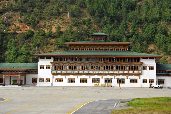 The Terminal of Paro Airport, Bhutan (PBH) |
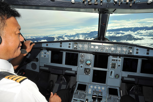
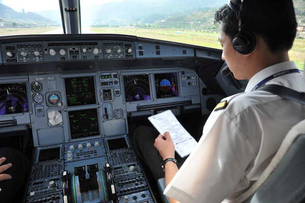 As an airline captain myself, I'm invited to sit in the cockpit for the flight, a great honor! |
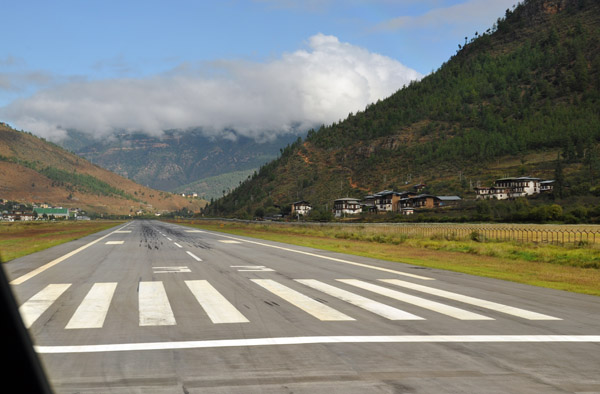 Lining up on Runway 33 at Paro Airport. It will be a visual departure, firs to the right, then down the valley to the left |
 There is so much terrain around, Drukair's SOP is to turn off the terrain warning system for the initial visual climb |
 Airborne from Paro Airport |
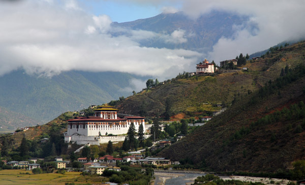
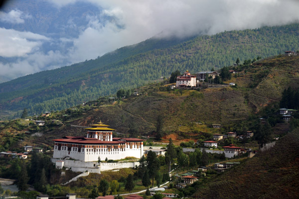 Climbing out past Paro Dzong and the National Museum of Bhutan |
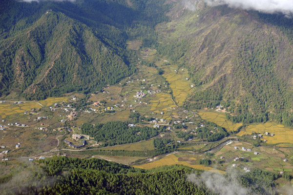
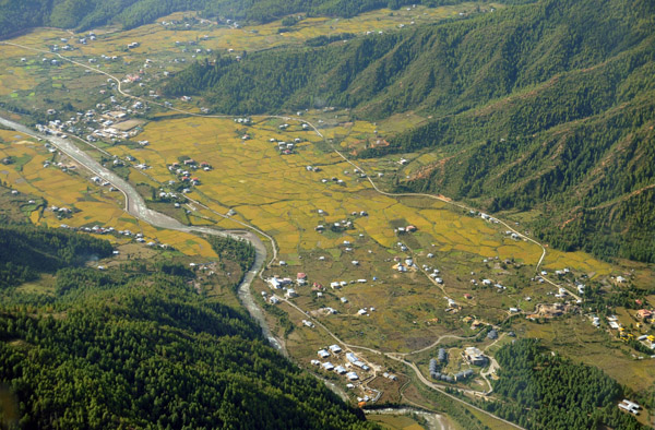
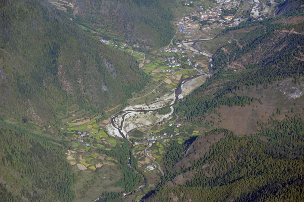
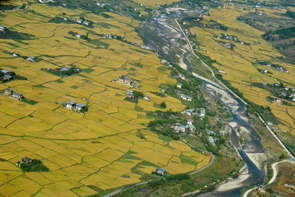 Rice fields and farm houses along the river northwest of Paro |
 Flying up the valley of the Paro River |
 Climbing out of Paro Airport, Bhutan |
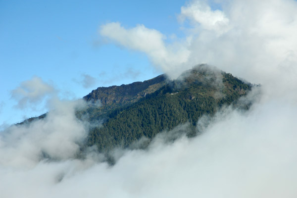 The mountain where the Tiger's Nest temple is |
 Climbing out over the Tiger's Nest - it's obscured but you can see the temples at the mountain's summit |
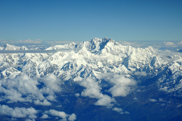
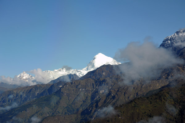 Snow capped Jomolhari (7326m/24,035ft) comes into view for the first time |
 Climbing out of the Paro Valley, Bhutan |
 Climbing out of the Paro Valley, Bhutan |
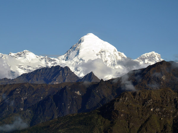 Jomolhari (7326m/24,035ft) on the Bhutan-Sikkim border, a popular destination for trekkers |
 Circling climb over the Paro Valley |
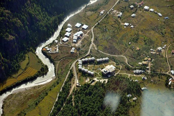 Paro's upscale Zhiwa Ling Hotel |
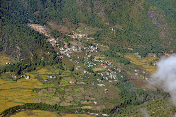
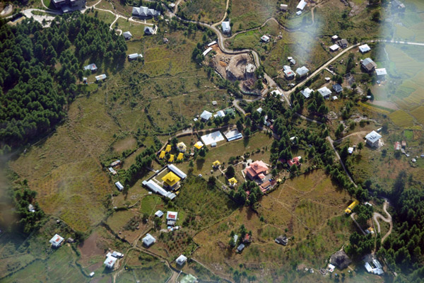 Kyichu Lhakhang far below |
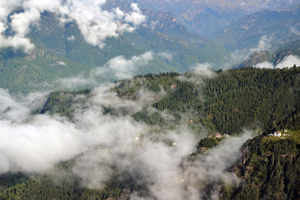
 Aerial view of the Paro valley and its irregular rice fields |
 Successful departure from Paro - a very challenging airport even for the highly experienced Drukair captains |
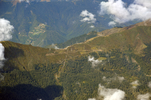 The serpentine dirt road over the pass leading from Paro Valley to neighboring Haa |
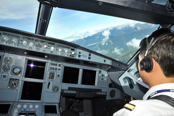 The cadet first officer at Drukair, a lucky man |
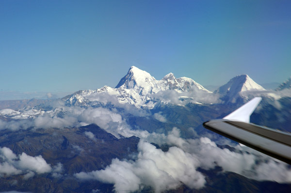
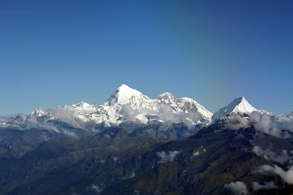 Bhutan Himalaya - Jomolhari (7326m/24,035ft) and the neighboring peak, Jichu Drake (6809m/22,339ft) |
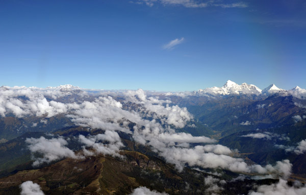 The highest peaks in Bhutan are almost all on the international borders with Sikkim (India) to the west & Tibet (China) N |
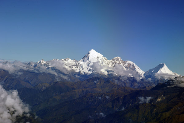 Bhutan Himalaya - Jomolhari (7326m/24,035ft) and the neighboring peak, Jichu Drake (6809m/22,339ft) |
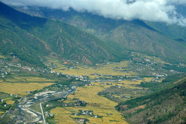
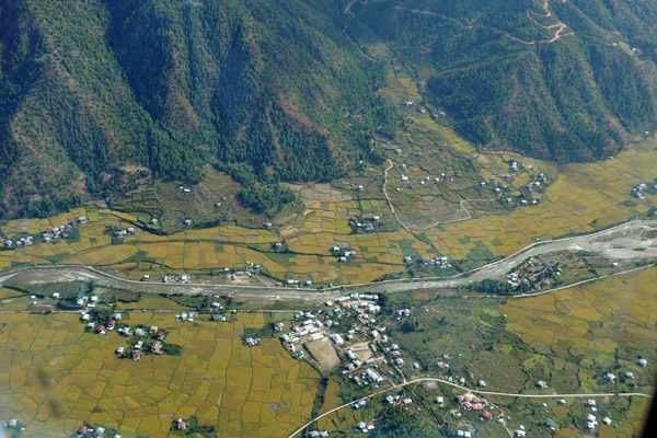
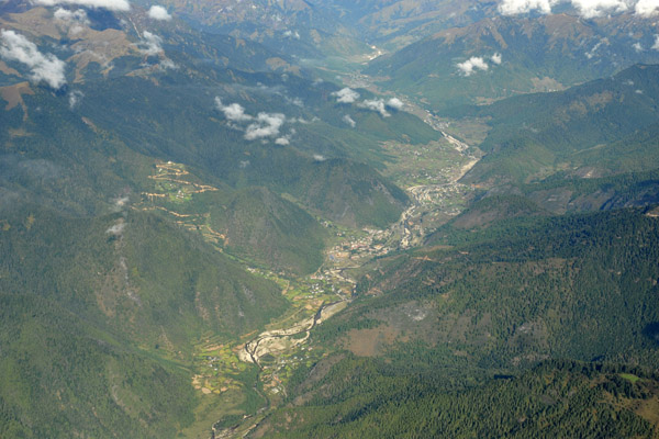 Paro Valley, Bhutan |
 I just noticed, but when I was labeling these photos and zoomed in, there's an inflated note air balloon |
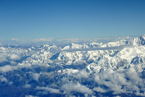
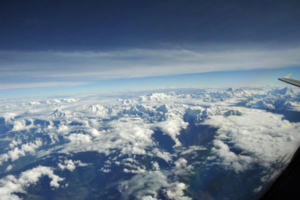
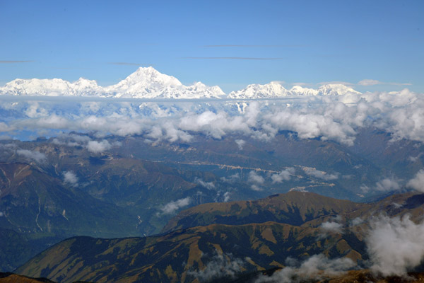 As we climb out of Bhutan, the massive snow covered peaks of the Himalaya make an appearance |
 As we leave Bhutan westbound over Sikkim, we leave Jomolhari behind |
 Leaving Bhutan climbing out of 20,000 feet, we first route towards Bagdogra, India, before turning right to fly across Nepal |
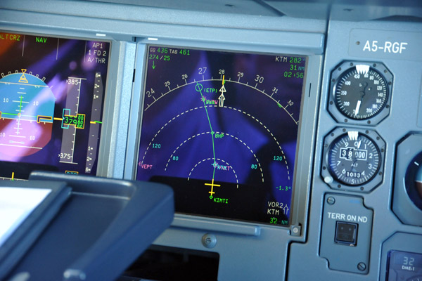
 Our route of flight from Paro to Delhi is along the Himalaya past Everest and over the top of Kathmandu |
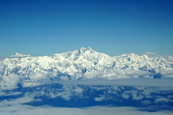 Number 3 on the list of the World's Highest Mountains, Kangchenjunga (8586m/28,169ft) on the Sikkim (India)-Nepal Border |
 My Drukair crew westbound for Dehi |
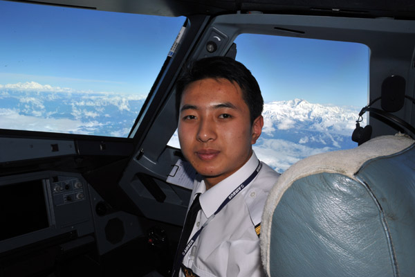 The young Bhutanese First Officer of Drukair |
 Kangchenjunga (8586m/28,169ft) |
 The Nepal Himalaya begin to the west of Kangchenjunga |
 Kangchenjunga (8586m/28,169ft) won't be the tallest mountain we fly past on the way from Paro to Delhi |
 Goodbye Bhutan...I remember the good times whenever I see Jomolhari on the horizon |
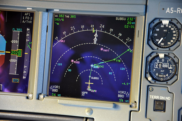
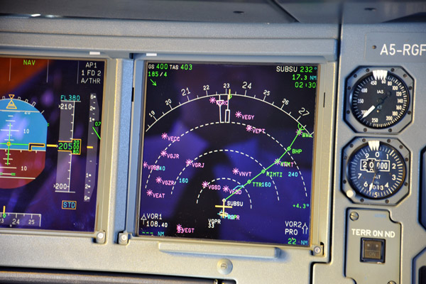
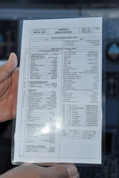 Druk Air Airbus A319 checklist includes the names and elevations of the 10 most significant peaks on their route structure |
 Kangchenjunga (8586m/28,169ft), the world's 3rd highest mountain, sits on the Sikkim (India)-Nepal border |
 The Himalaya of Sikkim (India) |
 The India-Nepal borderlands |
 Siniolchu (6887m/22,595 ft ) with the Yaling Glacier, Sikkim |
 Kangchenjunga (8586m/28,169ft) |
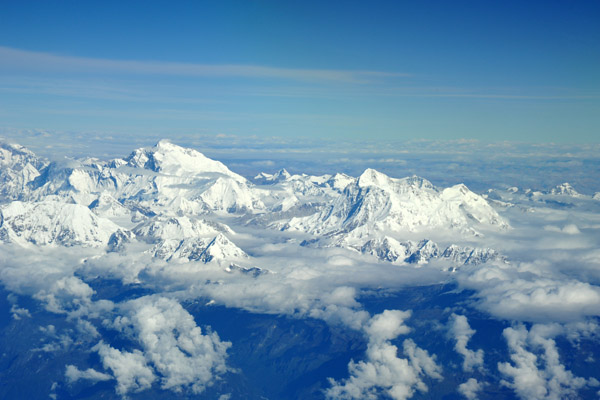
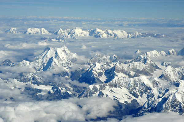
 The Himalaya of Eastern Nepal |
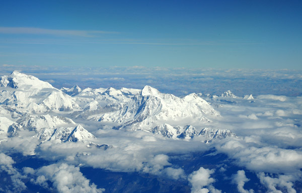
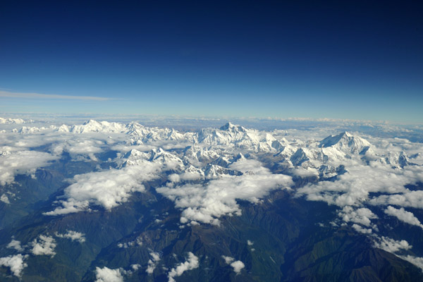
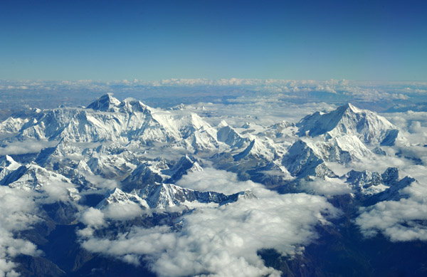
 Eastern Nepal with Mt. Everest just right of center |
 Flying over eastern Nepal on Drukair |
 Makalu, the world's 5th highest mountain (8484m/27,838ft) |
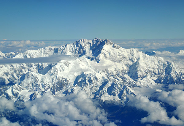
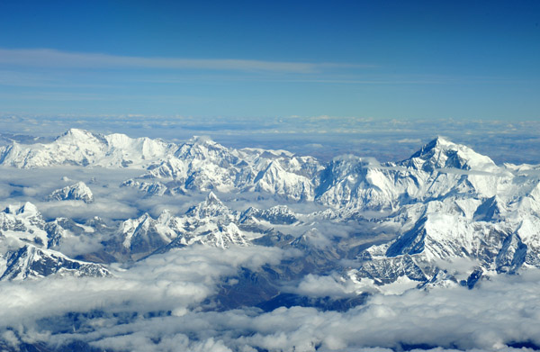
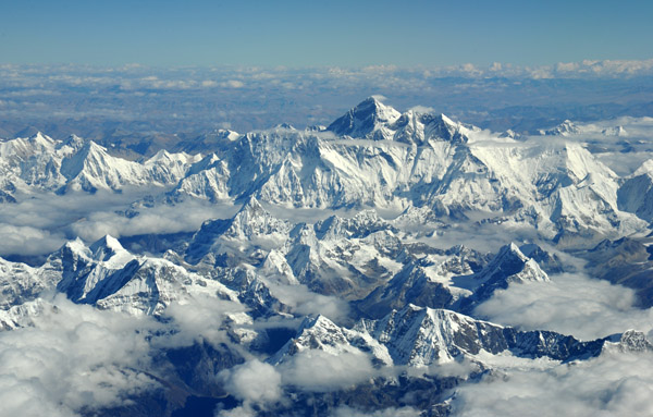
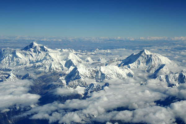 The Great Himalaya Range on the Nepal-Tibet (China) border with Everest on the left and Makalu on the right |
 The Great Himalaya Range on the Nepal-Tibet (China) border with Everest on the right and Cho Oyu (8188m/27838ft) on the left |
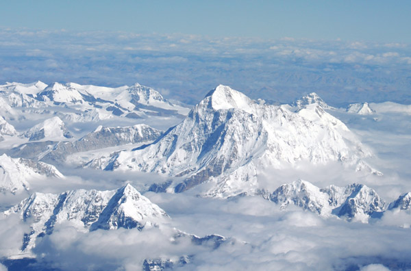
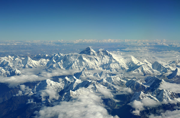
 A privileged view of Mount Everest from the cockpit of a Druk Air flight from Paro to Delhi routed over the top of Kathmandu |
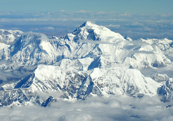
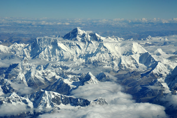 Mount Everest and Lhotse, the world's 4th highest mountain, from the Nepal side |
 The deep valleys that form Nepal on the southern slope of the Great Himalaya Range |
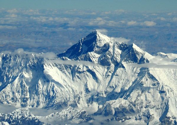
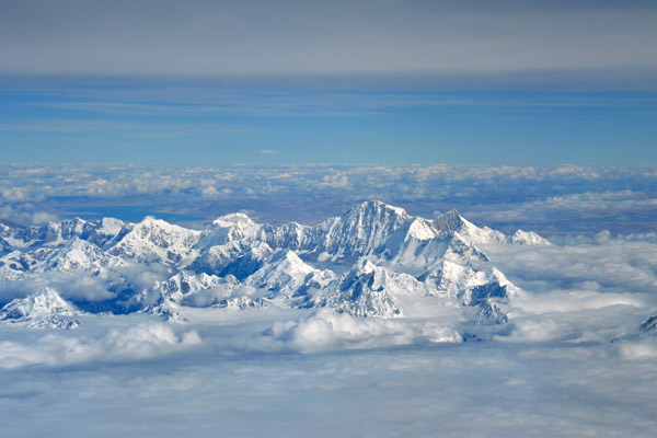
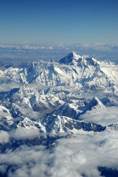 Mount Everest, the highest point on earth |
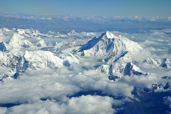
 Cho Oyu (8188m/26,864ft), the world's 6th highest mountain just west of Everest on the Nepal-Tibet (China) border |
 Flying 9,000 feet above the summit of Mount Everest courtesy of Drukair, Royal Bhutan Airlines |
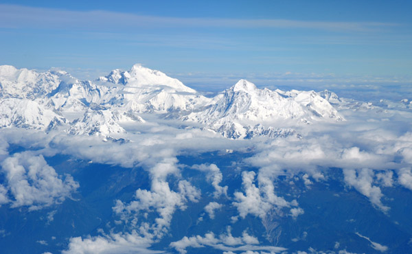
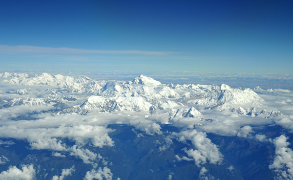
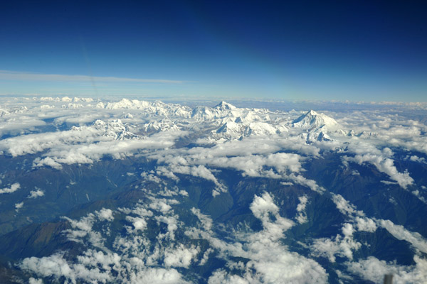
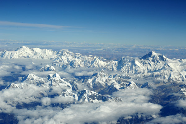
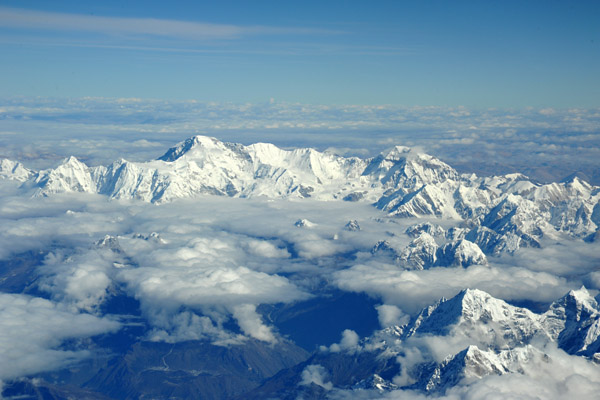
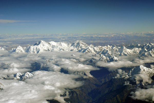
 Nepal Himalaya from Everest (left) to Makalu (right) |
 Nepal Himalaya centered on Mount Everest, our world's highest mountain |
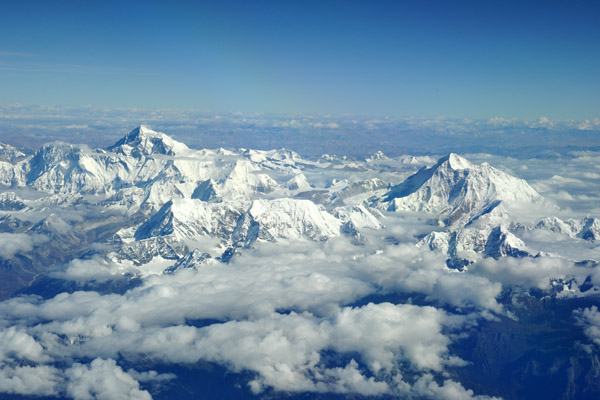
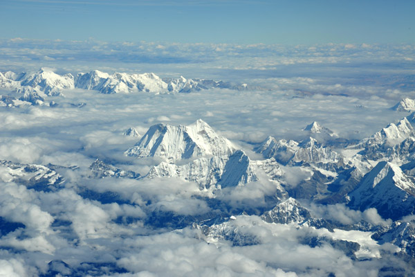
 The Nepali Himalaya to the west of Everest centered on Cho Oyu |
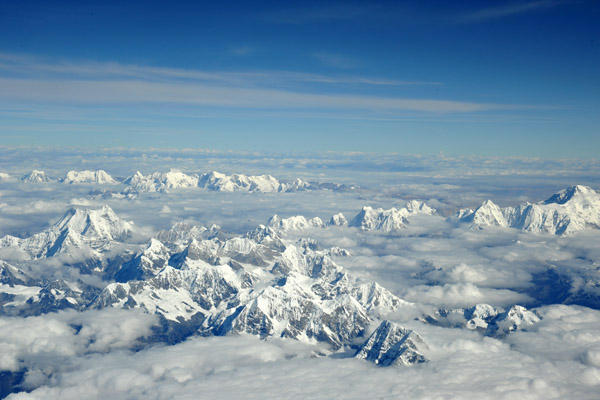 The Nepal Himalaya to the west of Cho Oyu |
 The Nepal Himalaya between Everest and Kathmandu |
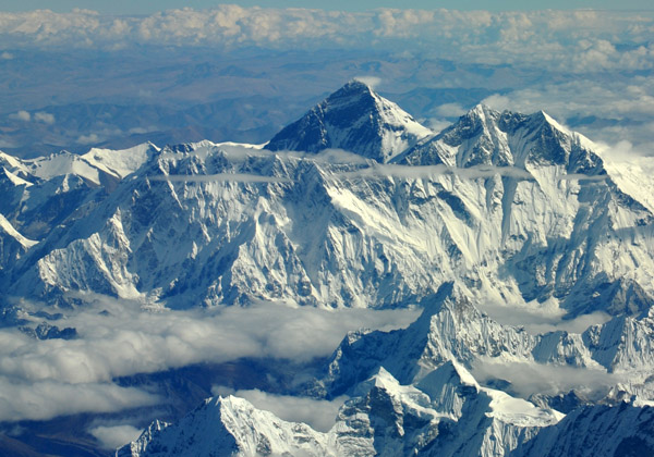 The southern face of Mount Everest, known in Nepal as Sagarmatha and in Tibet as Chomolungma, the Holy Mother |
 Nepal Himalaya with Cho Oyu on the right |
 The Nepal Himalaya from 38,000 feet |
 Flying towards Kathmandu, Nepal, at 38000 ft, a mere 9000 feet above the summit of Everest |
 Overflying eastern Nepal at 38,000 feet |
 Beyond Cho Oyu, the 6th highest peak in the Himalaya (8188m/26,864ft), Lake Peiku is visible in Tibet (China) |
 After re-entering Indian airspace, I return to the back of the bus |
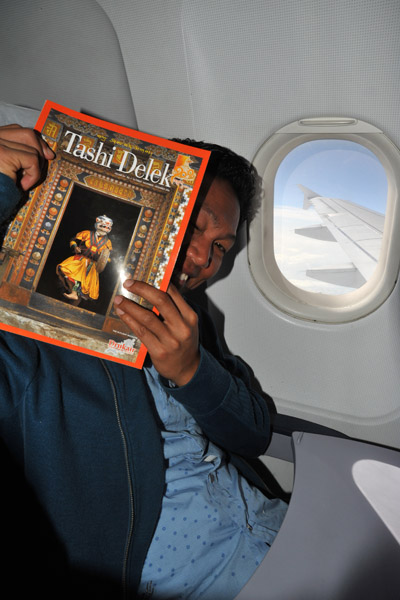
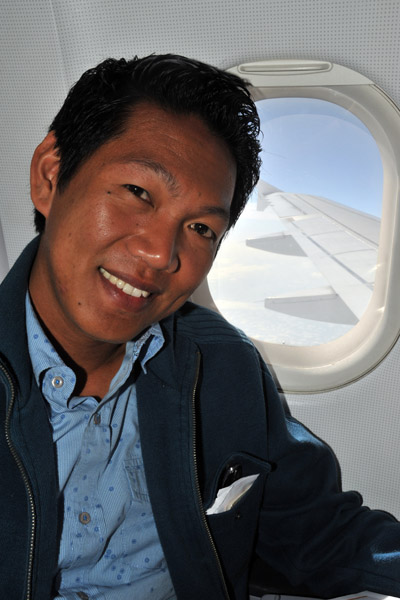 Dennis on the Drukair flight to Delhi |
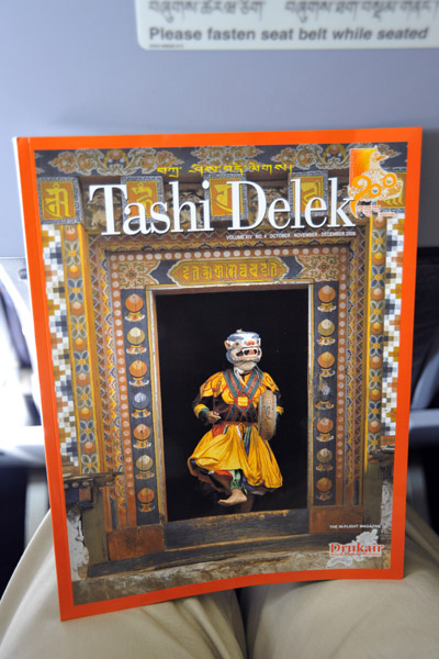 Tashi Delek, the inflight magazine of Druk Air, Royal Bhutan Airlines |
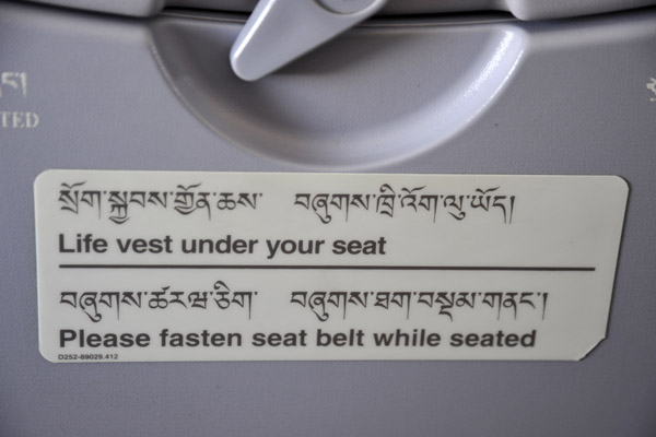 Druk Air's bilingual safety notices |
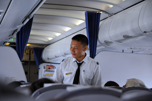 A Druk Air steward passing through the cabin |
| comment | share |