


|
|
|
|
|
|
| Brian McMorrow | profile | all galleries >> Aviation >> Aerial Photos >> Aerials-North America >> Aerials - Hawaii | tree view | thumbnails | slideshow |
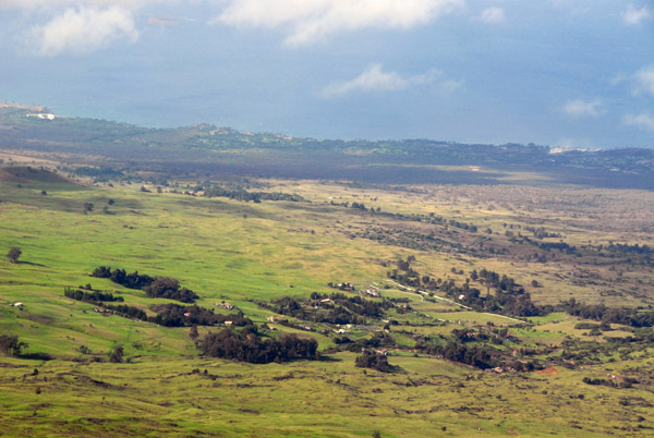
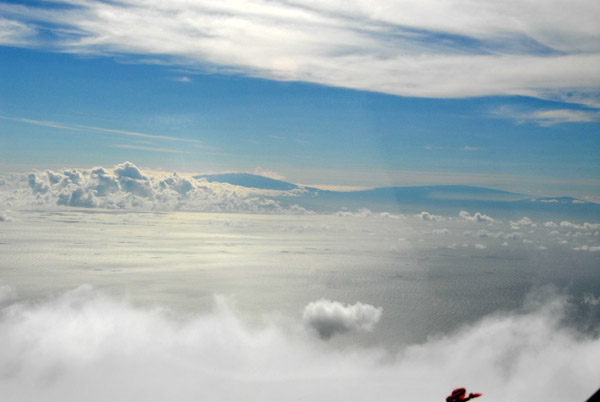
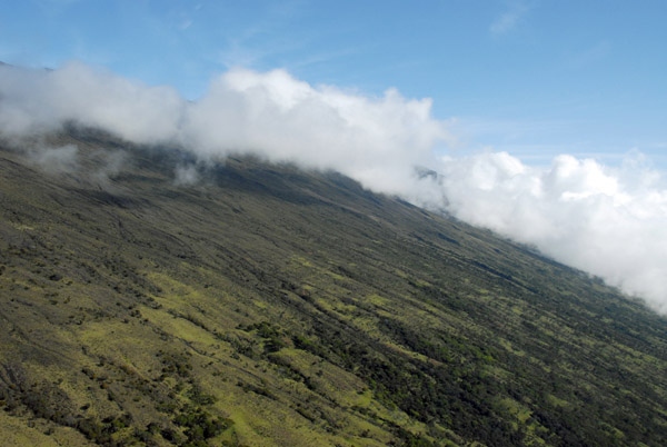
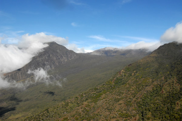
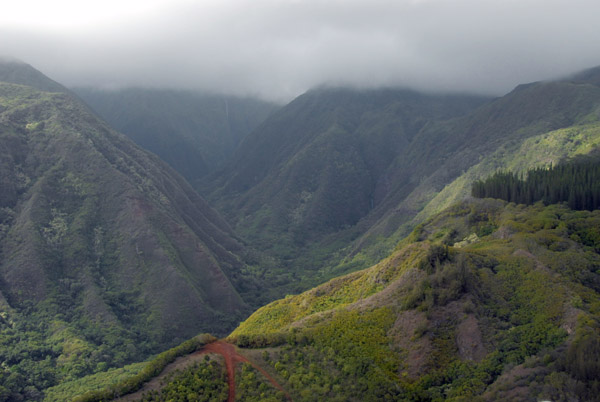
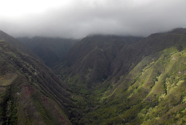
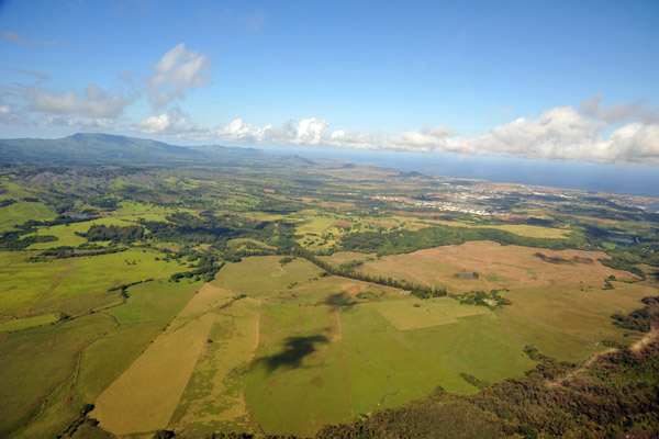
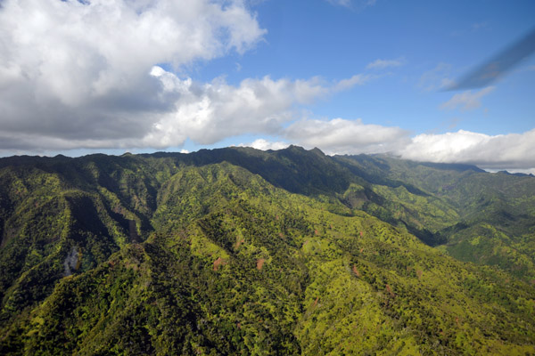
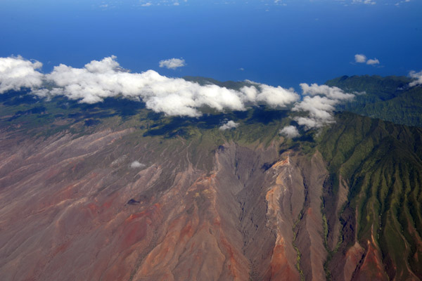
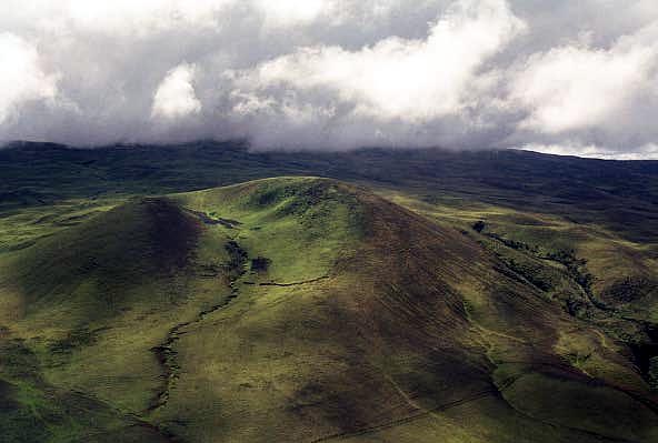 Flying across the center of the island through the Saddle |
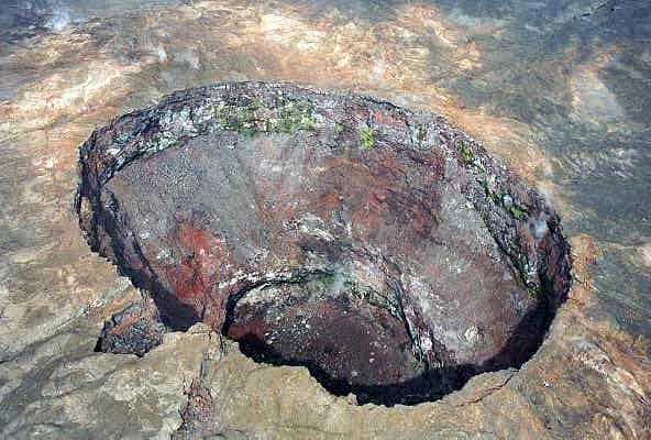
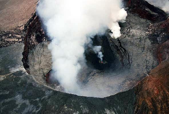
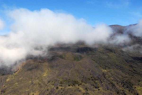
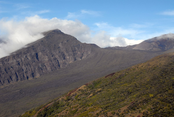
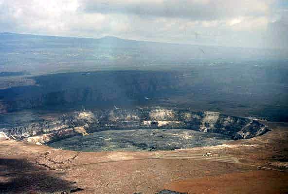 Kilauea Caldera, Hawaii Volcanoes National Park |
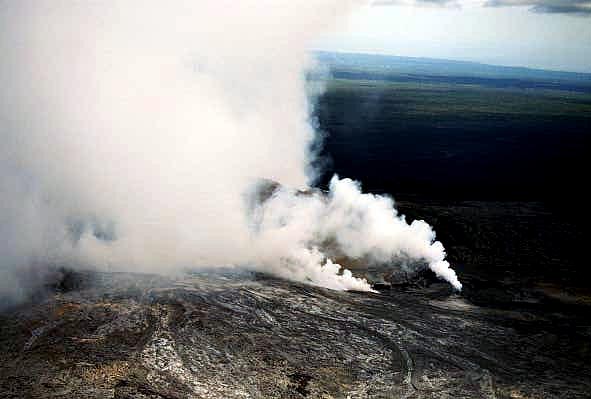
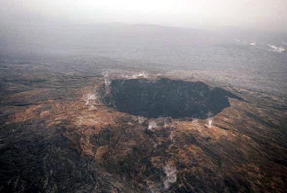 Hawaii Volcanoes National Park |
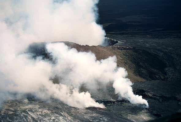
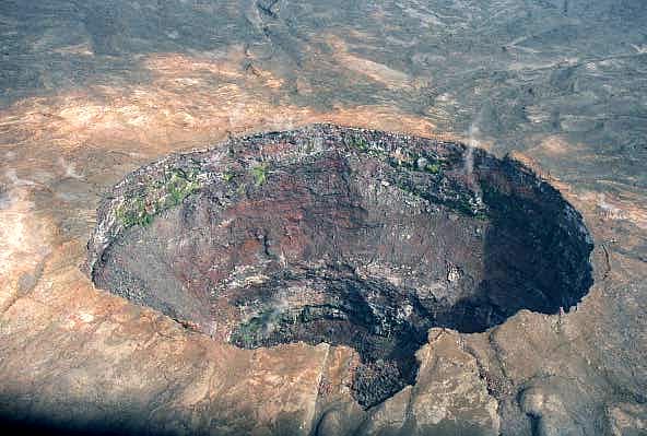 Hawaii Volcanoes National Park |
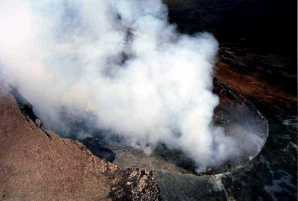
 Hawaii Volcanoes National Park |
 Hawaii Volcanoes National Park |
 Hawaii Volcanoes National Park |
 Hawaii Volcanoes National Park |
 Volcano, Hawaii |
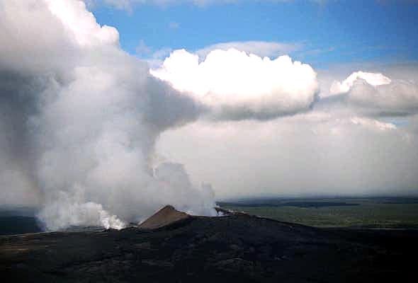
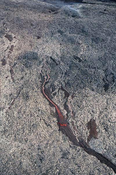 Active lava flow. Kilauea is the world's most active volcanoe |
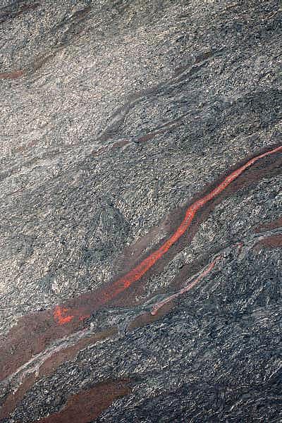 Active lava flow |
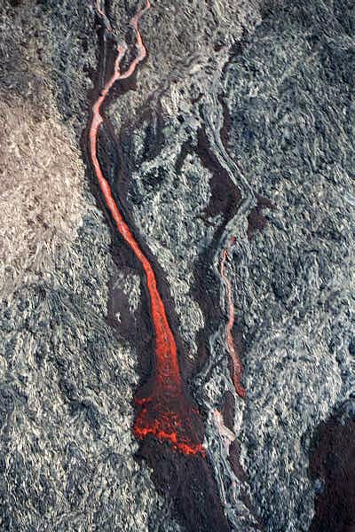 Active lava flow |
 Hawaii Volcanoes National Park |
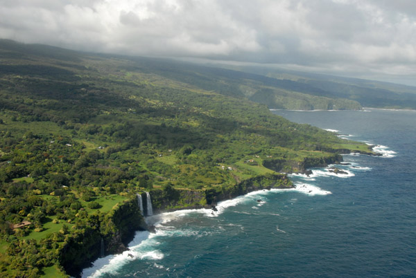
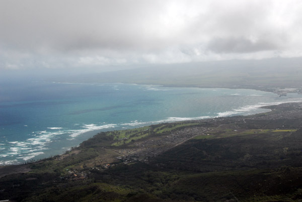
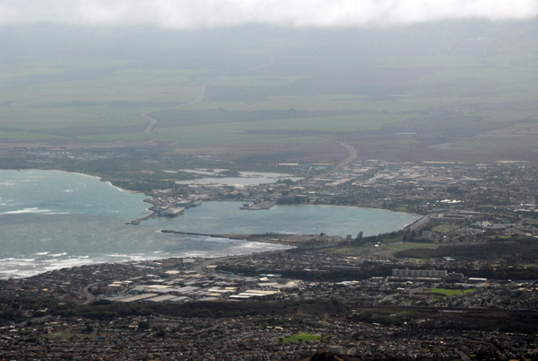
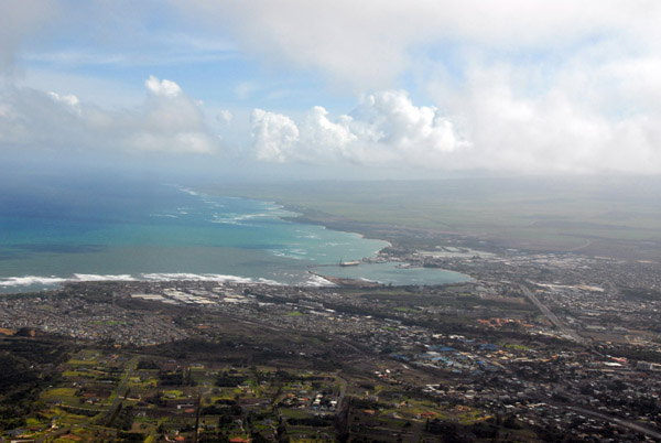
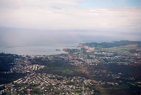 Hilo |
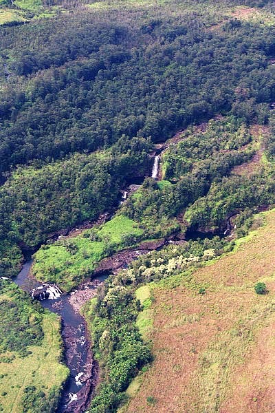
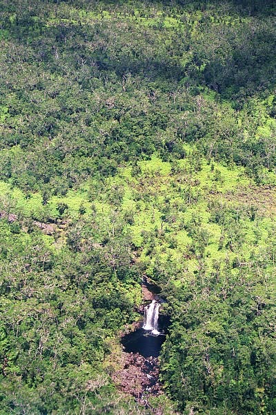
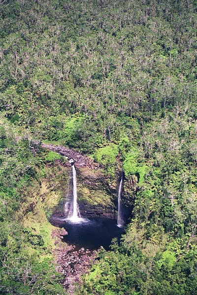
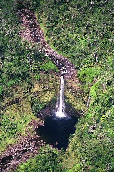
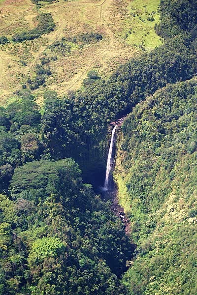
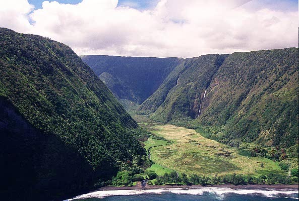
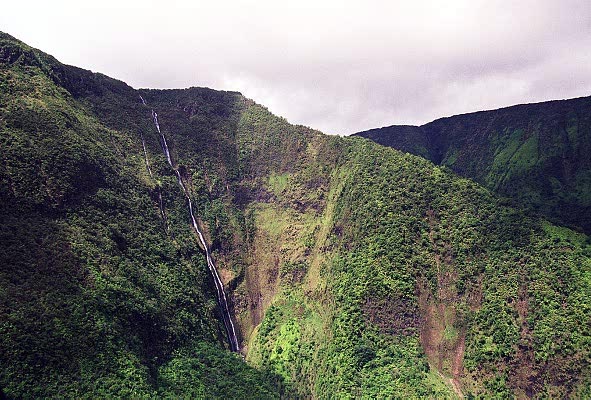
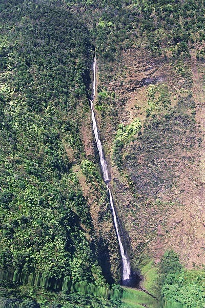
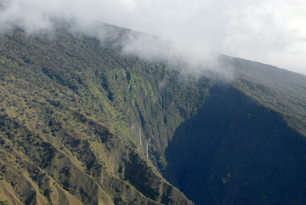
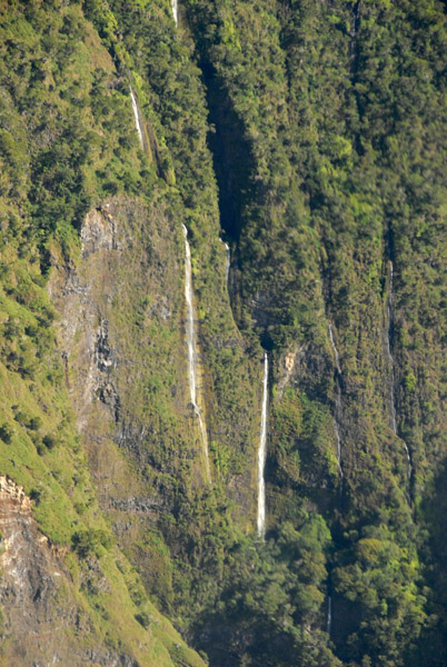
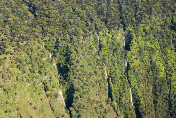
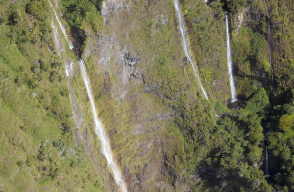
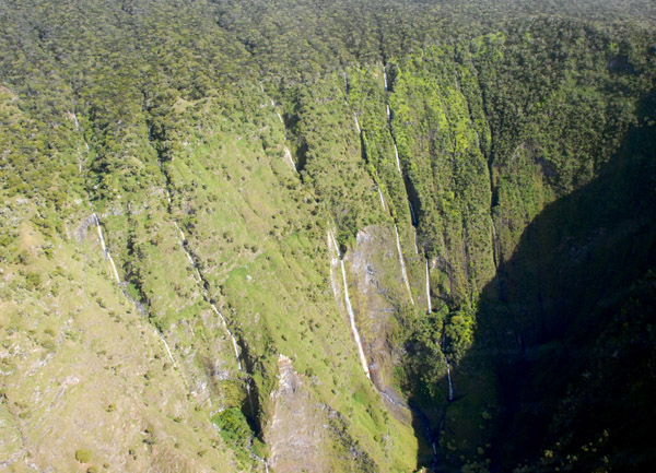
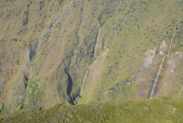
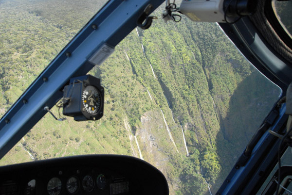
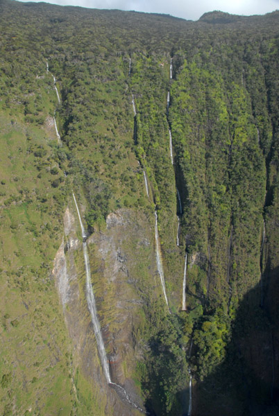
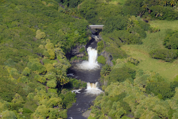
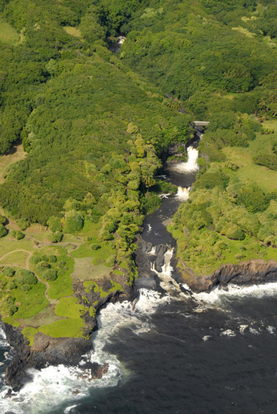
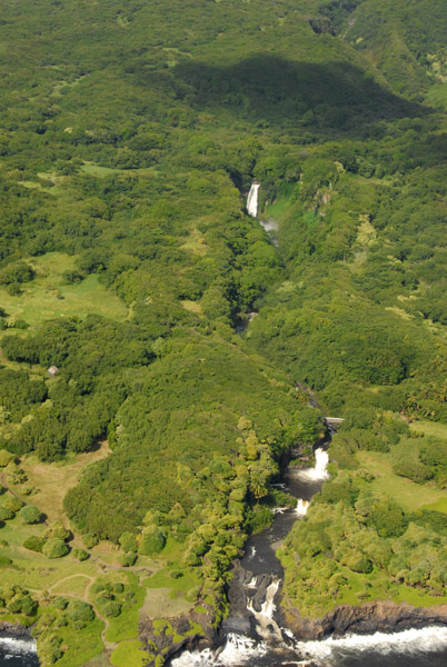
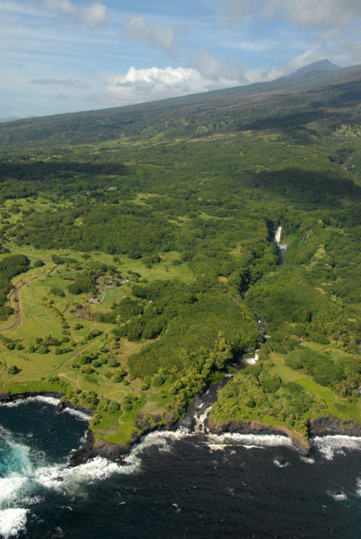
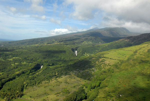
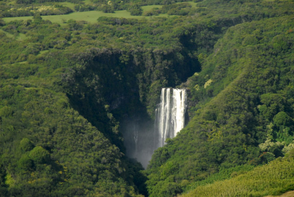
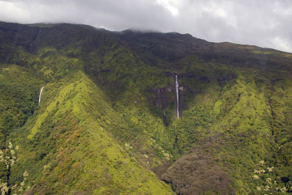
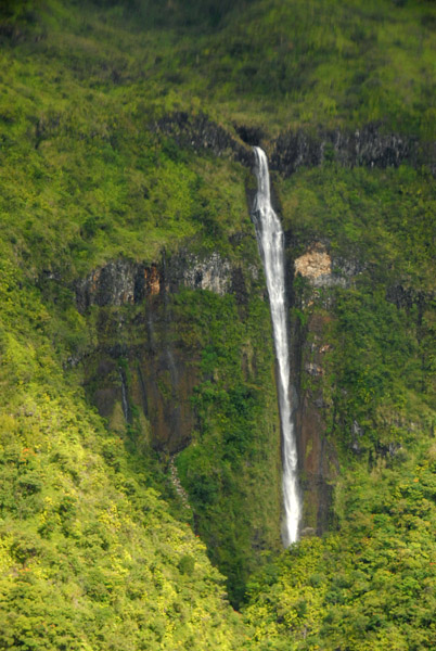
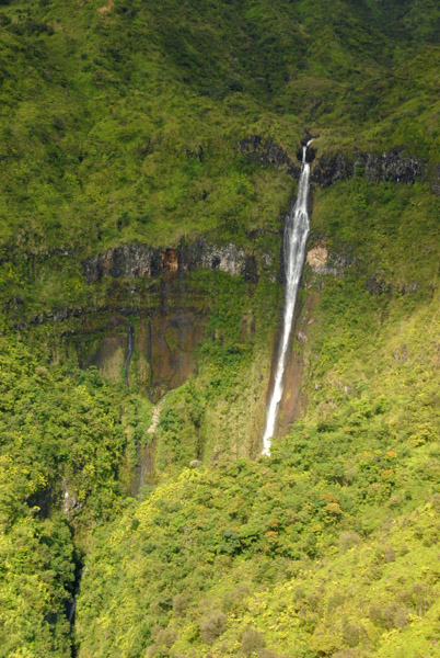
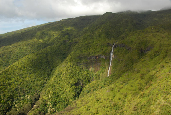
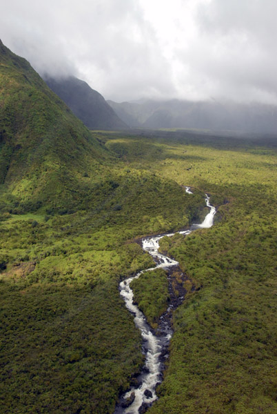
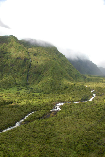
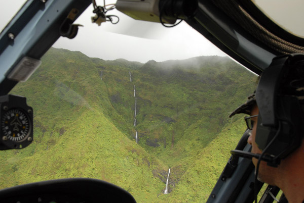
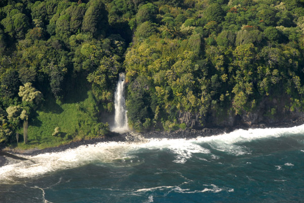
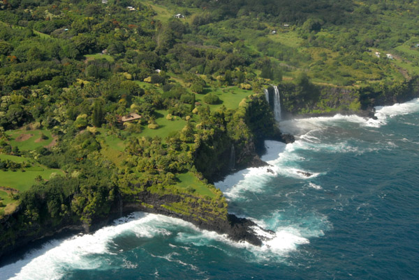
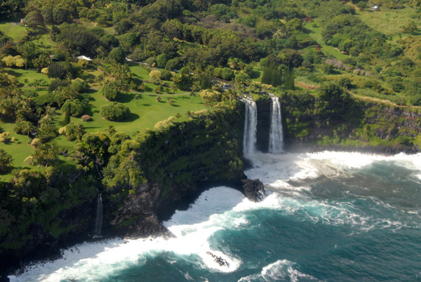
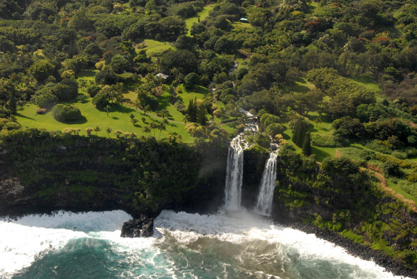
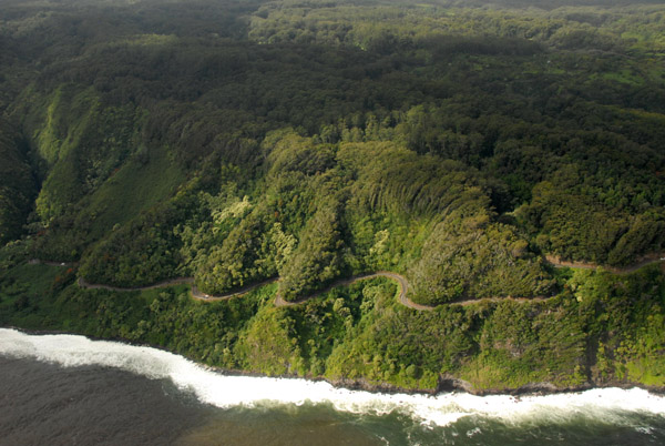
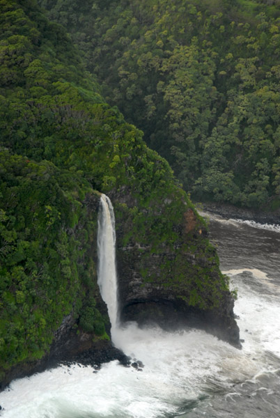
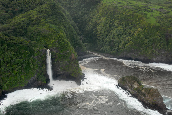
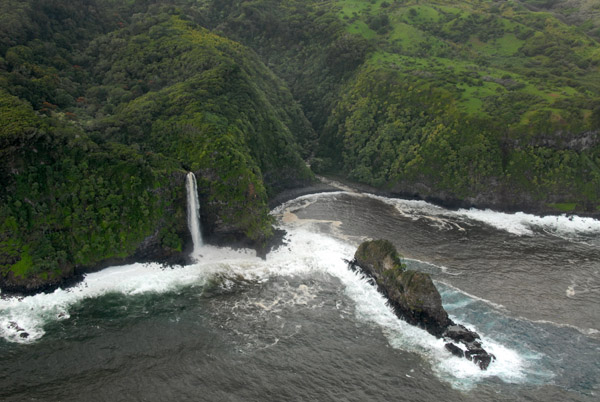
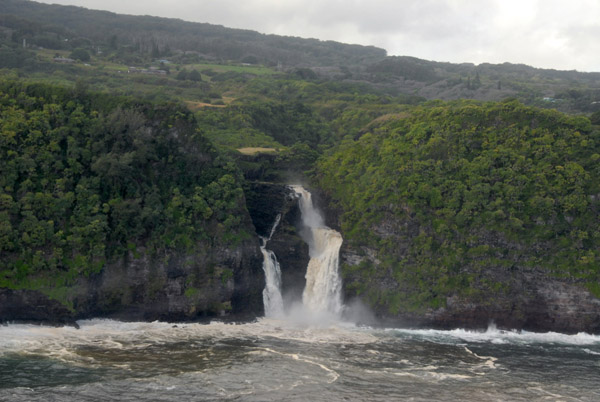
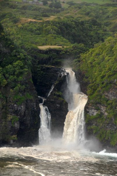
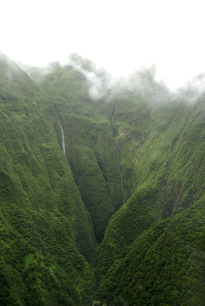
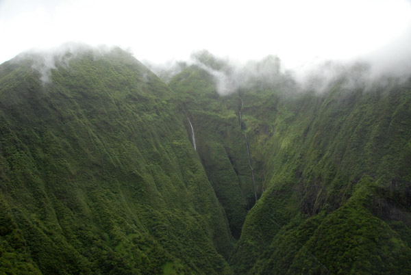
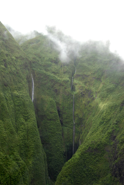
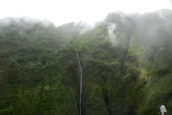
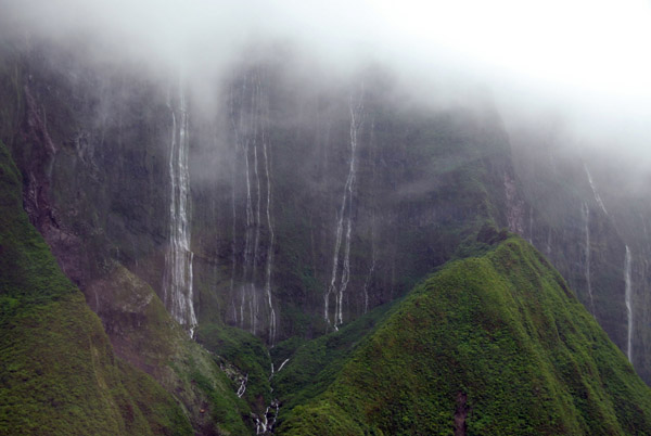
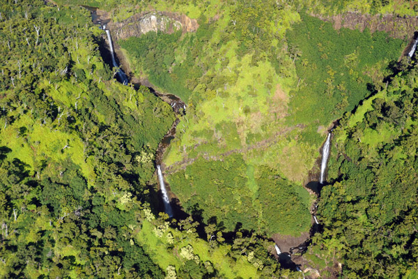
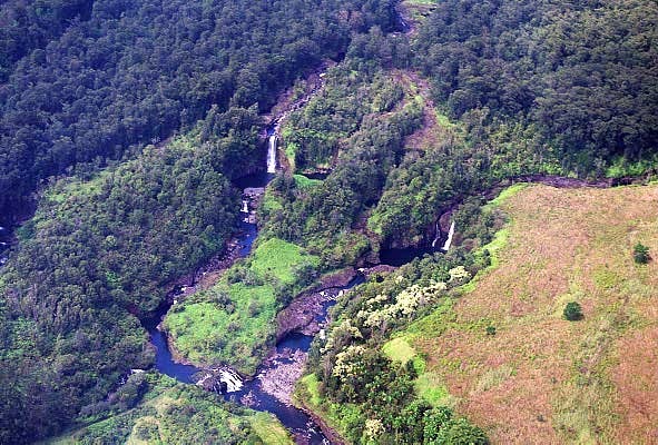 Waterfalls abound along the north side of the Big Island |
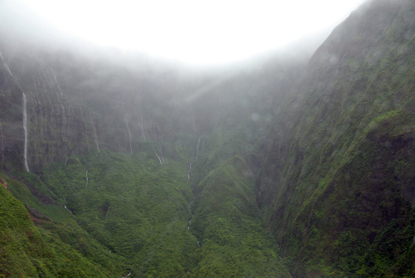
 Waterfalls, Hawaii |
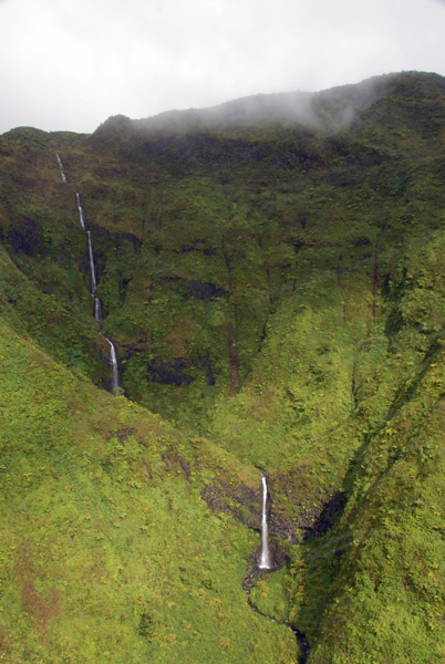
 Waterfalls, Hawaii |
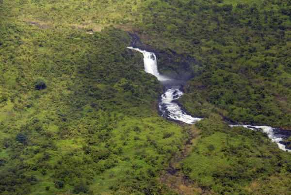
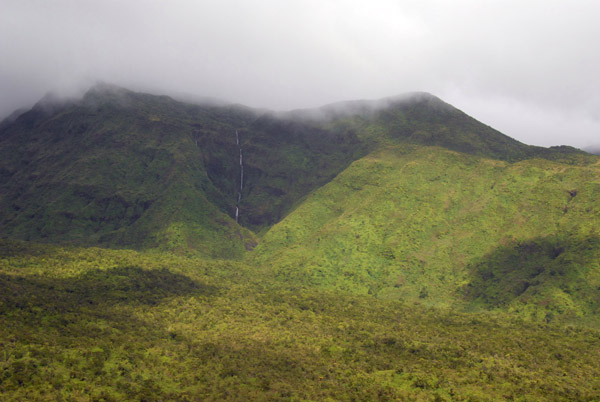
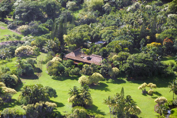
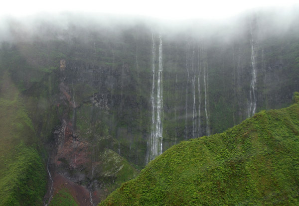
 Waterfalls, Hawaii |
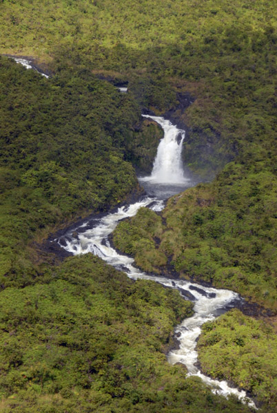
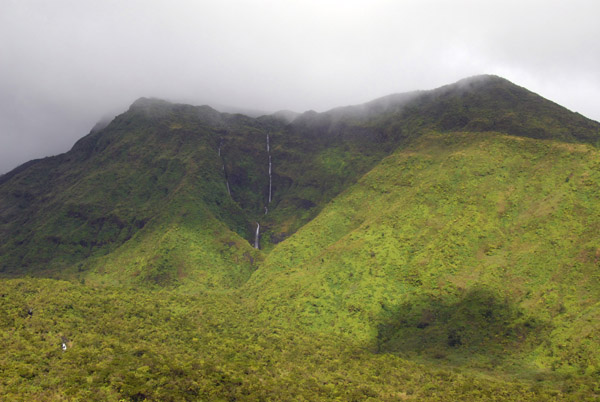
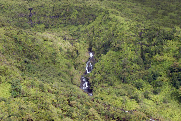
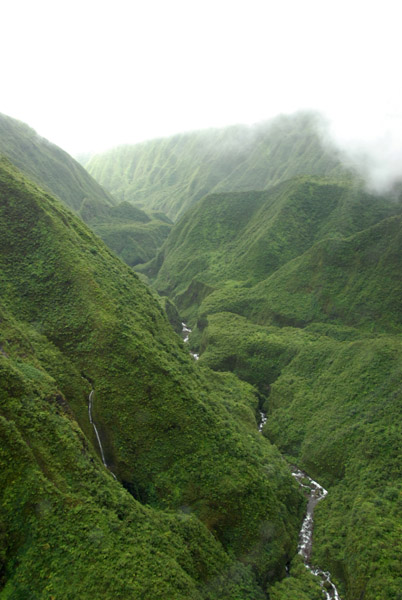
 Waterfalls, Hawaii |
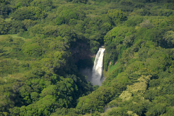
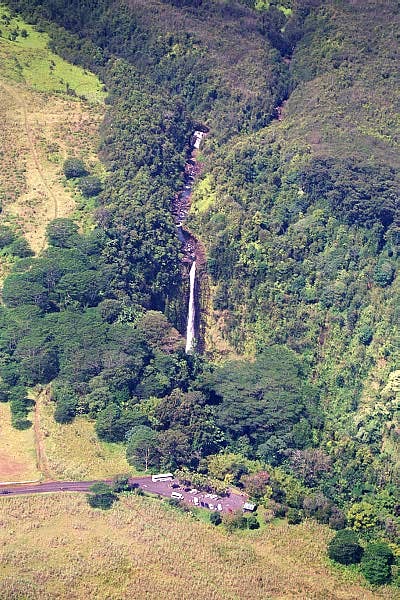 Akaka Falls, Hawaii |
 Akaka Falls, Hawaii |
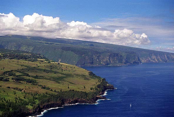
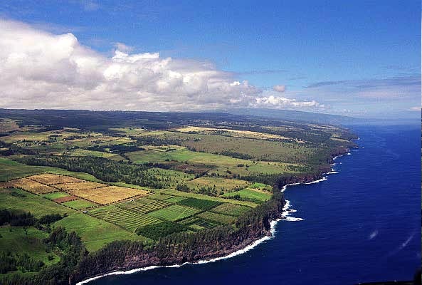
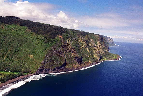
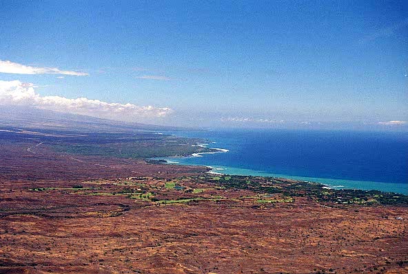
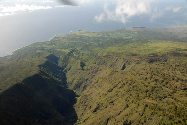
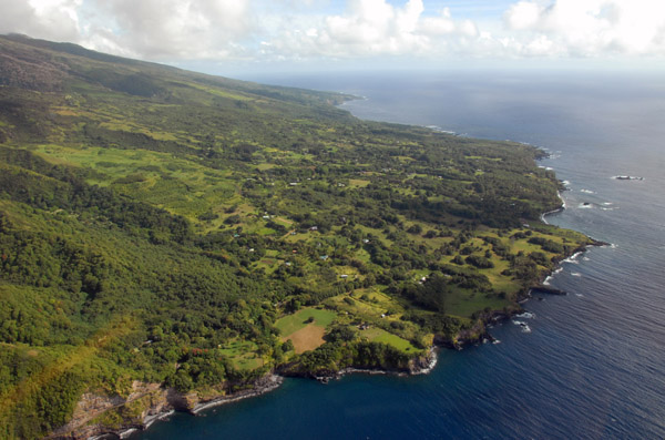
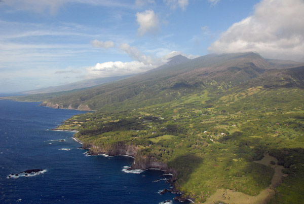
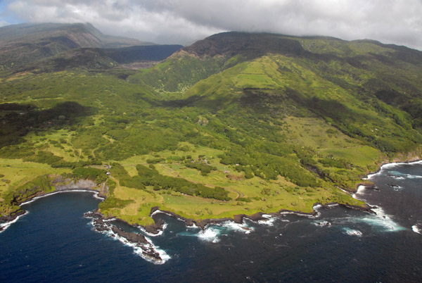
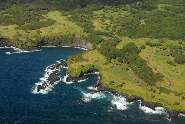
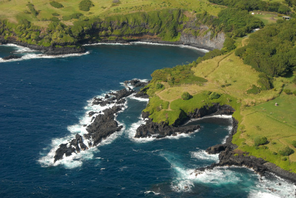
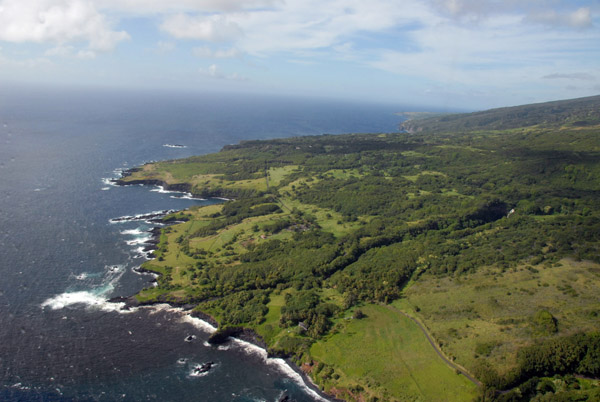
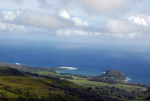
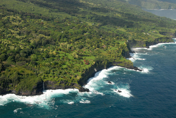
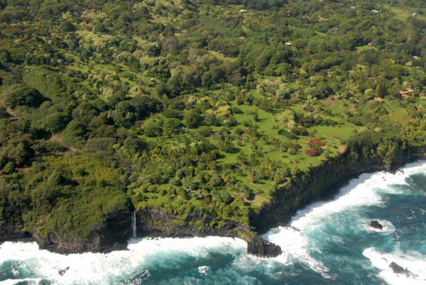
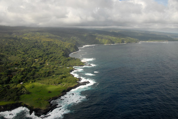
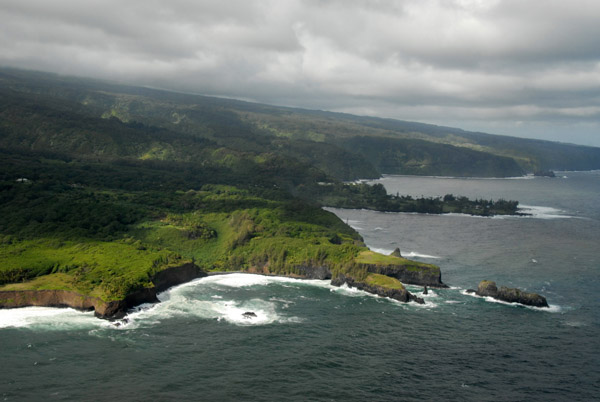
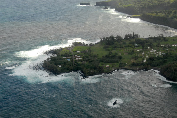
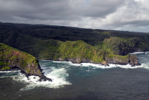
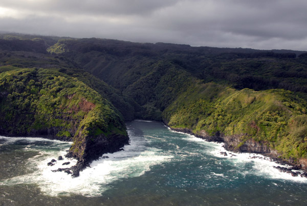
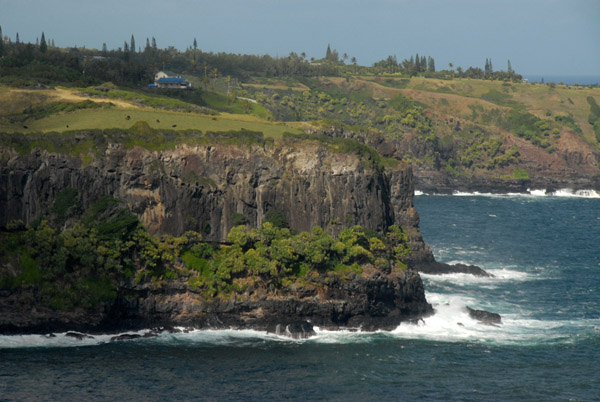
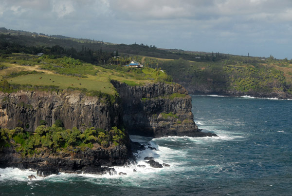
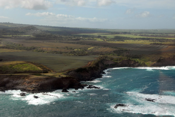
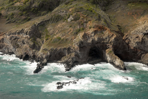
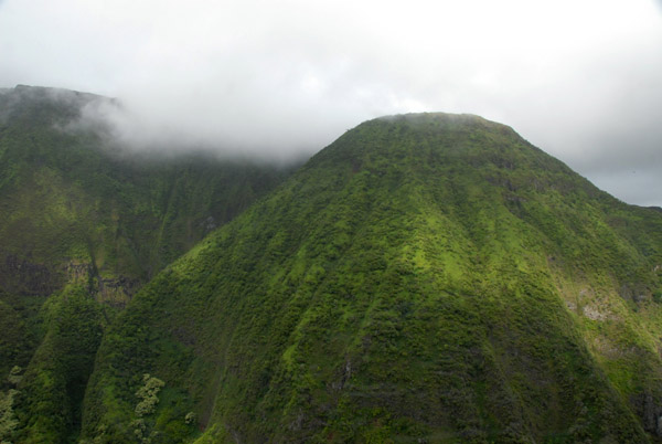
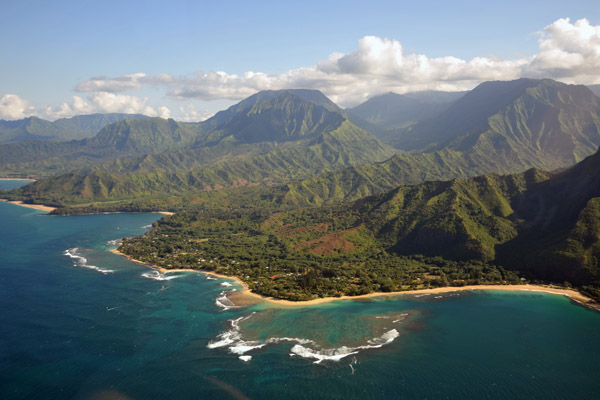
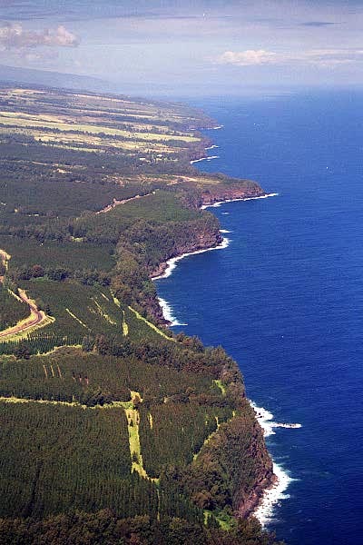 Northern Shore of the Big Island |
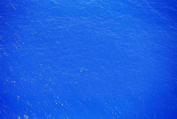 Submerged whale along the north shore of the Big Island |
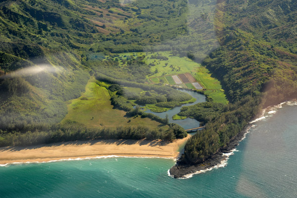
 Approaching Waipo Valley |
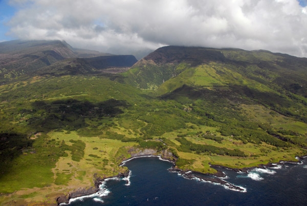
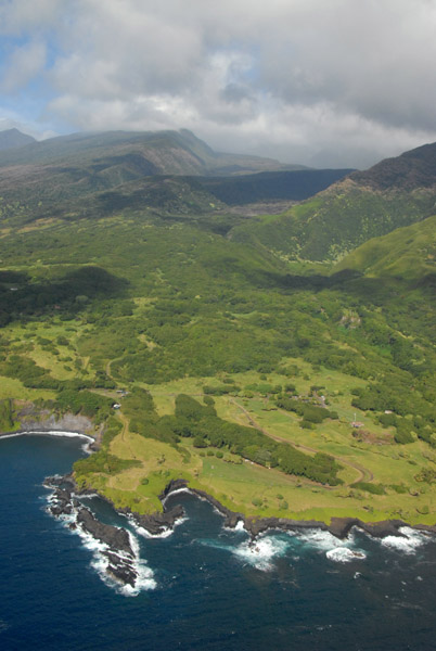
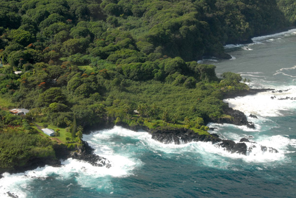
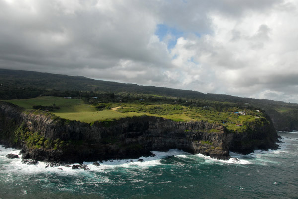
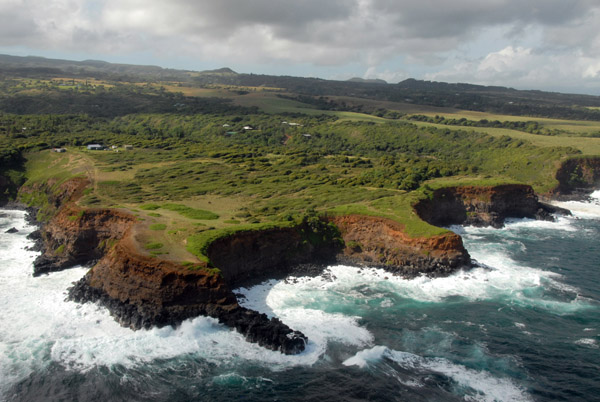
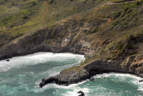
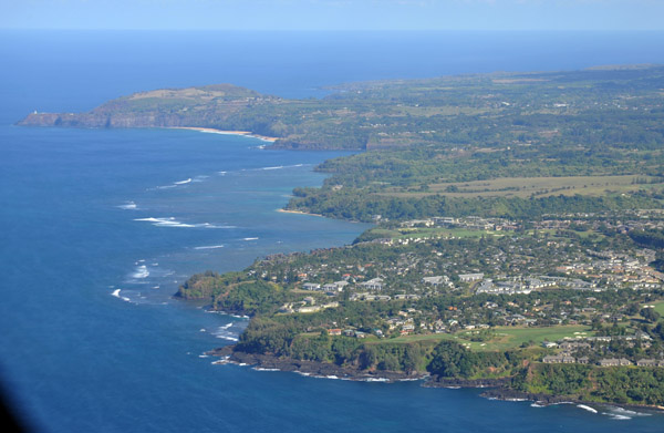
 Northern Shore of the Big Island of Hawaii |
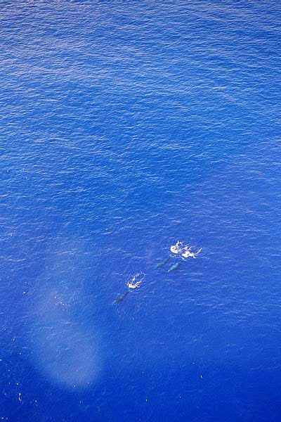 3 Whales diving, north shore of the Big Island |
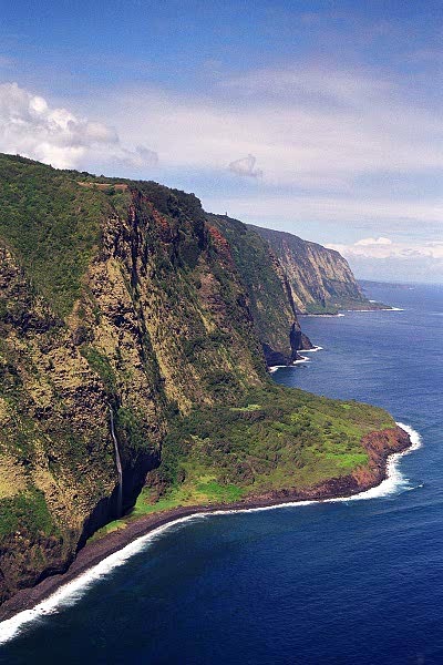
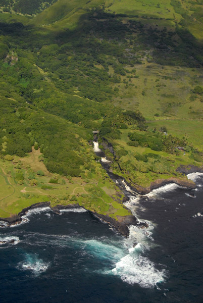
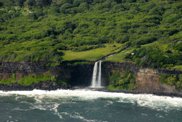
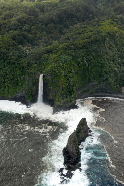
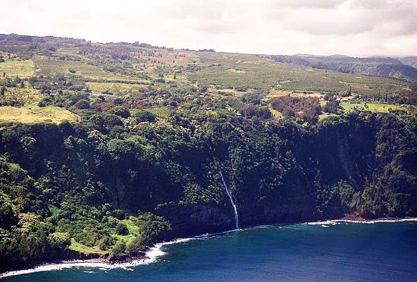 Waterfall entering the ocean |
 North Shore |
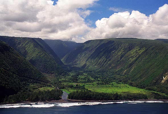 Waipio Valley |
 Western slope of Waipio Valley |
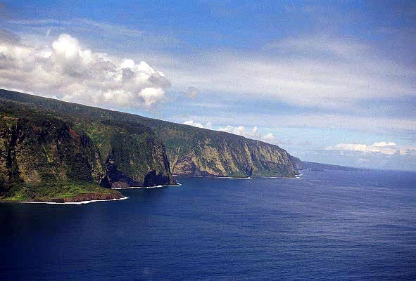
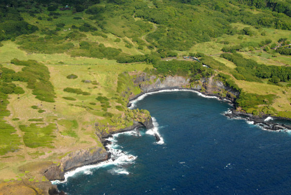
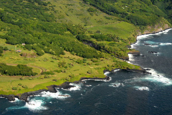
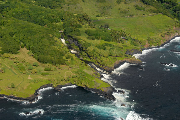
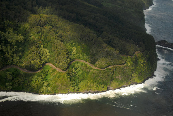
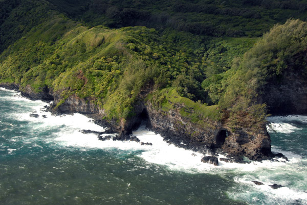
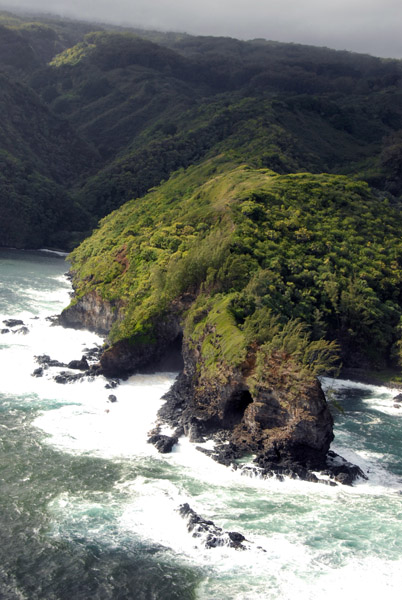
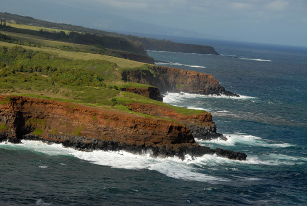
 Cliffs along the North Shore |
 We were allowed to fly up the uninhabited valley west of Waipo |
 Flying in the valley |
 Triple waterfall, Hawaii |
 Returning to land in Kona after a fanstastic tour |
 Taking off from Kahului Heliport to the north |
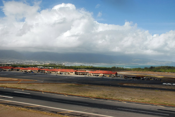 Kahului Airport (OGG/PHOG) Maui, Hawaii |
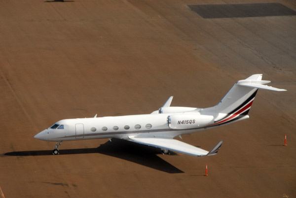 A Gulfstream GIV-X (N415QS) on the ramp at Maui |
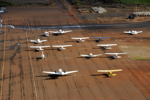 The general aviation ramp on the east side of Maui Airport |
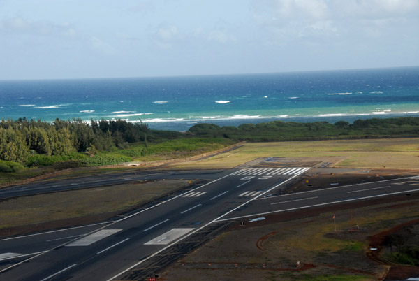 The north end of the main runway 02-20 at Maui and the smaller runway 05-23 |
 Crossing the Hana Highway while climbing out over the sugar cane fields of Maui's central valley |
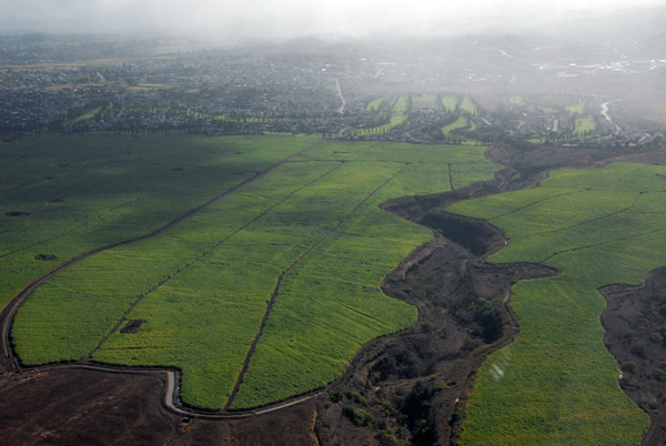
 Sugar cane fields east of Kahului along the north shore of the central valley, Maui |
 Haleakala Highway, Maui |
 Central valley of Maui with the north coast |
 Kaluapulani Gulch heading east towards Pukalani, Maui |
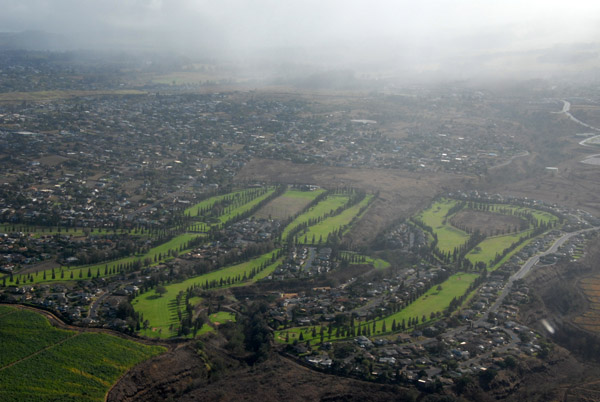 Pukalani Country Club, Maui |
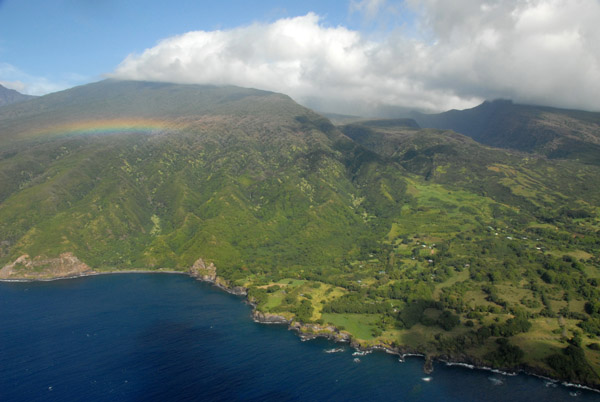
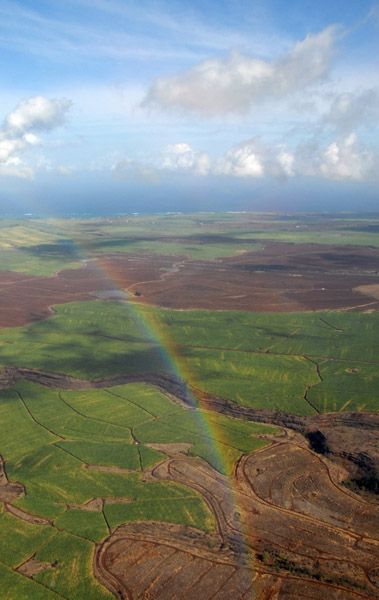 Rainbow over Maui's Central Valley |
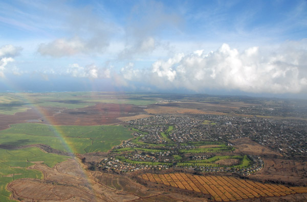 Rainbow with Pukalani and the central valley of Maui |
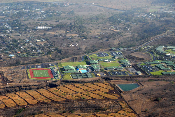 Kamehameha Schools Maui, a private school in Pukalani, Hawaii |
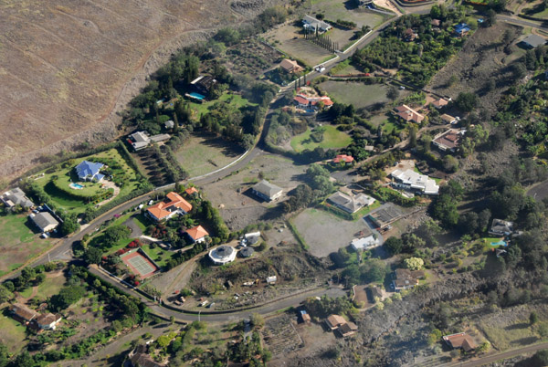 Hoopalua Drive and Alokele Place, Makawao HI |
 Waipoli Road, Kula, Maui |
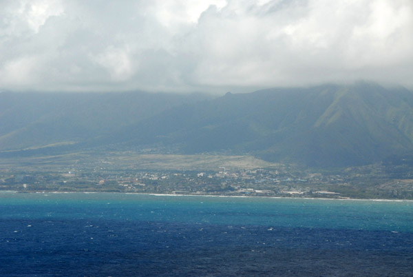
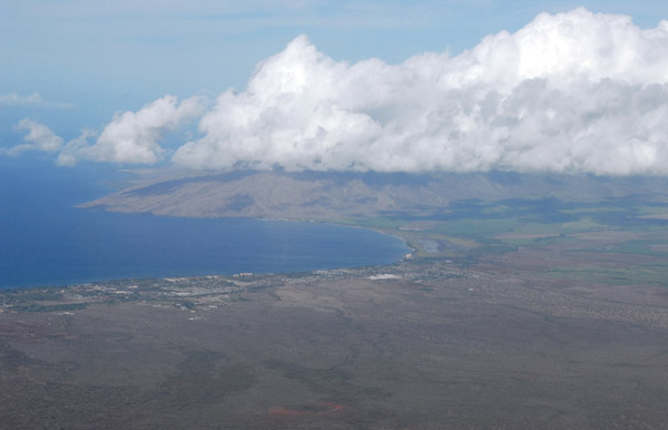 The south coast of around Kihei, Maui with Maalaea Bay |
 The pilot said something about Oprah's Ranch... |
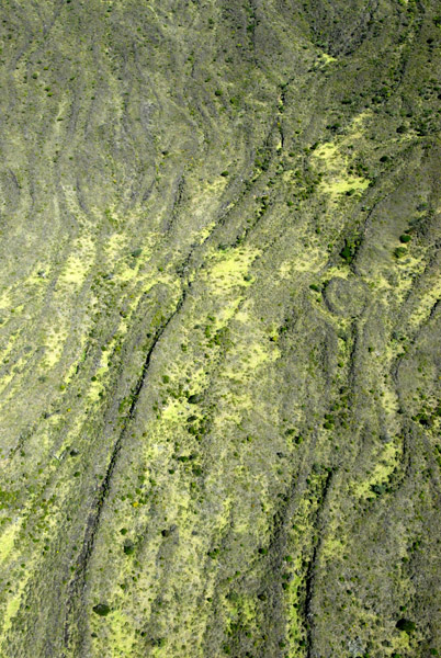
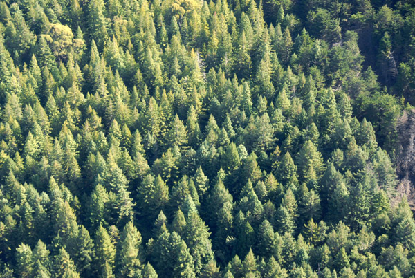 Forest on the lower slopes of Haleakala |
 Non-public road (Skyline Trail?) leading up the south side of Haleakala |
 Medium-sized crater on the south side of Haleakala |
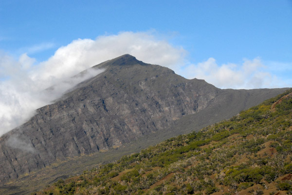
 The Big Island of Hawaii reaching up out of the clouds in the distance |
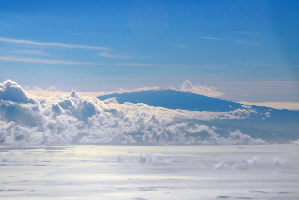 Mauna Kea - 13,803 feet (4,207 m) above sea level but 33,476 feet (10,203 m) above the sea floor |
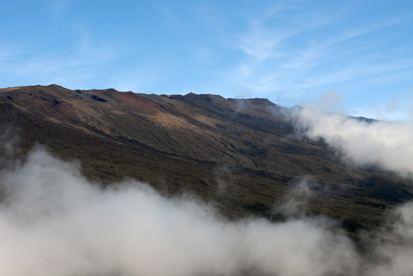 The helicopter didn't climb much above 6000 ft so we were well below the summit of Haleakala |
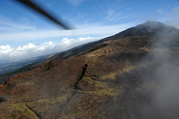
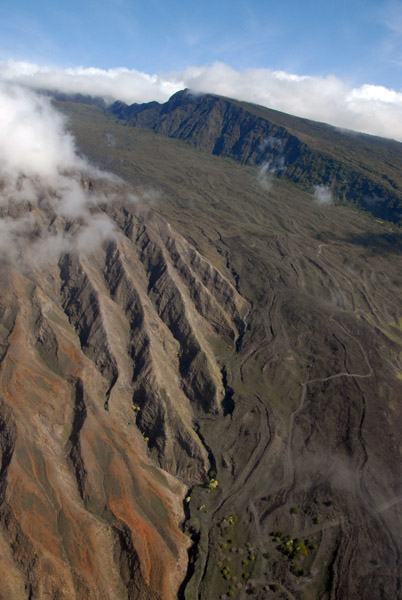
 The south flank of Haleakala |
 The south flank of Haleakala |
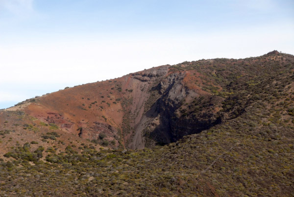
 A cinder cone on the south flank of Haleakala |
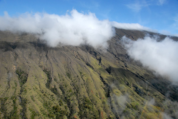
 Eroded southern flank of Haleakala |
 Clouds building on top of Haleakala |
 Haleakala National Park Hawaii from a helicopter tour |
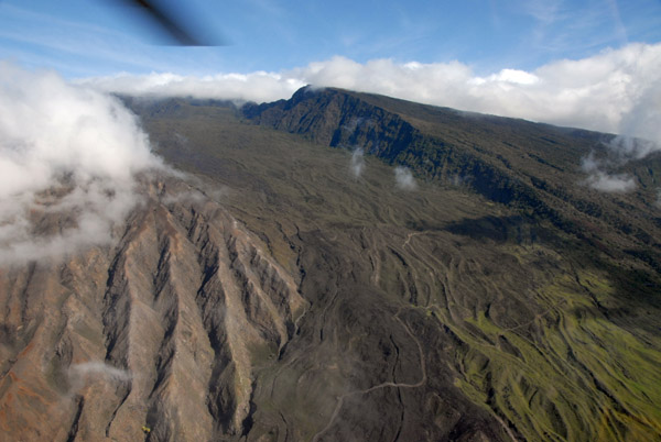
 Southeast flank of Haleakala |
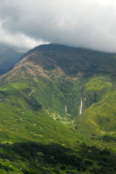
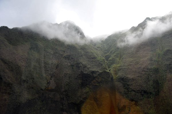
 Approaching the Kaupo Gap, a deep valley eroded into the side of Haleakala |
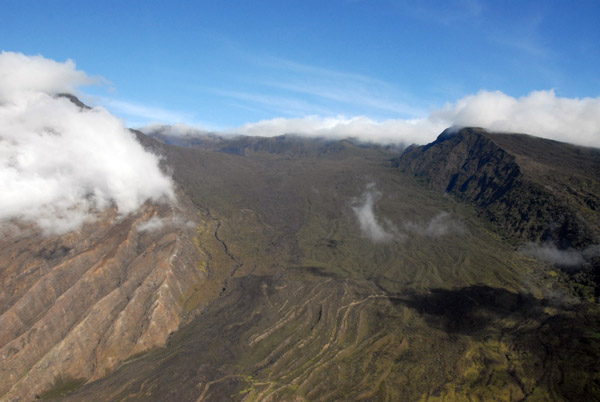 Looking up the Kaupo Gap into the main crater of Haleakala |
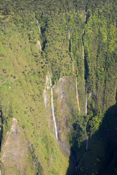
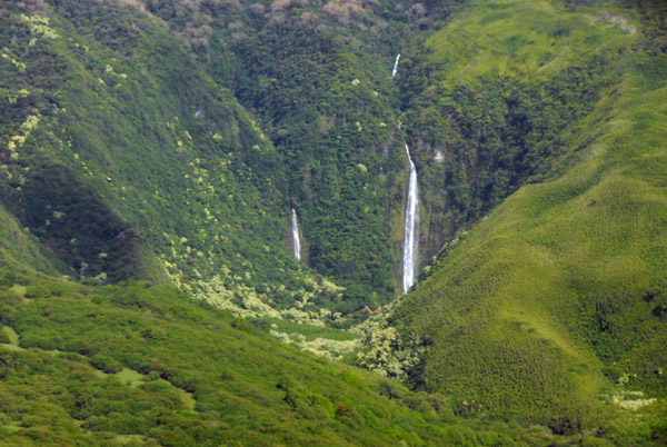
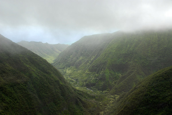
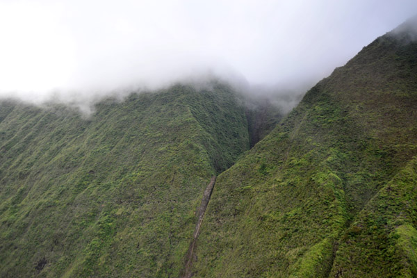
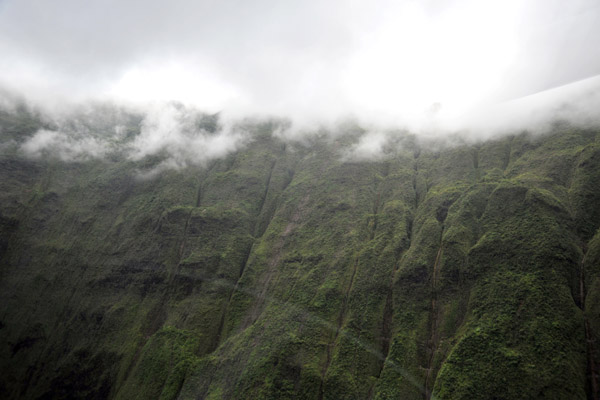
 Manawainui Valley on the southeast flank of Haleakala |
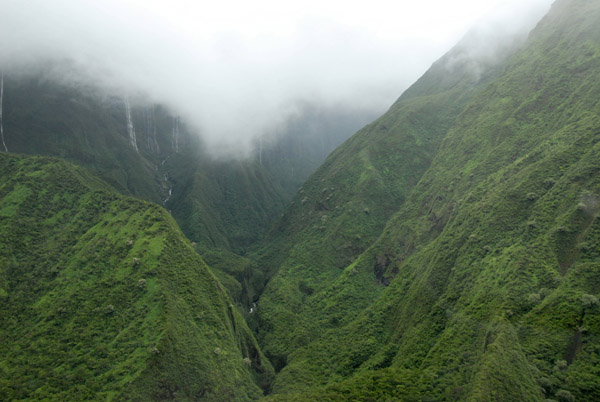
 Narrow waterfalls, Manawainui Valley, Mt Haleakala |
 Looking back at the Kaupo Gap as we circle over the Manawainui Valley |
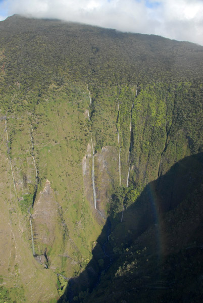
 Three ribbon waterfalls, Manawainui Valley, Mt Haleakala |
 Looking deep into the Manawainui Valley, Mt Haleakala |
 Kaupo Gap eroded into the side of Mount Haleakala |
 Looking down the Manawainui Valley to the Pacific, Mt Haleakala |
 Manawainui Valley from the air, Mt Haleakala, Maui |
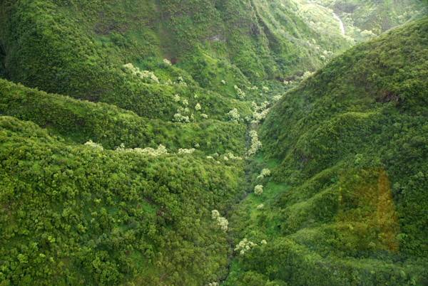
 Manawainui Valley, Mt Haleakala |
 Manawainui Valley, Mt Haleakala |
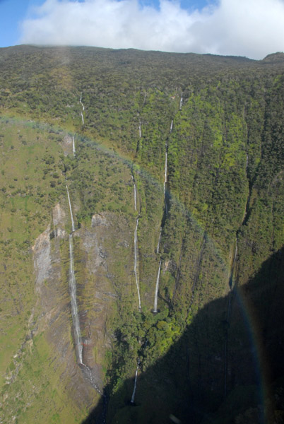
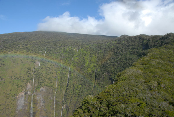
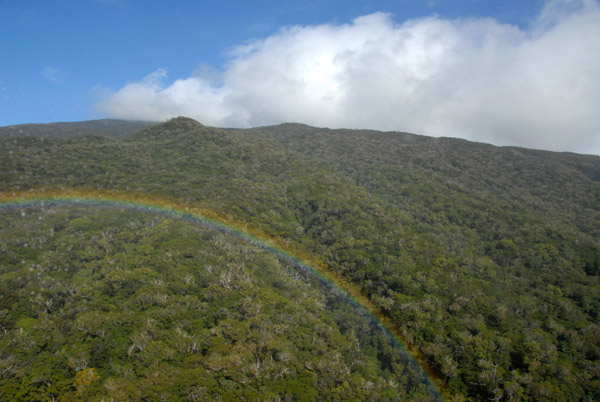
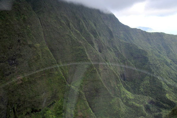
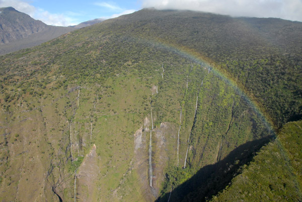 Rainbow over Manawainui Valley on the southeast flank of Mt Haleakala |
 Rainbow over Manawainui Valley on the southeast flank of Mt Haleakala |
 xxx |
 Clouds building on the crater rim of Mount Haleakala |
 Manawainui Valley through the helicopter window |
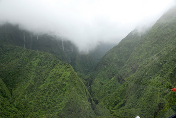
 Giant drop off with waterfalls, Manawainui Valley, Mt Haleakala |
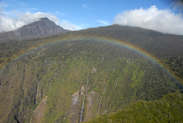
 Rainbow withe the three waterfalls of Manawainui Valley |
 Last look at Manawainui Valley with a rainbow |
 Think tropical forest on the southeast flank of Mount Haleakala |
 Haleakala National Park with rainbow |
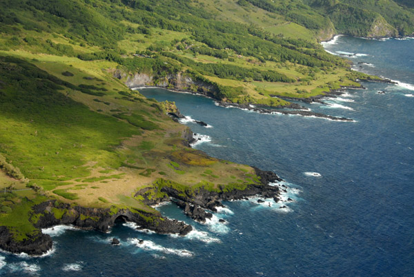
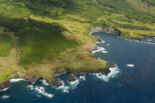
 Highway 31: Pi'ilani Hwy, the road around the southeast coast of Maui |
 The Piilani Highway had recently reopened |
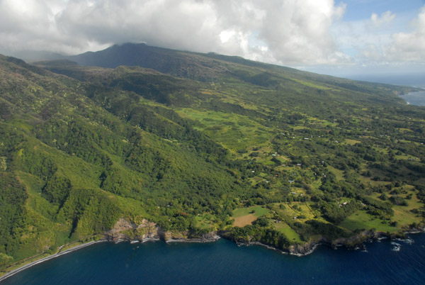
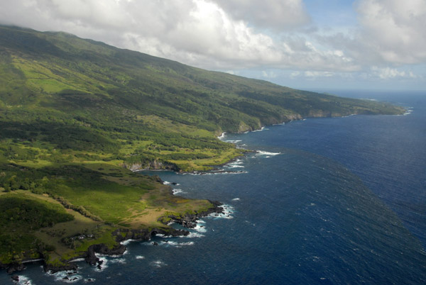
 Southeast Coast of Maui |
 A stretch of the Piilani Highway - the back road to Hana - along the isolated southeast coast of Maui |
 Southeast coast of Maui |
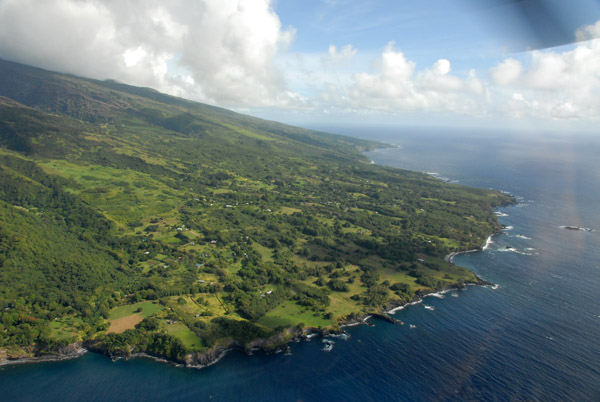 Southeast coast of Maui headed for Hana |
 Pi'ilanipapa and Kamilo Point, Maui (N20.6485/W156.9727) |
 Southeast coast of Mauiand Ma'ulili Bay from the air |
 A rainbow with the southeast coast of Maui |
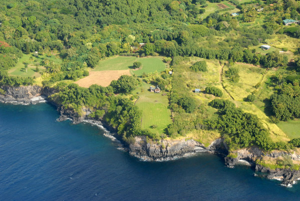
 Black sand beach at Ma'ulili Bay south of Hana (N20.6484/W156.0620) |
 Rocks off Kipahulu on the southeast coast of Maui (N20.647/E156.054) |
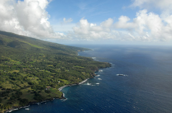
 Southeast coast of Maui from the Kipahulu Shoreline to Hana |
 Kipahulu Shoreline and Kukui Bay, southeast Maui |
 Kaukaui Gulch, Haleakala National Park |
 Southeast face of Haleakala |
 Kipahulu Shoreline and Kukui Bay, southeast Maui |
 Looking west back along the south coast of Maui |
 Cliffs at Kukui Bay, Maui, just off the Piilani Highway after the National Park visitor's center |
 Kukui Bay and Haleakala, southeast Maui |
 Coastal Kipahulu section of Haleakala National Park where the Ohe'o Gulch meets the Pacific |
 Haleakala National Park |
 Haleakala National Park |
 Ohe'o Gulch, Kipahulu section of Haleakala National Park |
 Ohe'o Gulch, Haleakala National Park |
 Kipahulu section of Haleakala National Park, Hawaii |
 Kipahulu section of Haleakala National Park, Hawaii |
 Ohe'o Gulch Falls, Haleakala National Park, Kipahulu Area |
 Ohe'o Gulch, Haleakala National Park |
 Ohe'o Gulch, Haleakala National Park |
 Ohe'o Gulch, Haleakala National Park |
 Makahiku Falls, Haleakala National Park |
 Haleakala National Park, southeast Maui |
 Southeast coast of Maui looking to the west |
 Waimoko Falls, a 400 foot drop at the top of the Pipiwai Trail, Haleakala National Park |
 The west side of Haleakala is the Hana Forest Reserve |
 Waihiumalu Falls, Hana Forest Reserve, Maui |
 Waihiumalu Falls, Hana Forest Reserve, Maui |
 Waihiumalu Falls, Hana Forest Reserve, Maui |
 A river running down from Haleakala through the Hana Forest Reserve |
 ...didn't find a name for this one... |
 ...Moomoonui Gulch maybe? |
 ...Moomoonui Gulch maybe? |
 Kawaipapa Gulch on the east side of Haleakala, Hana Forest Reserve |
 Kawaipapa Gulch on the east side of Haleakala, Hana Forest Reserve |
 Kawaipapa Gulch on the east side of Haleakala, Hana Forest Reserve |
 Kawaipapa Gulch |
 Hana Forest Reserve |
 Kaihalulu Bay and Hana, Hawaii, the east end of Maui |
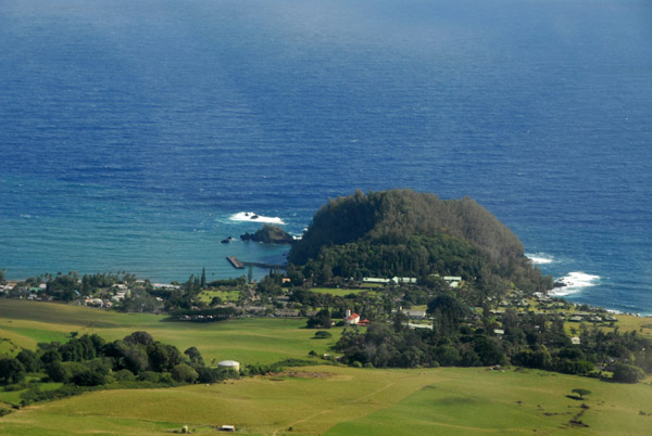 Ka'uiki Head, Hana, Maui |
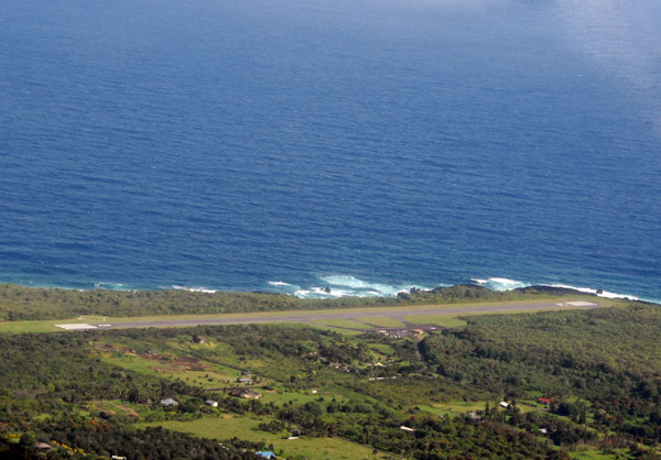 Hana Airport, Maui (HNM) |
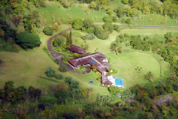 ...some actor's house... |
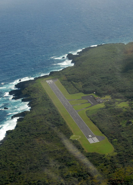 Runway 8/26 at Hana Airport (3606 ft) |
 Honoma'ele Gulch, northeast Maui (N20.806/W156.039) |
 Northeast coast of Maui |
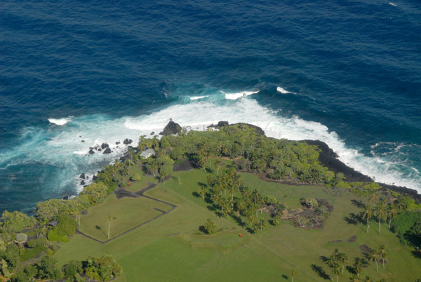
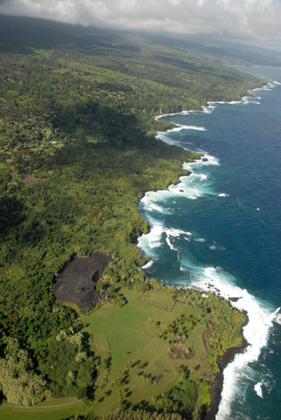
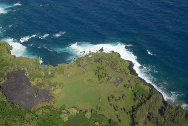 Kahanu Garden and Piʻilanihale Heiau, northeast Maui |
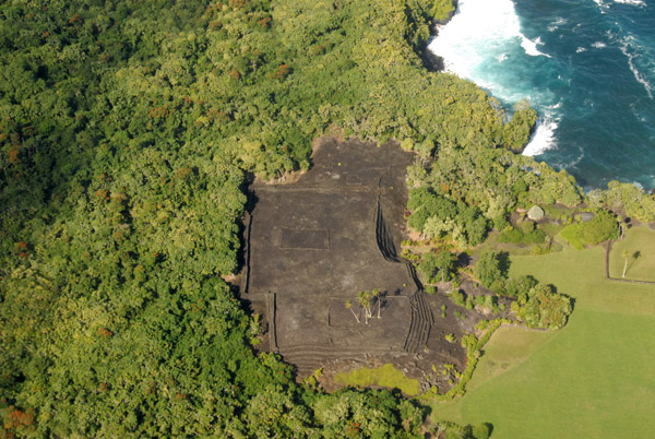 Piʻilanihale Heiau, the largest ancient temple in Hawaii |
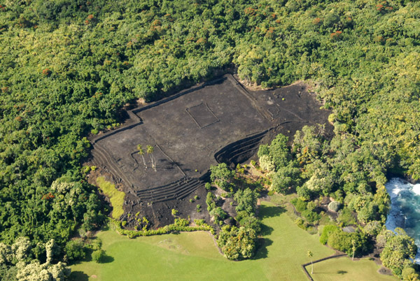 Piʻilanihale Heiau is believed to have been built in the 16th Century |
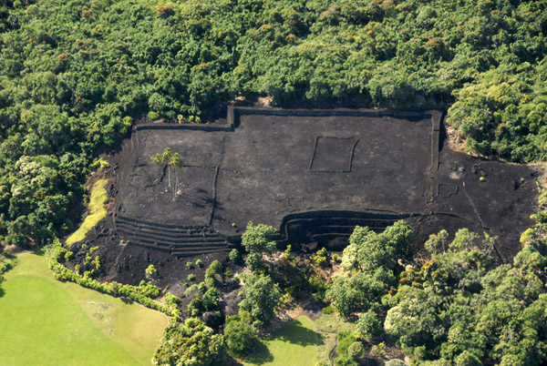 Piʻilanihale Heiau, made of basalt, 341 ft x 415 ft |
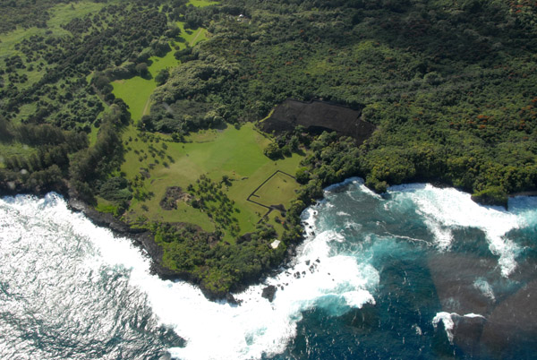 Kahanu Garden and Piʻilanihale Heiau, Honoma'ele Gulch, northeast Maui |
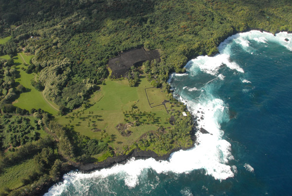 Kahanu Garden and Piʻilanihale Heiau, northeast Maui |
 Waterfall at the end of the Heleleikeoha Stream, Maui (N20.8077/E156.0578) |
 Northeast Coast of Maui at Waioni and Kea'aiki Gulches |
 Cliffs of northeast Maui, haunt of the rich and famous |
 Northeast Maui |
 Cliffs of northwest Maui (N20.818/W156.069) |
 A double waterfall plunging over the cliff directly onto Kea'a Beach, Maui |
 ...the pilot mentioned this as the home of a former Beatle (N20.817/W156.070)) |
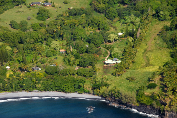
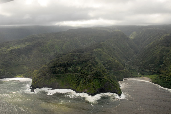
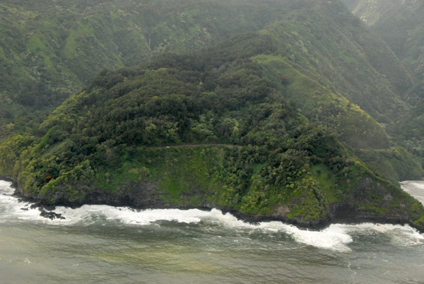
 Beautiful stretch of the northeast Maui coast best seen from the air |
 Northeast coast of Maui along Lower Nahiku Road from the air |
 The end of Nahiku Road, Maui, from the air (N20.827/W156.092) |
 Waiokilo Falls, northeast Maui |
 Northeast coast of Maui |
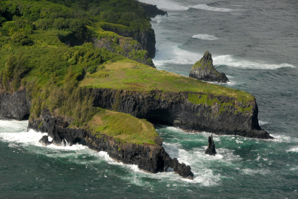 Paepaemoana Point |
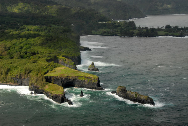 Paepaemoana Point |
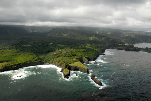 Paepaemoana Point |
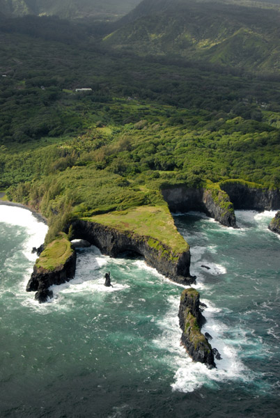 Paepaemoana Point |
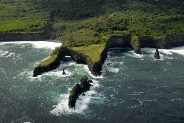 Paepaemoana Point |
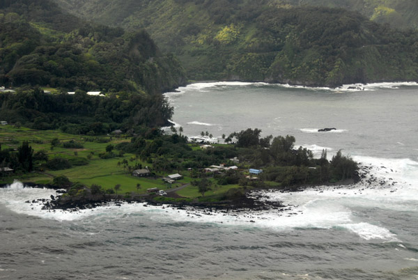 Ke'anae Peninsula |
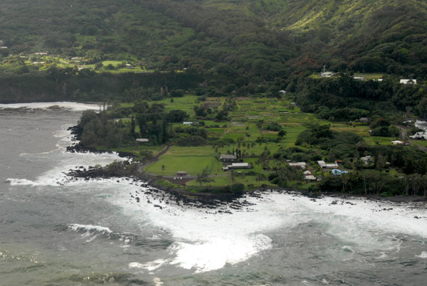 Ke'anae Peninsula |
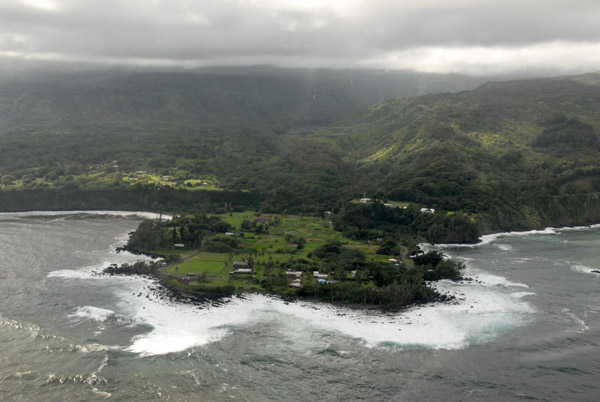 Ke'anae Peninsula |
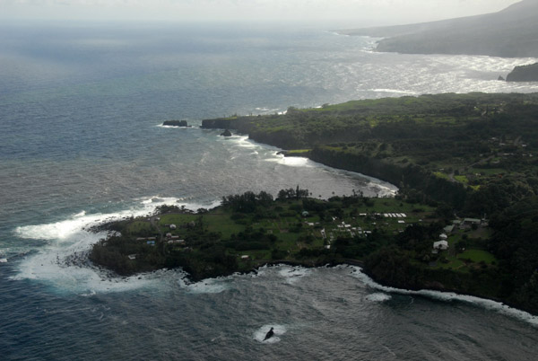
 Honomanu Bay, northeast Maui along the Hana Highway |
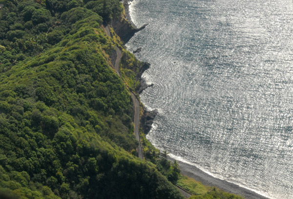
 A stretch of the Hana Highway along the coast at Honomanu Bay |
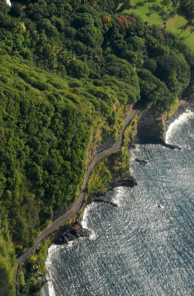
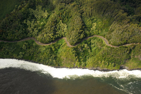
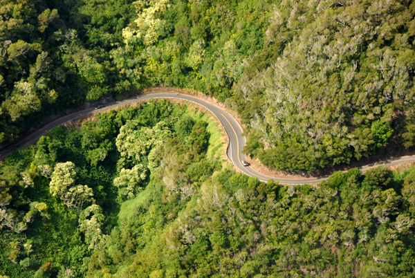
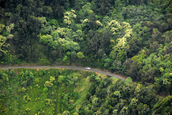 Most of the Hana Highway is hidden by dense vegetation |
 Looking back to the Ke'anae Peninsula and the Hana Coast |
 Ke'anae Peninsula |
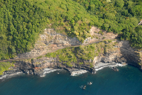
 Hana Highway along Honomanu Bay and Kaumahina State Wayside Park |
 Hana Highway along Honomanu Bay and Kaumahina State Wayside Park |
 Hana Highway along Honomanu Bay and Kaumahina State Wayside Park |
 Hana Highway along Honomanu Bay and Kaumahina State Wayside Park |
 Haipuaena Stream plunging into the Pacific |
 Keopuka Rock and Puohokamoa Valley of Jurassic Park fame |
 Keopuka Rock and Puohokamoa Valley, Garden of Eden Botanical Garden |
 Ke�puka Rock and Moiki Point |
 Northeast coast of Maui - Makaiwa Bay, 'O'opula Point and Kapukaamaui Point |
 Northeast coast of Maui - Makaiwa Bay, 'O'opula Point and Kapukaamaui Point |
 Kapukaamaui Point, Maui (N20.894/E156.195) |
 Kapukaamaui Point |
 Pu'ukukae Falls, Mailiilihaele Stream on the left, Kailua Stream on the right (N20.899/E156.205) |
 Pu'ukukae Falls into the Pacific, Maui |
 Cliffs of Hanehoi Point, northeast Maui |
 Cliffs of Hanehoi Point, northeast Maui |
 Cliffs of Hanehoi Point, northeast Maui |
 Cliffs of Honopou Point looking west, Maui |
 Honopou Point, northeast Maui (N20.934/E156.240) |
 Pineapple fields of the Central Valley of Maui along the north coast at Paulwela Point |
 Cutting across Kahului Bay for west Maui hoping for whales but they're out of season |
 West Maui from the middle of Kahului Bay |
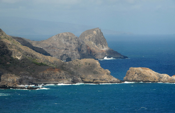 The rugged northwest Maui coast with Mokeehia Island, Hakuhee Point and Kahakuloa Head |
 Sea cave at the base of Kupaa Gulch, Maui (N20.955/W156.516) |
 Waihee Point below the K... Highway (N20.953/W156.515) |
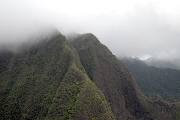
 Flying up the Waihee Valley on the north side of the West Maui Mountains |
 The summit of the West Maui Mountains is hidden in thick cloud but we have a high enough ceiling to fly up the Waihee Valley |
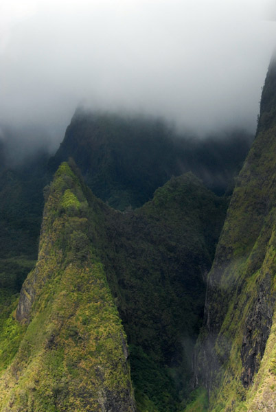
 Waihee Valley, West Maui Mountains |
 Waihee Valley, West Maui Mountains |
 Waihee Valley, West Maui Mountains |
 Waihee Valley, West Maui Mountains |
 Waihee Valley, West Maui Mountains |
 The inaccessible Waihee Valley floor, West Maui Mountains |
 Waihee Valley, West Maui Mountains |
 Waihee Valley, West Maui Mountains |
 Wall of Tears, Waihee Valley |
 The end of the Waihee Valley |
 Wall of Tears, Waihee Valley |
 Waihee River along the floor of the Waihee Valley |
 Leaving the Waihee Valley |
 Circling around from the north side of the West Maui Mountains to the Iao Valley on the east side |
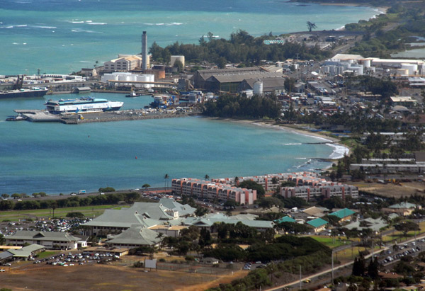
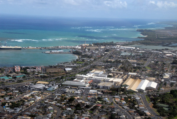
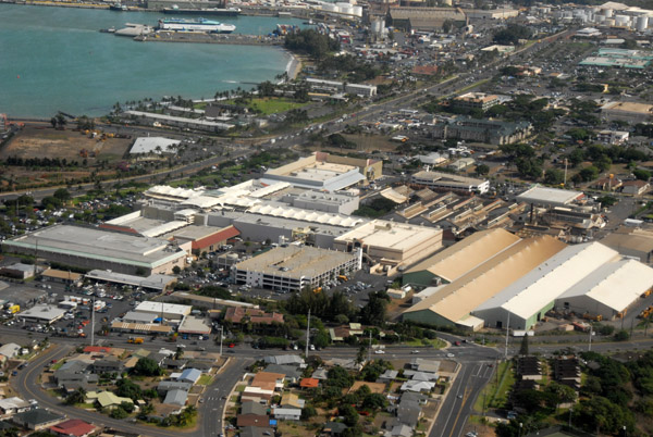
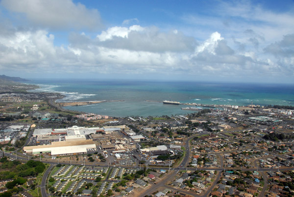
 Kahului, Maui |
 Kahului, Maui |
 Circling around the West Maui Mountains |
 Flying up the Iao Valley |
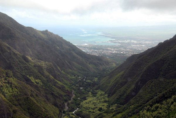 Iao Valley (�Ee-yow�) |
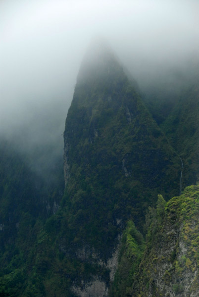 The Īʻao Needle in the West Maui Mountains |
 Iao Valley, West Maui Mountains |
 Iao Valley, West Maui Mountains |
 Iao Valley, West Maui Mountains |
 Heading back to the airport after the end of our one hour flight |
 Iao Valley Road |
 Wailuku, Maui HI - Kepaniwai Culture Park, Iao Valley Road |
 Wailuku, Maui HI - Kepaniwai Culture Park, Iao Valley Road |
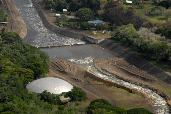
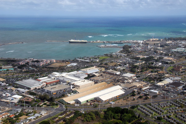
 Kahului Harbor, Maui |
 Kahului, Maui |
 N20.8865/W156.5123 |
 Mokuhau Road, Wailuku, Maui |
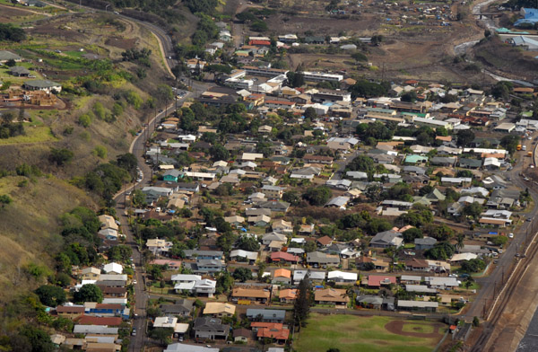
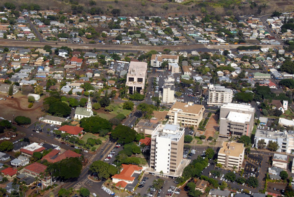
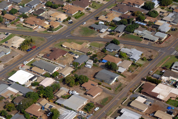
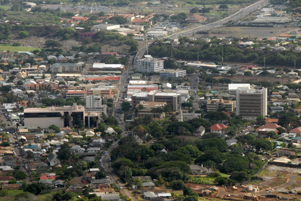 Downtown Wailuku, Maui HI |
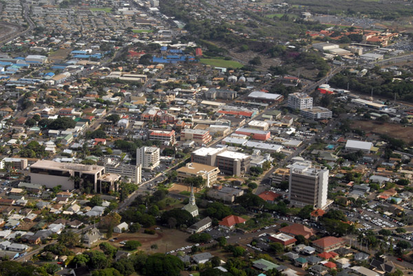 Downtown Wailuku, Maui HI |
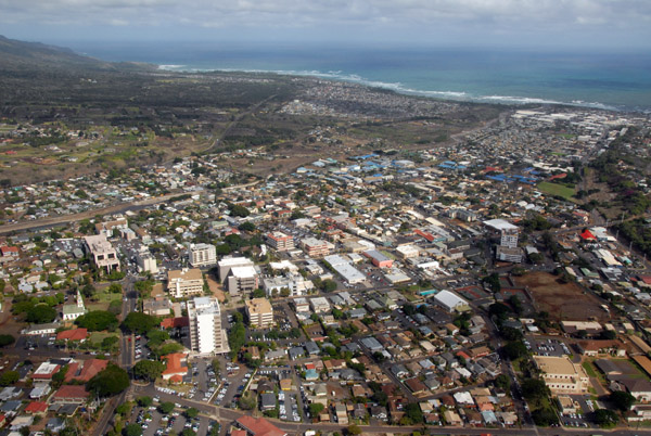 Wailuku, Maui HI |
 South High Street & Main Street, Wailuku, Maui HI |
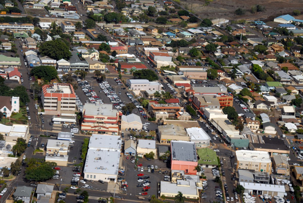 Downtown Wailuku, Maui HI |
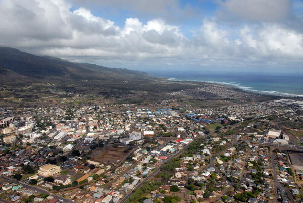 Wailuku, Maui HI |
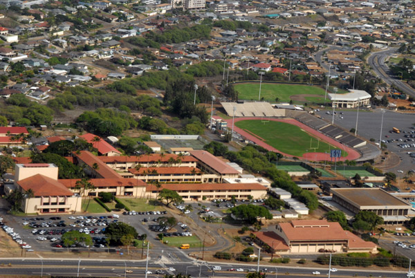 Henry Perrine Baldwin High School and War Memorial Stadium, Wailuku, Maui HI |
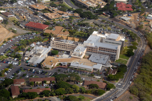 Maui Memorial Medical Center, Mauilani Parkway, Wailuku, Hawaii |
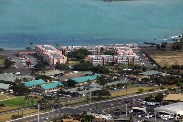 Maui Beach Hotel, Kahului |
 Kahului, Hawaii |
 Queen Ka'ahumanu Center, Kahului, Maui |
 Queen Ka'ahumanu Center, Kahului, Maui |
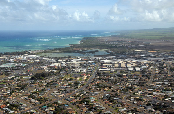 Kahului, Maui |
 Kahului, Maui |
 Kahului, Maui |
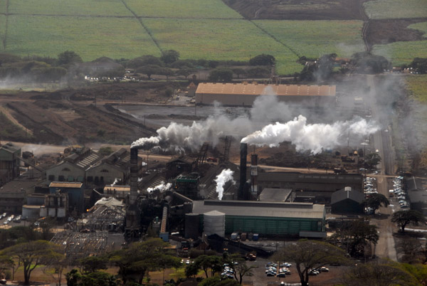 Active sugar mill with The Alexander & Baldwin Sugar Museum, Puunene, Maui, Kahului, Maui |
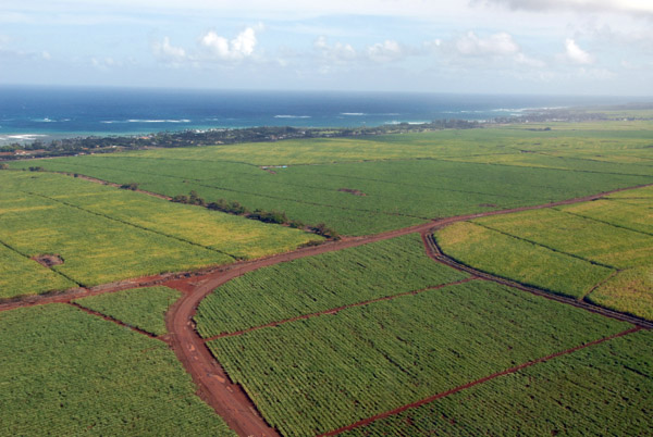
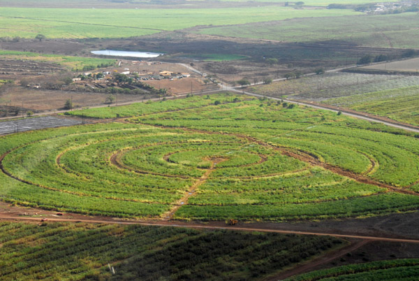 Sugar cane plantation outside Kahului, central valley of Maui |
 Sugar cane plantation outside Kahului, central valley of Maui |
 On approach to Maui's Kahului Airport |
 Kahului Airport, Maui (OGG/PHOG) |
 On approach to the Kahului Heliport east of the main runway |
 The approach end of Runway 02 at Maui |
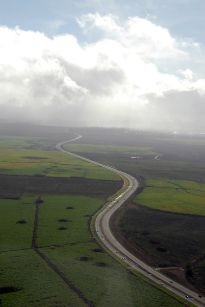
 Coming in over the cane fields of the Central Valley, Maui |
 Crossing the Mokulele Highway on final approach to Kahului Airport |
 Kahului Heliport, Maui |
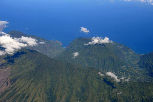
 Moloka'i |
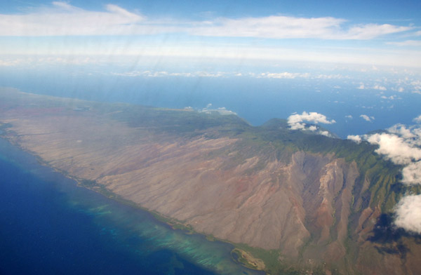 Moloka'i |
 Moloka'i |
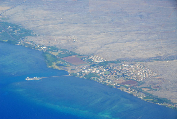 Moloka'i - Kaunakakai |
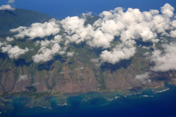
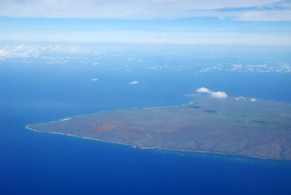 Western Moloka'i |
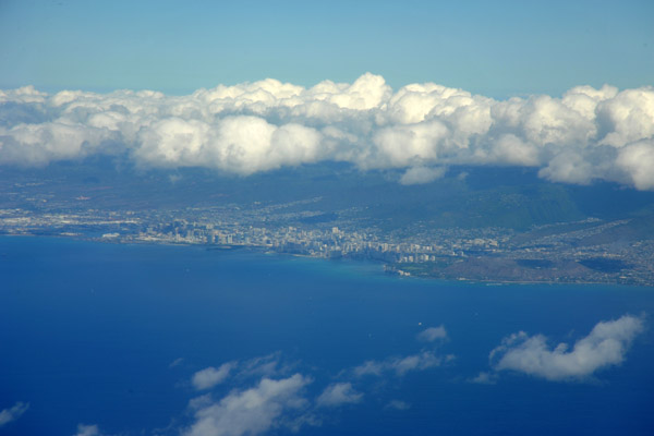
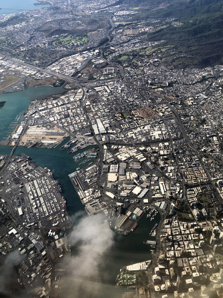
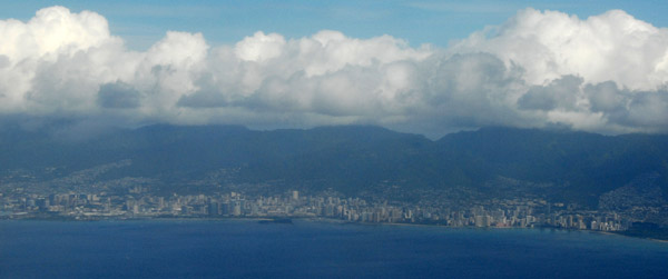 Honolulu |
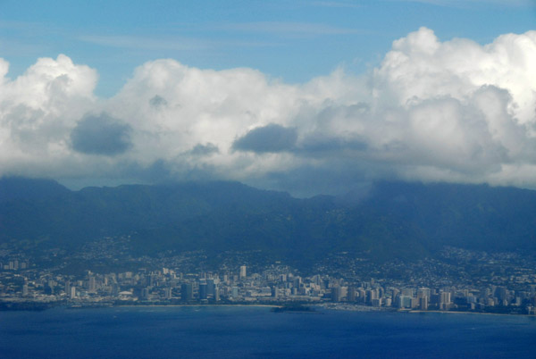 Honolulu |
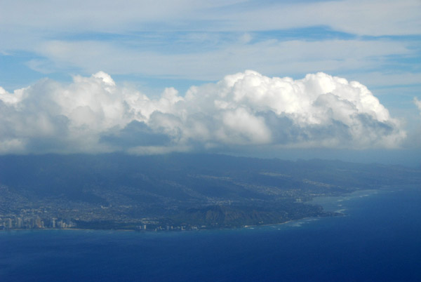 Honolulu |
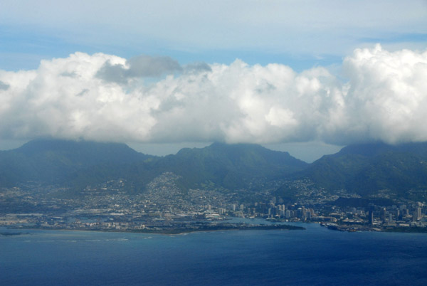 Honolulu |
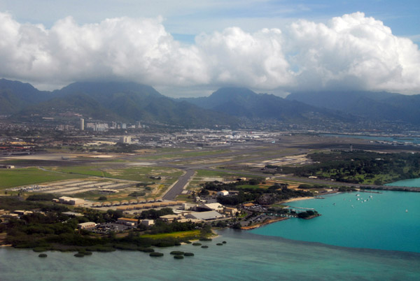
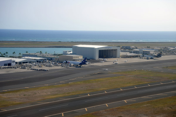
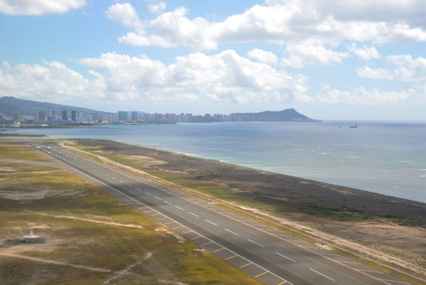
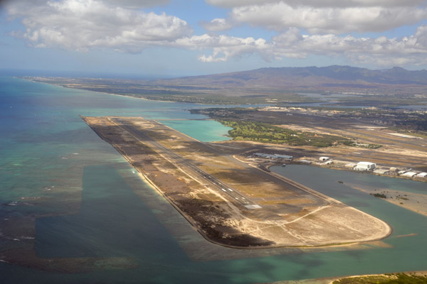
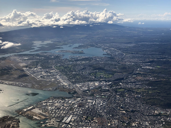
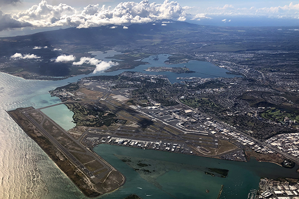
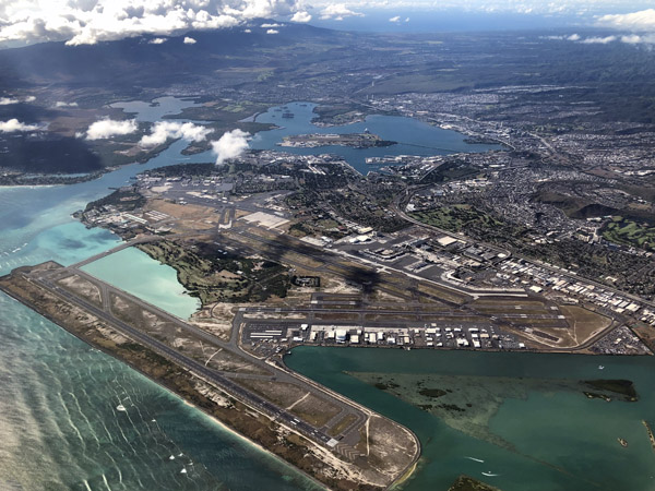
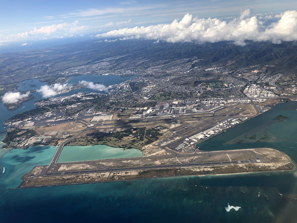
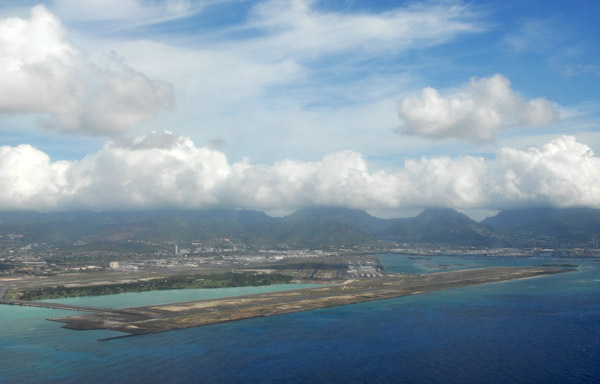 Honolulu International Airport |
 Honolulu International Airport |
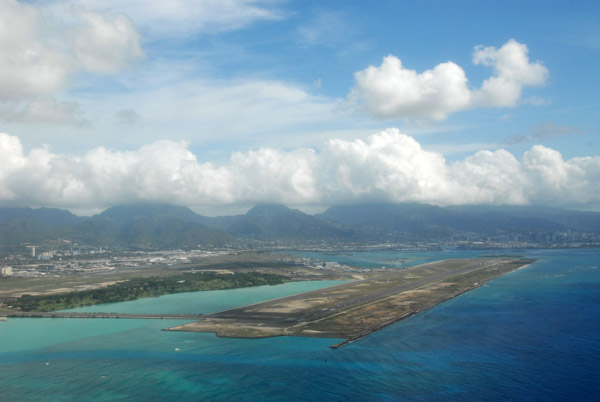
 Honolulu International Airport |
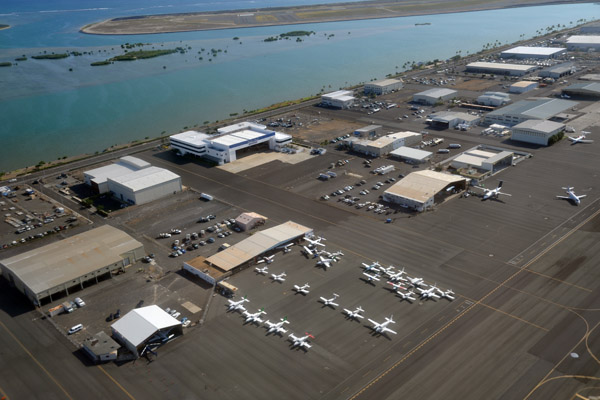
 Honolulu International Airport |
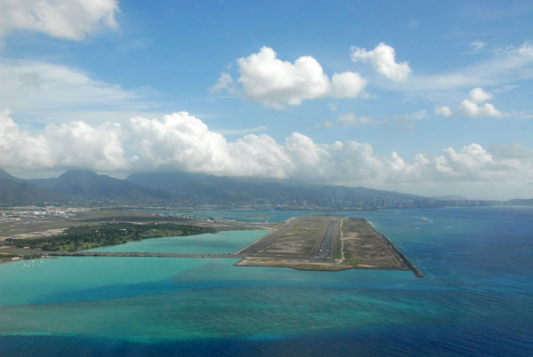
 Honolulu International Airport |
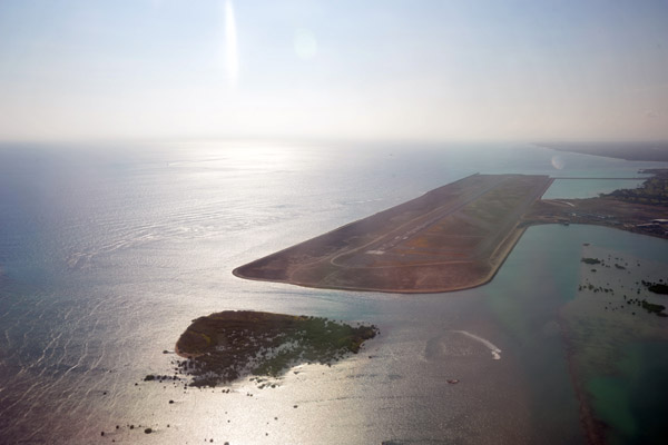
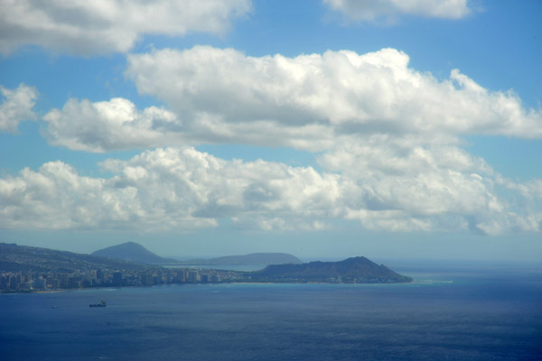
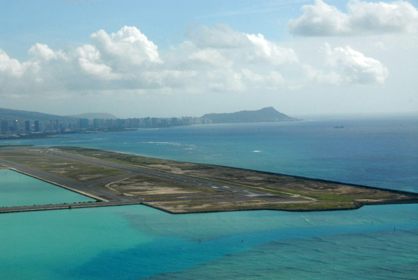 Honolulu International Airport and Diamond Head |
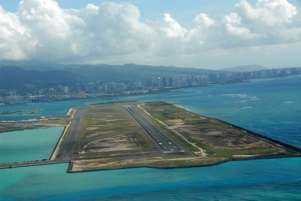
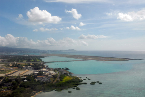 Honolulu International Airport |
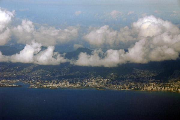 Honolulu |
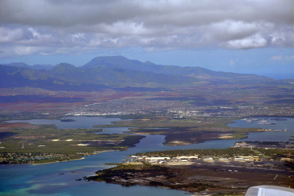
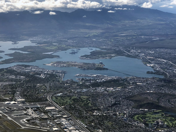
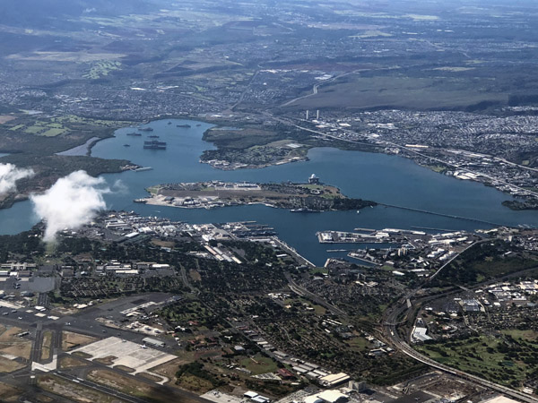
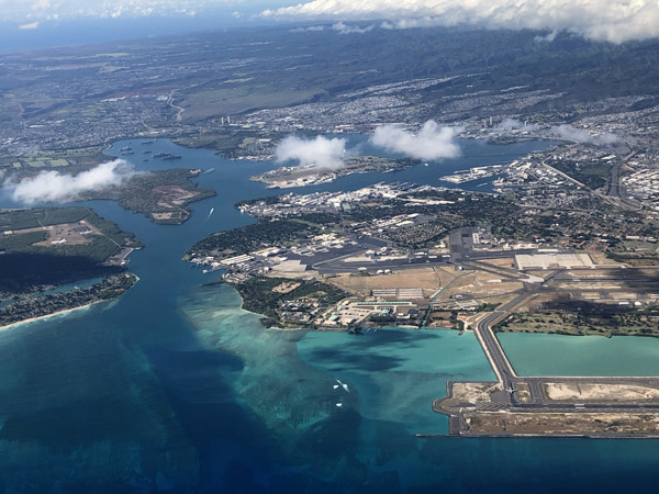
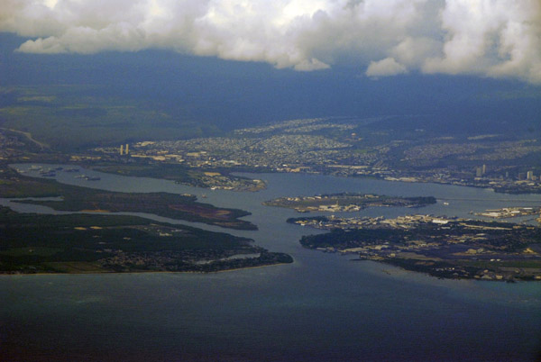 Pearl Harbor |
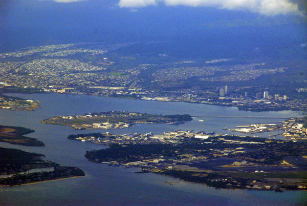 Pearl Harbor |
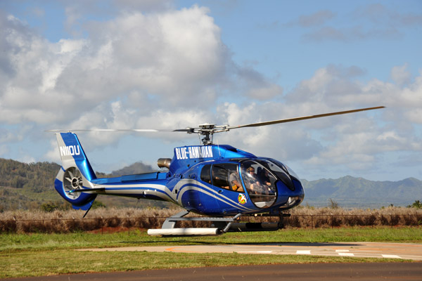 Blue Hawaiian (N11QU) landing at the Lihui heliport |
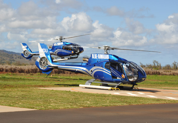 A second Blue Hawaiian Eurocopter(N11QP) arrives |
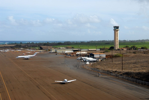
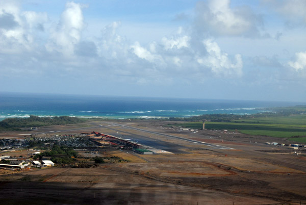
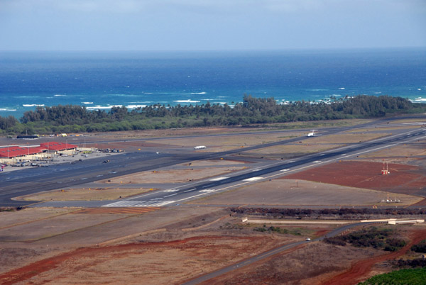
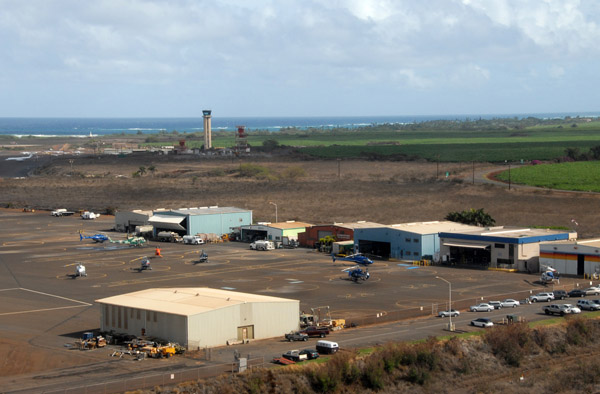
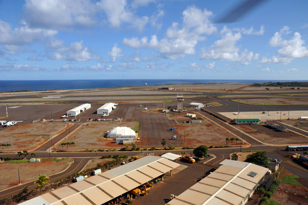 Lihui Airport, Kauai (LIH/PHLI) |
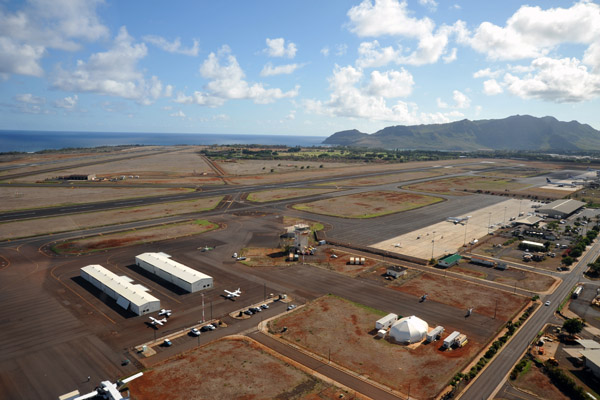 Lihui Airport, Kauai |
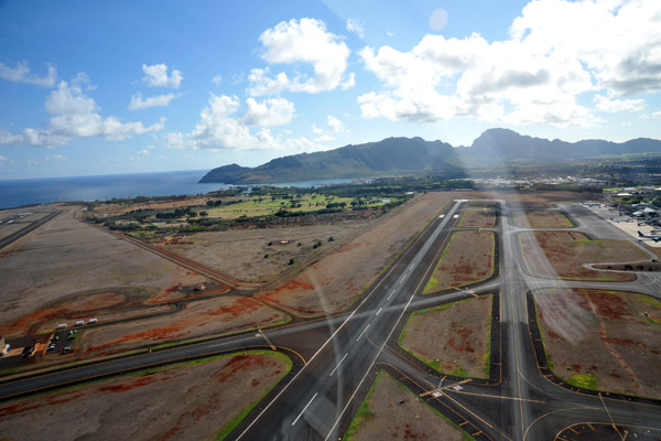 Lihui Airport, Kauai |
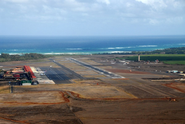
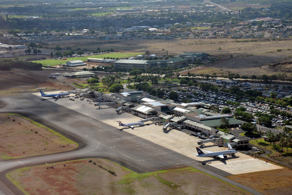 Passenger Terminal, Lihui Airport |
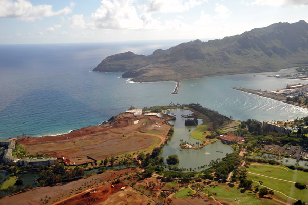 Nawiliwili Bay, Kauai |
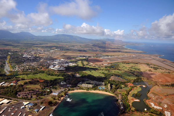
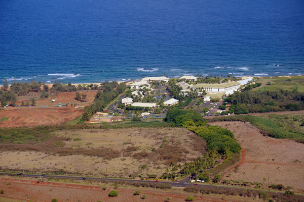
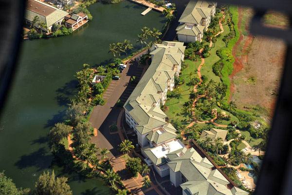 Kauai Lagoons Resort |
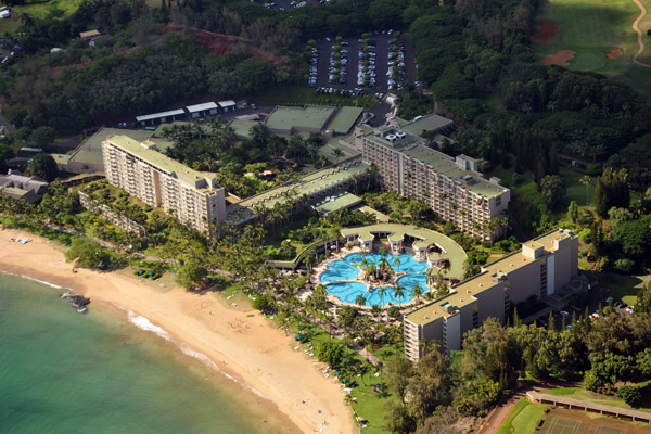
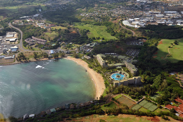 Kalapaki Beach |
 Marriott Kauai Resort and Spa |
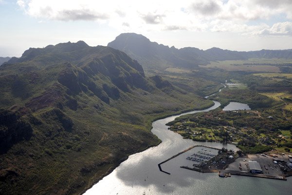 Nawiliwili Small Boat Harbor |
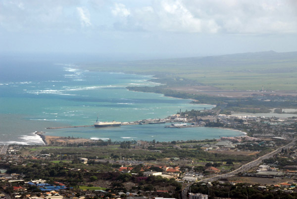
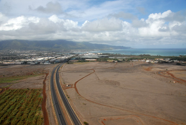
 Lihui, Kauai's main town |
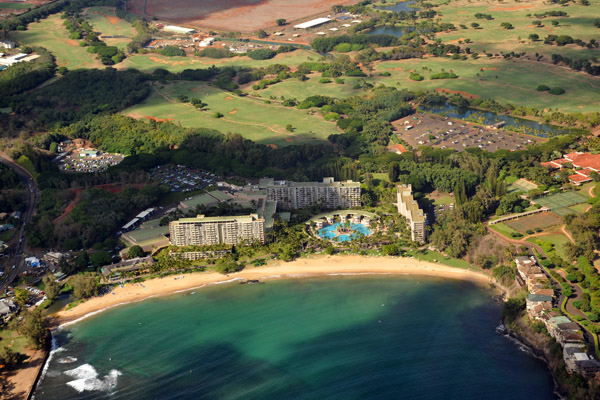 Kalapaki Beach and the Kauai Marriott |
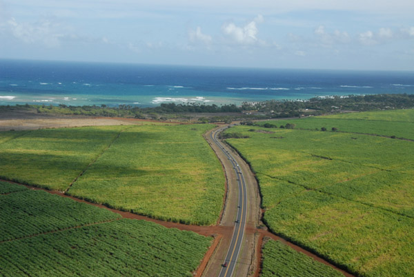
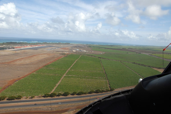
 Cane Fields - Kahili Road |
 Kipu Ranch southwest of Lihui |
 xxxx |
 Hawaii Route 50 - Kaumualii Highway |
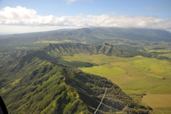
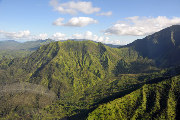
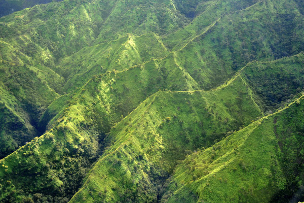
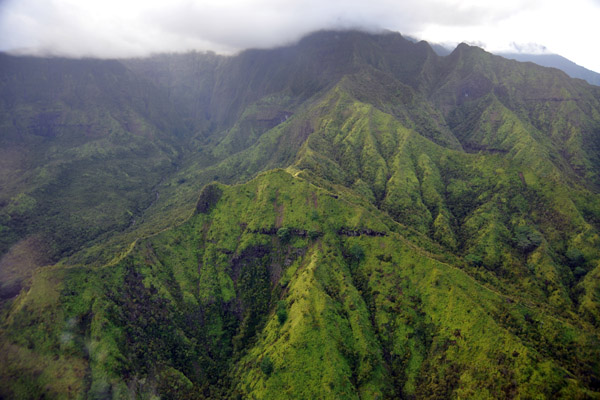
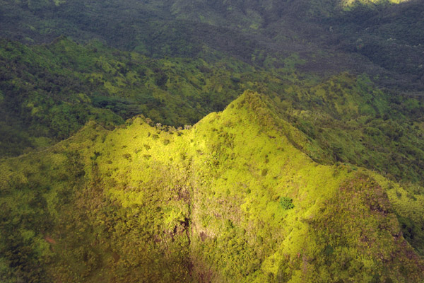
 Kahili Ridge, Kauai |
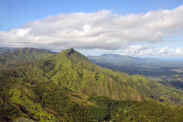 Kahili Ridge, Kauai |
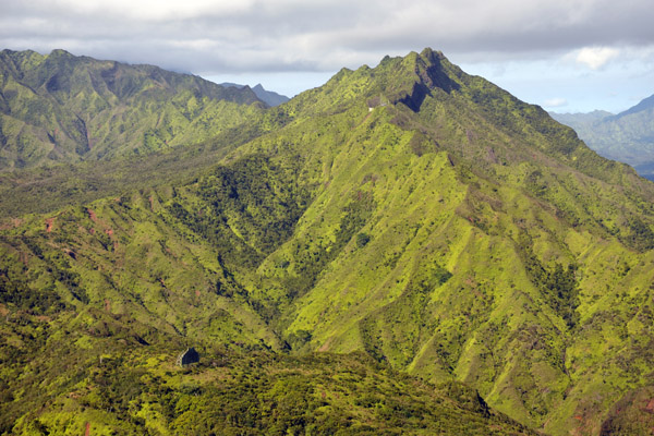 Kahili Mountain, Kauai |
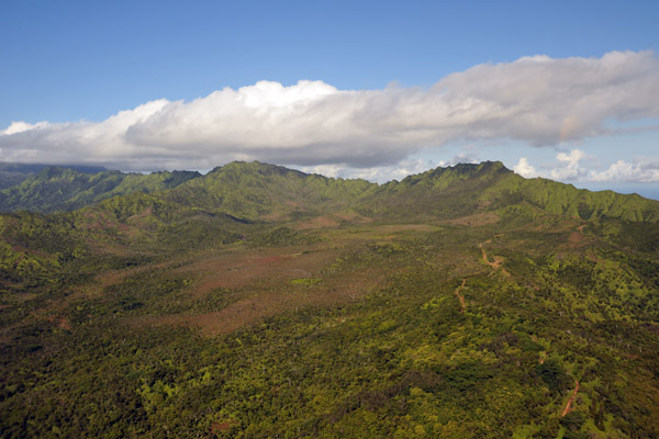 Valley to the north of Alexander Reservoir |
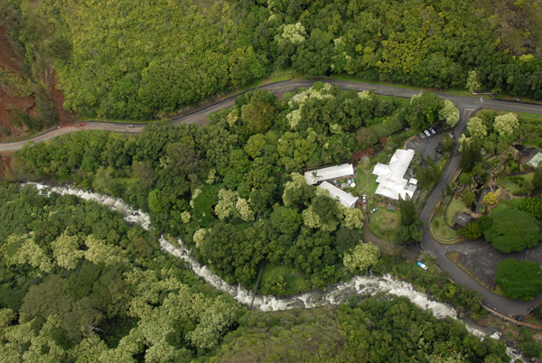
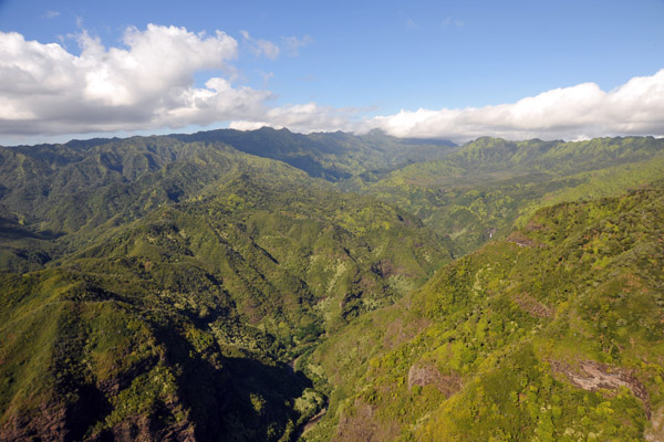 Valley of the Hanapepe River - famous from Jurassic Park |
 Valley of the Hanapepe River - famous from Jurassic Park |
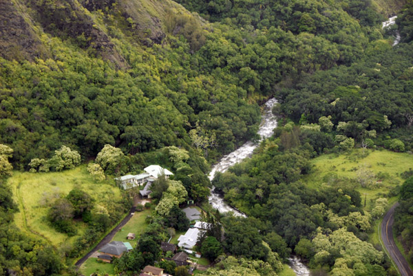
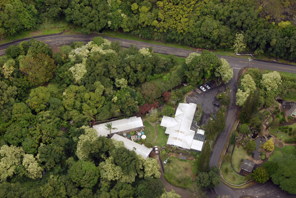
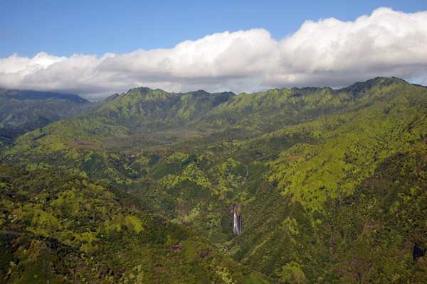
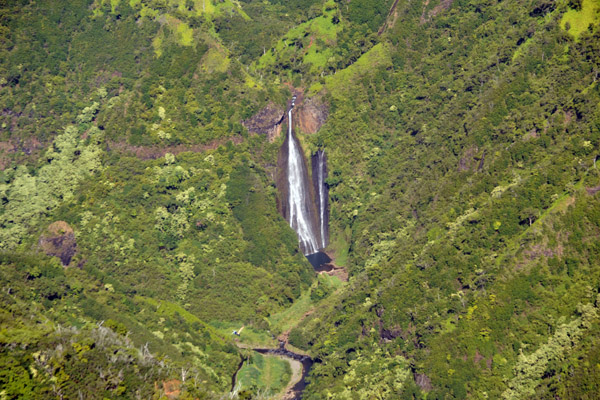
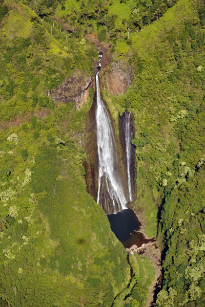
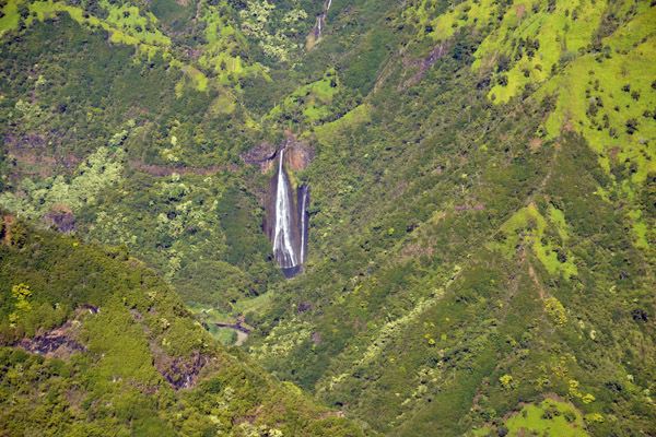 Manawaiopuna Falls - better known as "Jurassic Falls" |
 Valley of the Hanapepe River below Jurassic Falls |
 Valley of the Hanapepe River below Jurassic Falls |
 Manawaiopuna Falls - "Jurassic Falls" |
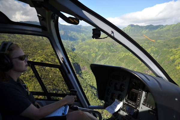 Not a bad job... |
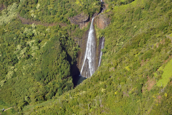 Manawaiopuna Falls - "Jurassic Falls" |
 Manawaiopuna Falls - "Jurassic Falls" |
 Manawaiopuna Falls - "Jurassic Falls" |
 Another helicopter company can actually land at the falls...next time |
 Manawaiopuna Falls - "Jurassic Falls" |
 Of course, there are lots of other waterfalls like Double Falls on the left - just not as famous |
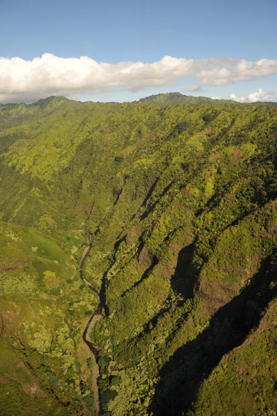
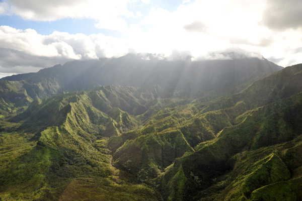
 Crossing the next ridge westbound to reach Waimea Canyon |
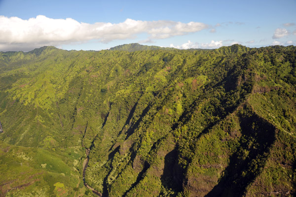
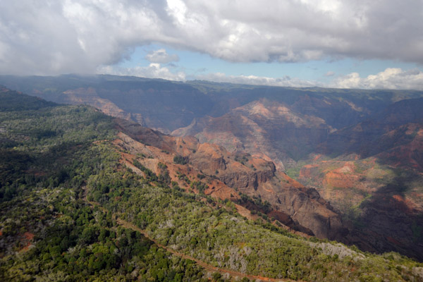
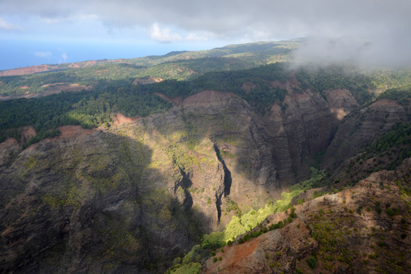
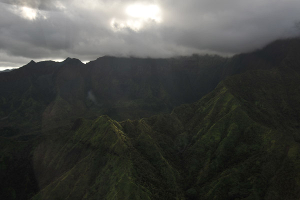
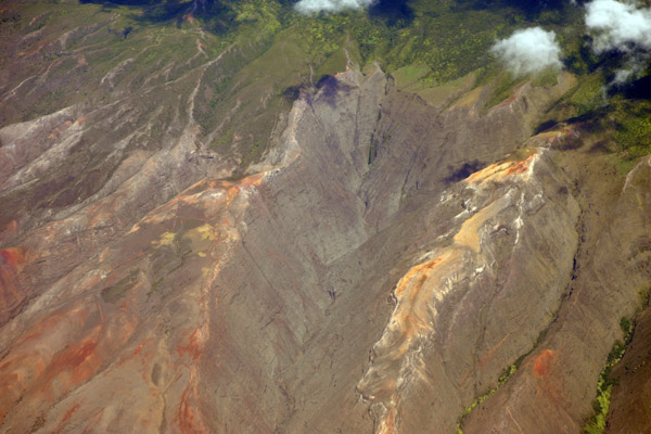
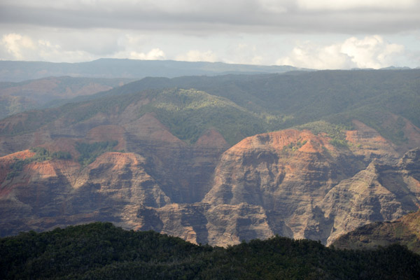 Waimea Canyon |
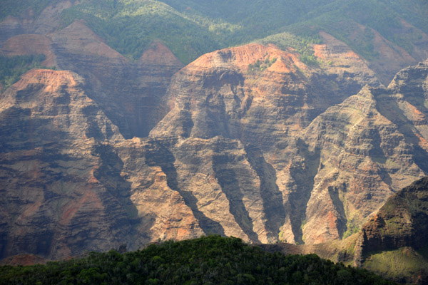 Waimea Canyon |
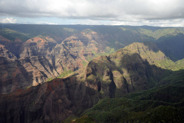 Waimea Canyon |
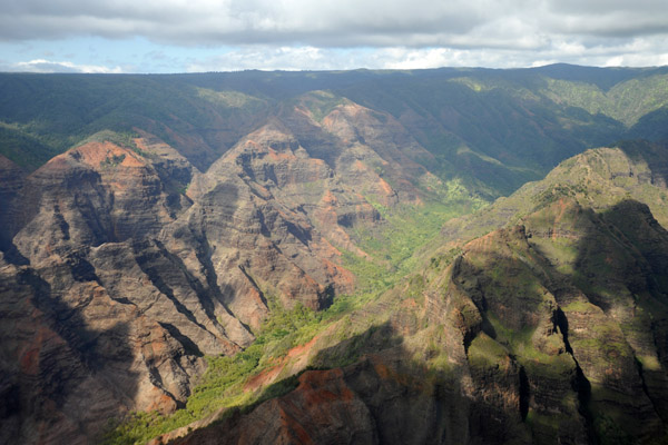 Waimea Canyon |
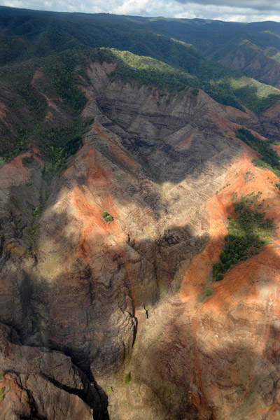 Waimea Canyon |
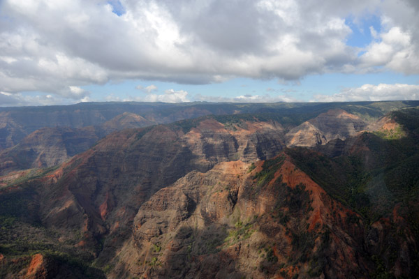 Waimea Canyon |
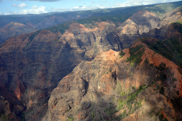 Waimea Canyon |
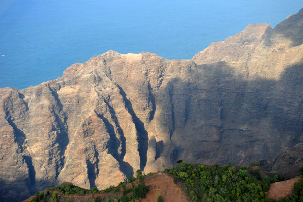
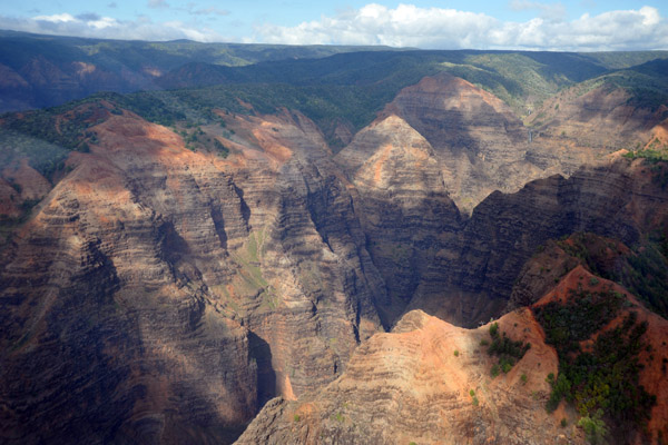 Waimea Canyon - up to 3000 feet deep |
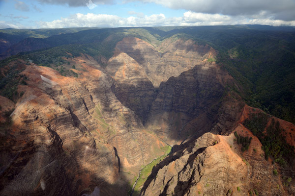 Waimea Canyon |
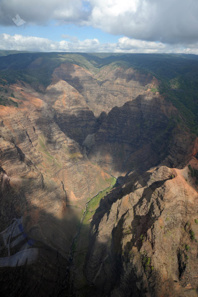 Waimea Canyon |
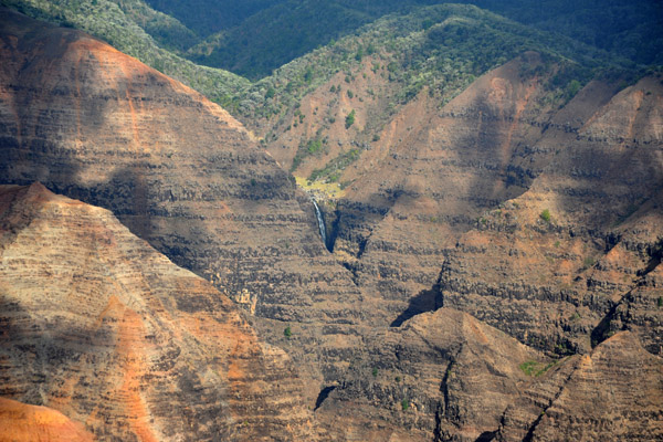 Waimea Canyon |
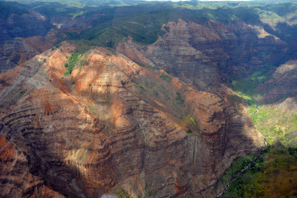 Waimea Canyon |
 Waimea Canyon Overlook from the air |
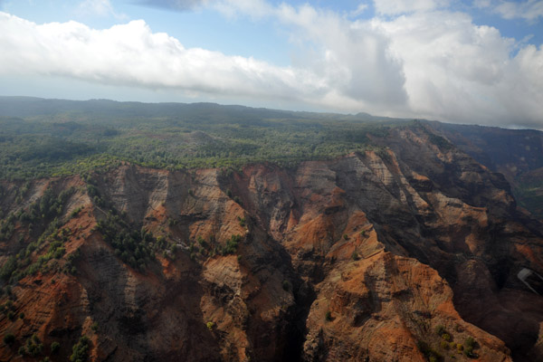 Waimea Canyon |
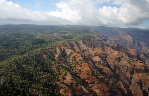 Waimea Canyon |
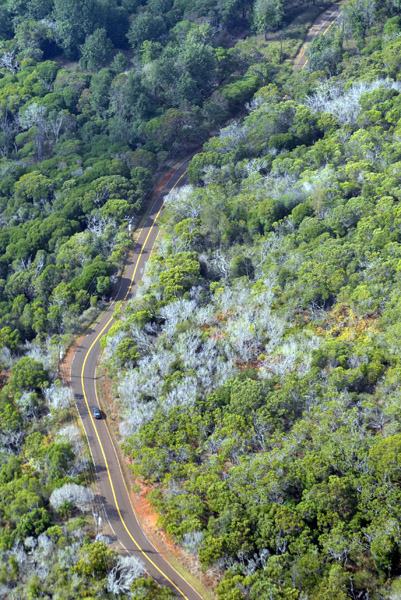 Waimea Canyon Drive |
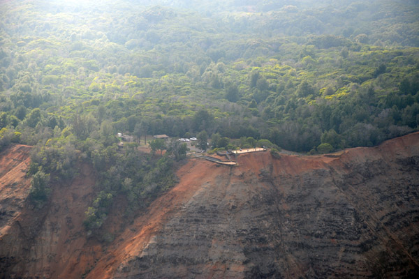
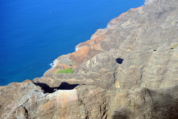
 West rim of Waimea Canyon |
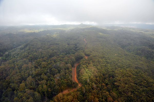 Dirt road heading for the military radar station |
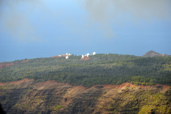 US Navy Pacific Missile Range Facility, Makaha Ridge |
 Canyon just to the north of the radar station at Makaha Ridge |
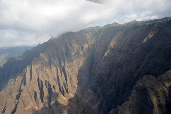
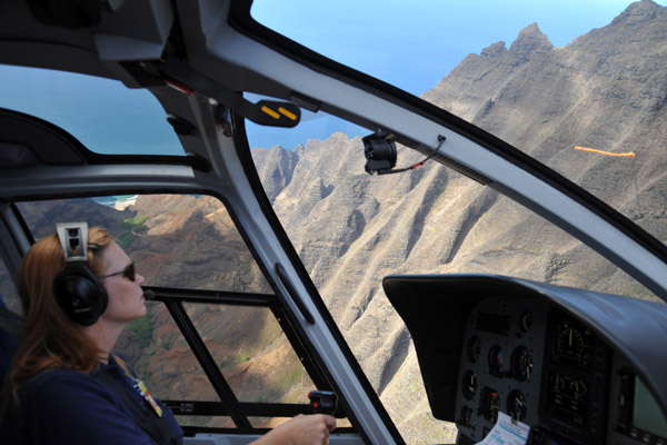
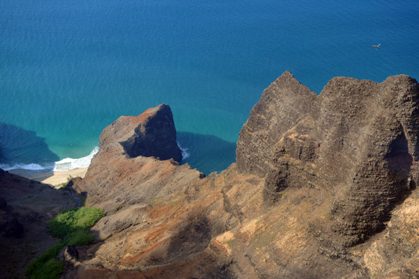
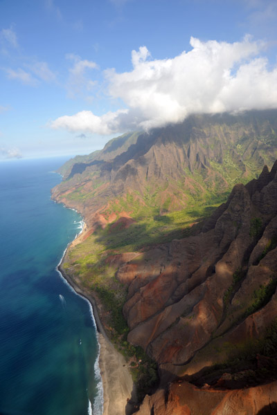
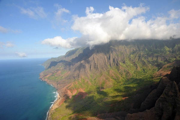
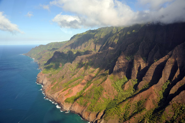
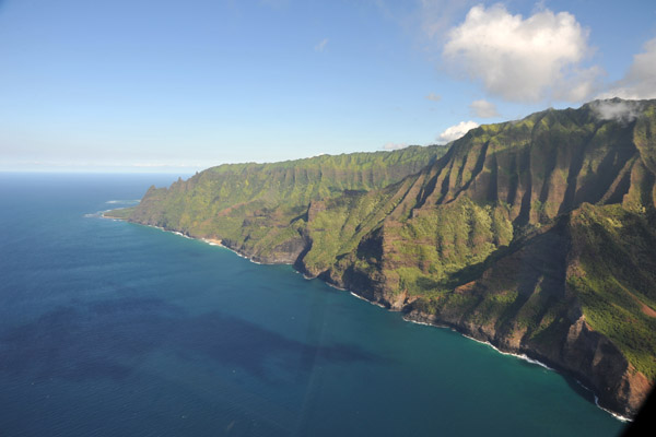
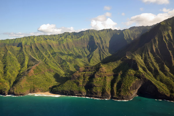
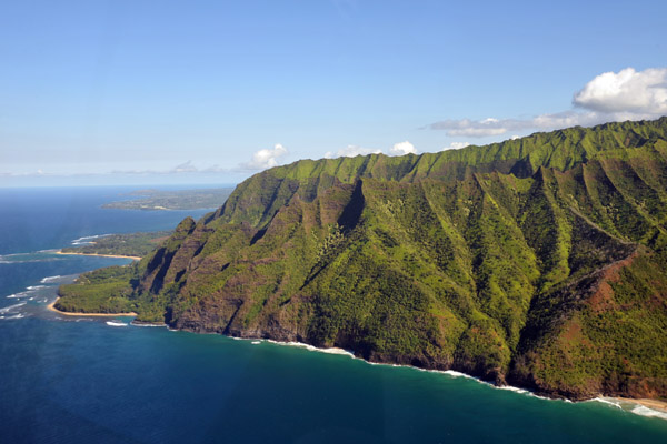
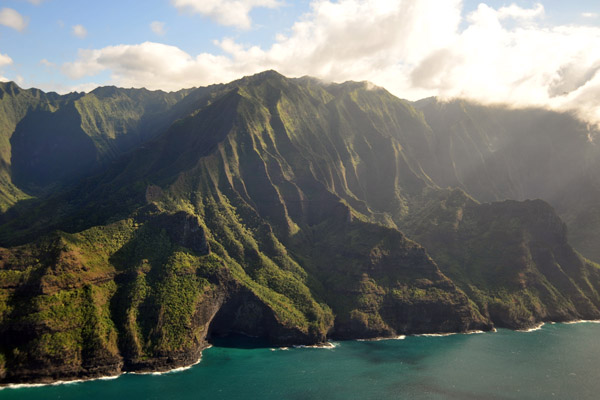
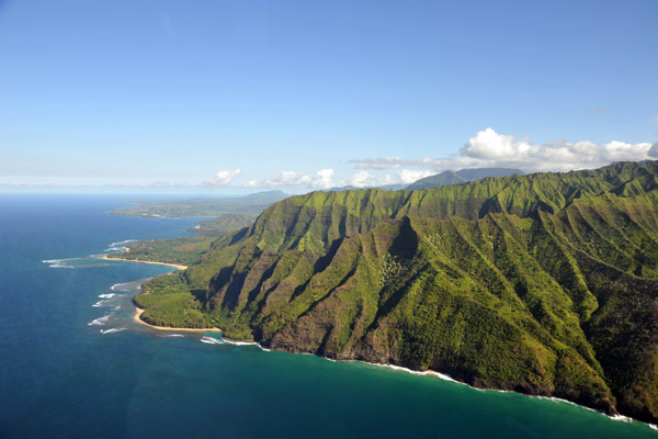
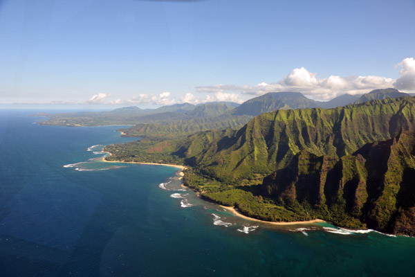
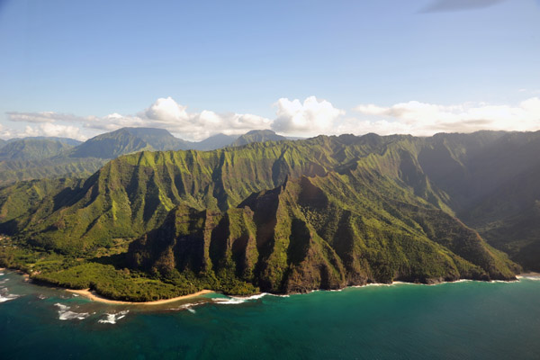
 Na Pali Coast - Crossing the Nualolo Cliff Trail |
 Na Pali Coast |
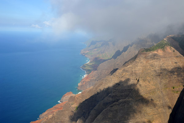 Na Pali Coast - Nualolo Cliffs |
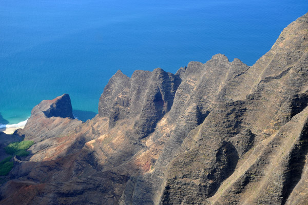
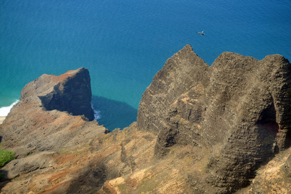
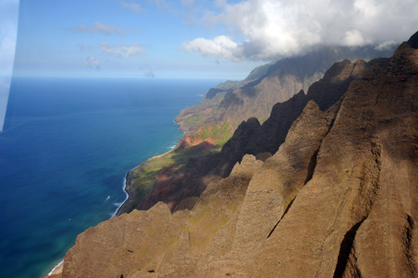
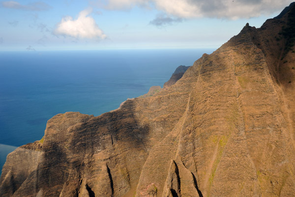
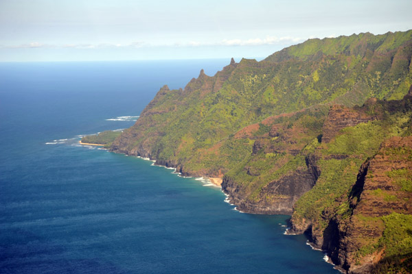
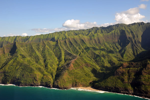
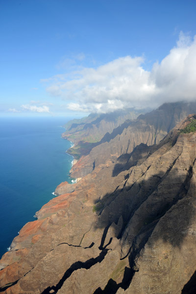 Na Pali Coast |
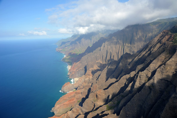 Na Pali Coast |
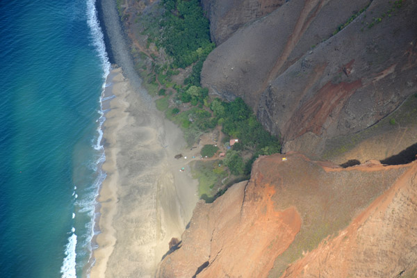
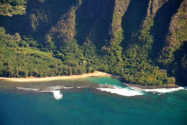
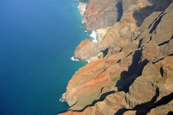 Na Pali Coast - Honopu Beach |
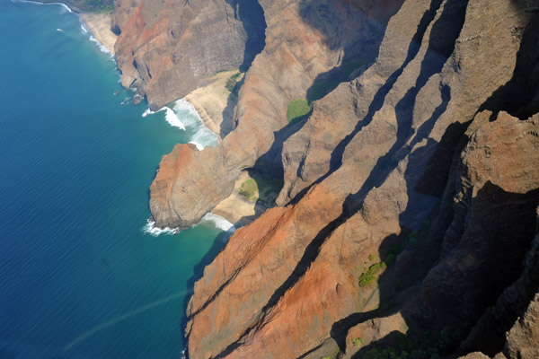 Na Pali Coast - Honopu Beach |
 Na Pali Coast - Honopu Valley |
 Na Pali Coast - a short detour inside the Honopu Valley |
 Na Pali Coast - Honopu Valley |
 Na Pali Coast - Honopu Valley Valley |
 Na Pali Coast - Honopu Valley Valley |
 Na Pali Coast, Kauai |
 Kalalau Beach with its Ranger Station and campsite |
 Na Pali Coast - Kalalau Beach |
 Na Pali Coast - Kalalau Valley |
 Na Pali Coast - Cliffs of Kalalau Valley |
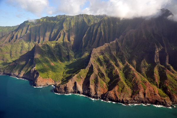
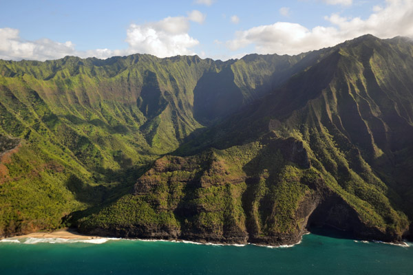
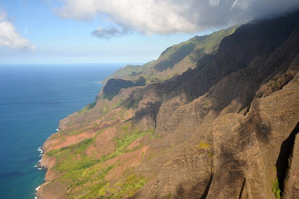 Kauai - Na Pali Coast |
 Kauai - Na Pali Coast |
 Kauai - Na Pali Coast |
 Na Pali Coast - Hanakapiai Beach |
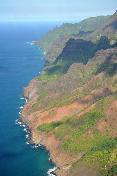
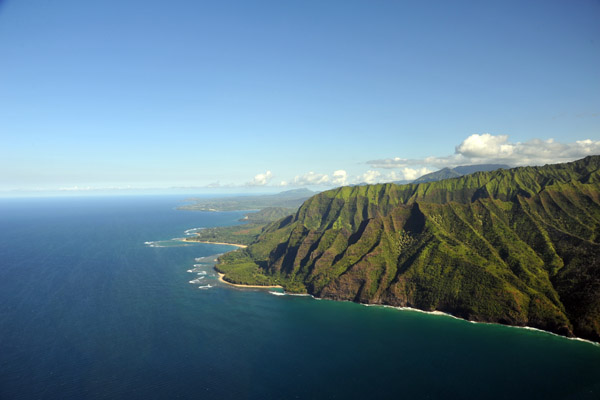
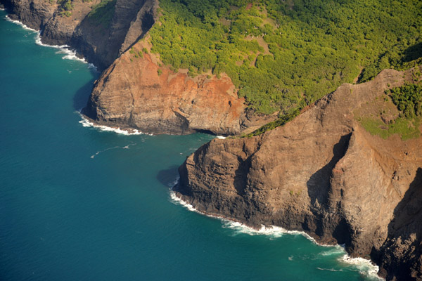 Na Pali Coast |
 Na Pali Coast |
 Na Pali Coast |
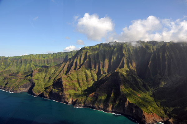 Na Pali Coast |
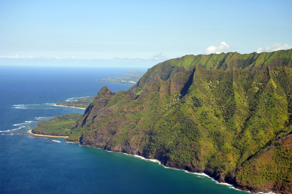 The north end of the Napali Coast at Haena State Park |
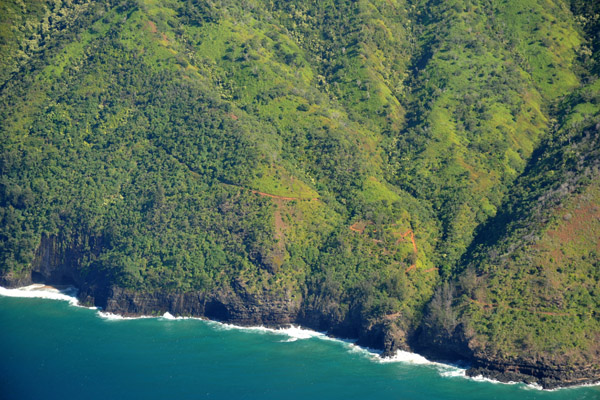 Kalalau Trail - Na Pali Coast |
 Na Pali Coast - Hanakapiai Beach and The Gate |
 Na Pali Coast - Haena State Park to Hanakapiai Beach |
 Na Pali Coast - Hanakapiai Beach |
 Na Pali Coast - Hanakapiai Beach and The Gate |
 Na Pali Coast - The Gate |
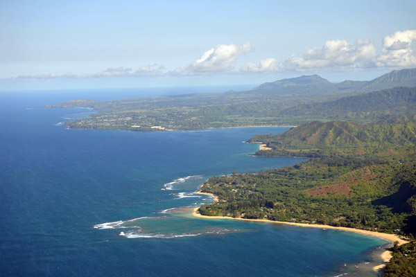
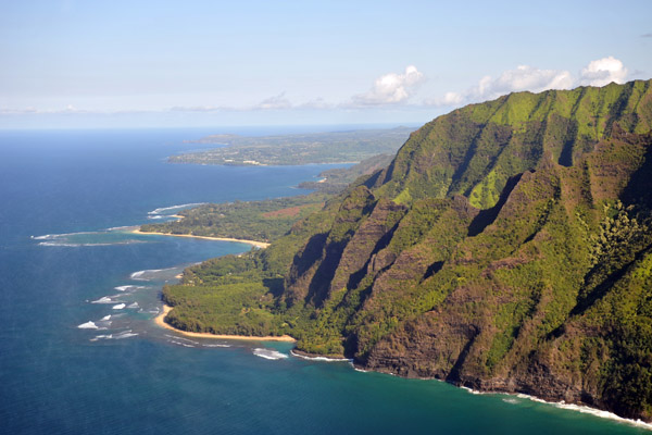 Back in civilization - Haena State Park on the north shore of Kauai |
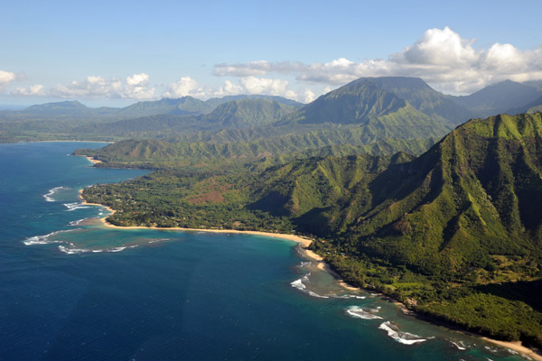
 Looking east along the north shore of Kauai |
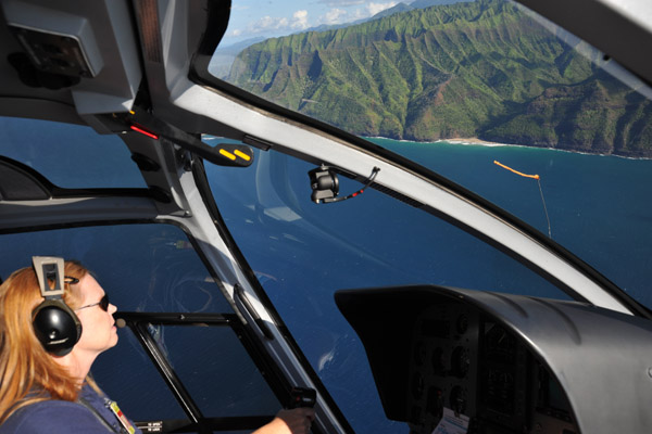 Blue Hawaiian - Red Hair |
 The Na Pali Coast meets the North Shore of Kauai |
 Ke'e Beach - Haena State Park |
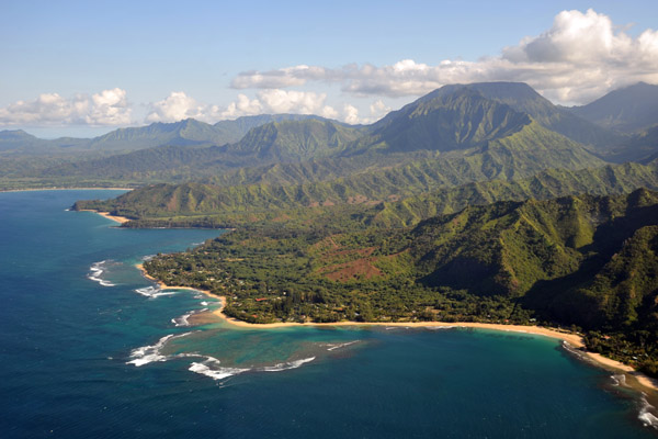
 North Shore - Haena to Princeville |
 North Shore - Haena State Park |
 North Shore - Haena State Park |
 North Shore - Haena |
 Haena - Tunnels Beach |
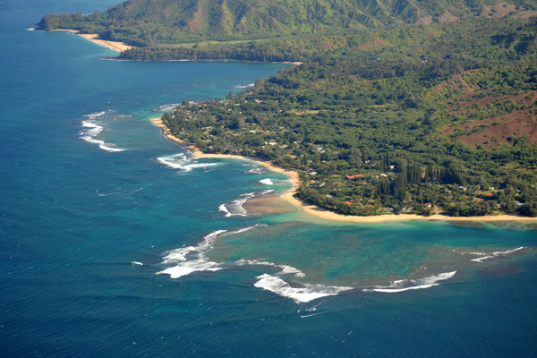 Haena - Tunnels Beach |
 Haena - Tunnels Beach |
 North Shore - Princeville to Kilauea Point |
 North Shore - Lumihi Beach |
 Northeastern Kauai |
 Heading inland from Hanalei Beach |
 xxxx |
 Hidden in the clouds, Mount Waiʻaleʻale, one of the wettest spots on earth |
 Flying up the Hanelai River Valley to Mount Waialeale |
 Approaching Mount Waialeale |
 A bit of sunlight in a rainy place |
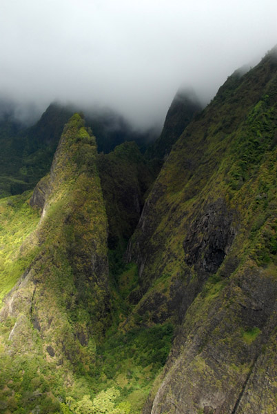
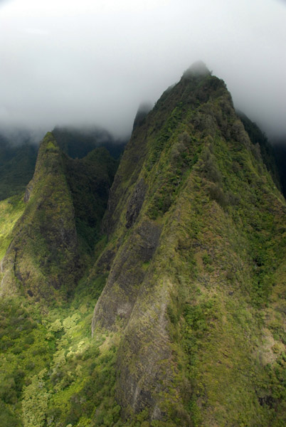
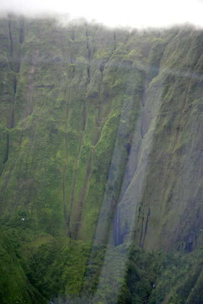 Mount Wai'ale'ale - Wall of Tears |
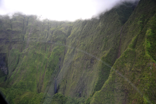 Crater of Mount Wai'ale'ale - Wall of Tears |
 N22 04.15/W159 29.5 |
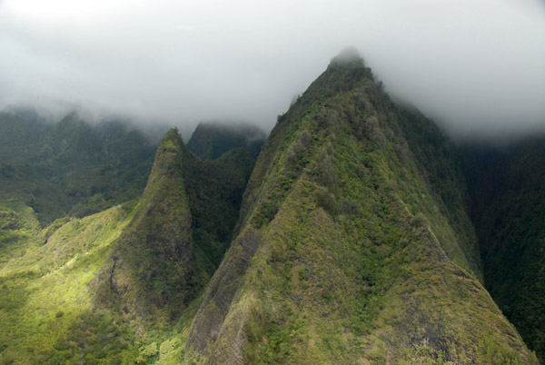
 Crater of Mount Wai'ale'ale - Wall of Tears |
 Crater of Mount Wai'ale'ale - Wall of Tears |
 Exiting the crater the way we came in |
 Central Kauai |
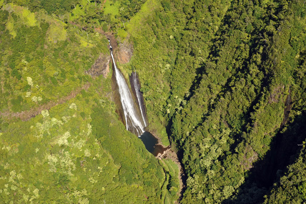
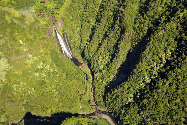
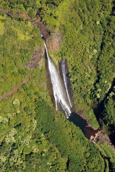
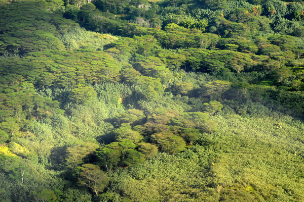
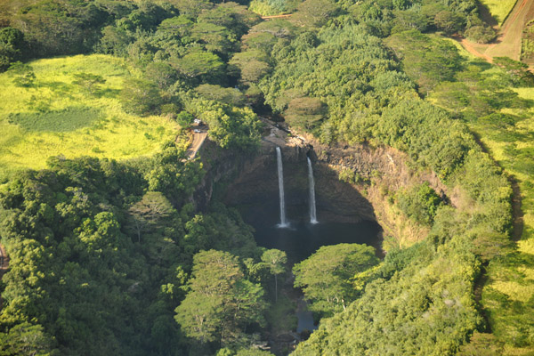 Wailua Falls |
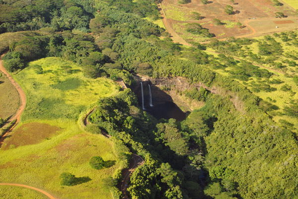 Wailua Falls |
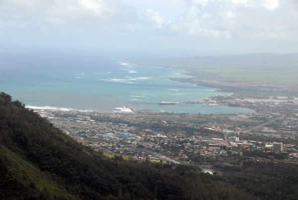
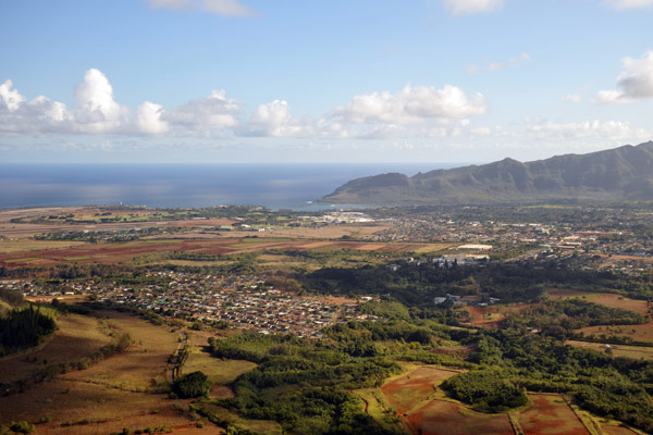 Back to Lihui |
 Kauai Beach Resort |
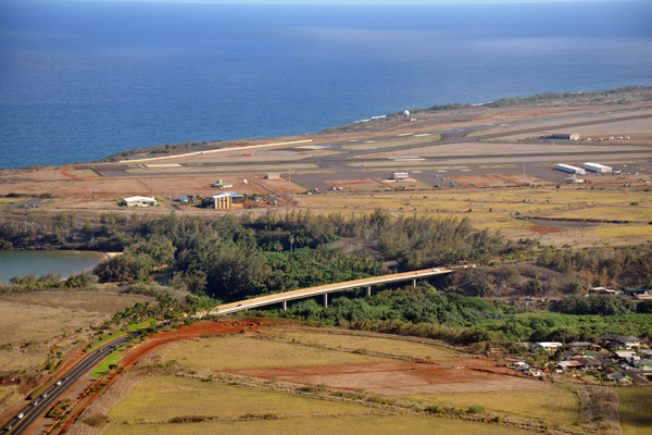 Bridge at Hanamaulu Beach near Lihue Airport |
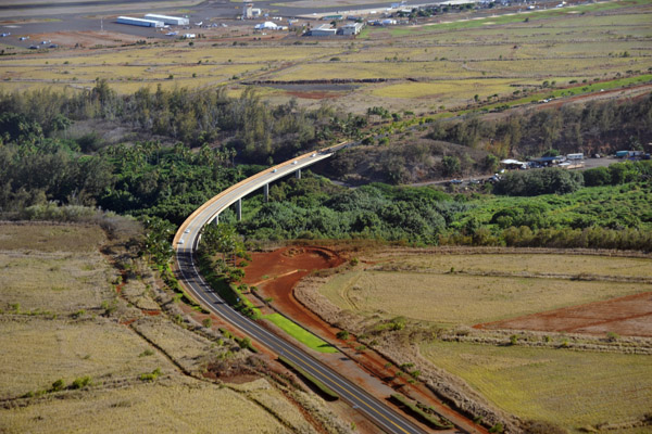 Hawaii Route 51 - Kapule Highway |
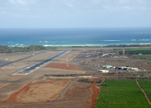
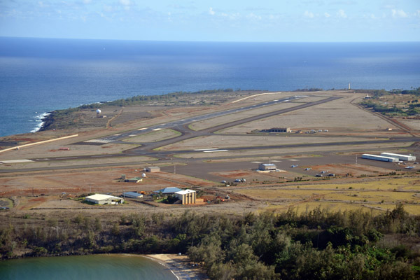 Lihue Airport |
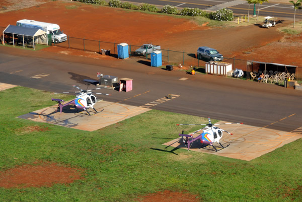 Hughes 500 - N454JH and N808JH - Jack Hart Helicopters |
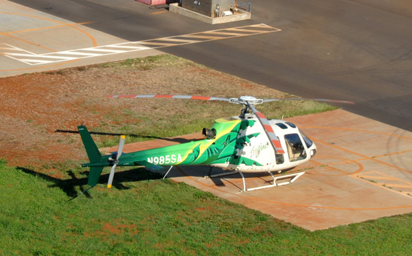 Eurocopter AS-350-B2 (N985SA) - Safari Helicopters |
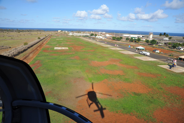 Approach to landing at Lihue |
 Landing at Lihui, Kauai |
 Honolulu International Airport |
 Honolulu International Airport |
 Honolulu International Airport |
 South coast of Maui, Kihei |
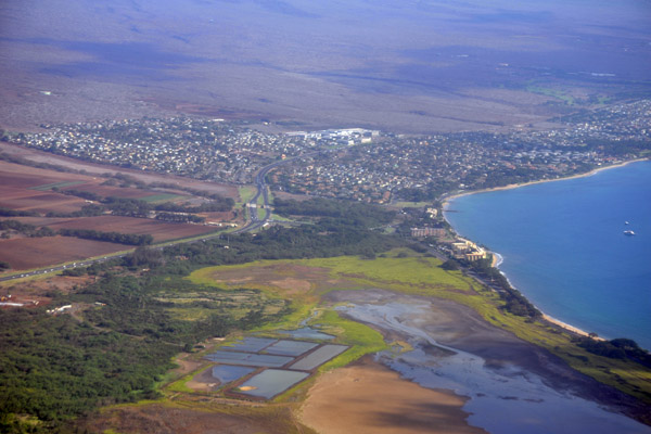 Kihei, Maui |
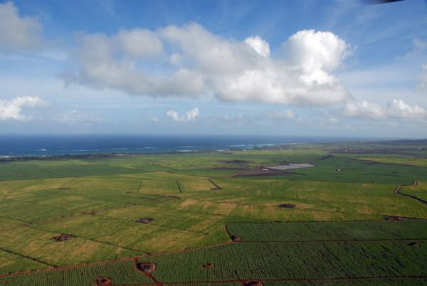
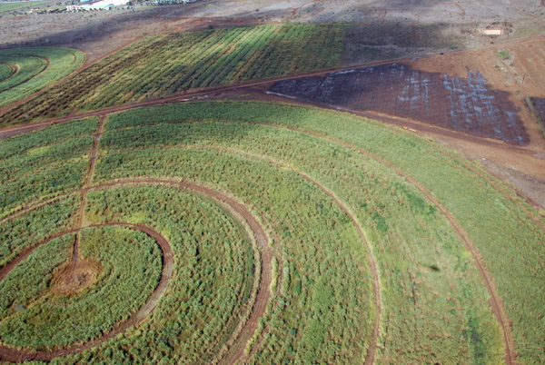
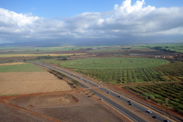
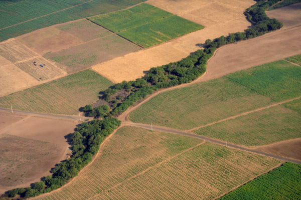 Sugar Cane Fields, Maui |
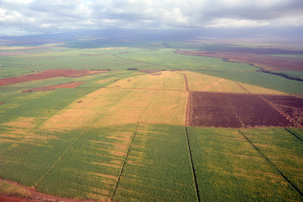 Sugar Cane Fields, Maui |
 Landing at Maui - Kahalui |
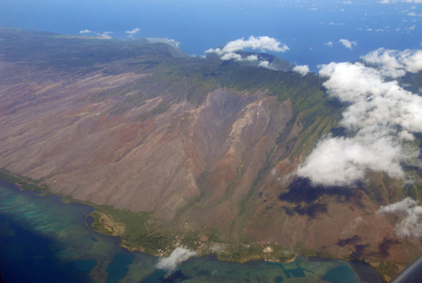
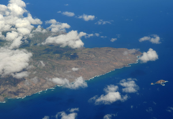 Eastern end of Molokai |
 Molokai |
 Molokai |
 Molokai |
 Molokai |
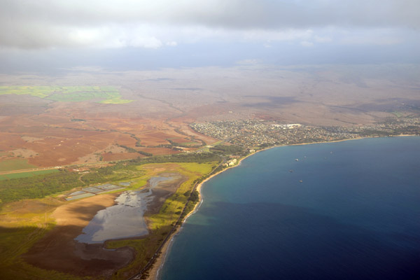
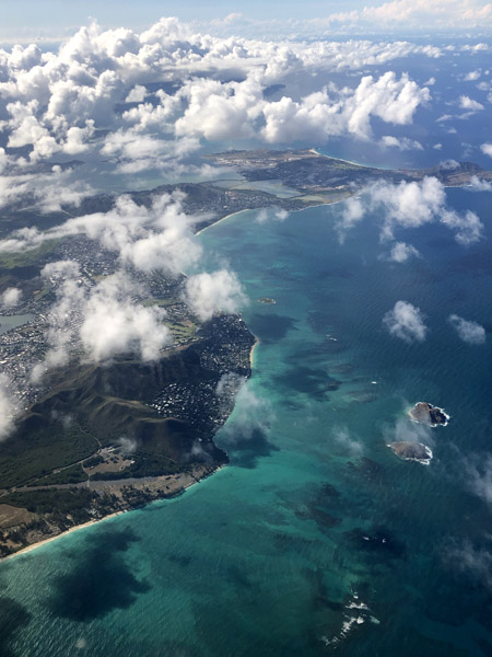
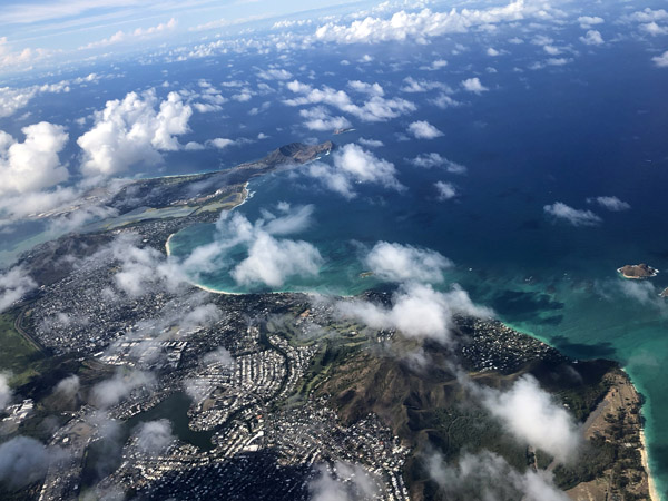
 Honolulu, Hawaii |
 Diamond Head, Waikiki, Oahu |
 Honolulu International Airport, Oahu |
 Honolulu International Airport, Oahu |
 Pearl Harbor |
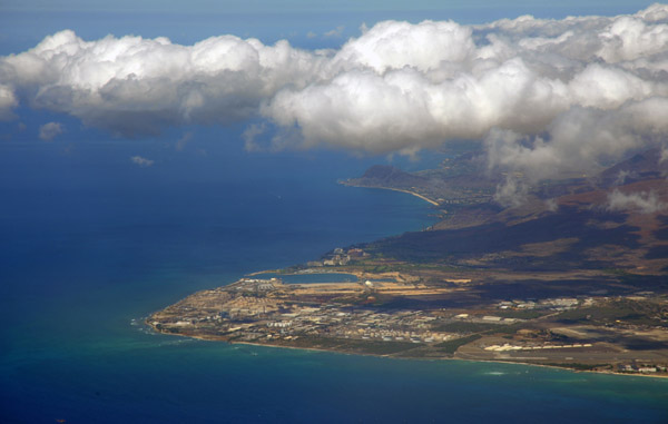 Industrial area, Kapolei, southwest Oahu |
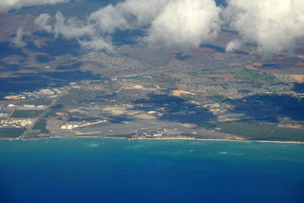 John Rogers Field, Kalaeloa, Oahu |
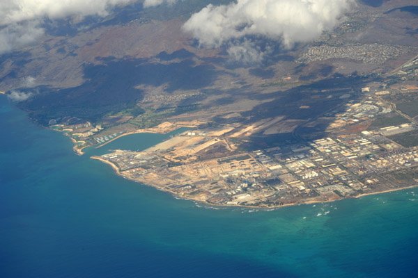 Industrial area, Kapolei, Barbers Point Harbor, southwest Oahu |
 HNL Aug19 002.jpg |
 HNL Aug19 004.jpg |
 HNL Aug19 007.jpg |
 HNL Aug19 008.jpg |
 HNL Aug19 009.jpg |
 HNL Aug19 010.jpg |
 HNL Aug19 012.jpg |
 HNL Aug19 013.jpg |
 HNL Aug19 014.jpg |
 HNL Aug19 015.jpg |
| comment | share |