


|
|
|
|
|
|
| Brooks Rownd | profile | all galleries >> Hawai'i >> Stranded In East Hawai'i >> March 6, 2010 - Mauna Loa Strip Road | tree view | thumbnails | slideshow |
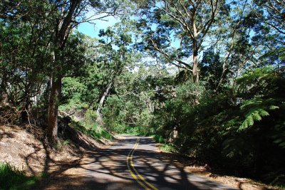
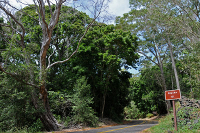
The El Nino drought broke this last week with cold wet weather streaming out of the North, a month or two later than usual. It rained heavily Saturday morning, and I felt like hell for some reason, so I slept in and watched some lacrosse, rugby and movies. In the afternoon the rain diminished, and I went up to one of the few places that is occasionally OK in the worst weather - Mauna Loa Strip Road, which is slightly in the lee of the ridge above Volcano Village. When I went to the Strip I often spent time checking rare plants and counting birds at Kipuka Ki and Kipuka Puaulu, but today it was even raining steadily there. Fortunately when I got up to Powerline Road at 5000 feet elevation it was just blowing mist, and I was able to do multiple point counts from 3PM to 6:30PM (dark) at 4 locations about 1 kilometer apart. (If I had arrived an hour earlier I would have been able to count every kilometer from Powerline Road to the top of Strip Road.) I've never counted this part of Strip Road before, so it was a useful and interesting exersize.
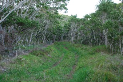
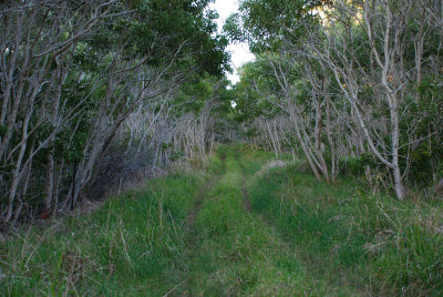
The Mauna Loa Strip is the narrow bit of Hawai'i Volcanoes National Park that connects the main park at the summit of Kilauea to the smaller part at the summit of Mauna Loa. (recently greatly expanded) It's sandwiched between Kapapala Ranch and Kapapala Forest Reserve to the southwest, and Keauhou Ranch to the northeast. The Strip was also grazing lease for many decades, so much of the middle section is degraded habitat of koa-'a'ali'i forest over pasture grass understory. Some of the upper elevation areas were only grazed by feral sheep and goats, and retain a better dry forest understory. Koa is filling in the former pastures quickly, but cannot completely shade out the thick pasture grasses underneath. Remnant 'ohi'a forest exists in some areas, but much of it has died out. Secondary trees in the upper part of The Strip include 'a'ali'i, mamane, pilo, naio and pukiawe.
Bird counts were varied and reasonably high despite wind, fog and drizzle. Nearly all common windward birds were represented, and the Strip is the kind of disturbed mesic habitat where a wide variety of native and alien birds are found together. 'Apapane, 'amakihi and 'elepaio were numerous, along with the ubiquitous Japanese white-eye. I was a little surprised to find hwamei this high, and i'iwi numerous below Powerline Road. On the other hand, I only heard a single 'oma'o all afternoon - there are few fruiting trees here. I didn't hear any Japanese bush warbler, either. Kalij pheasants and Erckel's francolin are widespread and often loitering in the road.
The attached satellite image shows the four locations where I stopped. The boundaries of the Mauna Loa Strip are easily seen as the forested wedge shape. Keauhou Ranch is on the right, and Kapapala Ranch is on the bottom. Upslope is towards the upper left. Kipuka Puaulu is the forest in the bottom right corner, and Kipuka Ki is the next forest across the lava flow to the left of it. The rightmost/bottom red point is where Powerline Road crosses Mauna Loa Strip Road, at 4900 feet elevation. The next three places I stopped are at 5150', 5400' and 5600' elevation. Between Kipuka Ki and Powerline Road pasture grass dominates under a koa canopy. Above Powerline Road the habitat alternates between lava flows and scrub forests and low stature koa-'a'ali'i forest, but it's more forested than it appears in the image. The leftmost side of the image seems to be taken at a different time of day than the rest, so the contrast between trees and other surfaces is not as high contrast as elsewhere in the image.
Strip Road 3/6/2010 Bird Counts: (Species Codes Here)
| station | time | APAP | IIWI | HAAM | OMAO | ELEP | JAWE | HOFI | YFCA | RBLE | NOCA | MELT | KAPH | ERFR | Notes |
|---|---|---|---|---|---|---|---|---|---|---|---|---|---|---|---|
| Strip, 11km | 1505 | 7 | 4 | 3 | 4 | 1 | 2 | 1 | Second point | ||||||
| Strip, 11km | 1524 | 4 | 3 | 3 | 5 | 2 | 1 | ||||||||
| Mea 'ai | 1544 | 7 | 1 | 5 | 2 | 2 | 1 | Third point | |||||||
| Mea 'ai | 1558 | 6 | 5 | 1 | 1 | 2 | |||||||||
| Mea 'ai | 1609 | 7 | 4 | 1 | 7 | 1 | 2 | 1 | |||||||
| Mea 'ai | 1630 | 5 | 3 | 2 | 3 | 1 | 1 | ||||||||
| Keamoku Flow | 1652 | 2 | 2 | 2 | 3 | 1 | Top point | ||||||||
| Keamoku Flow | 1703 | 3 | 5 | 1 | 2 | 2 | |||||||||
| Keamoku Flow | 1721 | 8 | 5 | 2 | 1 | 1 | 3 | ||||||||
| Powerline Rd | 1750 | 3 | 4 | 4 | Bottom point, | ||||||||||
| Powerline Rd | 1800 | 1 | 2 | 1 | 7 | 1 | former pastures | ||||||||
| Powerline Rd | 1810 | 4 | 3 | 1 | 4 | former pastures | |||||||||
| Powerline Rd | 1830 | 6 | 1 | 8 | 3 | 2 | 1 | 1 | former pastures | ||||||
| station | time | APAP | IIWI | HAAM | OMAO | ELEP | JAWE | HOFI | YFCA | RBLE | NOCA | MELT | KAPH | ERFR | Notes |
Species key: APAP='apapane, IIWI=i'iwi, HAAM='amakihi, OMAO='oma'o, ELEP='elepaio, JAWE=Japanese white-eye, HOFI=house finch, YFCA=yellow-fronted canary, RBLE=red-billed leiothrix, NOCA=northern cardinal, MELT=hwamei, KAPH=kalij pheasant, ERFR=Erckel's francolin.
 striproad_06mar10.gif |
 Kipuka Ki |
 Kipuka Ki |
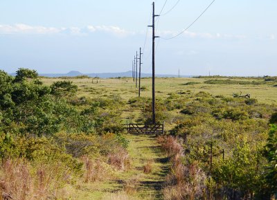
 Powerline Road |
 Koa Tunnel |
 Powerline Road and Kapapala Ranch |