


|
|
|
|
|
|
| Sunbird Photos by Don Boyd | profile | all galleries >> Landscape and Aerial Stock Photos Gallery >> Aerial Landscape Stock Photos Gallery | tree view | thumbnails | slideshow |
Most stock images are available for commercial licensing at reasonable prices. We can provide large size (usually landscape mode but portrait mode for some) 300dpi unsharpened TIF or JPG files fast via e-mail attachment. Please contact us at SunbirdPhotos@gmail.com or 305-401-9225 for a fast quote for your intended usage.
Airport Aerial Stock Photos Gallery |
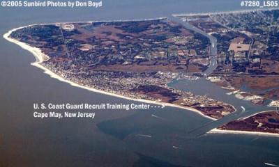
Cape May, New Jersey Aerial Stock Photos Gallery |
Florida Aerial Stock Photos Gallery (other than Ft. Lauderdale, Miami Lakes and Space Coast) |
Ft. Lauderdale and Broward County Aerial Stock Photos Gallery |
Highway Aerial Stock Photos Gallery |
Miami and Miami-Dade County Aerial Stock Photos Gallery |
Miami Lakes Aerial Stock Photos Gallery |

Minneapolis Aerial Stock Photos Gallery |

Nashville, Tennessee Aerial Stock Photos Gallery |
New Orleans Aerial Stock Photos Gallery |
Space Coast, Florida (Melbourne, Cocoa, Cocoa Beach, Cape Canaveral, Merritt Island, Titusville) Aerial Stock Photos Gallery |
St. Petersburg and Clearwater Aerial Stock Photos Gallery |
Tampa and Tampa Bay Area, excluding St. Pete/Clearwater, Aerial Stock Photos Gallery |
 2002 - wing of Continental Airlines B737-824 at sunrise over South Florida aviation stock photo |
 2002 - wing of Continental Airlines B737-824 at sunrise over South Florida aviation stock photo |
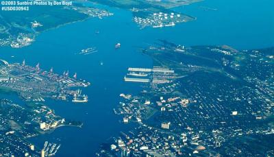
 2003 - Hampton Roads and Chesapeake Bay, Virginia (#7051) |
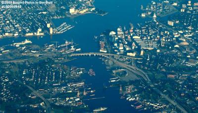
 2003 - Hampton Roads Bridge Tunnel, Virginia (#7053) |
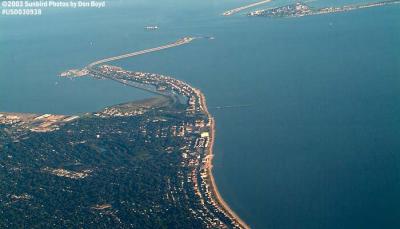
 2003 - Portsmouth, Virginia (#7059) |
 2003 - Portsmouth, Virginia (#7060) |
 2004 - clouds inflight landscape stock photo #2152 |
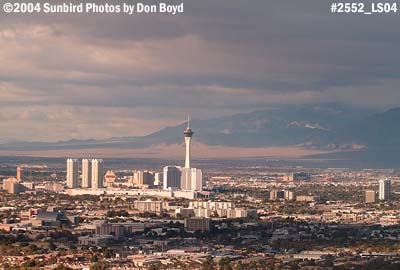 2004 - Las Vegas from the south aerial photo #2552 |
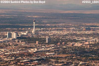 2004 - Las Vegas from the south aerial stock photo #2553 |
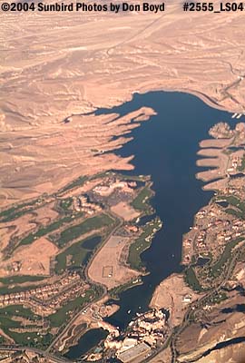 2004 - Lake Mead (?) aerial landscape photo #2555 |
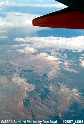 2004 - somewhere over Arizona aerial landscape stock photo #2557 |
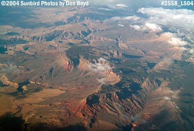 2004 - somewhere over Arizona aerial landscape stock photo #2558 |
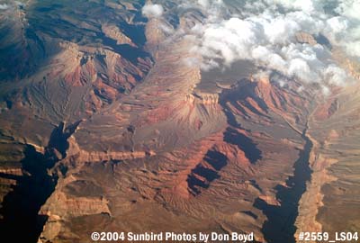 2004 - somewhere over Arizona aerial landscape stock photo #2559 |
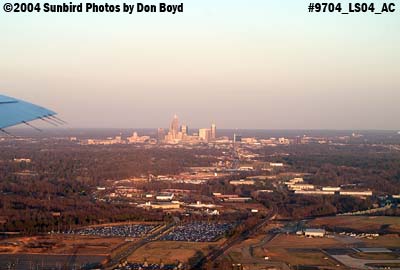 2004 - downtown Charlotte, NC, at sunset landscape stock photo #9704 |
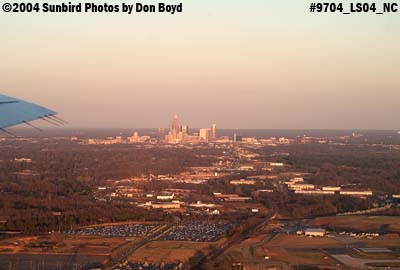 2004 - downtown Charlotte at sunset landscape stock photo #9704 |
 2004 - downtown Charlotte, North Carolina aerial stock photo #9773 |
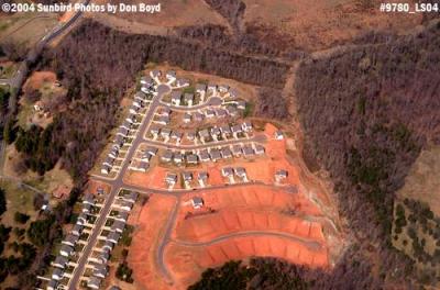 2004 - suburban sprawl and tree destruction into the south Charlotte countryside landscape aerial photo #9780 |
 2005 - left wing of Southwest B737-7H4 inflight aviation stock photo #6550 |
 2005 - left wing of Southwest B737-7H4 inflight aviation stock photo #6551 |
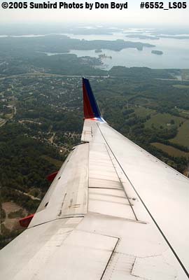 2005 - J. Percy Priest Lake east of Nashville International Airport aerial stock photo #6552 |
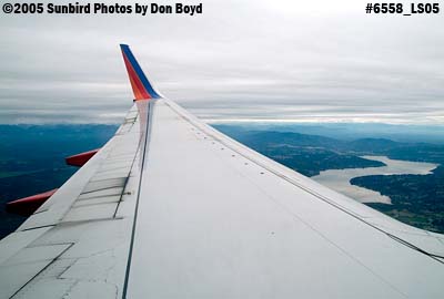 2005 - on approach to Seattle aerial stock photo #6558 |
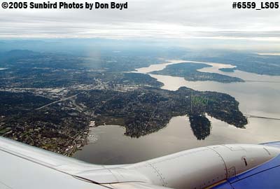 2005 - Yarrow Point, Seattle, aerial landscape stock photo #6559 |
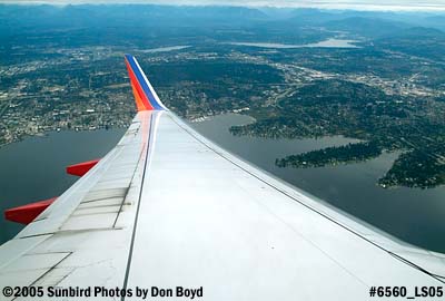 2005 - Yarrow Point, Seattle, aerial landscape stock photo #6560 |
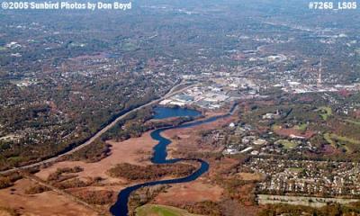 2005 - aerial view southwest of Boston aerial stock photo #7268 |
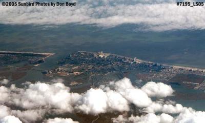 2005 - Atlantic City, New Jersey aerial stock photo #7195 |
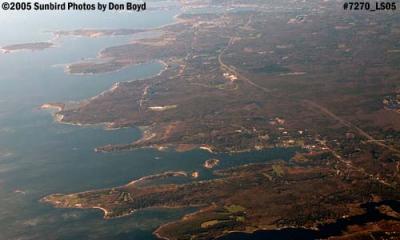 2005 - coastline southwest of Boston aerial stock photo #7270 |
 2005 - coastline southwest of Boston aerial stock photo #7271 |
 2005 - coastline over Massachusetts aerial stock photo #7272 |
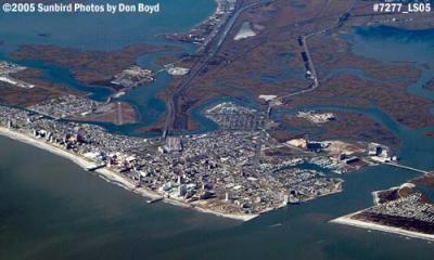 2005 - Atlantic City aerial photo #7277 |
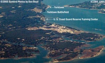 2005 - U. S. Coast Guard Reserve Training Center at Yorktown, Virginia aerial photo #7284 |
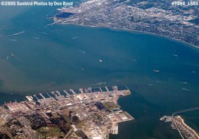 2005 - Norfolk, Virginia aerial stock photo #7286 |
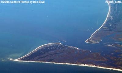 2005 - Cape Fear, North Carolina aerial stock photo #7288 |
 2007 - about 30 miles due south of Minneapolis, Minnesota aerial stock photo #2101 |
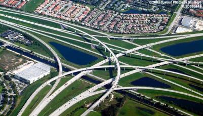
 2014 - aerial view of the US 27 I-75 interchange that wiped out Andytown - Weston on the right stock photo #4803 |
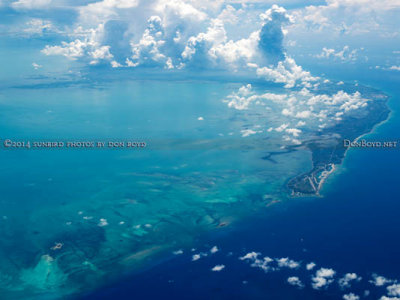 2014 - Grand Bahama Island aerial stock photo #5565 |
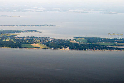 2014 - aerial view of the Kentmorr Restaurant and Crab House on Kent Island, Maryland landscape aerial stock photo #5574 |
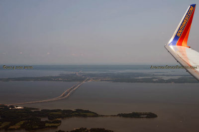 2014 - aerial view of the Chesapeake Bay Bridge aerial landscape stock photo #5580 |
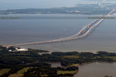 2014 - aerial view of the Chesapeake Bay Bridge landscape stock photo #5580C |
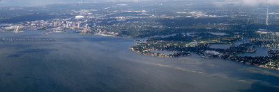 2014 - aerial photo of eastern St Petersburg from Whitted Airport to Shore Acres stock photo #5914C |
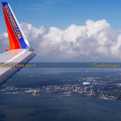 2014 - aerial view of the Southwest winglet and downtown St. Petersburg aerial landscape stock photo #5914C |
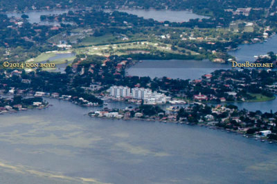 2014 - aerial photo of Shore Acres (foreground on right) and east end of Snell Island (condos) landscape stock photo #5914C |
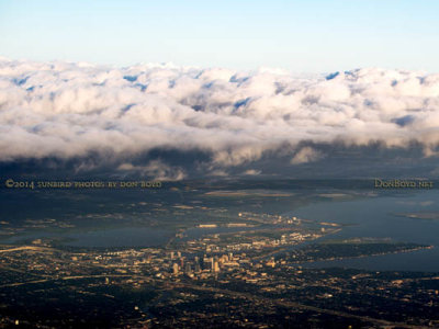
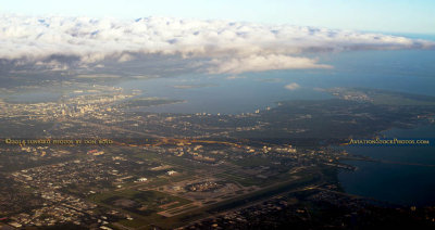 2014 - aerial view of a cloud bank over Tampa International Airport, downtown Tampa and MacDill AFB aerial stock photo #5923 |
 2014 - cloud bank over downtown Tampa aerial landscape stock photo #5923C |
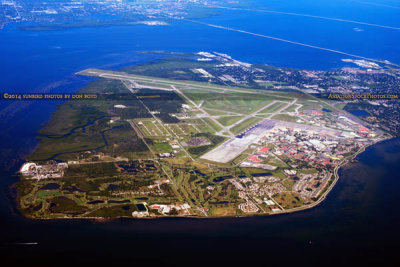 2014 - aerial photo of MacDill Air Force Base landscape military aerial stock photo #6118 |
 2014 - aerial photo of Tampa's Bayshore Boulevard (top), Davis Island and ship channel landscape aerial photo #6121 |
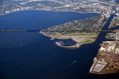
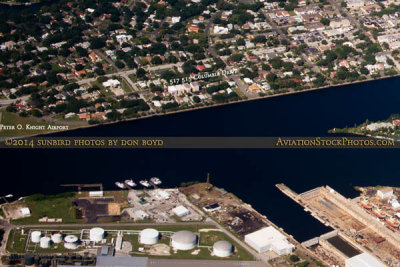
 2014 - aerial photo of Davis Island and Peter O. Knight Airport aerial landscape stock photo #6121C |
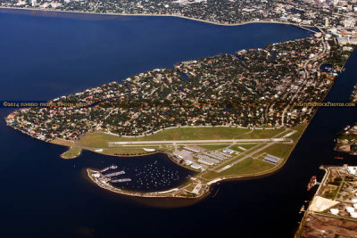
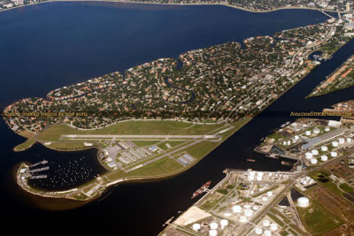 2014 - aerial photo of Davis Island and Peter O. Knight Airport landscape aviation airport stock photo #6123 |
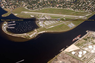 2014 - aerial photo of Peter O. Knight Airport and Seddon Channel landscape airport aviation stock photo #6123C |
 2014 - aerial photo of Davis Island, Seddon Channel (top) and Sparkman Channel (right) landscape stock photo #6125 |
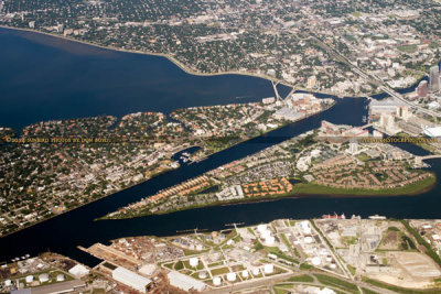 2014 - aerial photo of Davis Island, Seddon and Sparkman Channels and Harbour Island aerial landscape stock photo #6125 |
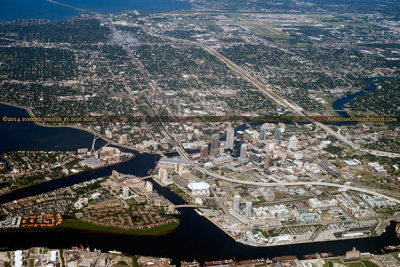 2014 - aerial photo of Davis Island, Harbour Island and downtown Tampa landscape aerial stock photo #6126 |
 2014 - aerial photo of downtown Tampa landscape stock photo #6126C |
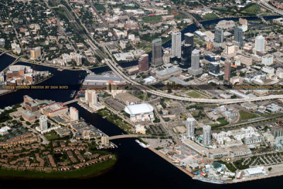
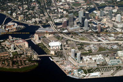 2014 - aerial photo of downtown Tampa landscape aerial stock photo #6127 |
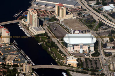 2014 - aerial photo of the Tampa Marriott Waterside Hotel and Tampa Convention Center (top) landscape aerial stock photo #6127C |
| comment | share |
| Eric | 11-Feb-2007 23:53 | |