


|
|
|
|
|
|
| |
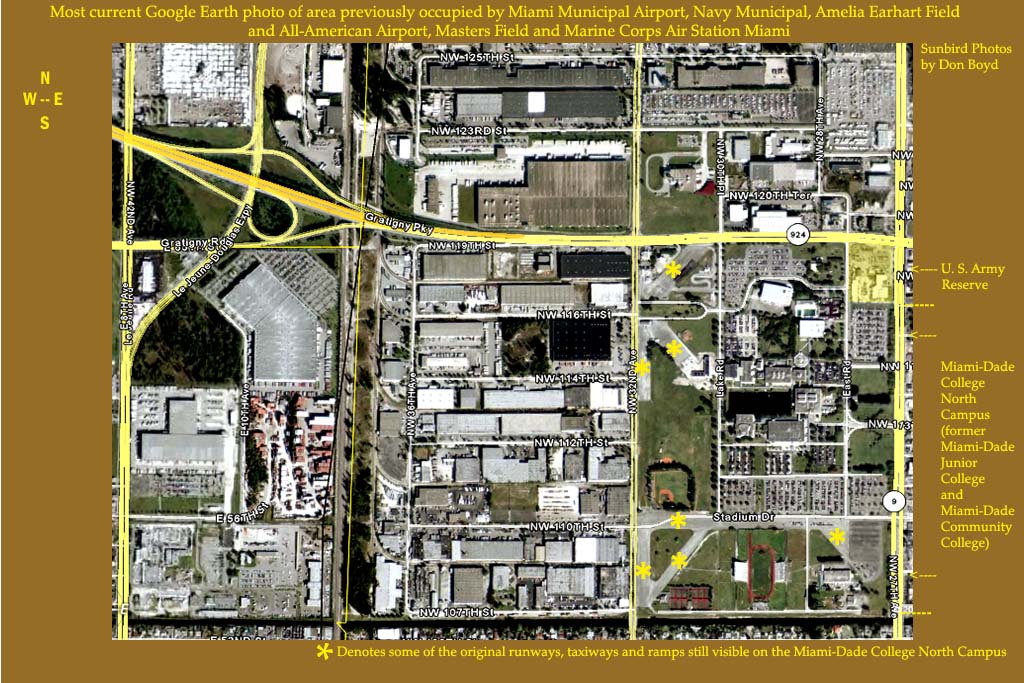
| Google Earth photo | |
Click on ORIGINAL below for the largest image size
This is the latest Google Earth photo of the area formerly occupied by Miami Municipal Airport/Amelia Earhart Field and All-American Airport/Masters Field/Marine Corps Air Station Miami.
If you click on PREVIOUS you can compare this photo the two previous photos to see how this area evolved. I attempted to keep both photos at the same size and content and if you flip back and forth between the three images you can better visualize then and now.
Unless noted, all photos are copyrighted Sunbird Photos by Don Boyd (AviationStockPhotos.com and AviationPhotoPrints.com)
| comment | |