Our pal Hal was in town, staying up at Harry's house in Lake Toxaway. He had to leave Saturday afternoon, but that was enough time to squeeze in a morning hike, so I headed up Friday after work. Bernie has been teasing me with pictures of new waterfalls he's been finding, so I called and begged and he said yes.
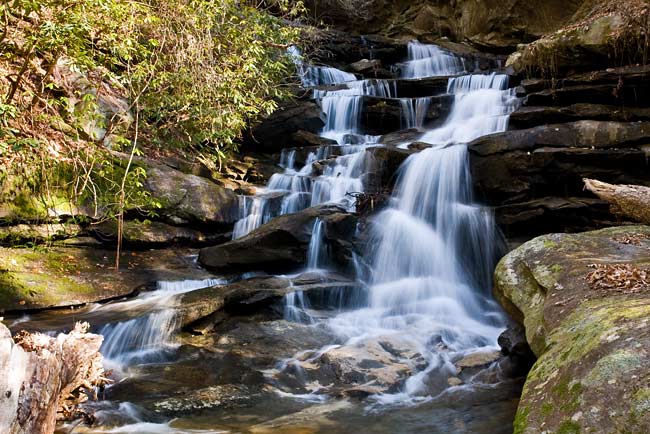
This waterfall is a beauty! The Palmetto Trail crosses the Rachael Creek 2 to 3 miles from the Table Rock parking area and the waterfall is about 3/4 mile down the creek. This map - http://www.palmettoconservation.org/maps/JocasseeWebMap.pdf - shows a waterfall symbol at #3, but this isn't the waterfall. We came from the Hwy 11 side and followed the creek up to the falls. Either way, there's not a trail along Rachael Creek to the waterfall. It's a bushwhack, but from Hwy 11 the woods were fairly open. From the intersection of Hwys 178 and 11, we drove north on 11 for 1.9 miles and pulled off at the end of the guard rails. Hwy 11 crosses Rachael Creek a little ways back, but we set out through the woods on the left which was the shorter path.