You were on the right trail, The concrete footings you saw were from the High Bridge in this photo
http://www.pbase.com/trailryder/image/125439112 The Building Remains you found are from the house seen in the background.
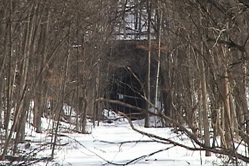
the Bridge was taken out after the line was abandoned and looks like this now
http://www.pbase.com/trailryder/image/125439114 The trail takes a long & winding course to get up to the RR Grade. the short route is to climb up alongside the east bridge footings it's steep but I made it several years ago.
As for the Stone Arch & Iron Bridge Girot Hill Road used to go thru this arch and across the bridge years ago, after abandonment the RR grade was cut out so the road could be widened. This area looks to be about 2-3 miles east of the east portal.
Check out the attached map I just made, http://www.pbase.com/image/137341929) I think it shows the layout of the Trails, Grade & Tunnel fairly accurately, this was done using Google maps and drawn from memory so small details may be incorrect.
I hope this helps you to find the tunnel on your next expedition to this area, Please report back on tunnel Conditions.
Later Bill Manon
Guest
15-Aug-2011 16:13
I parked at the DNR Winston tunnel parking lot (blackjack road)Saturday 8/13/11. I followed walking trail over a small rise then down and north through small meadow to creek on the right and sighted concrete blocks with bolts on west side of creek and about 3 foot by 3 foot by 12 foot horizontal concrete slabs on east side of creek. is that part of the west portal or something else ?
I continued on hunting trail north to ruins of limestone 2 story structure on the right and railroad tie set vertical, then followed trail north to a rise which I thought was was probably too far north, then returned to remains of the building and followed a side creek to the east which seemed a little too steep for a railroad grade -more than 1 or 2 % . the trees were about 1 foot thick or more. nothing like your photographs.
At the corner of Girot Road and Irish Hollow road , the remains of an iron bridge and stone arch next to a creek was sighted on south side of Girot road. is that significant to the east approach to east portal ?
I shall return, thank you for website and information. Greg (gregobern@yahoo.com )