


|
|
|
|
|
|
| Tracy O'Camera | profile | all galleries >> Personal photos -various >> 2011_11_17 Strange City Cameras - or are they not cameras? | tree view | thumbnails | slideshow |

|  |  |
|  |
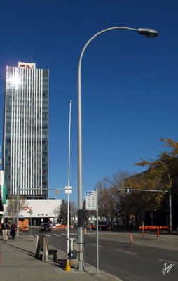 IMG_9992.jpg |
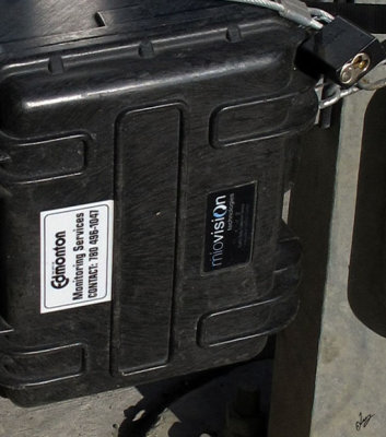 IMG_9993.jpg |
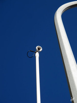 IMG_9994.jpg |
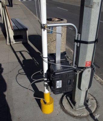 IMG_9993 1.jpg |
| comment | share |
| Tracy O'Camera | 23-Nov-2011 01:44 | |